
East Bay Bike Path
Trailhead at India Point Park, Providence
East Providence, RI
A flat, paved rail trail hugging the shore of Narragansett Bay for roughly fourteen miles, from the Providence waterfront to the seaport of Bristol.
The East Bay Bike Path is one of Rhode Island's great outdoor pleasures, a flat, paved rail trail that runs roughly fourteen miles along the eastern shore of Narragansett Bay from the edge of Providence down to the historic seaport of Bristol. For much of its length the water is right beside you, with marshes, coves, and open bay views unfolding as you ride, making it a favorite for cyclists, walkers, and families.
The trail follows the bed of a former railroad, and its gentle grade and steady scenery are a direct legacy of that past. Where trains once carried passengers along the bay to shore resorts and mill towns, riders now glide past the same water, stitching together a string of waterfront parks and old town centers into one continuous ribbon of coast.
What Travelers Love
- Miles of flat, easy riding with the bay in view for much of the route
- Passing through marshes, parks, and historic town centers along the way
- Water views, sea breezes, and good birdwatching over the tidal flats
- Connecting waterfront destinations like Colt State Park and Bristol harbor by bike
Worth Knowing
- The path is paved and mostly flat, making it friendly for families, casual cyclists, and walkers
- It crosses some town streets, so watch for traffic at road intersections
- There is little shade in the open marsh sections, so bring sun protection and water
- Several parks and town centers along the route offer good places to stop, rest, and eat
Learn about East Bay Bike Path
From railroad to bike path
The shores of upper Narragansett Bay were the homeland of the Pokanoket and Wampanoag peoples before English settlers established the colonial towns of Warren, Barrington, and Bristol along the water. For generations the bay was the region's main highway, carrying goods and people by boat.
In the nineteenth century a railroad was built along the eastern shore, connecting Providence with the bayside towns and the seaside resorts that drew summer crowds. The line carried both freight and passengers and helped these communities grow.
As rail travel declined in the twentieth century, the tracks fell out of use, leaving a straight, level, waterfront corridor. Rhode Island converted the abandoned rail bed into a paved recreational path, part of a national movement to turn old railroads into trails.
The result, opened in stages beginning in the 1990s, is a continuous route that has become one of the most popular bike paths in New England, prized for its flat grade and its almost constant views of the bay.
Along the route
Starting near the Providence waterfront, the path crosses into East Providence and then runs south through Barrington and Warren before reaching Bristol. Along the way it passes through open salt marsh, over tidal creeks on old railroad bridges, and past coves where boats ride at anchor.
The trail links a series of destinations. It runs beside Colt State Park in Bristol, connects to town centers with shops and restaurants where riders can stop for a meal, and offers access to swimming and picnic spots near the water.
Because it is flat and mostly separated from traffic, the path suits every kind of user, from serious cyclists covering the full length to families with young children and walkers out for a stroll by the water. Its steady scenery keeps the miles from feeling long.
Wildlife along the water
The salt marshes and tidal flats the path crosses are rich with birdlife. Herons and egrets stalk the shallows, ospreys nest on platforms and hunt the coves, and shorebirds probe the mud at low tide. Waterfowl gather in the sheltered water through the colder months.
The marshes themselves are vital habitat, filtering the water and nurturing the fish and shellfish of the bay. Riding through them offers a close, ground level view of an ecosystem that is easy to overlook from a car.
Watch the open bay for cormorants, gulls, and diving birds working the water, and in the quieter stretches you may glimpse turtles, muskrats, and other creatures of the marsh edge.
Season by season
Spring brings the return of ospreys and migrating birds to the marshes, along with mild air and a greening landscape ideal for riding.
Summer is the peak season, when the full length of the path buzzes with cyclists and walkers, and sea breezes off the bay temper the heat, though the open marsh sections offer little shade.
Fall is a favorite time here, with crisp air, thinning crowds, and warm color in the trees along the route, plus strong bird migration over the flats.
Winter quiets the path to a bracing, beautiful ride or walk, with waterfowl on the bay and long clear views across the water, best enjoyed bundled against the wind.
Closest Boutels
The closest Boutel™ stays, so you can turn this stop into an overnight. Each is a place we chose through independent editorial review, never a paid placement.
Details
East Providence, RI
Frequently asked questions
What is the East Bay Bike Path?
The East Bay Bike Path, running along the eastern shore of Narragansett Bay between Providence and Bristol, Rhode Island, is a beautiful and popular paved recreational trail offering stunning bay views along its scenic route. Built largely on a former railroad line, the path carries cyclists, walkers, runners, and skaters for miles along the water, past coves, marshes, parks, and waterfront towns, with lovely views of the bay much of the way. It connects charming East Bay communities and scenic spots like Colt State Park. A wonderful and scenic trail for outdoor recreation, it delights cyclists and walkers. With its bayfront route, the East Bay Bike Path offers a rewarding destination in Rhode Island.
What can you do on the East Bay Bike Path?
You can bike, walk, run, or skate along the paved path, enjoy sweeping views of Narragansett Bay, pass coves, marshes, parks, and waterfront towns, and stop at scenic spots and attractions like Colt State Park along the way. The beautiful bay views, the easy paved route, the connections between charming towns, and the scenic stops are the draws, making it a favorite for recreation of all kinds. The waterfront scenery is the highlight. With its scenic route, the East Bay Bike Path offers a rewarding experience in Rhode Island.
What should I know before using the East Bay Bike Path?
The East Bay Bike Path is a shared paved trail used by cyclists, walkers, runners, and others, so keeping to the right, passing with care, and being courteous to fellow users keep it safe and pleasant, and it crosses some roads, so caution at crossings matters. Bringing water and sun protection helps, as parts are exposed, and choosing an access point and planning your distance make for a good outing. Sharing the path courteously and taking care at crossings ensure a safe, enjoyable ride on the East Bay Bike Path in Rhode Island.
When is the best time to use the East Bay Bike Path?
The mild months of spring through fall are the most pleasant for biking or walking the path, when the weather is comfortable and the bay views glorious, with fall especially lovely along the water, and mornings quieter than busy summer weekends. Because it is an outdoor trail, comfortable weather makes it best. For the most pleasant conditions and loveliest scenery, aim for spring through fall on the East Bay Bike Path in Rhode Island.
What is near the East Bay Bike Path?
The East Bay Bike Path runs between Providence and Bristol, Rhode Island, along Narragansett Bay, within reach of Colt State Park, the Bristol attractions including Blithewold and the Herreshoff Marine Museum, and the East Bay towns. That makes the East Bay Bike Path a rewarding way to connect Colt State Park and the other attractions of the East Bay on a visit to Rhode Island.
Nearby

Crescent Park Looff Carousel
2.8 miles away
This is a genuine piece of amusement-park history kids can actually ride.
Colt State Park
4.1 miles away
This former gentlemans farm gives Bristol a broad, open front on Narragansett Bay.
Linden Place
5.0 miles away
It looks like a simple grand house on the parade route, but Linden Place at 500 Hope St carries a heavier story.

Herreshoff Marine Museum
5.3 miles away
Sailors know it, but plenty of visitors miss that a tiny Bristol yard once ruled world yacht racing.

Blithewold Mansion, Gardens and Arboretum
5.7 miles away
Garden people travel for this one; casual visitors are stunned to find giant sequoias on the Rhode Island shore.
Rocky Point State Park
6.1 miles away
Rocky Point is a shoreline haunted, in the fondest way, by a lost amusement park.

Roger Williams Park Zoo
6.3 miles away
This is the classic family day out in Providence. The Roger Williams Park Zoo, founded in 1872 and one of the oldest in the country, packs elephants, giraffes, zebras, red pandas, and snow leopards in...

Roger Williams Park
6.6 miles away
This is Providences great green lung, a 435-acre Victorian park laid out in the 1870s in the sweeping pastoral style of the era.
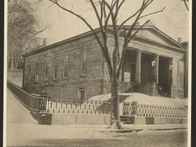
The Providence Athenaeum
7.7 miles away
Step off Benefit Street into the Providence Athenaeum and you step into 1838.

RISD Museum
7.7 miles away
Visitors to Providence often walk right past it, but the RISD Museum on Benefit Street rivals museums in far bigger cities.
Benefit Street, the Mile of History
7.8 miles away
Architecture lovers make pilgrimages here, but many visitors never climb the hill to see it.

Battleship Cove
8.0 miles away
People drive over the Braga Bridge and spot the gray battleship without realizing they can walk right through it.

Rhode Island State House
8.2 miles away
People photograph its dome from the highway without realizing they can walk right in.
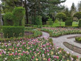
Green Animals Topiary Garden
9.9 miles away
Off the usual Newport circuit, up in Portsmouth on the bay, sits a garden that delights people who did not expect to be delighted.

Slater Park Looff Carousel
10 miles away
Most people driving past Slater Park have no idea one of the great early carousels in the country is turning inside it.

Slater Memorial Park
10 miles away
An easy family park with a hundred things to do and room to run.
Slater Mill
10 miles away
This is the actual birthplace of the American factory, and it is easy to walk past without grasping the weight of it.

Clemence-Irons House
12 miles away
This is architecture you cannot see almost anywhere else in America.
Nathanael Greene Homestead
12 miles away
Plenty of people know Nathanael Greene from a statue or a county named for him, but few realize his actual house survives, quietly, in western Rhode Island.
Hearthside House
13 miles away
A stone mansion with a jilted-lover legend, hiding on an old country road most travelers never find.
Smiths Castle
13 miles away
People drive right past this on Post Road without realizing they are passing one of the oldest houses in America.

Lincoln Woods State Park
13 miles away
This is the green lung just north of Providence, a rocky, wooded park of oak and glacial boulders wrapped around Olney Pond.

Historic Wickford Village
14 miles away
Wickford is the kind of place people stumble into and cannot believe is not more famous.
North Scituate Village Green
16 miles away
A pretty New England village green that turns into a giant fair once a year.

Scituate Reservoir
16 miles away
The Scituate Reservoir is the biggest lake in Rhode Island, but it is a drinking-water supply, so you cannot boat, swim, or fish it, and that restriction is exactly what keeps its shoreline so wild an...
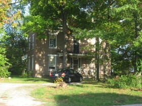
Paine House Museum
16 miles away
A small, friendly history museum where old-time daily life feels real.
Gilbert Stuart Birthplace and Museum
17 miles away
Hardly anyone realizes the face on the dollar bill was painted by a Rhode Islander born in this quiet mill hamlet.
Touro Synagogue
17 miles away
Tucked on a side street off Newports colonial core is a building most visitors walk past without knowing its weight.

The Cliff Walk
18 miles away
The Cliff Walk gives kids the best of Newport in one walk: crashing surf on one side, jaw-dropping mansions on the other, and the sense of an adventure along the edge of the sea.

Rosecliff Mansion
18 miles away
One of the loveliest of Newport's Gilded Age summer mansions, a gleaming white palace modeled on the Grand Trianon at Versailles and designed by Stanford White for the silver heiress and society hoste...

Fort Adams State Park
18 miles away
A real fortress to explore turns a history stop into an adventure.

The Breakers
19 miles away
Everyone knows Newport has mansions, but standing inside the Breakers still stops people cold.
Diamond Hill Park
19 miles away
For a quick leg-stretch with a view, pull off at Diamond Hill Park at 4097 Diamond Hill Rd in Cumberland.