
Sunset Crater Volcano National Monument
Forest Service Rd 776
Flagstaff, AZ
A black cinder cone rimmed in rust and gold, the youngest volcano on the Colorado Plateau and the last to erupt in Arizona.
Sunset Crater is the youngest volcano on the Colorado Plateau and the last one to erupt in Arizona, a nearly perfect black cinder cone standing about a thousand feet above the surrounding pine forest near Flagstaff. Sometime around the year 1085, and by tradition later than that, the ground here split open and threw up a fountain of glowing cinders and rivers of lava, building the cone in a matter of months and reshaping the landscape for miles. In geologic terms it happened only yesterday.
The volcano earns its name from the colors on its rim, where oxidized cinders in shades of red, orange, and yellow glow above the black lower slopes, so that even in shadow the crown of the mountain looks lit by a sunset. Around its base spread jagged fields of hardened lava and a strange, moon-like plain of cinders, slowly being reclaimed by ponderosa pines that rise straight out of the black ground.
What Travelers Love
- Walking the Lava Flow Trail across black, jagged lava at the foot of the cone
- The volcano's rim glowing red and gold, the colors that gave it its name
- The strange contrast of green pines growing straight out of black cinders
- The nearby San Francisco Peaks and the drive on to the Wupatki pueblos
Worth Knowing
- You can no longer climb the crater itself, since the loose cinders were eroding badly, so enjoy it from the trails at its base
- The lava rock is sharp and uneven, so wear sturdy shoes and watch your footing
- It sits at high elevation and can be cold, windy, or snowy, so bring layers even in warmer months
- Stay on marked trails, since the cinder slopes and lava beds are fragile and slow to recover
Learn about Sunset Crater Volcano National Monument
The eruption people witnessed
The eruption of Sunset Crater was witnessed by people. Ancestral Puebloan and other Native farming families were living and growing crops across this country when the ground tore open, and they saw their fields buried under cinders and their world transformed by fire. The nearby Hopi, the Navajo, the Zuni, and other Native nations of the region carry oral traditions and connections to this landscape, and Sunset Crater remains a place of deep cultural meaning to them.
In the years that followed, the eruption changed how people farmed. A layer of volcanic cinders spread across the land acted like a mulch, holding moisture in the soil, and in some places this may have made once-marginal ground newly productive. Many families resettled the surrounding country in the generations after the eruption, building the pueblos preserved today at Wupatki just to the north, so the same volcano that destroyed homes also, in time, helped shape new ones.
How the cone was built
Sunset Crater is a cinder cone, the simplest and most common kind of volcano. When the eruption began, blobs of molten rock were flung high into the air, cooling as they fell into cinders and lightweight, glassy fragments that piled up around the vent into a steep, symmetrical cone. This kind of volcano tends to build fast and then fall quiet, which is why the cone rose so quickly and has not erupted since.
At the same time, rivers of lava oozed from vents at the base of the cone, spreading across the land in the black, broken flows you can walk beside today. The whole area is part of a vast volcanic field of hundreds of cones and craters that has been active across this corner of the plateau for millions of years, with Sunset Crater simply the most recent to fire. Geologists watch the region, though no eruption is expected any time soon.
Life returns to the cinders
One of the most striking things about Sunset Crater is watching life take hold in what looks like a wasteland. The black cinders and raw lava are slowly being colonized by hardy plants, and in the sheltered pockets between rocks, ponderosa pines, aspens, and wildflowers have found a foothold. In midsummer, patches of bright penstemon and other blooms stand out vividly against the dark ground.
The recovering land supports its share of wildlife too, from mule deer and elk moving through the pines to Abert's squirrels, jays, and other creatures of the high forest. The contrast of green life against black rock makes the whole place a living lesson in how the land heals after a volcano, a process that has been unfolding here for nearly a thousand years and still has far to go.
Season by season
Summer is the most comfortable time to visit, with warm days at this high elevation and the wildflowers blooming among the cinders. Afternoon monsoon storms can build quickly over the peaks, so morning visits are often best.
Fall brings crisp air and golden aspens on the nearby San Francisco Peaks, a beautiful time for the scenic drive. Winter is cold and often snowy, and while the black cone dusted in white is a dramatic sight, roads and trails can be icy or closed, so it pays to check conditions. Spring is cool and windy as the high country slowly warms out of winter.
Closest Boutels
The closest Boutel™ stays, so you can turn this stop into an overnight. Each is a place we chose through independent editorial review, never a paid placement.
Lantern Light Inn & Wedding Gardens
Boutel+3085 W State Rte 89A, Sedona, AZ
39 miles away|Learn More ›
Details
Flagstaff, AZ
Frequently asked questions
What is Sunset Crater Volcano National Monument?
Sunset Crater Volcano National Monument, near Flagstaff in northern Arizona, preserves a striking young cinder-cone volcano that erupted roughly nine hundred years ago, dramatically reshaping the landscape. Its dark cinder cone, glowing with reddish hues near the top that inspired the name, rises above fields of black lava and volcanic rock. With trails winding through the otherworldly lava flows and cinder fields, and a visitor center explaining the eruption's story, the monument offers a fascinating glimpse into the region's fiery geologic past and its recovery.
Can you climb Sunset Crater?
No, hiking to the top of the Sunset Crater cinder cone is not allowed, as climbing the fragile slopes caused serious erosion, so the summit has long been closed to protect it. Instead, visitors explore the excellent Lava Flow Trail and other paths at the base, which wind through the black lava fields and cinders around the volcano, offering close-up views of the dramatic volcanic features. These trails provide a rewarding experience of the eruption's aftermath without damaging the protected cone.
What can you do at Sunset Crater Volcano National Monument?
You can walk the Lava Flow Trail through jagged lava fields, cinder dunes, and volcanic formations at the foot of the cone, learn about the eruption and the area's geology and ecology at the visitor center, and enjoy the scenic drive that connects the monument to nearby Wupatki National Monument. The stark, dark landscape dotted with hardy plants making a comeback is both beautiful and educational. It is a relatively easy, family-friendly stop that vividly brings the region's volcanic history to life.
When is the best time to visit Sunset Crater Volcano National Monument?
Late spring through fall offers pleasant weather for walking the trails at this high elevation, with summer comfortable compared to the lower desert but bringing afternoon monsoon storms, so morning visits are wise then. Winter can bring snow and cold, sometimes affecting road and trail access, so checking conditions is important in the colder months. The dark lava fields can get hot and sunny, so bring water and sun protection. The milder months are ideal for exploring comfortably.
What is near Sunset Crater Volcano National Monument?
The monument is linked by a scenic loop road to Wupatki National Monument and its ancestral Puebloan pueblos, and lies near Flagstaff, with its Lowell Observatory, historic downtown, and the San Francisco Peaks, plus Walnut Canyon's cliff dwellings nearby. The Grand Canyon is within reach to the north. That makes Sunset Crater an easy and fascinating stop to combine with Wupatki on the loop drive and the other natural and cultural attractions around Flagstaff.
Nearby

Wupatki National Monument
12 miles away
Wupatki was built by ancestral Puebloan people around 1100 CE following the eruption of Sunset Crater volcano around 1085 CE.

Walnut Canyon National Monument
13 miles away
Walnut Canyon contains over 25 cliff dwelling "rooms" built by the Sinagua people around 1100-1250 CE under natural overhanging ledges in the canyon walls.

Lowell Observatory
14 miles away
Lowell Observatory was founded in 1894 by Percival Lowell and is where Clyde Tombaugh discovered Pluto on February 18, 1930. Daytime tours cover the historic dome and 24-inch telescope.

Riordan Mansion State Historic Park
15 miles away
Riordan Mansion is a 40-room Arts and Crafts home built in 1904 for two Riordan brothers who ran Flagstaff's lumber empire, connected as a single duplex by a central common room.
Wupatki Blowhole
16 miles away
At Wupatki Pueblo, a concrete grate near the amphitheater leads to a crack that connects to an underground cave system.
The Arboretum at Flagstaff
18 miles away
The Arboretum at Flagstaff is a 200-acre botanical garden at 7,150 feet with a focus on plants native to the Colorado Plateau.
Historic Route 66, Flagstaff to Winslow
29 miles away
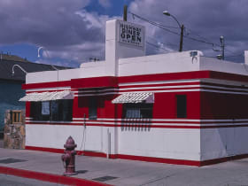
The Route 66 alignment east of Flagstaff passes through Winona (you need to know it) and ends at the famous Standin' on the Corner park in Winslow.
Red Rock Scenic Byway
40 miles away
Red Rock Scenic Byway follows AZ-179 for about seven miles between the Village of Oak Creek and Sedona, threading past some of the most photographed red rock in the Southwest.

Grand Canyon National Park
59 miles away
A mile deep and up to 18 miles wide, revealing nearly two billion years of Earth's history in its walls.