South Jetty of the Columbia River
Fort Stevens State Park, Parking Lot C
Hammond, OR
The very tip of Oregon, where the great Columbia River pours into the Pacific across the most dangerous bar in America, with a tower to watch it all from.
The South Jetty is where Oregon runs out of land. Drive to the end of Clatsop Spit inside Fort Stevens State Park and you reach a long, low finger of piled stone reaching out into the surf, the place where the Columbia River, the biggest river on the West Coast, finally empties into the Pacific. On a calm day it can look almost peaceful, dunes and driftwood and gulls, but this is one of the most powerful and dangerous stretches of water anywhere on the coast.
This is the mouth of the Columbia Bar, known to sailors around the world as the Graveyard of the Pacific. Since 1792 something like two thousand ships have come to grief here, and the jetty you are standing on is part of the century-long human effort to tame the crossing. A short wooden observation tower lets you climb up above the beach grass to take it all in: the breakers, the cargo ships riding the channel, the seals in the surf, and in winter the spouts of passing gray whales.
What Travelers Love
- Standing at the exact spot where the mighty Columbia River meets the Pacific Ocean
- Climbing the wooden observation tower to watch waves, ships, and wildlife
- Nearly guaranteed seal sightings year round, with whales passing in winter
- The raw, elemental feel of wind, dunes, and surf at the edge of the continent
Worth Knowing
- The jetty rocks themselves are slippery and can be swept by rogue waves, so stay well back and never walk out onto them
- This is inside Fort Stevens State Park, which charges a day-use parking fee, and the jetty is reached by driving out to Parking Lot C
- Parts of the beach near the jetty close in spring and summer to protect nesting western snowy plovers, so watch for posted signs
- It is exposed and often cold, wet, and very windy even in summer, so bring layers and a windbreaker
Learn about South Jetty of the Columbia River
The Graveyard of the Pacific
Where the Columbia meets the ocean, four forces collide at once: the enormous outflow of the river, which can push over a million cubic feet of water per second, the incoming Pacific tides, the coastal currents, and long swells born in storms clear across the ocean. When those deep waves reach the sudden shallow water of the sandbar, they rear up and break with tremendous force. The bar shifts constantly, waves can rise many stories high, and the whole crossing has earned a fearsome worldwide reputation as the Graveyard of the Pacific.
The numbers are sobering. Since the first recorded crossing in 1792, roughly two thousand vessels and hundreds of lives have been lost on or near the bar. Even today, giant cargo ships do not attempt it alone. Specially trained Columbia River bar pilots board each ship and take the helm to steer it safely across, one of the most demanding jobs in American seafaring. From the jetty you can often watch these ships lining up to make the crossing.
Why the jetty is here
For most of history the mouth of the Columbia was a shifting, unreliable maze of sand that could swallow a ship without warning. To make the river a dependable highway for trade, engineers built two great stone jetties, the South Jetty on the Oregon side and the North Jetty across the water in Washington, constructed between 1885 and 1895 and later extended. The South Jetty runs for miles out into the ocean, a wall of piled rock meant to pen the river into a single deep channel and keep the sand from wandering.
The jetties worked, more or less. They stabilized the channel enough to let modern shipping reach Portland and the inland ports, but they also reshaped the whole coastline. Clatsop Spit itself, the broad sandy point you drive out on to reach the jetty, grew dramatically after the jetties changed how sand moved along the shore. The relentless ocean is still wearing at the rock, and the jetties require ongoing repair to hold the line.
Wildlife and the observation tower
The tip of Clatsop Spit is a magnet for wildlife, and the park has built a short wooden observation tower near the jetty so visitors can watch it from up high. Harbor seals are almost a sure thing year round, bobbing in the surf or hauled out on the sand, and California sea lions are common too. In winter, gray whales pass offshore on their long migration, and patient watchers on the tower are sometimes rewarded with a distant spout or fluke.
The dunes and beach here are just as important to birds. This is prime habitat for the western snowy plover, a small threatened shorebird that nests right on the open sand, which is why parts of the beach are fenced off in nesting season. Shorebirds, pelicans, gulls, and raptors all work the shoreline, making the jetty and its wildlife viewing bunker a favorite of birdwatchers along the north coast.
Visiting the South Jetty
The jetty sits at the far end of Fort Stevens State Park, one of Oregon's largest and most popular parks. From the park entrance you drive out several miles across the spit to Parking Lot C, then walk a short distance to the observation tower and the jetty itself. A day-use parking fee applies. Give yourself time, because the same park holds the rusting skeleton of the shipwreck Peter Iredale, historic military batteries, a freshwater lake, and miles of beach and trails.
Come dressed for the ocean. Even on a warm summer day the point can be cold, wet, and fiercely windy, and the weather changes fast. Above all, respect the water: the jetty rocks are slick, and sneaker waves and rogue swells can sweep across them without warning, so stay back on the sand and off the rocks. Kept at a safe distance, this is one of the most dramatic and memorable spots on the entire Oregon coast, the exact place where a continent's greatest river hands itself over to the sea.
Closest Boutels
The closest Boutel™ stays, so you can turn this stop into an overnight. Each is a place we chose through independent editorial review, never a paid placement.
Details
Hammond, OR
Frequently asked questions
What is there to see at the South Jetty of the Columbia River?
At the far northwest tip of Fort Stevens State Park, the South Jetty marks the dramatic spot where the mighty Columbia River meets the Pacific Ocean. A tall observation tower gives sweeping views of crashing surf, the long rock jetty, and the busy marine traffic crossing the river mouth. It is a prime place to watch wildlife and big water, and it anchors a state park full of history, beaches, and trails.
Is the South Jetty good for wildlife watching?
Yes, excellent. From the observation tower and nearby wildlife viewing area you can spot seals and sea lions year-round, gray whales during their winter migration, and a great variety of birds, from pelicans and gulls to herons and sandpipers, working the river mouth and dunes. Bring binoculars, and check the elk and heron habitat around nearby Coffenbury Lake elsewhere in the park for even more wildlife.
Is it safe to go out on the South Jetty?
This is a place to respect deeply. The mouth of the Columbia, the treacherous Columbia Bar, lies within the Graveyard of the Pacific, where waves can reach enormous heights and conditions turn deadly fast. Enjoy the scene from the observation tower and the beach rather than climbing out onto the wet, slick jetty rocks, keep children well back, and never turn your back on the surging ocean.
Can you see the Peter Iredale shipwreck nearby?
Yes. Just down the beach within Fort Stevens State Park lie the rusted ribs and bow of the Peter Iredale, a sailing ship that wrecked here in 1906, now one of the most famous and photographed shipwrecks on the coast. Easily reached and visible at most tides, it pairs perfectly with a South Jetty visit, though as always, watch the surf and sneaker waves when walking near the water.
When is the best time to visit the South Jetty?
Clear days reward you with the fullest views across the river mouth and the best odds of spotting wildlife, and winter adds migrating whales and thrilling storm-driven surf for those watching safely from shore. The tower is exposed and can sway in strong wind, so dress warmly and hold onto hats and children. Mornings are often calmer, and the whole park is worth a full day.
Nearby
Fort Stevens State Park
3.0 miles away
At the wild northwest tip of Oregon where the Columbia River meets the Pacific, Fort Stevens stacks a Civil War through World War II coastal fort, the rusted beach wreck of the Peter Iredale, and warm...

Cape Disappointment State Park
3.8 miles away
Cape Disappointment is where the Columbia River collides with the Pacific at the foot of the Long Beach Peninsula, a place of fog, wind, and enormous history.
World Kite Museum
8.8 miles away
The World Kite Museum in Long Beach has a collection of more than 1,500 kites from 33 countries, displayed in changing exhibits covering military kites, fighter kites, Japanese rokkaku competition kit...

Long Beach Pacific Shoreline
9.8 miles away
A wide, hard-packed strand billed as the longest continuous beach on a peninsula anywhere, running some 28 miles up Washington's southwest coast.
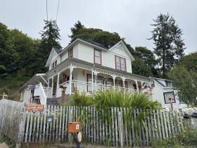
The Goonies House
11 miles away
The hillside Victorian in Astoria that played Mikey's house in the 1985 movie The Goonies still stands above the Columbia River, at the top of its long gravel drive in the oldest town in the Pacific N...

Gearhart Beach
15 miles away
A wide, dune-backed public beach on the quiet north Oregon coast, just above Seaside.
Seaside Aquarium
16 miles away
The hand-feeding harbor seal experience at Seaside Aquarium is one of the most memorable hands-on wildlife moments kids can have on the Oregon coast - seals come right up to the edge of the pool to ta...
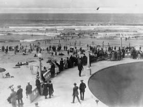
Seaside Promenade and Turnaround
17 miles away
Seaside's mile-and-a-half oceanfront boardwalk, the classic Oregon coast Prom, running along the wide Pacific beach to a landmark Turnaround circle where a Lewis and Clark statue marks the end of thei...
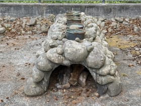
Lewis and Clark Salt Works, Seaside
17 miles away
Most people in Seaside never leave the Promenade, so this small stone ring on a quiet corner goes unnoticed.

Willapa National Wildlife Refuge
20 miles away
Willapa National Wildlife Refuge protects the tidal mudflats, salt marshes, and upland forests of Willapa Bay, one of the cleanest estuaries in the Pacific Northwest.