
Napatree Point Conservation Area
Fort Rd
Watch Hill, Westerly, RI
A wild, undeveloped sand spit reaching a mile into the sea off Watch Hill, with an empty beach, a crumbling fort, and shorebirds by the thousand.
Napatree Point is the rare barrier beach that got to stay wild. A mile-and-a-quarter finger of sand and dune curving west off the village of Watch Hill, it belongs to no boardwalk and holds no cottages, just an open Atlantic beach on one side, the calm water of Little Narragansett Bay on the other, and a low spine of grass and dune in between. Walk it end to end and you leave the crowds behind within minutes.
It was not always empty. Napatree was once longer and sickle-shaped, lined with grand summer houses along a lane called Fort Road, and topped by a real coastal-artillery fort. Then the Great Hurricane of 1938 swept in without warning and erased nearly all of it in a single afternoon. Rather than rebuild, people chose to let the spit heal and stay wild, and today it is one of the finest stretches of protected shore in Rhode Island.
What Travelers Love
- A wide, uncrowded beach with the open Atlantic on one side and calm bay water on the other
- A ruined turn-of-the-century coastal fort to explore at the far end of the walk
- Some of the best shorebird and osprey watching in southern New England
- The wild, undeveloped feel of a barrier spit left almost entirely to nature
Worth Knowing
- The point is a protected conservation area, so there are no facilities out on the spit and you carry out everything you bring
- The walk to the fort at the tip and back is a few miles of soft sand, so wear sturdy shoes and bring water, especially in summer heat
- Dune and grassland areas are fenced off in spring and summer to protect nesting piping plovers and other rare birds, so stay on the beach and marked routes
- Parking near Watch Hill is very limited and fills early on summer weekends, so arrive in the morning or come off season
Learn about Napatree Point Conservation Area
The fort at the end of the spit
Walk the length of Napatree and you reach the crumbling remains of Fort Mansfield, a coastal-defense post the United States government built out here at the turn of the twentieth century. The army bought about sixty acres at the west end of the point in 1898 and armed it with heavy gun batteries, staffing it with as many as a hundred soldiers to guard the approaches to Long Island Sound and the Rhode Island coast.
The fort had a short life. War games soon showed that its guns could themselves be knocked out from an angle they could not defend, and it was declared obsolete and abandoned within a couple of decades, active only from about 1901 to 1926. What is left are the low, sea-worn concrete gun emplacements, weathered and half-buried in sand, a strange and quiet ruin to come upon at the wild tip of a beach walk. It is easy to poke around, but the old concrete has rough edges and drops, so watch children closely.
The hurricane that made it wild
For a long time Napatree was not wilderness at all. A row of substantial summer homes lined Fort Road along the spit, and the point stretched farther out to sea, with a long northern arm called Sandy Point reaching toward the mainland. On September 21, 1938, a hurricane no one saw coming slammed into the Rhode Island coast with almost no warning, driving a storm surge straight down the length of the point.
The sea swept the houses away completely. Of the forty-two people caught in their Fort Road homes that day, fifteen died, and the surge tore the northern arm loose and reshaped the whole spit. In the aftermath, no one rebuilt on Napatree. The dunes and beach grass slowly reclaimed the sand, and the point became what it is now, a moving, living barrier beach that shifts a little with every big storm, left to the tides and the birds.
A haven for birds
Because it was left wild, Napatree is one of the best places to watch birds in southern New England. The mix of open beach, dune, salt marsh, and shallow bay draws migrating and nesting shorebirds in real numbers, and the point sits along a busy Atlantic migration route, so the cast of characters changes with the season. Ospreys nest and fish here, and the tip holds a small off-limits refuge for endangered piping plovers and least terns.
That is why parts of the dunes and grassland are roped off in spring and summer: the plovers nest right on the open sand, their eggs almost invisible, and a single footstep in the wrong place can end a whole clutch. Staying on the beach and the marked routes is not just courtesy here, it is the reason the point still teems with life. Bring binoculars and give the fenced areas a wide berth, and you will see far more for it.
Visiting Napatree Point
Napatree runs off the village of Watch Hill, at the southwestern corner of Rhode Island in the town of Westerly. You reach the spit on foot from the edge of Watch Hill near Fort Road, and the walk out to Fort Mansfield and back is a few miles of soft sand, so wear real shoes, bring water, and plan on a couple of unhurried hours. There are no restrooms, no snack bars, and no shade out on the point, so carry what you need and pack out every bit of trash.
The catch is getting there: Watch Hill is tiny and parking is scarce and fills early on summer weekends, so the smart plan is an early morning arrival, a shoulder-season visit, or a walk over from wherever you are staying. Once you are past the village, though, the reward is a long, quiet, open shore with the ocean on one hand and the bay on the other, a ruined fort at the end, and shorebirds working the tide line, one of the wildest walks left on the crowded southern New England coast.
Closest Boutels
The closest Boutel™ stays, so you can turn this stop into an overnight. Each is a place we chose through independent editorial review, never a paid placement.
Details
Watch Hill, Westerly, RI
Frequently asked questions
What is the Napatree Point Conservation Area?
The Napatree Point Conservation Area, in the Watch Hill area of Westerly, Rhode Island, is a beautiful and unspoiled barrier beach and sandy spit reaching out between the ocean and a protected harbor at the far southwestern tip of the state. This lovely undeveloped peninsula of sand dunes, beach, and grasses is a haven for birds and marine life and a wonderful place for walking, swimming, birdwatching, and enjoying wild coastal beauty, with the historic ruins of an old fort at its end. As a protected conservation area, it offers a peaceful, natural shoreline experience. A gorgeous and tranquil coastal gem, it delights nature lovers. With its wild beach and dunes, Napatree Point offers a rewarding destination in Rhode Island.
What can you do at the Napatree Point Conservation Area?
You can walk the sandy spit between the ocean and the harbor, swim, birdwatch among the dunes and shoreline, explore the historic fort ruins at the point, and enjoy the wild, unspoiled coastal beauty and views. The undeveloped barrier beach, the dunes and wildlife, the fort ruins, and the peaceful natural setting are the draws, making it a favorite for a scenic walk and nature. The wild, quiet shoreline is a refreshing contrast to busier beaches. With its beauty, Napatree Point offers a rewarding experience in Rhode Island.
What should I know before visiting the Napatree Point Conservation Area?
Napatree Point is a fragile, protected barrier beach and important wildlife habitat, so staying on the beach and designated paths, keeping off and out of the fragile dunes and their grasses, respecting nesting-bird areas and any seasonal closures, and carrying out all trash are essential to protect it. There are no facilities on the spit, and it involves a walk, so bringing water and sun protection helps. Treading lightly and respecting the habitat ensure this special place endures at the Napatree Point Conservation Area in Rhode Island.
When is the best time to visit the Napatree Point Conservation Area?
The mild months of late spring through early fall are the most pleasant for walking the spit, swimming, and birdwatching, with summer good for the beach and spring and fall excellent for birds and quieter walks, though respecting any seasonal wildlife closures matters year-round. Because conditions and any closures vary, checking current information before you go is wise. For pleasant weather and rich birdwatching, aim for late spring through early fall at the Napatree Point Conservation Area in Rhode Island.
What is near the Napatree Point Conservation Area?
The Napatree Point Conservation Area is in the Watch Hill area of Westerly, Rhode Island, within reach of the Flying Horse Carousel, the charming Watch Hill village and beaches, Misquamicut State Beach, and the South County shore. That makes Napatree Point a rewarding stop to combine with the Flying Horse Carousel and the other attractions of the Watch Hill and Westerly area on a visit to Rhode Island.
Nearby
Flying Horse Carousel
0.2 miles away
Most visitors to Watch Hill notice the beach before they notice the little carousel on Bay Street, but it is the real treasure here.
Misquamicut State Beach
1.0 miles away
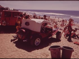
Rhode Island's largest state beach spreads a wide half-mile of warm, gentle Atlantic surf in Westerly, with a lively strip of vintage carousel, mini-golf, and water slides just behind the sand.
Mystic Aquarium
6.4 miles away
This is the stop kids ask for in Mystic. The aquarium keeps beluga whales in one of the largest outdoor beluga habitats in the country, and you can watch them glide past the underwater viewing windows...
Mystic Seaport Museum
6.5 miles away
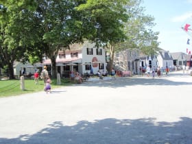
People come to Mystic for the village and miss that its museum is the largest maritime museum in the country.
Bluff Point State Park
9.0 miles away
This is the last big piece of wild coast in Connecticut, and it feels like it.
Custom House Maritime Museum
12 miles away
Most visitors to New London walk right past it, but this is the oldest custom house still working in the country.

North Light
16 miles away
Getting to North Light is half the fun for kids: a flat beach walk of about three quarters of a mile out to Sandy Point at the very tip of Block Island.
Montauk Point and the Bluffs
16 miles away
Montauk Point is where Long Island runs out, a headland of glacial rubble left by the ice sheet and now slowly given back to the sea.
Montauk Point Lighthouse
16 miles away
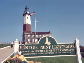
New York's oldest lighthouse, authorized by George Washington and built in 1796 at the very tip of Long Island.

Slater Memorial Museum
18 miles away
Hardly anyone outside Norwich knows this hall exists, and it is genuinely rare.
Mohegan Bluffs
19 miles away
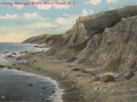
The south face of Block Island falls away in clay cliffs that stand about 150 feet above the surf, and Mohegan Bluffs is where you feel their full height.
Kirk Park Beach
20 miles away
Montauk's walk-to public Atlantic beach, a wide, easygoing sweep of soft sand at the western edge of the village.

Point Judith Lighthouse
20 miles away
This brown-and-white 1857 lighthouse guards one of New England's most treacherous points, where Narragansett Bay meets the open Atlantic.