

Mohegan Bluffs
Mohegan Trail
New Shoreham, RI
Clay cliffs 150 feet above the Atlantic, a lighthouse pulled back from the edge, and a place name that carries a Native battle remembered for four centuries.
Mohegan Bluffs are the great natural landmark of Block Island, a wall of clay cliffs rising roughly 150 feet straight out of the Atlantic along the island's southern shore. From the top the ocean spreads to the horizon, and on a clear day the view can carry all the way to Montauk Point on Long Island. A long wooden staircase drops down the face to a rugged, boulder-strewn beach where few people go.
The name carries a story. It commemorates a battle remembered in local tradition from around the 1590s, when the Manisseans, the island's Native people, met a raiding party of mainland Mohegans at these cliffs. The Narragansett and Niantic peoples and their relatives lived across this region long before European arrival, and their descendants, including the Narragansett Tribe, remain part of Rhode Island today.
What Travelers Love
- Sweeping views from clay cliffs that drop about 150 feet to the surf
- Descending the long wooden staircase to a wild, uncrowded beach
- The red brick Southeast Light standing above the bluffs
- Sunrises and clear-day views that can reach toward Montauk on Long Island
Worth Knowing
- Reaching the beach means a long staircase down and, harder, back up, so pace yourself
- The cliff edges are unstable clay and erode constantly, so stay back from the lip
- There are no services at the bluffs, so bring water, and note the beach has no lifeguards
- Block Island is reached by ferry, and many visitors get around by bicycle or moped
Learn about Mohegan Bluffs
The name and the Native history
The island's original inhabitants were the Manisseans, a people connected to the Niantic and Narragansett of the nearby mainland. They called the island Manisses, often translated as island of the little god, and lived here by fishing, farming, and gathering for thousands of years before Europeans came.
By tradition, the bluffs are named for a confrontation in the late 1500s in which a party of Mohegans from the mainland came to raid the island and were met and defeated by the Manisseans at these cliffs. The story is remembered in the place name that endures today. The Native peoples of this region are living communities, not a closed chapter, and the Narragansett Tribe continues in Rhode Island in the present.
How the cliffs formed
Block Island itself is a product of the last ice age. It is a terminal moraine, a ridge of clay, sand, gravel, and boulders bulldozed to the surface and left behind by the glacier that once covered New England, then stranded offshore as the seas rose when the ice melted.
The bluffs are the cut edge of that glacial pile, exposed where the ocean gnaws at the island's southern side. Because they are made of soft clay rather than hard rock, they erode quickly, reshaping year by year, which is both what makes them dramatic and why the edges are dangerous. Boulders that tumble from the cliff litter the beach below.
The Southeast Light
Above the bluffs stands the Southeast Light, a red brick lighthouse with an attached keeper's house, built in 1875 to warn ships off this hazardous corner of the island. Its Victorian Gothic design makes it one of the handsomest lighthouses in New England.
By the 1990s erosion had brought the cliff edge so close that the entire lighthouse was in danger of falling into the sea. In a remarkable feat of engineering in 1993, the whole structure was jacked up and moved about 300 feet back from the eroding edge, saving it. That the light still stands is a direct result of the same erosion that makes the bluffs so striking.
Down the stairs to the beach
A long wooden staircase, rebuilt over the years and running well over a hundred steps, descends the bluff to the beach below. The climb back up is the real workout, so visitors are wise to save energy for it, but the reward is a wild shoreline of clay, cobbles, and fallen boulders with the cliffs towering overhead.
The beach is undeveloped, with no services and no lifeguards, and the surf can be strong, so it suits walking, tide-pooling, and taking in the scale of the place more than casual swimming. For many visitors, simply standing at the cliff-top overlook, with the ocean falling away beneath, is the whole experience.
Closest Boutels
The closest Boutel™ stays, so you can turn this stop into an overnight. Each is a place we chose through independent editorial review, never a paid placement.
Details
New Shoreham, RI
Frequently asked questions
What are the Mohegan Bluffs?
The Mohegan Bluffs, on Block Island off the coast of Rhode Island, are dramatic clay cliffs rising high above the Atlantic, offering some of the most spectacular ocean views in the state. These towering bluffs of colorful clay drop steeply to a rocky beach far below, with sweeping views of the sea stretching to the horizon, and a long stairway descends from the clifftop to the shore. The bluffs take their name from a historic event in the region's Native American history. Their soaring beauty and stunning views make them a highlight of Block Island. A breathtaking coastal landmark, they delight visitors. With their cliffs and views, the Mohegan Bluffs offer a spectacular destination in Rhode Island.
How did the Mohegan Bluffs get their name?
The Mohegan Bluffs take their name from a historic event in the Native American history of the region, recalling a conflict long ago involving the Mohegan people and the Native inhabitants of Block Island. The name preserves the memory of this early history at the dramatic cliffs. As with many places tied to Native American history, the site invites reflection on the deeper past of the land and its peoples. Understanding this history adds meaning to a visit to the Mohegan Bluffs in Rhode Island.
What should I know before visiting the Mohegan Bluffs?
The Mohegan Bluffs are steep clay cliffs high above the ocean, so keeping well back from the crumbling, eroding cliff edges is essential, as the edges can give way, and reaching the beach below requires descending a long, steep stairway, so being prepared for the climb back up and wearing sturdy shoes matter. The clay can be slippery, and the surf and rocks at the base call for caution near the water. Staying back from the edges and taking care on the stairs ensure a safe, spectacular visit to the Mohegan Bluffs in Rhode Island.
When is the best time to visit the Mohegan Bluffs?
The warm months of late spring through early fall are the best time to visit, when Block Island is in season, the weather is pleasant for the clifftop views and the stairway to the beach, and the ferries run most frequently, with summer the peak season. Because reaching Block Island requires a ferry with a seasonal schedule, checking current ferry times and planning ahead are important. For the best weather and easiest access, aim for late spring through early fall at the Mohegan Bluffs in Rhode Island.
What is near the Mohegan Bluffs?
The Mohegan Bluffs are on Block Island off the Rhode Island coast, within reach of the island's other attractions, including the North Light lighthouse, the beaches, and the town of New Shoreham, all reached by ferry from the mainland. That makes the Mohegan Bluffs a spectacular stop to combine with the North Light and the other attractions of Block Island on a visit to Rhode Island.
Nearby

North Light
5.3 miles away
Getting to North Light is half the fun for kids: a flat beach walk of about three quarters of a mile out to Sandy Point at the very tip of Block Island.
Scarborough State Beach
15 miles away
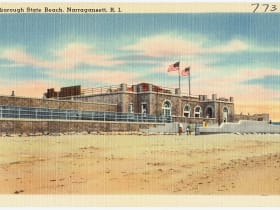
Rhode Island's most beloved ocean beach, a wide crescent of Atlantic surf on Ocean Road in Narragansett with a long boardwalk, an observation tower, and the stone ruins of a lost Gilded Age mansion ab...

Point Judith Lighthouse
15 miles away
This brown-and-white 1857 lighthouse guards one of New England's most treacherous points, where Narragansett Bay meets the open Atlantic.
Montauk Point and the Bluffs
17 miles away
Montauk Point is where Long Island runs out, a headland of glacial rubble left by the ice sheet and now slowly given back to the sea.
Montauk Point Lighthouse
17 miles away
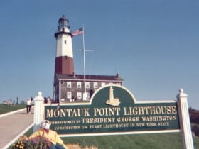
New York's oldest lighthouse, authorized by George Washington and built in 1796 at the very tip of Long Island.
Flying Horse Carousel
19 miles away
Most visitors to Watch Hill notice the beach before they notice the little carousel on Bay Street, but it is the real treasure here.

Misquamicut State Beach
19 miles away
Rhode Island's largest state beach spreads a wide half-mile of warm, gentle Atlantic surf in Westerly, with a lively strip of vintage carousel, mini-golf, and water slides just behind the sand.
Napatree Point Conservation Area
19 miles away
A wild, undeveloped mile-long sand spit curving off Watch Hill, with open Atlantic on one side and calm bay on the other, the ruins of turn-of-the-century Fort Mansfield at the tip, and some of the be...

The Towers
20 miles away
This granite arch spanning Ocean Road is the last piece of an 1880s seaside casino designed by McKim, Mead & White, all that survived a fire in 1900.