

Bridal Veil Falls
46250 Historic Columbia River Hwy
Corbett, OR
A graceful two-step waterfall on a short forest trail, wrapped in the quiet ghost story of a company lumber town that once ran on the creek below it.
Bridal Veil Falls drops in two graceful steps through a mossy, fern-hung cleft in the forest, a short walk below the Historic Columbia River Highway. It is one of the gentler, more intimate waterfalls in a Gorge full of giants, the kind of place you have largely to yourself if you time it right, with a footbridge set perfectly for a long look.
But Bridal Veil is unusual among Gorge waterfalls because it once had a town. For decades a company lumber mill ran at the base of these falls, and a whole community lived and worked here on the banks of the Columbia. Today the town is gone, and walking the quiet trails you are moving through a ghost as much as a forest.
What Travelers Love
- A pretty two-tier waterfall reached by a short, shaded trail
- The cliff-top interpretive loop with wide Columbia River views and spring wildflowers
- The strange, quiet history of a vanished company town underfoot
- Its place on the Gorge's famous waterfall corridor, easy to pair with others
Worth Knowing
- The lower trail to the falls is short but drops and climbs and can be muddy and slick, with steps and a footbridge
- There are two separate trails from the lot: a downhill path to the falls and a flat, accessible clifftop loop with the big views
- This is a heavily visited corridor; arrive early on summer weekends and check whether timed-use permits are in effect on the Historic Highway
- Little remains of the old town itself; the history is mostly interpretive signs and imagination now
Learn about Bridal Veil Falls
The river, the people, and the floods that shaped the Gorge
Long before it carried a scenic highway, the Columbia Gorge was one of the great gathering places of the continent. It is the homeland of Chinookan-speaking peoples, including the Multnomah of the lower river and the Cascades, or Watlala, at the narrows upstream, and its rapids and falls made it a rich fishery and a trading corridor where nations met and exchanged goods up and down the river. Today the Gorge is tied to the Confederated Tribes of Warm Springs, Grand Ronde, the Yakama Nation, and the Umatilla, and salmon and this river remain central to their cultures and their lives.
The Gorge you look out on from the clifftop trail was cut by water on an almost unimaginable scale. The dark rock is Columbia River basalt, floods of lava that spread across the region millions of years ago. Then, near the end of the last Ice Age, a series of cataclysmic floods roared down the Columbia when a glacial dam upstream in Montana failed again and again, scouring the canyon walls sheer. That scouring is why so many side creeks, Bridal Veil among them, are left hanging on the cliffs and plunge off as waterfalls rather than joining the river gently.
The lost town of Bridal Veil
In 1886 the Bridal Veil Falls Lumbering Company set up shop at the foot of the falls, and a company town grew up around it on the narrow bench between the cliffs and the Columbia. For half a century Bridal Veil was a working mill town, complete with houses, a store, a church, and a post office, all owned by the company.
The operation had two halves. High on the slopes of Larch Mountain sat the town of Palmer, where timber was cut into rough lumber, and that rough lumber was sent racing down the mountain to Bridal Veil through a long wooden flume, a water-filled trough, to be finished at the planing mill beside the river and loaded onto the railroad. Palmer and Bridal Veil lived and died together as a pair.
Fire and dwindling timber closed the upper mill at Palmer in the 1930s, and the Bridal Veil mill reinvented itself, turning out wooden boxes for cheese and, during World War Two, ammunition. When the box mill finally closed in 1960 the town faded away, and the buildings were eventually removed. One quirky legacy lingered: for years couples mailed their wedding invitations here just to get the romantic Bridal Veil postmark.
The falls and the two trails
From the parking area, a lower trail switches down through second-growth forest, crosses the creek on a footbridge, and arrives at a viewing platform below the falls, where the water drops in its two distinct tiers into a rocky pool. It is a short outing, though it does climb back out, and the shaded path stays cool even on hot days.
The second trail is completely different: a flat, paved, accessible loop out to the edge of the cliffs, with sweeping views up and down the Columbia River. In late spring this overlook lights up with camas, lupine, and other wildflowers, and interpretive signs tell the story of the town and the mill. Together the two short trails give you both the waterfall and the wider Gorge in under an hour.
Nature reclaiming the ground
The forest here is classic western Gorge rainforest, Douglas fir and bigleaf maple dripping with moss, sword fern and salmonberry crowding the creek, all fed by the mild, wet climate that funnels through this end of the Columbia. It is remarkable to stand in that green and remember that a smoky, clattering mill town filled this exact spot within living memory.
The clifftop meadows are the seasonal showpiece, with camas turning the grass blue in spring and butterflies working the flowers. Watch for songbirds in the forest, raptors riding the wind along the cliffs, and the constant, patient work of moss and fern erasing the last traces of the town.
When to go and the wider corridor
Spring is the sweet spot, when the falls run full with snowmelt and the clifftop wildflowers peak, though the shaded lower trail is a welcome cool retreat in summer and the forest glows in fall. Winter brings high water and, in cold snaps, ice, along with far fewer people.
Bridal Veil is one bead on the necklace of waterfalls strung along the Historic Columbia River Highway, so it is easy to combine with Latourell, Wahkeena, and mighty Multnomah Falls just up the road. Because this corridor is so popular, come early, and check ahead, since Oregon sometimes requires timed-use permits on the old highway during the busy season.
Closest Boutels
The closest Boutel™ stays, so you can turn this stop into an overnight. Each is a place we chose through independent editorial review, never a paid placement.
Details
Corbett, OR
Frequently asked questions
How long is the hike to Bridal Veil Falls?
Short and rewarding. The trail down to the base of the two-tiered falls is only about six-tenths of a mile round trip, though it drops and climbs a bit with some stairs and rocky, sometimes slippery footing. It is one of the best short waterfall hikes in the Columbia Gorge for the effort involved.
Is there an easier, accessible trail at Bridal Veil Falls?
Yes. Besides the path down to the falls, there is a short paved loop along the top of the cliffs that is easy and accessible to nearly everyone, with lovely views out over the Columbia River Gorge, and wildflowers in spring. If stairs and uneven trail are a concern, the overlook loop is a gentle alternative.
What should I watch out for on the Bridal Veil Falls trail?
The path to the base has loose gravel and some steep, rocky sections, so wear shoes with good grip and take the stairs and switchbacks carefully. Poison oak grows along parts of the trail, so it is wise to stay on the path and avoid brushing against the greenery. Keep children close near the falls and the pool at the bottom.
When is the best time to visit Bridal Veil Falls?
It is worth a stop year-round, but the falls and trails are at their best from spring through fall, with spring bringing the fullest flow and wildflowers on the overlook loop. It is a popular, easy-to-reach Gorge stop, so parking is limited and fills quickly on nice-weather weekends; arriving early makes for an easier, quieter visit.
How do I get to Bridal Veil Falls?
It sits along the Historic Columbia River Highway in the western Columbia Gorge east of Portland. One thing to know: the nearest freeway exit can only be reached heading eastbound, so westbound travelers usually continue to the next exit and loop back along the scenic old highway. Either way, the drive past other waterfalls on the historic highway is part of the fun.
Nearby
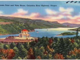
Vista House at Crown Point
3.3 miles away
Most Gorge visitors are aimed at the waterfalls and treat Crown Point as a drive-by.

Multnomah Falls
3.4 miles away
Multnomah Falls drops 620 feet in two tiers, the tallest waterfall in Oregon, with the arched Benson Bridge spanning the gap between them.

Oneonta Gorge
5.8 miles away
The cliffs of Oneonta Gorge are close enough together that a full-grown Douglas fir could not fall across the gap in the narrowest section.
Beacon Rock
9.2 miles away
Beacon Rock is right off SR-14 in Beacon Rock State Park, about 35 miles east of Vancouver.

Bonneville Dam Fish Ladder
13 miles away
The underwater viewing windows are the draw: floor-to-ceiling glass with salmon and steelhead swimming past at eye level. During fall Chinook season, the volume of fish can be extraordinary.

Eagle Creek Trail
14 miles away
A legendary Columbia Gorge waterfall hike blasted into sheer basalt cliffs in 1915, stringing together fall after fall, including the emerald pool of Punch Bowl Falls and Tunnel Falls, where the trail...

Bridge of the Gods and Cascade Locks
15 miles away
A slender steel toll bridge across the Columbia River in the heart of the Gorge, named for a Native American legend of a natural stone land bridge, at the historic town of Cascade Locks where steamboa...
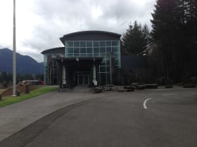
Columbia Gorge Interpretive Center
17 miles away
The Columbia Gorge Interpretive Center Museum in Stevenson documents the natural and human history of the gorge, from Ice Age floods through Native American cultures, the Lewis and Clark Expedition, a...
Rocky Butte Natural Area
19 miles away
Five Cascade volcanoes visible from one overlook inside a major city is not common.