

Oneonta Gorge
Historic Columbia River Hwy, Cascade Locks, OR
Cascade Locks, OR
A narrow, dripping basalt slot canyon in the Columbia River Gorge, its vertical walls hung with ferns and moss, hiding a waterfall at its end, and, for now, closed and impassable after wildfire.
Oneonta Gorge is one of the Columbia River Gorge's most striking hidden places: a slot canyon so narrow you can nearly touch both walls at once, carved into sheer basalt and cloaked in a hanging garden of ferns, moss, and lichen that keeps it green and dripping year-round. At its far end, out of sight from the road, Lower Oneonta Falls drops into a pool. For generations, reaching it meant an adventurous wade up the creek bed itself.
It is important to be honest up front. Oneonta Gorge has been closed since the 2017 Eagle Creek Fire, and it is likely to remain closed. Even in its heyday the trip in was risky, over a treacherous log jam and through deep, cold water, and the fire made it far more dangerous. This is a page about a remarkable place you can admire and understand, and hopefully visit again someday, rather than one you should try to enter now.
What Travelers Love
- The sheer, narrow beauty of a true slot canyon walled in dark basalt and dripping with green
- Its setting among the Gorge's greatest waterfalls, an easy pairing with Multnomah and Horsetail Falls
- The rare botanical richness of the canyon, a hanging garden of ferns, mosses, and wildflowers
- The romance of a hidden waterfall tucked at the end of a canyon you have to wade to reach
Worth Knowing
- The gorge has been closed to entry since the 2017 Eagle Creek Fire and, as of 2026, is expected to stay closed; respect all closures and signs
- Even before the fire, reaching the falls meant scrambling over a huge, unstable log jam and wading through cold, chest-deep water, and people were injured and rescued there
- The fire sent hundreds more logs into the creek, making any entry genuinely dangerous now
- You can still admire the mouth of the gorge and the nearby falls from the highway while access is restored
Learn about Oneonta Gorge
How the slot canyon was carved
Oneonta Gorge is a narrow box canyon, only about a third of a mile long, cut through the thick layers of basalt that form the walls of the Columbia River Gorge. That basalt was laid down by enormous ancient lava flows, and the Gorge itself was later widened and scoured by the Missoula Floods, a series of colossal Ice Age floods that roared down the Columbia when glacial dams gave way, around fifteen thousand years ago.
Since then, Oneonta Creek has done the fine work, slowly undercutting the vertical basalt and deepening the slot a little more with every high-water season. The result is a canyon far narrower than it is deep, so tight and shaded that sunlight only reaches the floor for part of the day. That constant cool, wet shade is exactly what makes the canyon such an unusual living place.
The log jam that came to define the entrance is part of this same restless geology. Van-sized boulders collapsed into the mouth of the gorge in the late 1990s, and over the years floods piled fallen trees against them into a growing tangle of logs, the obstacle every visitor once had to climb over to get inside.
A hanging garden in the rock
What sets Oneonta apart from the Gorge's other canyons is its botany. The narrow walls, constant spray, and deep shade create a cool, humid, stable microclimate found in few other places, and rare plants have taken hold on the wet rock faces, a vertical garden of ferns, mosses, liverworts, and lichens, with delicate wildflowers tucked into the seams.
The canyon has been recognized for this richness for a very long time, valued by botanists as a refuge where uncommon moisture-loving plants cling to the dripping basalt. It is one of those places where the geology, the water, and the light all conspire to grow something you cannot find just anywhere.
That same fragility is part of why the closure matters. Heavy foot traffic, and the churn of thousands of people wading through, takes a toll on a place this delicate, and the enforced rest may in time be a kindness to the canyon as much as a safety measure.
The highway, the tunnel, and a borrowed name
The gorge owes its fame in part to the Historic Columbia River Highway, the pioneering scenic road that engineer Samuel Lancaster laid out through the Gorge in the 1910s. Completed in the early 1920s, it was built to show off the landscape rather than just get through it, and at Oneonta, Lancaster blasted a tunnel through solid rock and added a staircase down toward the creek so travelers could reach the water.
The name Oneonta is a transplant. It was borrowed from the Oneonta, a side-wheeler steamboat that once worked the Columbia River, which in turn took its name from Oneonta, New York. The Native peoples of the Columbia River Gorge lived along this river for thousands of years before any of that, and their descendants remain in the Columbia River tribes today; the English place name is a much later, imported layer over far older ground.
In the twentieth century the Forest Service and the Civilian Conservation Corps built trails into the upper canyon and to viewpoints above the falls, and the Oneonta Tunnel, long buried and then restored, became a small landmark of its own, before heavy visitation and vandalism began to take a toll.
Fire, closure, and an uncertain future
On September 2, 2017, a teenager set off fireworks during a burn ban above the Gorge, and the Eagle Creek Fire tore through the Oregon side, burning tens of thousands of acres and heavily damaging many of the area's most beloved trails, Oneonta among them. Fire-killed trees toppled into the watershed, and hundreds more logs washed into Oneonta Creek, swelling the already dangerous log jam at the entrance to what officials have called epic proportions.
The gorge has been closed to entry ever since. Land managers point to a genuine mix of hazards: the unstable log jam, falling burned trees, the confined slot with no easy escape, deep and cold water, and the sheer number of people who used to crowd in. As of 2026, the closure is expected to continue while the Forest Service works through a plan for whether and how access might one day be restored, whether fully open, kept closed, or managed seasonally.
So the honest picture is this: Oneonta Gorge is a wonder worth knowing about and worth hoping to visit in some safer future, but not a place to slip past a closure sign today. From the Historic Columbia River Highway you can still take in the mouth of the gorge and the great waterfalls all around it, and let the slot canyon keep its rest.
Season by season
In the years it was open, late summer and early fall were the classic time to wade the gorge, when Oneonta Creek ran lowest and warmest and the trip to the falls was least treacherous. Even then it was cold, wet, and not for everyone.
Spring and early summer bring snowmelt and rain that swell the creek into a fast, cold, and dangerous flow, when the canyon is at its greenest but least safe to enter.
Winter turns the Gorge stormy and icy, with high water, slick rock, and short days. While the closure holds, the seasons mainly change how the waterfalls of the surrounding highway corridor look from the road, thundering in spring, gentler by late summer.
Closest Boutels
The closest Boutel™ stays, so you can turn this stop into an overnight. Each is a place we chose through independent editorial review, never a paid placement.
Details
Cascade Locks, OR
Frequently asked questions
Is Oneonta Gorge open, and can you hike into it?
For years the famous scramble up into the narrow gorge has been closed to public access, and it is genuinely dangerous, so this is not a place to just show up and wade in. Conditions here can change, and any reopening is uncertain, so it is important to check the current official status with the Forest Service before planning a visit rather than assuming it is open. If it is closed or posted as hazardous, respect that and do not enter.
Why is Oneonta Gorge considered dangerous?
The route up the slot canyon to Lower Oneonta Falls requires climbing over a large, unstable logjam of massive slick logs and then wading through deep, frigid water that carries a real risk of hypothermia year-round. A major wildfire also destabilized the canyon walls, adding rockfall danger. This combination has led to numerous injuries, rescues, and a death, which is why officials have repeatedly warned people to stay out.
Is there a safer way to see the Oneonta area?
Yes. Rather than risk the closed slot canyon, you can hike the nearby Oneonta Trail, which climbs through the same beautiful, fern-draped canyon and crosses Middle Oneonta Falls on a footbridge on its way to the lovely Triple Falls. It gives you gorgeous, photogenic waterfall scenery in far safer conditions. Always check current trail status and closures for this area before you go, since Gorge trails can change.
What is Oneonta Gorge known for?
It is a strikingly narrow, moss- and fern-lined slot canyon in the Columbia River Gorge, long famous as a botanical treasure with rare plants clinging to its shaded walls, and for the hidden waterfall tucked at its end. Its beauty is exactly why so many people were drawn to it, but that same tight, water-filled canyon is what makes unguided entry so hazardous now that it is closed.
What else is nearby in the Columbia River Gorge?
Plenty of world-class scenery sits close by. The towering Multnomah Falls, Oregon's most famous waterfall, is just down the road, along with Horsetail and Wahkeena Falls and the historic Columbia River Highway viewpoints. You can easily build a rewarding day of Gorge waterfalls and overlooks without entering any closed or hazardous area, so check what is open and enjoy the many safe, spectacular options.
Nearby

Multnomah Falls
2.4 miles away
Multnomah Falls drops 620 feet in two tiers, the tallest waterfall in Oregon, with the arched Benson Bridge spanning the gap between them.
Beacon Rock
3.6 miles away
Beacon Rock is right off SR-14 in Beacon Rock State Park, about 35 miles east of Vancouver.
Bridal Veil Falls
5.8 miles away
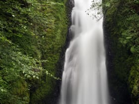
Most drivers on the Historic Columbia River Highway stop at Multnomah and skip Bridal Veil three miles back, even though the walk is the same length and the falls are easily as dramatic.

Bonneville Dam Fish Ladder
7.3 miles away
The underwater viewing windows are the draw: floor-to-ceiling glass with salmon and steelhead swimming past at eye level. During fall Chinook season, the volume of fish can be extraordinary.

Eagle Creek Trail
8.0 miles away
A legendary Columbia Gorge waterfall hike blasted into sheer basalt cliffs in 1915, stringing together fall after fall, including the emerald pool of Punch Bowl Falls and Tunnel Falls, where the trail...
Vista House at Crown Point
9.1 miles away
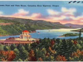
Most Gorge visitors are aimed at the waterfalls and treat Crown Point as a drive-by.

Bridge of the Gods and Cascade Locks
9.6 miles away
A slender steel toll bridge across the Columbia River in the heart of the Gorge, named for a Native American legend of a natural stone land bridge, at the historic town of Cascade Locks where steamboa...
Columbia Gorge Interpretive Center
11 miles away
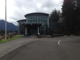
The Columbia Gorge Interpretive Center Museum in Stevenson documents the natural and human history of the gorge, from Ice Age floods through Native American cultures, the Lewis and Clark Expedition, a...