


Multnomah Falls
48314 Historic Columbia River Hwy
Corbett, OR
Oregon's tallest waterfall drops in two silver tiers under a slim 1914 footbridge, the most-visited natural wonder in the Pacific Northwest.
Multnomah Falls is the waterfall on every Oregon postcard, and in person it lives up to the picture. Water drops a total of about 620 feet in two tiers, an upper plunge of roughly 542 feet and a lower fall of about 69 feet, which makes it the tallest waterfall in the state. Spanning the gap between the two, the slim Benson Bridge lets you stand right in the spray with the upper falls thundering over your head.
What most visitors do not realize is how much of this scene was shaped by ice-age catastrophe and by one lumber baron's generosity. The Gorge and its hanging waterfalls were carved by enormous floods at the end of the last ice age, and the footbridge, the lodge, and the parkland at the base all trace back to Simon Benson, who gave the land to the city of Portland a century ago.
What Travelers Love
- The full two-tier drop of Oregon's tallest waterfall, seen head-on from the base
- Walking out onto the Benson Bridge, suspended between the upper and lower falls
- The stone-and-timber lodge at the foot of the trail, unchanged since the 1920s
- The mossy, fern-hung forest and the paved switchback climb to the top of the upper falls
Worth Knowing
- It is the most-visited natural site in the Pacific Northwest, so arrive early or late, and in summer a timed-use permit is often required to reach the falls
- The paved trail to the upper viewpoint climbs steadily with switchbacks; the base and the Benson Bridge are an easy walk from the lodge
- The falls run hardest in spring from snowmelt and rain, and can freeze into ice curtains in a cold snap
- The 2017 Eagle Creek Fire burned across the cliffs above; the falls came through, but stay on trails as the slopes above are still healing
Learn about Multnomah Falls
The falls and how the Gorge was carved
Multnomah Falls pours over a cliff of Columbia River basalt, dark volcanic rock laid down in enormous lava floods millions of years ago and stacked hundreds of feet thick. Little Multnomah Creek, fed by springs and snowmelt off Larch Mountain to the south, gathers just enough water to make a year-round waterfall, thin in late summer and roaring in spring.
The reason so many tall, narrow waterfalls hang along this one stretch of the Gorge goes back to the Ice Age. Near the end of the last glacial period, a series of gigantic floods, released when an ice dam holding back a glacial lake in Montana broke again and again, tore down the Columbia and scoured the canyon walls nearly vertical. Side streams that once met the river gently were left spilling off high cliffs, and Multnomah is the grandest of them.
From the lodge, a short paved path reaches the base and the Benson Bridge. A steeper mile of switchbacks climbs to a railed platform at the lip of the upper falls, where you can look straight down the drop and out across the river to Washington.
Simon Benson, the bridge, and the lodge
In 1914, the lumberman and philanthropist Simon Benson was walking the grounds with Samuel Lancaster, the engineer building the new Columbia River Highway, and remarked that a footbridge across the falls would be a fine thing. That year the Benson Bridge went up, a graceful reinforced-concrete arch set about a hundred feet above the lower falls. It still carries visitors across the water today.
Benson went further. He bought the land around the falls and gave it to the city of Portland for a public park, so that the waterfall would never be walled off behind a fee gate or a hotel. In 1925 the Cascadian-style Multnomah Falls Lodge was built at the base from local stone and timber, designed by the Portland architect A.E. Doyle. It still stands at the foot of the trail, on the National Register of Historic Places, serving travelers just as it did when the highway was new.
Tourism here is older still. As early as the 1880s, trains from Portland stopped near the base so passengers could step off and walk to the falls, one of the first tourist attractions in the young state.
The legend of the falls
The falls carry a story long told of the Multnomah people, and it is worth telling with care. As the legend goes, a sickness once swept through the village, and a medicine man said only the sacrifice of a chief's daughter, offered from the high cliff, would call on the Great Spirit to lift it. To save her people, the young woman climbed the rock and stepped off, and where she fell the water began to pour, a silver ribbon that had never been there before.
In the telling, the fine drifting mist that hangs at the upper falls is her spirit, still watching over the people below. Like all such stories it exists in several versions, passed down through generations, and it is offered here as a legend held by the Native people of this river, not as documented history.
Forest, wildlife, and the fire
The walls around the falls are a hanging garden: sword fern, moss, and dripping seeps cling to the basalt, and the forest is Douglas fir, western hemlock, and bigleaf maple. Watch the cliff faces for the white flash of water and for peregrine falcons and swifts working the updrafts, and listen along the creek for the American dipper, a gray songbird that walks underwater to feed.
In September 2017 the Eagle Creek Fire, started by a firework, swept the cliffs above Multnomah Falls and burned much of the surrounding Gorge. The lodge and the falls survived, protected by crews who stayed through the night, but the slopes above are still recovering, which is why staying on the trails here matters more than ever. Rockfall and the occasional closure are part of a landscape putting itself back together.
When to visit
Spring brings the falls to full power, fed by snowmelt and gorge rain, and the surrounding creeks and side falls run high. Summer is the busiest and driest season, when a timed-use permit is often needed to reach the site and the parking fills early. Fall quiets the crowds and adds gold to the maples.
Winter has its own reward. In a hard cold snap the falls can freeze into towers and curtains of ice, a rare and beautiful sight, though the trails turn slick and the upper path may close. Whatever the season, coming at the edges of the day rewards you with the falls closer to the way the first train passengers found it.
Closest Boutels
The closest Boutel™ stays, so you can turn this stop into an overnight. Each is a place we chose through independent editorial review, never a paid placement.
Details
Corbett, OR
Frequently asked questions
Do I need a permit to visit Multnomah Falls?
In the busy summer season, a timed-use permit is generally required to park in the main lot off the interstate during daytime hours, reserved online ahead of time for a small fee. It is worth checking the current requirements before you go, since the system changes year to year, and note that a permit reserves an arrival window, not a guaranteed parking space. Outside the summer permit hours, and if you arrive by shuttle, bike, or on foot, you typically do not need one.
How do I avoid the crowds at Multnomah Falls?
Timing is everything. The falls are busiest from mid-morning through late afternoon in summer, so arriving early, before around nine, or in the evening, after six, means far smaller crowds, easier parking, and, conveniently, no permit needed during those hours. Spring and fall weekdays are quieter than summer weekends, and a rainy day can leave the paved viewpoints almost to yourself.
How far is the hike to the top of Multnomah Falls?
It depends how far you want to go. Reaching the famous Benson Bridge between the two tiers is a short, mostly paved walk of well under a mile round trip. Continuing all the way to the overlook at the top of the upper falls is a steeper climb of a bit over two miles round trip with real elevation gain, taking most people around an hour and a half to two hours. The lower viewpoint is accessible to nearly everyone.
When does Multnomah Falls have the most water?
It flows impressively year-round, fed by underground springs, but it runs fullest and most powerful in the winter and spring from rain and snowmelt, when spring also brings wildflowers along the trails. Summer flows are lighter but the falls are still striking, and in a hard winter the mist can even coat the surroundings in ice. There is really no bad season to see it.
What should I wear or bring to Multnomah Falls?
Sturdy shoes with good grip are wise, because even the paved lower path gets slippery from the constant mist, and proper footwear matters if you hike to the top. Bring a light layer too, since the spray off the 620-foot falls noticeably cools the air near the base even on a warm day. A water bottle and a camera round out the essentials.
Nearby

Oneonta Gorge
2.4 miles away
The cliffs of Oneonta Gorge are close enough together that a full-grown Douglas fir could not fall across the gap in the narrowest section.
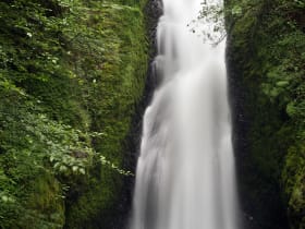
Bridal Veil Falls
3.4 miles away
Most drivers on the Historic Columbia River Highway stop at Multnomah and skip Bridal Veil three miles back, even though the walk is the same length and the falls are easily as dramatic.
Beacon Rock
5.9 miles away
Beacon Rock is right off SR-14 in Beacon Rock State Park, about 35 miles east of Vancouver.
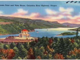
Vista House at Crown Point
6.7 miles away
Most Gorge visitors are aimed at the waterfalls and treat Crown Point as a drive-by.

Bonneville Dam Fish Ladder
9.7 miles away
The underwater viewing windows are the draw: floor-to-ceiling glass with salmon and steelhead swimming past at eye level. During fall Chinook season, the volume of fish can be extraordinary.

Eagle Creek Trail
10 miles away
A legendary Columbia Gorge waterfall hike blasted into sheer basalt cliffs in 1915, stringing together fall after fall, including the emerald pool of Punch Bowl Falls and Tunnel Falls, where the trail...

Bridge of the Gods and Cascade Locks
12 miles away
A slender steel toll bridge across the Columbia River in the heart of the Gorge, named for a Native American legend of a natural stone land bridge, at the historic town of Cascade Locks where steamboa...
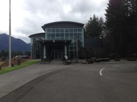
Columbia Gorge Interpretive Center
14 miles away
The Columbia Gorge Interpretive Center Museum in Stevenson documents the natural and human history of the gorge, from Ice Age floods through Native American cultures, the Lewis and Clark Expedition, a...