
Beacon Rock
Beacon Rock State Park, WA-14
North Bonneville, WA
A switchback trail spirals up the sheer face of an ancient volcano's core to one of the great views of the Columbia River Gorge.
Beacon Rock is an 848-foot tower of basalt standing alone on the north bank of the Columbia River, one of the largest freestanding monoliths on the continent. What makes it more than a landmark to photograph is the trail: a mile of paved switchbacks, more than fifty of them, bolted and bridged onto the sheer face so that anyone reasonably fit can walk to the very top.
The rock is the hard inner core of a volcano whose softer outer cone was stripped away, first by erosion and then, dramatically, by the Ice Age floods that scoured this whole gorge. Lewis and Clark noted it on their way to the sea, and a century later one determined man spent three years and his own money carving the path that still carries visitors to the summit today.
What Travelers Love
- Climbing the mile of paved switchbacks bolted to the sheer rock face, with the river opening up below at every turn
- The summit view straight down the Columbia River Gorge in both directions
- The audacity of the hand-built trail, with its bridges and railings clinging to a vertical wall
- A short, punchy hike that delivers a huge payoff for the distance
Worth Knowing
- The trail is only about a mile up but it gains roughly six hundred feet quickly, with long drop-offs along the railings, so it is not for anyone uneasy with heights
- There is no shade on the face and the metal railings bake in summer, so go early or bring water
- A Washington Discover Pass is required to park
- In ice or heavy rain the switchbacks get slick, and the trail can close in winter storms
Learn about Beacon Rock
The core of a volcano
Beacon Rock is what geologists call a volcanic plug. Tens of thousands of years ago molten rock hardened inside the throat of a volcano, and over time the looser ash and rock of the outer cone wore away, leaving only the dense central pillar standing.
The finishing work was done by water. During the last Ice Age, a series of catastrophic floods roared down the Columbia when ice dams holding back glacial Lake Missoula gave way in Montana. Walls of water hundreds of feet deep swept through the gorge, scraping it clean and exposing the bare rock you see today. Beacon Rock is one of the tough survivors of that scouring.
It stands about 848 feet above the river, and because the surrounding land is low, it reads as even taller. Lewis and Clark measured a tidal rise and fall in the river here in 1805, the first place they noticed the ocean's pull, so the rock marks the rough upstream edge of the tides on the Columbia.
The trail Henry Biddle built
For a while the rock's future was grim. In the early 1900s there were plans to blast it apart for stone to build river jetties, which would have erased it entirely. A man named Henry Biddle bought Beacon Rock in 1915 specifically to save it, and then set out to make it climbable.
From 1915 to 1918 Biddle and his crew built the trail that is still in use, a remarkable piece of hand engineering with more than fifty switchbacks, wooden bridges, and railings pinned to a nearly vertical wall. His family later offered the rock to Washington as a state park, and after some back and forth it was accepted, so the whole thing is preserved today because one person refused to let it be quarried away.
A gorge that people have traveled for thousands of years
Long before it had a trail, this stretch of the river was a highway and a gathering place for Native peoples, including Chinookan-speaking communities of the lower Columbia. The gorge was one of the great trade corridors of North America, its rapids and falls famous fishing sites where people met, traded, and fished the salmon runs for generations.
The Corps of Discovery passed the rock in the fall of 1805 and again in 1806, recording it in their journals. The name has drifted a little over the years, but Beacon Rock stuck. Today the monolith sits inside the Columbia River Gorge National Scenic Area, a landscape managed to keep its dramatic character intact.
Wildlife and the wider park
Watch the cliffs for raptors, since the rock's ledges make good perches and nest sites, and peregrine falcons have used the gorge walls. The river below draws waterfowl, and bald eagles work this stretch of the Columbia, especially in winter.
Beacon Rock State Park is much bigger than the monolith itself, with miles of trails climbing into the forested hills behind it, including routes to Hamilton Mountain and its waterfalls. So the rock is often just the start of a longer day on foot.
Closest Boutels
The closest Boutel™ stays, so you can turn this stop into an overnight. Each is a place we chose through independent editorial review, never a paid placement.
Details
North Bonneville, WA
Frequently asked questions
What is Beacon Rock?
Beacon Rock, in the Columbia River Gorge of southwestern Washington, is a massive and iconic basalt monolith rising about eight hundred forty-eight feet above the Columbia River, one of the largest freestanding rocks of its kind. The core of an ancient volcano left standing after erosion, it is a striking landmark named by explorers Lewis and Clark. What makes Beacon Rock special is the remarkable trail to its summit, an ingenious series of switchbacks, bridges, and railings built into the cliff, offering hikers stunning panoramic views of the Columbia River Gorge from the top. With its dramatic monolith and thrilling summit trail, Beacon Rock offers a memorable hiking destination in the Columbia River Gorge.
What is the hike up Beacon Rock like?
The trail to the top of Beacon Rock is a remarkable engineering feat, climbing about a mile up the face of the monolith via more than fifty switchbacks with handrails, bridges, and walkways clinging to the cliff, gaining roughly six hundred feet in elevation. Though steep and exposed, the well-built, railed trail makes the summit accessible to reasonably fit hikers, and it is not technical, just a steady climb. The reward at the top is spectacular panoramic views of the Columbia River Gorge. The unique, dramatic trail with its many switchbacks is part of what makes climbing Beacon Rock such a memorable experience.
What safety tips apply at Beacon Rock?
While the trail has handrails and is well-built, it is steep, narrow in places, and exposed with drop-offs, so watch your footing, hold the railings, keep children close, and use caution, especially when passing others on the narrow switchbacks. The trail can be slippery when wet or icy, so take care in bad weather. Those uneasy with heights should know the trail is exposed. Wear good shoes and carry water. Being cautious on the steep, exposed trail, holding the railings, and watching children ensures a safe climb to the top of Beacon Rock.
When is the best time to visit Beacon Rock?
Spring through fall offers the most pleasant weather for the hike, with spring bringing wildflowers to the gorge and fall offering comfortable temperatures and color, while summer is popular and warm, so earlier visits mean fewer crowds on the narrow trail. Winter can bring rain, ice, and slippery conditions on the exposed trail, so caution is needed then. Clear days offer the best views from the summit. For the best combination of comfortable weather, safe trail conditions, and clear gorge views, aim for spring through fall at Beacon Rock.
What is near Beacon Rock?
Beacon Rock is in the Columbia River Gorge of southwestern Washington, near the town of Stevenson with the Columbia Gorge Interpretive Center, the many waterfalls and trails of the gorge, and within reach of the Bonneville Dam, Portland, Oregon, across the river, and the gorge's Washington and Oregon attractions. That makes Beacon Rock a spectacular stop to combine with the Columbia Gorge Interpretive Center, the gorge's waterfalls and scenery, and the other attractions of the Columbia River Gorge on a visit to Washington.
Nearby

Oneonta Gorge
3.6 miles away
The cliffs of Oneonta Gorge are close enough together that a full-grown Douglas fir could not fall across the gap in the narrowest section.

Bonneville Dam Fish Ladder
4.0 miles away
The underwater viewing windows are the draw: floor-to-ceiling glass with salmon and steelhead swimming past at eye level. During fall Chinook season, the volume of fish can be extraordinary.

Eagle Creek Trail
4.9 miles away
A legendary Columbia Gorge waterfall hike blasted into sheer basalt cliffs in 1915, stringing together fall after fall, including the emerald pool of Punch Bowl Falls and Tunnel Falls, where the trail...

Multnomah Falls
5.9 miles away
Multnomah Falls drops 620 feet in two tiers, the tallest waterfall in Oregon, with the arched Benson Bridge spanning the gap between them.

Bridge of the Gods and Cascade Locks
6.2 miles away
A slender steel toll bridge across the Columbia River in the heart of the Gorge, named for a Native American legend of a natural stone land bridge, at the historic town of Cascade Locks where steamboa...
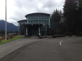
Columbia Gorge Interpretive Center
7.7 miles away
The Columbia Gorge Interpretive Center Museum in Stevenson documents the natural and human history of the gorge, from Ice Age floods through Native American cultures, the Lewis and Clark Expedition, a...
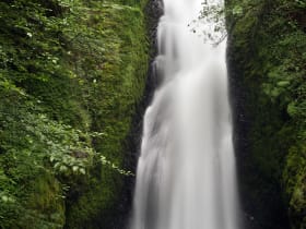
Bridal Veil Falls
9.2 miles away
Most drivers on the Historic Columbia River Highway stop at Multnomah and skip Bridal Veil three miles back, even though the walk is the same length and the falls are easily as dramatic.
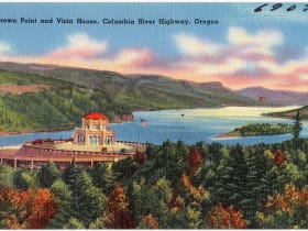
Vista House at Crown Point
12 miles away
Most Gorge visitors are aimed at the waterfalls and treat Crown Point as a drive-by.