
Rocky Butte Natural Area
NE Rocky Butte Rd
Portland, OR
Drive to the top of a long-dead volcano in the middle of Portland and stand on a stone parapet hand-laid during the Depression, with the whole city and a line of Cascade peaks spread out below.
Rocky Butte is one of Portland's small surprises: an extinct volcano rising a few hundred feet above the east-side neighborhoods, with a road that curls all the way to the top. At the summit sits a compact park ringed by a low stone wall, and from behind that parapet the whole city opens up, the downtown towers, the Columbia River, and on a clear day a line of snowcapped Cascade peaks from Mount Hood to Mount St. Helens.
The best of it is that so little effort buys so much. You can drive nearly to the crown, walk a few steps, and take in one of the finest free views in the city. The stonework you lean on to do it is a piece of history in its own right, laid by hand by unemployed workers during the Great Depression.
What Travelers Love
- A sweeping view of Portland, the Columbia River, and the Cascade peaks, all reached by a short drive
- The handsome stone parapet and archways at the summit, hand-built during the Great Depression
- Sunset and city-lights views that make it a favorite quiet spot after dark
- The novelty of standing on top of an extinct volcano in the middle of a big city
Worth Knowing
- The summit view area is a small city park, so it can feel busy on clear evenings and around sunset
- The stone walls sit above a real cliff, so keep children and dogs close and stay behind the parapet
- There is little shade at the top, and the view depends on the weather, so clear days are far better
- It is surrounded by neighborhoods, so be a considerate visitor, especially late in the day
Learn about Rocky Butte Natural Area
A volcano in the city
Rocky Butte is an extinct cinder cone, one of dozens of small volcanoes that make up the Boring Lava Field scattered across the Portland area. It grew from eruptions of basaltic andesite in the deep past, well over a hundred thousand years ago, and long ago went cold. What stands today is essentially the hard core of that old volcano, the tough rock that once filled its vent.
That toughness is why the butte is still here. During the great Ice Age floods that swept down the Columbia and scoured the region, softer hills were buried or washed away, while the resistant plug of Rocky Butte held its ground. The steep, rocky faces that give the butte its name are the exposed bones of that ancient volcanic vent.
Those same faces have long drawn rock climbers, who work the old quarry walls on the butte's flanks. Stone cut from the butte itself went into building projects around the city, so in a real sense pieces of this little volcano are scattered through Portland's older architecture.
The stonework at the crown
The park at the summit is Joseph Wood Hill Park, named for the founder of a military academy that once stood nearby, and it was dedicated to the city in 1935. What draws the eye is the stonework: massive basalt-block walls, cut-stone archways, and a broad flat viewing platform ringed by a parapet, all of it heavy, handsome, and clearly made to last.
It was built by hand during the Great Depression. Between about 1934 and 1939, crews drawn from the ranks of the unemployed, working under relief programs including the Works Progress Administration, laid the walls, cut the archways, and graded the two scenic approach roads that climb the butte. The whole ensemble is recognized today as a historic district, a well-preserved example of Depression-era public works.
Nearby, workers using hand methods bored a tunnel through the butte in the same era, a companion piece to the celebrated highway engineering of the period. For a time the butte also held a large county jail, since gone, but it is the graceful stonework at the crown that endures as the reason to come up.
The people and the wider view
The land here is part of the traditional homelands of the Chinookan peoples of the lower Columbia and the Clackamas and Kalapuya peoples of the Willamette Valley, who lived, fished, and traded across this country for countless generations. Their descendants today are enrolled in communities including the Confederated Tribes of Grand Ronde and the Confederated Tribes of Siletz Indians, living Oregon nations with enduring ties to this landscape.
The view from the parapet helps explain why this ground has always mattered. Below runs the Columbia River, one of the great travel and trading corridors of the continent, and on a clear day the horizon fills with volcanic peaks, Mount Hood to the east and Mount St. Helens and Mount Adams to the north across the river in Washington.
Rocky Butte sits among a family of similar buttes across east Portland, each a small remnant volcano. Taken together they are a reminder that the tidy, green city below is built across a quiet volcanic field, its old cones now softened into parks, viewpoints, and neighborhood hills.
Wildlife and the forest slopes
For all its city setting, the butte keeps a wooded, natural feel on its slopes, especially through the Rocky Butte Natural Area below the summit. Douglas fir and bigleaf maple shade the hillsides, mixed with holly, cherry-laurel, and a tangle of ivy, and in spring wildflowers come up along the leafy paths.
The trees and thickets draw the birds you would expect in a Portland greenspace, songbirds working the canopy, woodpeckers on the dead snags, and hawks that ride the updrafts along the rocky faces. Squirrels and the occasional coyote move through the wooded margins, quietly at home on the edge of the neighborhoods.
It is worth remembering that the summit park and the natural area serve different moods. The crown is about the sweeping view and the stone parapet, while the slopes below offer a shadier, greener, more low-key woodland walk close to home.
Season by season
Summer is the reliable season for the view. Long, clear evenings put the whole Cascade skyline on display, and the summit becomes a favorite spot to catch the sunset and, after dark, the lights of the city spreading out below.
Spring greens up the wooded slopes and brings wildflowers to the natural area's paths, a good time for a quieter walk below the crown even when valley clouds are hiding the far peaks.
Fall brings crisp, clear stretches between the rains, some of the sharpest long-distance visibility of the year, and a scatter of color from the bigleaf maples on the slopes.
Winter is the gamble. Portland's gray, wet days can swallow the view entirely, but a rare clear, cold spell rewards you with snow-bright volcanoes standing over the city. Come on a bright day and dress warm, since the exposed summit catches the wind.
Closest Boutels
The closest Boutel™ stays, so you can turn this stop into an overnight. Each is a place we chose through independent editorial review, never a paid placement.
Details
Portland, OR
Frequently asked questions
What can you see from Rocky Butte?
A sweeping 360-degree panorama over Portland from the top of an extinct volcano. On a clear day you can pick out downtown, the Columbia River, the busy airport below, and a lineup of Cascade peaks including Mount Hood and Mount St. Helens, with Mount Rainier and Mount Jefferson sometimes joining in. It is one of the easiest big views in the city.
Is Rocky Butte easy to get to and accessible?
Yes. It sits only about twenty minutes from downtown Portland, reached by a road that winds up to the summit, so you can drive nearly to the top. The crowning viewpoint, set within a stone-walled historic park, has paved access and is welcoming to families and visitors of most mobility levels, making it a quick, rewarding stop.
When is the best time to visit Rocky Butte?
Clear days deliver the mountain views, and sunset is a local favorite, when the city lights begin to twinkle below. Autumn can be especially magical, with low fog filling the valley so the peaks and even airplanes seem to float above the clouds. Weekends and fine evenings draw crowds and photographers, so an early or off-peak visit is calmer.
Is Rocky Butte good for plane spotting?
Surprisingly good. The butte looks down toward Portland International Airport, and watching jets line up and land from this high vantage is a genuine draw for aviation fans and curious kids alike. Pair it with the mountain and city views and you have a lot of scenery from one easy overlook.
What should I know before visiting Rocky Butte?
The summit is a historic stone-walled viewpoint with some rocky, uneven ground, so wear decent shoes and keep children away from any unfenced edges and drop-offs. Bring water and sun protection, since the top is exposed, and remember it is a beloved local spot, so be respectful of neighbors and other visitors. Time it for a clear day and you will not be disappointed.
Nearby
Oaks Bottom Wildlife Refuge
6.8 miles away
The refuge occupies a floodplain terrace between the Willamette River and the Springwater Corridor. The shallow wetland pools were restored after years of industrial fill.

Pittock Mansion
7.3 miles away
A grand French Renaissance-style chateau on a hilltop in Portland's forested West Hills, built in the early twentieth century by Henry Pittock, the pioneering publisher of The Oregonian, and his wife...
Fort Vancouver National Historic Site
7.3 miles away
Fort Vancouver National Historic Site is in Vancouver, Washington, directly across the Columbia River from Portland, Oregon.

Witch's Castle, Forest Park
7.6 miles away
The Lower Macleay Trail follows Balch Creek into the canyon below Thurman Street and reaches the Witch's Castle at about one mile.

Tryon Creek State Natural Area
8.3 miles away
Good for ages three and up. The trail network has multiple loops from half a mile to three miles, and all of them cross Tryon Creek at least once. Mud is expected in winter and spring.

Cathedral Park
10 miles away
The St. Johns Bridge was completed in 1931, designed by David Steinman, and is one of only a handful of Gothic-styled suspension bridges ever built in the United States.
Willamette Falls Overlook, West Linn
14 miles away
People rushing between Portland and Salem blow past one of the largest waterfalls in North America without knowing it is there.
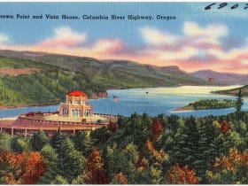
Vista House at Crown Point
16 miles away
Most Gorge visitors are aimed at the waterfalls and treat Crown Point as a drive-by.
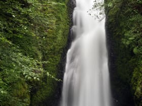
Bridal Veil Falls
19 miles away
Most drivers on the Historic Columbia River Highway stop at Multnomah and skip Bridal Veil three miles back, even though the walk is the same length and the falls are easily as dramatic.