
Mogollon Rim
Rim Road (FR 300) off SR 260, near Pine
Pine, AZ
A thousand-foot cliff running for two hundred miles across Arizona, the ragged edge of the Colorado Plateau, with cool pine forest on top and the desert falling away below.
The Mogollon Rim is one of the great dividing lines of the American Southwest, a rugged escarpment nearly a thousand feet tall that runs for some two hundred miles across Arizona and on into New Mexico. It marks the southern edge of the vast Colorado Plateau, the point where the high, forested tableland simply ends and the land plunges away toward the desert country below. Stand at its lip near Pine and Strawberry and you can look out over an enormous sweep of Arizona.
On top the Rim carries something you might not expect in Arizona: cool, tall Ponderosa pine forest, in fact the largest continuous stand of Ponderosa on the planet. That combination, a dramatic cliff edge, endless pine woods, and air ten or fifteen degrees cooler than the valley, has made the Rim a beloved escape for generations, and gave the Western novelist Zane Grey the country he loved best.
What Travelers Love
- Standing at the edge of a thousand-foot escarpment with the desert country falling away below
- The largest continuous stand of Ponderosa pine in the world spreading across the forested rim top
- Cool, tall-timber air that draws Phoenix families up to escape the summer heat
- The historic Rim Road, small hidden lakes, and a landscape steeped in Zane Grey's Western tales
Worth Knowing
- The scenic Rim Road (Forest Road 300) is unpaved and best in dry weather, and it is usually snow-closed in winter
- This is high country, roughly 7,000 feet at the rim, so afternoons can turn cold and summer brings sudden lightning storms
- Services are thin on top, so fuel up and carry water, food, and layers before you drive out along the rim
- It is a fire-prone forest, so heed any campfire restrictions or closures that may be in effect
Learn about Mogollon Rim
The edge of the Colorado Plateau
Geologically the Rim is a doorway into deep time. Its cliffs are capped by pale Coconino sandstone and Kaibab limestone, the same rock layers that form the rim of the Grand Canyon far to the north. The sandstone preserves a vast dune desert that covered this ground some 275 million years ago, and the limestone above it records a shallow inland sea that flooded the region and then vanished around 250 million years ago.
The escarpment itself has been taking shape for tens of millions of years as the Colorado Plateau rose and its southern edge eroded back. The result is a long, ragged step in the land where the high, cool plateau ends abruptly and the terrain drops toward the warmer basins below, a boundary you can literally stand on and see.
The world's largest pine forest
One of the Rim's quiet wonders is the forest it carries. The plateau top holds the largest continuous belt of Ponderosa pine anywhere on Earth, a sweep of tall, orange-barked trees that follows the escarpment across Arizona and into New Mexico. Walk among them on a warm day and the bark gives off a faint smell of vanilla or butterscotch, one of the small delights that keep people coming back.
That forest, and the elevation of roughly 7,000 feet, is why the little towns below the Rim fill up every summer. When Phoenix bakes, Pine, Strawberry, and Christopher Creek stay cool and green, and the Rim becomes a refuge of shade, small lakes, and pine-scented air. Hidden reservoirs like Bear Canyon and Knoll lakes dot the rim top, reached by the old road that runs along the edge.
Zane Grey's country and the General Crook Trail
The Rim is soaked in Western history. In the early 1870s the Army, under General George Crook, built a supply and patrol road that ran two hundred miles from Fort Whipple across the top of the Rim to Fort Apache, used through the long Apache campaigns. Much of that route survives today as the Rim Road, Forest Road 300, which traces the very edge of the escarpment past overlook after overlook.
Not far along it, at a fork of East Clear Creek in 1882, the Battle of Big Dry Wash was fought, one of the last major clashes of the Apache wars in Arizona, and a monument and the old General Springs cabin mark the ground. A generation later the novelist Zane Grey built a hunting cabin below the Rim and set many of his most famous Westerns in this exact country, so the landscape you drive through is the one that shaped a whole genre of frontier fiction.
Visiting the Mogollon Rim
The easiest way to reach the rim edge near Pine and Strawberry is from State Route 260 or Highway 87, where forest roads climb to the top and the scenic Rim Road, Forest Road 300, runs for about 35 miles along the escarpment past lakes and overlooks before rejoining pavement. The Rim Road is unpaved and best driven in dry weather with good clearance, and it is generally closed by snow in winter.
This is genuine high country, cool and prone to sudden afternoon storms in summer, so carry water, food, and layers, top off your gas in town first, and mind any fire restrictions in this dry pine forest. Give yourself at least half a day to drive the rim, stop at the overlooks, and let the sheer scale of the view sink in, and longer if you want to fish a hidden lake or hike down one of the trails that drop off the edge.
Closest Boutels
The closest Boutel™ stays, so you can turn this stop into an overnight. Each is a place we chose through independent editorial review, never a paid placement.
Details
Pine, AZ
Frequently asked questions
What is the Mogollon Rim?
The Mogollon Rim is a dramatic geological escarpment stretching across central and eastern Arizona, marking the southern edge of the vast Colorado Plateau. Rising thousands of feet, this rugged cliff edge is cloaked in one of the largest ponderosa pine forests in the world and offers breathtaking views over the lower country to the south. A cool, forested refuge from the desert heat, the Rim country is beloved for its scenic drives, lakes, hiking, camping, and stunning overlooks, making it one of Arizona's most beautiful and refreshing high-country regions.
What can you do at the Mogollon Rim?
You can drive the scenic Rim Road along the edge for spectacular overlooks, hike trails through the pine forests and along the Rim, fish and camp at the many nearby lakes like Woods Canyon Lake, watch wildlife, and enjoy the cool, fragrant forest air. The dramatic viewpoints over the country below are a highlight, especially at sunset. In autumn, color adds to the beauty. With its overlooks, forests, lakes, and trails, the Mogollon Rim offers wonderful high-country recreation and scenery far from the desert heat.
What safety tips apply at the Mogollon Rim?
Near the Rim's edge, keep back from unfenced drop-offs, watch your footing on rocky ground, and supervise children closely, since the cliffs are steep and falls are dangerous. The forest roads can be rough and remote, so carry supplies and check conditions, especially in winter when snow and ice can close routes. Be aware of afternoon thunderstorms and lightning risk on exposed overlooks in summer, and note wildfire danger in dry seasons. Bringing water and layers and respecting the terrain and weather keeps a Rim visit safe.
When is the best time to visit the Mogollon Rim?
Late spring through fall is the prime time, with summer offering a cool, green escape from the desert heat, ideal for hiking, fishing, and camping, and fall bringing beautiful color, while winter brings snow that can close forest roads, so checking conditions is essential then. Summer afternoons can bring thunderstorms, so morning outings are wise. For the best combination of comfortable weather, open access, and lush scenery, the warm-weather months from late spring through fall are ideal on the Rim.
What is near the Mogollon Rim?
The Mogollon Rim runs through central Arizona's Rim Country, near the town of Payson, the lakes atop the Rim like Woods Canyon Lake, Tonto Natural Bridge State Park, and the communities of Pine and Strawberry, with the White Mountains to the east and the desert and Phoenix area to the south. That makes the Mogollon Rim a spectacular high-country escape to combine with the Rim's lakes, Payson, Tonto Natural Bridge, and the scenic forests of central Arizona on a getaway from the desert heat.
Nearby

Arizona Trail at Pine Trailhead
5.9 miles away
Just south of Pine, this trailhead opens onto the 800-mile Arizona National Scenic Trail and the historic 1870s Highline Trail, in cool ponderosa-pine forest beneath the towering Mogollon Rim.

Fossil Springs
9.2 miles away
One of Arizona's largest springs pours tens of millions of gallons a day of clear, seventy-degree water from the base of the Mogollon Rim, building turquoise travertine pools and waterfalls in a deser...
Tonto Natural Bridge State Park
9.2 miles away
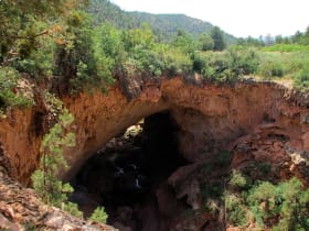
Tonto Natural Bridge is a natural arch formed by travertine deposits building up over centuries from a spring.
Red Rock Scenic Byway
24 miles away
Red Rock Scenic Byway follows AZ-179 for about seven miles between the Village of Oak Creek and Sedona, threading past some of the most photographed red rock in the Southwest.
Historic Route 66, Flagstaff to Winslow
49 miles away
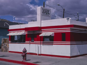
The Route 66 alignment east of Flagstaff passes through Winona (you need to know it) and ends at the famous Standin' on the Corner park in Winslow.