

Na Pali Coast and the Kalalau Trail
Kuhio Highway (HI 560) end
Haena, HI
A wall of fluted green cliffs plunging straight into the sea, reached only on foot from a trailhead at the literal end of the road.
The Na Pali Coast is the roadless northwest shore of Kauai, about seventeen miles of sea cliffs that rise as much as four thousand feet straight out of the Pacific, folded into sharp green pleats by millions of years of rain and wind. Hanging valleys open between the ridges, waterfalls thread down the rock, and the only ways to see it up close are by boat, from the air, or on the Kalalau Trail, the single footpath that traces the cliffs from Kee Beach to Kalalau Valley.
The trail is one of the most famous and demanding day-to-multi-day hikes in the islands. The first two miles to Hanakapiai Beach are the classic day hike and hard enough on their own, climbing and dropping over rooted, often muddy ground with the surf far below. Beyond that, the eleven-mile route to Kalalau is a wilderness undertaking that requires a permit, planning, and respect for a coast that is as unforgiving as it is beautiful.
What Travelers Love
- The first-viewpoint payoff about a mile in, where the fluted Na Pali cliffs open up above the surf
- Hanakapiai Beach and the side trail up to Hanakapiai Falls in its deep green amphitheater
- The sense of reaching a coast that no road has ever touched
- Sunset from Kee Beach at the trailhead, with the first cliffs glowing gold
Worth Knowing
- Entry to Haena State Park and the trailhead requires an advance reservation for non-residents, for parking, a shuttle, or both, and it books out early
- The full trail runs about eleven miles one way to Kalalau Valley and requires a separate camping permit; day hikers without a Kalalau permit may go only as far as Hanakapiai
- Never cross Hanakapiai Stream in high water and never swim at Hanakapiai Beach, where the currents and shorebreak have taken many lives
- The trail is narrow, rooted, and often muddy along drop-offs, so sturdy footing and an early start matter
Learn about Na Pali Coast and the Kalalau Trail
A coast people have lived with for centuries
The Na Pali valleys are not empty wilderness in the way they can look from a tour boat. Native Hawaiians lived in these hanging valleys for centuries, terracing the slopes to grow kalo, or taro, in irrigated loi, and fishing the waters below. Kalalau, Nualolo, and Miloli'i valleys held settled communities connected by trail and canoe, and stone wall terraces, house platforms, and heiau remain in the valleys today as evidence of that life.
The name Na Pali means the cliffs. Families farmed and fished here into the late nineteenth and early twentieth centuries, and Kalalau in particular was worked for its taro long after most other valleys had emptied. The archaeological sites in these valleys are protected and sacred to Native Hawaiians, and hikers are asked to leave stone structures, terraces, and any cultural features exactly as they find them.
The modern Kalalau Trail largely follows older Hawaiian routes between the valleys. It was improved in the late nineteenth and early twentieth centuries, and the coast has drawn a long line of hikers, wanderers, and those seeking solitude ever since, which is part of why the permit and reservation systems exist today.
How the fluted cliffs were carved
Kauai is the oldest of the main Hawaiian islands, roughly five million years old, and Na Pali shows what time does to a volcano. The island was built by lava from a shield volcano, and once the eruptions stopped, water went to work. Kauai's interior, around Mount Waialeale, is among the wettest places on earth, and all that rain pours off the high ground toward the sea.
The sharp vertical flutes that make the cliffs so distinctive are the work of countless small streams cutting parallel grooves down the soft volcanic rock, while the ocean undercuts the base and whole sections collapse into the sea. The result is a coastline of knife-edge ridges, amphitheater valleys, sea caves, and arches that no road could ever cross, which is exactly why none does.
The day hike to Hanakapiai
The most-walked stretch is the two miles to Hanakapiai Beach. The first mile climbs to a viewpoint where the coast reveals itself, then descends toward the stream and beach. In summer Hanakapiai has a sandy beach, but in winter the sand strips away to boulders, and in every season the water here is deadly. A hand-painted sign near the beach tallies the many people lost to the surf and rip currents, and the warning is not decorative.
From the beach, a rough two-mile side trail climbs inland to Hanakapiai Falls, a tall ribbon of water dropping into a pool in a green box canyon. The round trip to the falls turns the day into a serious eight-mile outing over slick, rooted ground with multiple stream crossings, and the streams can rise fast and dangerously after rain upslope even when it is dry at the coast.
Wildlife, sea and sky
The waters off Na Pali are alive. Spinner dolphins travel the coast in pods and are known for leaping and spinning clear of the water, and Hawaiian green sea turtles, the honu, feed and surface along the shore. In winter, roughly December through April, humpback whales fill the channel, having traveled thousands of miles from Alaska to breed and calve in Hawaiian waters, and their spouts and breaches are often visible from the trail.
Overhead, white tropicbirds with long streaming tail feathers ride the updrafts against the cliffs, and seabirds nest in the folds of the rock. The endangered Hawaiian monk seal, one of the rarest seals on earth, sometimes hauls out to rest on the beaches, and when one does it is roped off and must be left completely undisturbed.
Season by season
Summer, roughly May through September, brings calmer north-shore seas, more settled weather, and the return of sand to Hanakapiai. It is the more forgiving time to hike, though the trail can still be muddy and the sun strong.
Winter, roughly October through April, is the north shore's wet and high-surf season. Big swells pound the coast, streams run high, and the trail can be slick and dangerous, but it is also whale season and the waterfalls run their fullest. In any season, weather here can turn quickly, and a dry morning can become a downpour by afternoon.
Closest Boutels
The closest Boutel™ stays, so you can turn this stop into an overnight. Each is a place we chose through independent editorial review, never a paid placement.
Details
Haena, HI
Frequently asked questions
What are the Napali Coast and the Kalalau Trail?
The Napali Coast, on the northwest shore of Kauai, Hawaii, is one of the most spectacular and dramatic coastlines in the world, a wild expanse of towering green cliffs, hidden valleys, waterfalls, and sea, and the Kalalau Trail is the famous, challenging hiking trail that traverses part of it. The soaring, fluted cliffs of the Napali Coast, rising thousands of feet from the sea and inaccessible by road, are breathtaking, and the strenuous Kalalau Trail winds along the coast, offering unforgettable views for those prepared for its rigors. The coast can also be seen by boat or air. Its stunning, wild beauty makes it a bucket-list destination. A breathtaking and wild coastline, it awes visitors. With its cliffs and trail, the Napali Coast offers a spectacular destination in Hawaii.
How dangerous is the Kalalau Trail, and what should I know?
The Kalalau Trail is extremely challenging and can be dangerous, with narrow, steep, muddy, and eroded sections along high cliffs with serious drop-offs, stream crossings prone to sudden and deadly flash floods, and remote terrain where injuries and deaths have occurred, so it is only for experienced, fit, and well-prepared hikers, requires permits for its longer sections, and demands great caution, proper gear, water, and attention to weather. Even the first stretch to a beach is strenuous and requires care. Never crossing flooded streams and turning back in bad conditions are vital. Only well-prepared hikers with permits should attempt it, with great caution, on the Kalalau Trail in Hawaii.
How can you see the Napali Coast?
You can experience the Napali Coast in several ways: by hiking the challenging Kalalau Trail for those prepared for its rigors and holding required permits, by boat tour along the coast to see the cliffs and sea caves from the water, or by helicopter or air tour for aerial views of the dramatic landscape, since much of the coast is inaccessible by road. Boat and air tours offer stunning views without the trail's dangers, and are popular with many visitors. Choosing the way that fits your ability and preparation lets you enjoy the Napali Coast in Hawaii.
When is the best time to visit the Napali Coast?
The drier summer months generally bring calmer seas and more settled conditions, making them the best time for boat tours and the safest window for the trail, while winter brings large swells, heavy rain, rougher seas, and greater flash-flood danger, so the calmer season is preferable, especially for the water and trail. Because conditions, permits, and access vary, checking current requirements and weather before you go is essential. For the calmest conditions, aim for the summer months, and always check current conditions and permits, at the Napali Coast in Hawaii.
What is near the Napali Coast and the Kalalau Trail?
The Napali Coast and the Kalalau Trail are on the northwest shore of Kauai, Hawaii, with the trail beginning at Kee Beach at the end of the north-shore road, within reach of the Haena caves, the Limahuli Garden and Preserve, and the Hanalei Valley, while boat tours often depart from the west or south. That makes the Napali Coast a spectacular centerpiece to combine with Kee Beach and the other attractions of the Kauai north shore on a visit to Hawaii.
Nearby
Ke e Beach
0.6 miles away
In summer this is the gentlest snorkel-and-swim on the north shore for kids.
Limahuli Garden and Preserve
0.7 miles away
Most north-shore visitors race to Ke e Beach and never turn in at Limahuli, just before the road end. That is a mistake.
Haena Wet and Dry Caves
1.2 miles away
Caves right off the road always win with kids, and Haena has two kinds.

Waioli Mission House
5.5 miles away
In a town that is all about the bay, this is the human-history gem people walk right past.
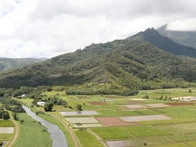
Hanalei Valley Lookout
7.0 miles away
Everyone drives past the turnout, but pulling in rewards you with the north shores signature view.
Waimea Canyon State Park
11 miles away
The Grand Canyon of the Pacific, a mile-wide gorge of rust-red and green cliffs plunging over 3,000 feet into western Kauai.
Polihale State Park
15 miles away
At the far western end of Kauai, past Waimea and Kekaha, paved Highway 50 gives out and a rough dirt cane road runs several miles to Polihale, one of the longest and widest beaches in Hawaii.

Captain Cook Monument
19 miles away
A stone statue marking where Captain Cook first landed in Hawaii on January 20, 1778, the first meeting of the islands and the outside world.