Mount Baker Highway
Washington
Some roads end at a parking lot. The Mount Baker Highway ends in the sky. Washington State Route 542 begins near sea level in Bellingham and climbs roughly fifty-seven miles east, trading farm fields and river valleys for old-growth forest and finally for the raw alpine world of the North Cascades. It stops at Artist Point, a windswept saddle at about 5,100 feet perched right between two of Washington's most beautiful peaks, Mount Baker and Mount Shuksan.
This is one of the great mountain drives in the country, a road so scenic that Washington long ago named it a state scenic highway. The reward at the top is a 360-degree panorama that feels almost unfair, with glaciers and jagged rock in every direction. But the top of this road is only reachable for a short window each year, because few places on Earth pile up more snow. Time it right and you get one of the most memorable approaches to any stay in the Pacific Northwest.
Learn about Mount Baker Highway
The Road
State Route 542 is a paved two-lane highway that runs almost due east from Bellingham to the very edge of the alpine zone. The lower half rolls gently through the Nooksack River valley, past dairy farms, small towns, and thick stands of fir, following the river upstream toward the mountains. It is an easy, pretty drive that gives no hint of the drama waiting at the end.
Past the town of Glacier, the last real services on the route, the road enters the Mount Baker-Snoqualmie National Forest and the climbing begins in earnest. The highway tightens into curves and switchbacks, gaining thousands of feet as it winds up toward the ski area and beyond. Waterfalls, mossy canyon walls, and glimpses of white summits keep pulling your eyes off the pavement, so it pays to use the pullouts.
The final stretch above the ski area, the part that reaches Picture Lake and climbs to Artist Point, is the payoff and the catch. It is a steep, narrow mountain road that is buried under snow for most of the year and only clears for a short summer season. When it is open, any passenger car can make the drive on a clear day, and the last few miles deliver one jaw-dropping view after another right up to the road's end at 5,100 feet.
How to Get There
The Mount Baker Highway is easy to reach because it starts at a major freeway. Coming from Seattle or the south, drive north on Interstate 5 to Bellingham and take the exit for State Route 542, the Mount Baker Highway. From there you simply follow 542 east. The road is well signed the whole way, and you stay on it all the way to the end.
Coming from Vancouver, British Columbia, or the Canadian border to the north, head south on Interstate 5 to the same Bellingham exit for State Route 542 and turn east toward the mountains. Either way, once you are on 542 there are no confusing turns. The highway is a single continuous route from town to Artist Point.
One thing to plan for is that this is an out-and-back drive. Artist Point sits at a dead end, so you return to Bellingham the same way you came. Fill your tank before you leave town and stock up on food and water, because the town of Glacier is the last place to get gas or supplies, and there is nothing beyond it but forest and mountains.
History
People dreamed of a road to the high country around Mount Baker for well over a century. In the early 1900s, promoters imagined a grand resort in the alpine meadows and even a route toward the summit, and by the 1920s and 1930s crews had pushed a road up the valley and into the mountains. The stone-and-timber Mount Baker Lodge opened in the meadows in 1927, and though it burned only a few years later, it fixed the idea that this landscape was a place worth traveling to see.
The highway we drive today grew out of those early efforts, extended and improved over the decades until it reached Artist Point at the very top. Washington recognized how special the route was and made it an official state scenic and recreational highway. The long upper section was designated in 1967, and the lower stretch from Bellingham was added in 1993, so the whole road now carries that state scenic honor.
The mountains earned their own national recognition too. In 1989 the upper end of the route, the roughly two dozen miles climbing through the national forest, was named a Forest Service Scenic Byway, a designation the U.S. Forest Service reserves for roads with outstanding scenery on public forest land. It is worth being clear that this is not a federal All-American Road or National Scenic Byway. It is a Washington state scenic highway with a Forest Service scenic byway on its upper miles, honors that celebrate the drive without overstating it.
The place at the top, Artist Point, takes its name from exactly what you would guess. The meadows and ridges up here have drawn painters and photographers for a hundred years, ever since the first travelers reached the high country and tried to capture Mount Shuksan mirrored in the still water below. The road has never gone any higher. Artist Point remains the end of the line and the whole point of the trip.
Little-Known Facts
- The Mount Baker area holds the world record for the most snow ever measured in a single season. During the winter of 1998 to 1999, the Mount Baker Ski Area recorded 1,140 inches, which is 95 feet, a total later confirmed by the National Climate Extremes Committee.
- Because of that snow, the road to Artist Point is buried most of the year and usually opens only from around late July into early October. The exact dates shift every year depending on how fast the snowpack melts.
- The highway stays open through the winter as far as the Mount Baker Ski Area so people can ski, but the final steep miles up to Artist Point are not plowed and stay closed until summer.
- Picture Lake, with its perfect reflection of Mount Shuksan, is considered one of the most photographed mountain scenes in North America, and the loop path around it was designed to frame that exact view.
- Artist Point sits at roughly 5,100 feet in the saddle between two very different peaks. Mount Baker is a snow-capped volcano, while Mount Shuksan is a jagged, glacier-carved mountain of ancient rock.
- Mount Baker is an active volcano and one of the snowiest volcanoes on Earth. Its glaciers are fed by the same enormous snowfalls that close the road each winter.
- The historic Mount Baker Lodge opened in the alpine meadows in 1927 and burned in 1931, but it helped establish the area as a scenic destination long before the modern highway reached the top.
- The town of Glacier is the last stop for fuel, food, and supplies. Everything east of it is national forest, so the smart move is to arrive with a full tank and everything you need.
Along the Route
Nooksack Falls
About seven miles past the town of Glacier, the North Fork of the Nooksack River drops roughly 88 feet over a rocky ledge in a thundering double cascade. A short walk from a small pullout leads to a fenced overlook, and in spring and early summer the falls run fierce with snowmelt. The rocks near the edge are slick and dangerous, so the viewing area is the place to take it in.
Mount Baker Ski Area
This is the famous ski resort that recorded the world-record snowfall, and it marks where the highway is plowed to in winter. In summer the parking lots become the jumping-off point for high-country trails, and it is the last developed spot before the final climb to Artist Point. Even outside ski season the setting is striking, ringed by peaks and often holding snow well into the warm months.
Picture Lake
Picture Lake is the postcard everyone comes for, a small alpine tarn that mirrors the jagged summit of Mount Shuksan in its still water. A short, mostly level loop path circles the lake and was laid out to frame that exact reflection, making it one of the most photographed mountain scenes in North America. Early morning, when the water is calm and the light is soft, is the classic time to catch the reflection.
Artist Point
Artist Point is the end of the road and the whole reason to make the drive, a windswept saddle at about 5,100 feet set squarely between Mount Baker and Mount Shuksan. From the large parking area a sweep of alpine meadows, glaciers, and jagged ridges opens in every direction, and short trails fan out for those who want to walk deeper into the view. It is only reachable for a short summer window each year, so a clear morning here feels like a genuine gift.
Details
Bellingham
Frequently asked questions
Is the Mount Baker Highway a designated scenic byway?
Yes. The Mount Baker Highway, State Route 542, is a Washington state scenic and recreational highway. The long upper section received that designation in 1967 and the lower stretch from Bellingham was added in 1993. In addition, the upper roughly two dozen miles through the national forest were named a Forest Service Scenic Byway in 1989. It is a state and Forest Service honor, not a federal All-American Road.
How long is the Mount Baker Highway, and how long does it take to drive?
The highway runs about fifty-seven miles from Bellingham east to Artist Point. Driven straight through it takes roughly an hour and a half each way, but because it is an out-and-back road with so much to see, most travelers give the round trip the better part of a day to stop at waterfalls, Picture Lake, and the viewpoints near the top.
What are the must-see stops along the Mount Baker Highway?
Heading east, the highlights include Nooksack Falls past the town of Glacier, the Mount Baker Ski Area, the famous reflection of Mount Shuksan at Picture Lake, and finally Artist Point at the road's end, where a 360-degree panorama of Mount Baker and Mount Shuksan opens in every direction.
Is the Mount Baker Highway free to drive?
Driving the highway itself is free, since State Route 542 is a public road. However, if you park at trailheads and day-use areas in the national forest, such as those near Artist Point, you generally need a Northwest Forest Pass or an equivalent federal recreation pass displayed in your vehicle. A brief stop at a pullout to take a photo usually does not, but leaving your car parked to hike does.
What is the best time of day and year to drive the Mount Baker Highway?
The full drive to Artist Point is only possible in summer, usually from around late July into early October, once the deep snow has melted off the top. Within that window, a clear morning is ideal, both for the light and for the calm water that mirrors Mount Shuksan at Picture Lake. Always check the forecast, since clouds can hide the peaks entirely.
Is the Mount Baker Highway open year-round?
The lower highway is open all year and is plowed in winter as far as the Mount Baker Ski Area, so skiers can reach the slopes. But the final steep miles up to Picture Lake and Artist Point are not plowed and stay buried under snow for most of the year. That upper section usually opens only from around late July into early October, and the exact dates change from year to year, so check the current road status before you drive the whole way.
Do you need four-wheel drive to drive the Mount Baker Highway?
No. When the road to Artist Point is open in summer, it is paved the whole way, and any passenger car can make the drive. Four-wheel drive is not required. The only real barrier is the season itself, since the upper road is simply closed when it is buried in snow rather than requiring a special vehicle.
What are the winter driving conditions on the Mount Baker Highway?
In winter the lower highway to the ski area is plowed but can be snowy and icy, so carry chains and check conditions before heading up. The road above the ski area to Artist Point is closed entirely by snow in the colder months. This is one of the snowiest places on the continent, so winter driving here calls for real caution and should never be attempted beyond the plowed section.
Are there gas stations and services along the Mount Baker Highway?
Plan ahead, because services thin out fast. The town of Glacier is the last place on the route to get fuel, food, and supplies. Everything east of Glacier is national forest with no gas and no stores, all the way to Artist Point. Fill your tank in Bellingham or Glacier and bring water and snacks before you make the climb.
Why does the Mount Baker area get so much snow?
Storms roll in off the Pacific Ocean carrying huge amounts of moisture, and when that wet air is forced up and over the high peaks of the North Cascades it releases enormous snowfalls. Mount Baker sits right in the path of these storms, which is how the ski area set the world record for the most snow ever measured in a single season, 1,140 inches during the winter of 1998 to 1999.
Nearby
Mount Baker Highway
0.1 miles away
A scenic byway that climbs 58 miles east from Bellingham (SR 542) through farmland and forest to Artist Point at 5,100 feet, with 360-degree views of Mount Baker and Mount Shuksan.
North Cascades Highway (SR-20)
22 miles away
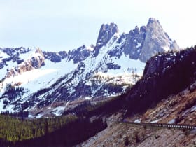
One of the great mountain scenic drives in the country, climbing over Washington Pass past the granite spires of Liberty Bell Mountain and the turquoise water of Diablo Lake.

North Cascades National Park
23 miles away
Jagged alpine peaks and more than 300 glaciers, one of the most rugged ranges in the lower 48.

North Cascades Visitor Center
24 miles away
The North Cascades Visitor Center in Newhalem is the primary entry point for North Cascades National Park, with free exhibits on the park's glaciers, forests, and wildlife.
Gorge Creek Falls
25 miles away
Gorge Creek Falls is a tall, plunging waterfall right beside the North Cascades Highway, where Gorge Creek drops through a deep, rocky gorge on its way to the Skagit River.
Diablo Lake
27 miles away
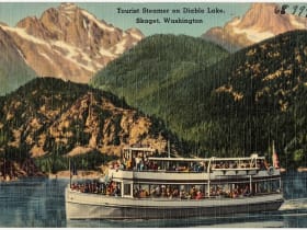
Diablo Lake turns a vivid turquoise-to-aquamarine color from glacial flour - fine particles ground from rock beneath the glaciers above that scatter blue and green wavelengths of light.

Chuckanut Drive
37 miles away
Chuckanut Drive is Washington's original scenic byway, a twisting cliffside two-lane (State Route 11) that hugs the sandstone shoulders of the Chuckanut Mountains south of Bellingham, the one place on...