

Chuckanut Drive
Washington
Most roads carry you along the coast. Chuckanut Drive carries you above it. This is State Route 11, a slender two-lane ribbon that clings to the sandstone shoulders of Chuckanut Mountain, running about twenty-one miles from the Victorian brick streets of Bellingham's Fairhaven district south to the wide green farmland of the Skagit Valley. It is the one place along this stretch of coast where the foothills of the Cascade Range do not ease down to the water but drop almost straight into the sea.
For much of the way the road is cut into the cliff itself, with Samish Bay glinting far below and the San Juan Islands scattered across the horizon like green stones. This was one of the very first scenic highways in Washington, a route built for the view long before anyone used the word tourism, and it still earns that honor today as a Washington State Scenic Byway. Roll it slowly, pull off at the marked turnouts, and let the water and the islands do their work.
Learn about Chuckanut Drive
The Road
Chuckanut Drive is State Route 11, a paved two-lane highway that leaves Interstate 5 at both ends and loops out along the shoreline in between. The scenic heart of it runs roughly twenty-one miles, starting in Bellingham's historic Fairhaven neighborhood, climbing and curving along the flank of Chuckanut Mountain above Samish Bay, and finally spilling down into the flat, fertile Skagit Valley near the small towns of Bow and Edison. It stays at low elevation the whole way, never climbing a mountain pass, so the drama comes from the cliffs beside the sea rather than any great height.
The driving is slow and deliberate, and that is the point. The road twists and doubles back through tight curves, with the rock wall on one side and a steep, forested drop to the water on the other. Guardrails are few, so this is a route for patient hands on the wheel and a light foot on the gas. Marked pullouts and turnouts appear at the best viewpoints, giving you a safe place to stop and take in the bay without holding up the car behind you.
What makes the drive so memorable is the mix of forest and salt water pressed together. Tall Douglas firs and mossy sandstone lean over the pavement, then the trees open and the whole of Samish Bay spreads out below, dotted with oyster rafts and framed by the San Juan Islands. Larrabee State Park sits along the way with trails down to the shore, and near the south end a pair of well-loved oyster bars perch right on the water. Then the cliffs release you into farm country, and the world flattens into fields, barns, and open sky.
How to Get There
Chuckanut Drive connects to Interstate 5 at both ends, so it is easy to find from either direction. Coming from the north, from Bellingham or the Canadian border, take Interstate 5 to Exit 250 and follow signs for Fairhaven and Chuckanut Drive. The route begins in Bellingham's Fairhaven district and heads south along the water, which is the classic way to drive it if you want the bay on your right the whole way.
Coming from the south, from Seattle or Mount Vernon, take Interstate 5 to Exit 231 near Burlington and follow State Route 11 north through the Skagit Valley farmland. From there the road runs up to the coast and begins its climb along the cliffs, saving the big water views for the second half of the drive.
Either approach works beautifully. Many travelers driving south from Bellingham like to start with the islands filling the windshield, while those coming up from the valley enjoy the slow build from farm fields to sudden sea cliffs. Fuel up before you start, since there are no gas stations along the drive itself.
History
Chuckanut Drive is one of the oldest scenic roads in Washington, with roots stretching back to the 1890s. An early wagon and rail route was pushed along this rugged shoreline in the mid-1890s, around 1896, when crews blasted a shelf into the sandstone cliffs so people and goods could move between Bellingham and the Skagit Valley. Before that, the mountains dropping straight into Samish Bay had been a genuine barrier, and travelers often went by boat instead.
The road as a true automobile route came together in the years that followed, and by 1921 Chuckanut Drive was completed and opened as part of the original Pacific Highway, the main north-south motor road up the West Coast. For a time this cliffside stretch was the primary highway linking the region, carrying everyday traffic between towns. When a straighter, faster inland route (today's Interstate 5 corridor) was built through the valley, Chuckanut Drive was left to become what it had secretly always been, a road worth taking purely for the beauty of it.
That shift is what saved its character. Freed from being the fast way through, the road settled into its role as a scenic route, and Washington later recognized it formally as a State Scenic Byway, part of the state's network of drives singled out for their exceptional views and sense of place. The designation celebrates the road's rare combination of sea cliffs, forest, islands, and farmland packed into a single short highway.
Larrabee State Park along the way carries its own piece of history. Established in the early 1900s and named for the Larrabee family, who donated the original land, it holds the distinction of being the first state park in Washington. Its trails, tide pools, and shoreline have drawn visitors for well over a century, making the park and the road that serves it a matched pair of the region's earliest efforts to set aside beautiful places for everyone to enjoy.
Little-Known Facts
- Chuckanut Drive was completed and opened in 1921 as part of the original Pacific Highway, the main motor road running up the West Coast, so this narrow cliffside lane was once a primary interstate route.
- The very first shelf for a road here was blasted into the sandstone cliffs back in the mid-1890s, around 1896, for a wagon and rail route, long before automobiles existed in the area.
- Larrabee State Park, which the drive passes, is the oldest state park in Washington, established in the early 1900s on land donated by the Larrabee family.
- The name Chuckanut comes from the Coast Salish language of the region's Indigenous peoples, and this is the one spot on the coast where the Cascade Range foothills plunge directly into salt water rather than easing down to a beach.
- The pale, wave-carved rock along the road is Chuckanut sandstone, an ancient formation quarried locally and used to build stately buildings around the Pacific Northwest.
- Samish Bay below the road is prized oyster water, and the tidelands here have been farmed for oysters for well over a hundred years, feeding the roadside oyster bars the drive is famous for.
- On a clear day the turnouts look west across the San Juan Islands, and the sunsets that sink behind them are a big reason people time their drive for the end of the day.
- Because the road never climbs a mountain pass and stays low along the shore, it rarely closes for snow, unlike Washington's high alpine scenic drives.
Along the Route
Fairhaven Historic District
The drive begins in Bellingham's Fairhaven district, a walkable pocket of red brick buildings from the 1890s boom years, now filled with shops, cafes, and a bookstore or two. It is the natural place to stretch your legs, grab a coffee, and wander the old streets before the road turns wild and coastal. Starting here also means the water and the islands sit on your right for the whole southbound run.
Teddy Bear Cove
A short, steep trail drops from a roadside pullout down to Teddy Bear Cove, a quiet crescent of pale sand and driftwood tucked below the cliffs. At low tide the beach widens and tide pools appear among the rocks, a favorite spot for families and beachcombers. The walk down is worth it for the sudden hush of the shoreline after the winding road above.
Larrabee State Park
Larrabee State Park is the anchor stop on the drive and the oldest state park in Washington. Trails lead down to rocky tide pools and coves along Samish Bay, while others climb into the forest toward mountain lakes and viewpoints high above the water. With picnic areas, shoreline access, and miles of paths, it is the easiest place to turn a scenic drive into a proper half-day outdoors.
Clayton Beach
Reached by a walking trail at the southern edge of Larrabee State Park, Clayton Beach is a sandy stretch backed by dramatic, wind-carved sandstone that many consider the prettiest shoreline on the drive. The path winds through forest and over an old railroad grade before opening onto the beach, so it feels like a small hike to a hidden reward. It is a classic spot to watch the tide and the light change over the bay.
Samish Bay Cliffside Overlooks
Along the middle of the drive, the road is cut straight into the cliff, and a series of marked turnouts frame the widest views of the whole route. Samish Bay opens out below with oyster rafts floating on the water, and the San Juan Islands stack across the horizon to the west. Pull off, step out carefully, and this is where the drive earns its reputation, especially near sunset.
Oyster Bar & Taylor Shellfish
Near the south end of the cliffs, the drive is famous for its oysters, pulled fresh from the Samish Bay tidelands just below. A pair of long-standing roadside spots serve them right on the water, one a historic hillside restaurant with a sweeping bay view, the other a working shellfish farm's shoreline stand where you can buy oysters straight from the source. It is the drive's signature taste of place, more than a century of oyster farming in a single bite.
Skagit Valley Farmland
At its southern end the road releases you from the cliffs into the broad, flat Skagit Valley, some of the most productive farmland in the state. Fields of vegetables and, in spring, famous blooms of tulips and daffodils spread out under an open sky, with the little towns of Bow and Edison offering a bakery, an art gallery, and a slower pace. It is a gentle, grounding finish after the drama of the sea cliffs.
Details
Bellingham
Frequently asked questions
Is Chuckanut Drive a designated scenic byway?
Yes. Chuckanut Drive, State Route 11, is recognized as a Washington State Scenic Byway, part of the state's network of roads singled out for exceptional scenery and sense of place. It is also one of Washington's oldest scenic routes, completed in 1921 as part of the original Pacific Highway up the West Coast.
How long is Chuckanut Drive, and how long does it take to drive?
The scenic route runs about twenty-one miles from Bellingham's Fairhaven district south to the Skagit Valley near Bow and Burlington. Driven straight through, it takes roughly forty-five minutes to an hour because of the tight curves and slow speeds, but most people give it a half day or more to stop at overlooks, walk the trails at Larrabee State Park, and pause for oysters.
What are the must-see stops along Chuckanut Drive?
Heading south, the highlights include the historic Fairhaven district where the drive begins, Teddy Bear Cove and its hidden beach, Larrabee State Park with its shoreline trails and tide pools, the cliffside overlooks above Samish Bay and the San Juan Islands, the famous oyster spots near the south end, and finally the open farmland of the Skagit Valley.
Is Chuckanut Drive free to drive?
Yes. Chuckanut Drive is a public state highway, so driving it costs nothing. A Washington Discover Pass is required to park at Larrabee State Park and other state park lands along the way, but simply driving the road and stopping at roadside pullouts is free.
What is the best time of day and season to drive Chuckanut Drive?
The hour before sunset is the classic time, when the sun sinks behind the San Juan Islands and lights up Samish Bay. Late spring through early fall brings the clearest weather and the best island views, and spring adds the bonus of tulip season in the nearby Skagit Valley. The drive is beautiful year-round, so much of it comes down to catching a clear day.
Is Chuckanut Drive open year-round?
Yes. Because the road stays at low elevation along the shoreline and never climbs a mountain pass, it does not have a seasonal winter closure the way Washington's high alpine scenic drives do. It is open all year. In winter, fallen branches or occasional icy patches on the shaded cliffside curves are the main things to watch for, so it is wise to check current conditions before you go.
Do you need four-wheel drive or high clearance for Chuckanut Drive?
No. Chuckanut Drive is fully paved, and any ordinary passenger car handles it easily. What the road asks for is not a rugged vehicle but a patient driver, since the lane is narrow and winding with tight curves and few guardrails.
What are the winter driving conditions on Chuckanut Drive?
The drive is generally fine in winter thanks to its low elevation, but the cliffside curves are narrow, shaded, and can hold moisture, so slow down for wet leaves, occasional ice, or fallen limbs after a storm. Give yourself extra time, keep to the marked turnouts for stopping, and check current road and weather conditions before setting out in the colder months.
Is there gas or fuel along Chuckanut Drive?
No. There are no gas stations on the scenic stretch of Chuckanut Drive itself. Fill up in Bellingham to the north or in Burlington to the south before you begin, so you can take your time on the road without worrying about fuel.
Why is Chuckanut Drive known for oysters?
The road runs right above Samish Bay, whose cold, clean tidelands are prized oyster water and have been farmed for shellfish for well over a hundred years. That is why a pair of long-standing oyster spots sit right on the water near the south end of the drive, serving the local catch just steps from where it is grown. Fresh Samish Bay oysters are one of the drive's signature draws.
Nearby

Chuckanut Drive
0.1 miles away
Chuckanut Drive is Washington's original scenic byway, a twisting cliffside two-lane (State Route 11) that hugs the sandstone shoulders of the Chuckanut Mountains south of Bellingham, the one place on...
Padilla Bay National Estuarine Research Reserve
8.3 miles away
Padilla Bay is one of the largest remaining eelgrass meadows in the Pacific Northwest, covering 11,000 acres and providing critical habitat for juvenile salmon, crab, and over 200 species of birds.
Mount Baker Highway
11 miles away
A scenic byway that climbs 58 miles east from Bellingham (SR 542) through farmland and forest to Artist Point at 5,100 feet, with 360-degree views of Mount Baker and Mount Shuksan.
Deception Pass State Park
17 miles away
Deception Pass State Park is Washington's most visited state park, where Whidbey and Fidalgo Islands nearly meet at a narrow, churning tidal channel.
Lime Kiln Point State Park
33 miles away
Lime Kiln Point State Park on San Juan Island is the best place in the continental United States to watch orcas from shore.
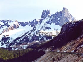
North Cascades Highway (SR-20)
48 miles away
One of the great mountain scenic drives in the country, climbing over Washington Pass past the granite spires of Liberty Bell Mountain and the turquoise water of Diablo Lake.

North Cascades National Park
54 miles away
Jagged alpine peaks and more than 300 glaciers, one of the most rugged ranges in the lower 48.

Olympic National Park
58 miles away
Three worlds in one park: rugged Pacific coast, temperate rainforest, and glacier-capped mountains.