
North Cascades National Park
376 Newhalem St, Marblemount, WA
Marblemount, Washington
Some mountains just look wilder than the rest, and the North Cascades are the wildest range most people in the Lower 48 will ever lay eyes on. This is a country of knife-edged peaks, deep green valleys, and ice so thick and so widespread that people call the range the American Alps. More than three hundred glaciers hang in these mountains, the most of any national park in the country outside Alaska, and their cold melt feeds rushing rivers and lakes that glow an almost unreal turquoise.
This is a national park, established in 1968, and one of the least crowded in the country. What surprises most visitors is how little of it you can drive to. There is no road through the wild heart of the park, so the mountains are reached mainly on foot, and yet the whole place sits only about two hours from Seattle. The one road that comes close, the North Cascades Highway, runs along the park's southern edge and delivers one of the great scenic drives in America.
Learn about North Cascades National Park
The Park
The North Cascades are young, steep, and heavily glaciated, a tangle of sharp summits and hanging valleys carved by ice over and over again through the ages. The park holds more than three hundred glaciers, a concentration matched nowhere else in the continental United States, and those slow-moving rivers of ice grind the rock beneath them into a fine powder called glacial rock flour. This is genuine, roadless wilderness, some of the ruggedest terrain anywhere in the Lower 48, which is exactly why it stays so quiet even with a big city just down the highway.
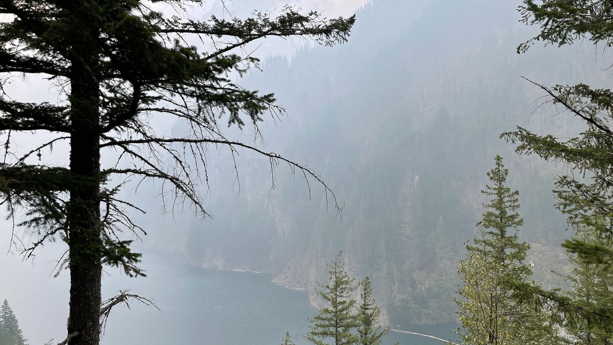
That rock flour is why the lakes glow. When glacial meltwater carrying suspended flour fills the reservoirs of the Skagit River, the tiny particles scatter blue and green light and turn the water a vivid turquoise, most famously at Diablo Lake. Longer, wilder Ross Lake stretches twenty-four miles north toward Canada, bordered by wilderness on every side. Between the glowing water, the dark old-growth forest of towering western red cedar, and the jagged skyline overhead, the park feels like a landscape still being built.
North Cascades is one of the least-visited national parks in the continental United States, and the North Cascades Highway (State Route 20) that threads its southern edge is ranked among the most scenic drives in North America. The main way in is the North Cascades Visitor Center at Newhalem, where free exhibits explain the glaciers, forests, and wildlife before you head up the road. From there the mountains take over, and most of the park becomes a place you walk into rather than drive through.
How to Enter
- North Cascades Highway (State Route 20) is the main access, running along the park's southern edge between Marblemount to the west and Winthrop to the east, past Newhalem, the Skagit lakes, and a string of overlooks and short trails. The high section over Rainy and Washington passes closes for winter, so check road status before you go in the colder months.
- From Seattle and Interstate 5, follow State Route 20 east through the Skagit Valley and Marblemount to reach the park corridor, roughly a two-hour drive to Newhalem. From the drier east side, come up through the Methow Valley and Winthrop and cross the passes when the highway is open.
Things to Do
- Diablo Lake is the park's signature sight, a reservoir turned vivid turquoise by suspended glacial rock flour. The Diablo Lake Overlook is a short walk from the highway and gives a direct view down onto the water from high above.
- Ross Lake is a twenty-four-mile-long reservoir bordered by wilderness on all sides, a favorite for paddling, boat-in camping, and fishing in a setting almost no road reaches.
- Rainy Pass has an easy half-mile paved trail that leads to a waterfall and an alpine lake, a gentle taste of the high country right off the highway.
- Winthrop is the eastern gateway town, with historic frontier architecture on the sunny, drier side of the mountains and easy access to hiking and biking in summer.
History
These mountains and valleys are the ancestral homelands of Coast Salish and interior Salish peoples, including the Upper Skagit and their neighbors, who traveled and traded through the passes and fished the salmon rivers here for thousands of years. They knew the high country, the seasons of the meadows, and the routes across the range long before any road, and their connection to this land continues today.
The mountains were rugged enough to resist settlement and roads for a very long time. Prospectors and miners pushed in during the late 1800s looking for gold and other ore, but the terrain was so steep and the winters so hard that few stayed. In the early twentieth century, Seattle City Light built a series of dams on the upper Skagit River, creating the reservoirs of Gorge, Diablo, and Ross lakes and lighting the growing city downstream. Those lakes are the turquoise water so many visitors come to see.
By the mid-twentieth century, conservationists were fighting to protect the range from logging and further dams. After a long campaign, North Cascades National Park was established in 1968, together with the Ross Lake and Lake Chelan national recreation areas that flank it. The pairing was deliberate. The recreation areas hold the reservoirs and the highway corridor, while the park proper was kept wild and largely roadless.
The North Cascades Highway itself was a hard-won project, finally pushed over the passes and opened to through traffic in the early 1970s after decades of effort. Even now, crews cannot keep the high section clear in winter, so the road that unlocked the range for visitors still bows to the same deep snow that kept these mountains wild for so long.
Little-Known Facts
- North Cascades holds more than three hundred glaciers, the most of any national park in the country outside Alaska and about a third of all the glaciers in the Lower 48.
- It is one of the least-visited national parks in the continental United States, so even in summer you can find real solitude close to a major city.
- The turquoise color of Diablo Lake comes from glacial rock flour, fine rock ground up by the glaciers above and carried down in the meltwater, where it scatters blue and green light. The color is most intense in late summer when the glacial melt peaks.
- There is almost no road inside the wild core of the park. Most of it is backcountry reached only on foot, which is a big reason it stays so quiet.
- The village of Stehekin, at the head of Lake Chelan inside the park's recreation area, has no road connecting it to the outside world. You can only get there by ferry, float plane, or trail.
- The glaciers here, like glaciers almost everywhere, have been shrinking as the climate warms, and scientists have tracked their steady retreat over recent decades.
- The park spans a dramatic divide in climate, from wet, mossy old-growth forest on the western slopes to dry ponderosa pine country in the Methow Valley just over the passes to the east.
- The range is so rugged and remote that it shelters some of the wildest animals in the Lower 48, including mountain goats on the crags and, in the broader ecosystem, rare predators like wolverine.
Plan Your Visit
- There is no entrance fee for the North Cascades Highway corridor, so driving the scenic route through the park costs nothing.
- Wilderness permits are required for backcountry camping, and they run on a reservation system, so plan ahead if you want to sleep out in the mountains.
- The North Cascades Highway over the passes closes for winter, generally from late November through April, so check current road status before a cold-season trip.
- The Diablo Lake Overlook is just a short walk from the highway and gives the classic view of the turquoise, glacier-fed water.
- Stehekin is reachable only by ferry, float plane, or trail, with no road access at all, so factor in the travel if you want to visit that corner of the park.
Inside the Park
Diablo Lake
The turquoise glacial lake ringed by jagged peaks, with a sweeping overlook right off Highway 20.
Cascade Pass
A classic alpine hike through forest and meadow to a high pass among glaciated peaks.
Ross Lake
A long, fjord-like reservoir reached by boat or trail, a base for paddling and backcountry camping.
Gorge Creek Falls
A tall waterfall plunging through a deep gorge, an easy stop right on Highway 20.
Details
Marblemount, Washington
Frequently asked questions
Is there an entrance fee for North Cascades National Park?
There is no entrance fee to drive the North Cascades Highway corridor through the park, which is one of the rare national parks you can experience for free from the road. Wilderness permits are required if you want to camp in the backcountry, and those run on a reservation system. Check the National Park Service website for current permit details before you go.
When is the North Cascades Highway open, and does it close in winter?
The high section of the North Cascades Highway, State Route 20, over Rainy and Washington passes closes every winter when the snow gets too deep to keep plowed, generally from around late November through April, and it reopens once crews clear it in spring. The lower stretch to Newhalem and Diablo Lake usually stays open longer. If you are visiting outside summer, always check the current road status first, because the pass closure is the single biggest thing that shapes a trip here.
How remote and developed is the park?
North Cascades is genuinely remote and largely undeveloped, one of the least-visited national parks in the Lower 48. There is no road through the wild core of the park, so most of it is trail-only backcountry reached on foot. Services along the highway are limited, cell coverage is spotty, and the nearest towns are small. Fuel up, bring supplies, and come prepared to be off the grid once you leave the main road.
Why is Diablo Lake so turquoise?
The vivid turquoise color comes from glacial rock flour, which is rock ground into a fine powder by the glaciers in the mountains above and carried down in the meltwater. Those tiny particles stay suspended in the lake and scatter blue and green light back to your eye, turning the water an almost unreal shade. The color is strongest in late summer, when the glacial melt is at its peak, and it can look almost artificial on a clear day.
Are the glaciers really shrinking?
Yes. The park protects more than three hundred glaciers, the most of any national park outside Alaska, but like glaciers almost everywhere they have been retreating as the climate warms. Scientists have monitored several of them for decades and recorded a steady loss of ice over that time. The glaciers are still a defining feature of the range, and they are still what feeds the turquoise lakes, but they are smaller than they once were.
When is the best time to visit North Cascades National Park?
Summer, roughly July through September, is the best time by far. The North Cascades Highway is open over the passes, the high trails are melted out and accessible, the weather is mildest, and the meadows bloom before turning to fall color. Through late fall, winter, and much of spring the pass is closed and the high country is under snow, so the fullest experience of the scenic drive, overlooks, and trails comes in the warm-weather months.
How much time do you need at North Cascades?
You can drive the highlights of the North Cascades Highway, stop at the Diablo Lake Overlook, and walk a short trail or two in a single day. To hike deeper into the high country, paddle or camp on Ross Lake, or slow down and explore both the Newhalem area and the Methow Valley over the passes, give it two or three days. The more you are willing to get out of the car, the more this park rewards you.
What are the must-see stops?
The Diablo Lake Overlook is the classic stop for the park's famous turquoise water. Ross Lake is the wilder reservoir for paddlers and boat-in campers, the Rainy Pass trail is an easy paved walk to a waterfall and alpine lake, and the North Cascades Visitor Center at Newhalem is the best place to get oriented. On the drier east side, the frontier town of Winthrop makes a fun gateway.
Are pets allowed in the park?
Pets are allowed in developed areas, parking lots, and along roads, but they are not permitted on most trails or in the wilderness backcountry, which is standard for national parks. That means they can come along for the scenic drive and the overlooks but cannot join you on the mountain hikes. Keep pets leashed, bring water, and never leave one in a hot vehicle. Check the park website for the current pet rules.
Where can you stay in or near the park?
There is very little lodging inside the park itself, aside from remote options like the roadless village of Stehekin and backcountry camping by permit. Most visitors base out of the small towns along the highway, Marblemount and the Skagit Valley to the west or Winthrop in the Methow Valley to the east. Because services in the park are so limited, it is smart to book a place to stay in one of those gateway towns and drive in for the day.