

Clear Creek Canyon
US Highway 6
Idaho Springs, CO
A deep, cliff-walled granite canyon where the Colorado gold rush started, now the steepest commercially rafted river in the state, all barely half an hour from Denver.
Clear Creek Canyon is where Colorado, in a real sense, began. In January 1859 a prospector named George Jackson found placer gold in the creek gravel just below what is now Idaho Springs, and within months tens of thousands of hopeful miners were pouring up these narrow gorges. The canyon that once carried the gold rush now carries US Highway 6, which hugs the rushing water for about twenty miles between Golden and Idaho Springs, so an ordinary drive retraces one of the most consequential routes in the state's history.
It is also a playground. Clear Creek cuts through very hard granite and gneiss, and those sheer, resistant walls give the canyon both its steep, fast whitewater, the steepest commercially rafted river in Colorado, and its world-class rock climbing straight off the road. A wide paved trail runs along the creek for walkers and cyclists, and the whole cliff-walled corridor sits barely half an hour from Denver, so it feels far away without being far.
What Travelers Love
- Steep, punchy whitewater, packed with named rapids on the steepest commercially rafted river in Colorado
- World-class rock climbing on hard granite and gneiss walls reachable right off the highway
- The Peaks to Plains Trail, a wide paved path along the creek for walking, biking, and fishing
- A deep, rushing, cliff-walled canyon that feels remote yet sits about half an hour from Denver
Worth Knowing
- Whitewater season follows the snowmelt, generally running from late spring into summer, with the biggest water usually in early summer
- The creek is cold, fast, and pushy snowmelt, so a guided trip and a properly fitted life jacket and helmet matter, and conditions shift with the day's water level
- The canyon has nesting raptors, including golden eagles, so some climbing areas close seasonally to protect the nests
- Access is from signed trailhead lots along US-6; the shoulder is narrow and the road is busy, so use the designated parking rather than stopping on the highway
Learn about Clear Creek Canyon
Where the gold rush started
The canyon's history is the story of Colorado's founding. George Jackson's 1859 strike in Clear Creek, and John Gregory's strike soon after farther up at what became Black Hawk and Central City, set off the rush that filled these gorges with prospectors almost overnight. Over the century that followed, roughly two hundred million dollars in gold and silver ore shipped out of the mining district around Idaho Springs, making this one of the birthplaces of the state itself.
Getting through the canyon was always the hard part. The walls are so steep that early wagon and toll roads climbed around the gorge rather than through it, threading Golden Gate Canyon to the north and Mount Vernon Canyon to the south. Only in 1872, when the narrow-gauge Colorado Central Railroad was blasted in on a grade just above the water, did the canyon floor finally open as a direct route to the mines. Today's highway follows that same hard-won corridor.
A gorge carved from ancient rock
The drama of the canyon is written in its geology. Clear Creek slices through granite and gneiss, ancient rock formed deep beneath older mountain ranges, and the creek has flowed near its present path for something like forty million years. In just the last ten million or so, the land uplifted, steepening the stream and letting the water saw down into the hard rock to carve the deep, sheer-walled gorge you drive through now.
Those same stubborn walls are what make the canyon such a magnet for climbers and rafters. The rock holds its shape, so it climbs well and drops fast, funneling the creek into a tight, steep gradient. It is a landscape shaped by resistance, rock that would not wear away easily and water that never stopped trying, and the result is one of the Front Range's most striking canyons.
Whitewater, climbing, and the creekside trail
Clear Creek is famous among rafters for being the steepest commercially guided river in Colorado, which means more rapids packed into every mile. Guided trips run through named drops with reputations of their own, and because it is snowmelt water the season follows the mountains, biggest and fastest in early summer, lower and more technical later on. It is cold, quick, and pushy, so a guide and proper gear are part of the deal.
Above the water, the hard granite walls draw climbers to routes reachable from the highway trailheads, and along the creek the Peaks to Plains Trail, also called the Clear Creek Trail, runs as a wide paved path perfect for a walk, a ride, or a spot of fishing. Between the three, the canyon rewards anyone who wants to get out of the car, whether for a full day of rapids or a quiet hour by the water.
Visiting Clear Creek Canyon
The canyon is easiest to reach by taking US Highway 6 west from Golden or dropping in from Idaho Springs at the upper end. The lower stretch is public land managed as Clear Creek Canyon Park, with signed Jefferson County Open Space trailhead lots strung along the highway. Use those marked lots rather than the narrow, busy shoulder, and check for seasonal raptor closures, since nesting golden eagles sometimes put climbing areas off limits for part of the year.
Idaho Springs, at the top of the canyon, makes the natural base, an old mining town with the Argo Mill, hot springs, and food, and a launching point for the high country just beyond. Give the canyon a half day if you are rafting or climbing, or simply pull off at a trailhead, walk out along the paved creekside path, and let the rushing water and the towering granite do the rest.
Closest Boutels
The closest Boutel™ stays, so you can turn this stop into an overnight. Each is a place we chose through independent editorial review, never a paid placement.
Details
Idaho Springs, CO
Frequently asked questions
What is Clear Creek Canyon?
Clear Creek Canyon is a scenic and rugged canyon west of Golden in the Front Range foothills of Colorado, carved by Clear Creek as it rushes down from the mountains toward the plains. A popular outdoor recreation area close to Denver, the canyon offers world-class rock climbing on its steep walls, whitewater kayaking and rafting on the creek, fishing, hiking, and a scenic drive that winds through the canyon and its tunnels toward the historic mining town of Idaho Springs. With its dramatic rock walls, rushing creek, and abundant recreation just outside the metro area, Clear Creek Canyon is a beloved and easily accessible natural escape in the Colorado foothills.
What can you do at Clear Creek Canyon?
You can rock climb on the canyon's popular cliffs, go whitewater kayaking or rafting on Clear Creek, fish for trout, hike trails including a developing canyon trail, drive the scenic route through the canyon and its tunnels toward Idaho Springs, and enjoy the dramatic scenery. The canyon is a hub for climbing and paddling close to Denver. Its accessibility makes it a favorite for quick outdoor outings. With its rock climbing, whitewater, fishing, hiking, and scenic drive just west of Golden, Clear Creek Canyon offers abundant and accessible outdoor recreation in the Colorado Front Range foothills.
What safety precautions should I take at Clear Creek Canyon?
Clear Creek can run swift, cold, and powerful, especially during spring and early summer snowmelt, so whitewater kayaking and rafting require proper skills and equipment or guides, and swimming or wading in the fast creek is very dangerous and has caused drownings, so keep well back from the water during high flows. Rock climbing requires proper skills and gear. The canyon road is winding with tunnels, so drive carefully, and watch for rockfall. Being cautious near the swift creek, properly prepared for climbing and paddling, and careful on the road keeps a visit safe.
When is the best time to visit Clear Creek Canyon?
Spring through fall is ideal for most activities, with summer offering warm weather for climbing, hiking, and fishing, late spring and early summer bringing high flows for skilled whitewater paddlers, and fall offering pleasant weather and color. Rock climbing is popular in the milder months, best avoiding the hottest midday sun in summer on exposed walls. Winter is cold, though some climbing and activities continue. For the best combination of comfortable weather and recreation, aim for spring through fall, choosing activities suited to the season and the creek's flow at Clear Creek Canyon.
What is near Clear Creek Canyon?
Clear Creek Canyon is west of Golden in the Front Range foothills of Colorado, near the town of Golden with its history and brewery, Lookout Mountain, the historic mining town of Idaho Springs at the canyon's upper end, and within reach of the Interstate 70 mountain corridor and Denver to the east. That makes Clear Creek Canyon an accessible outdoor stop to combine with Golden, Idaho Springs, Lookout Mountain, and the attractions of the Denver area and Front Range on a visit to Colorado.
Nearby

Mount Blue Sky Scenic Byway
0.3 miles away
Mount Blue Sky Scenic Byway is the highest paved road in North America, climbing from Idaho Springs to above 14,000 feet in about 28 miles.
Continental Divide Overlook
14 miles away
Berthoud Pass at 11,307 feet on US-40 between Winter Park and Idaho Springs has a signed summit parking area on the Continental Divide.

Lookout Mountain
15 miles away
Buffalo Bill Cody's grave and museum sit at 7,370 feet on Lookout Mountain above Golden, 20 miles west of Denver via I-70 and the Lariat Loop (CO-26).
Dinosaur Ridge
17 miles away
Dinosaur Ridge in Morrison, 15 miles west of Denver, has actual dinosaur footprints and bones exposed in the roadcut along a 1-mile paved road - not a museum exhibit, but the actual formation where th...
Red Rocks Amphitheatre
17 miles away
Red Rocks Park is free to enter when no concert is scheduled - the park opens at 5 AM and closes at 11 PM.
Tiny Town and Railroad
18 miles away
In a canyon southwest of Morrison sits a whole village built at one-sixth scale, more than a hundred miniature buildings a small child can peer into at eye level, with a real steam-and-diesel train yo...
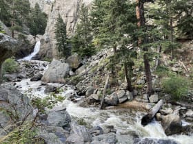
Boulder Falls
19 miles away
A 70-foot waterfall spills into Boulder Canyon just steps from Highway 119, the natural halfway marker on the scenic mountain drive between Boulder and the little town of Nederland.

Rocky Mountain National Park
43 miles away
Tundra, alpine lakes, and elk-filled meadows along Trail Ridge Road, the highest paved road in the country.