

Bixby Creek Bridge Viewpoint
Highway 1
Big Sur, CA
A slender concrete arch leaping a 260-foot canyon above the surf, the bridge that finally opened Big Sur and became its defining image.
Bixby Creek Bridge is the picture that says Big Sur: a slender, pale concrete arch spanning a plunging canyon, with the surf breaking far below and the coast marching off into the haze. Completed in 1932, it is one of the most photographed bridges in the world, and it looks as if it grew out of the cliffs it connects.
It is beautiful, but it was also a lifeline. Before it was built, the people of the Big Sur coast were effectively cut off in winter, when the old inland road became impassable. The bridge, and the coastal highway it made possible, ended that isolation and opened one of the most dramatic drives on earth.
What Travelers Love
- The graceful single concrete arch leaping a deep canyon straight to the ocean's edge
- One of the most photographed bridges in the world, and the signature image of Big Sur
- Turnouts at both ends for the classic side-on view
- The wild, open headlands and surf on either side
Worth Knowing
- The pullouts are small and popular; park only in the designated turnouts and never stop on the bridge itself
- Traffic on the narrow highway moves fast, so take care crossing to viewpoints
- Highway 1 through Big Sur closes periodically for landslides, so check conditions before you go
- Fog can erase the view; a clear day shows the arch and coast at their best
Learn about Bixby Creek Bridge Viewpoint
Building an arch on a cliff
The bridge was designed by engineers C.H. Purcell and F.W. Panhorst as an open-spandrel concrete arch, and built by the Ward Engineering Company. Construction ran from August 1931 to October 1932. Concrete was chosen because it was affordable and because, weathered, it would echo the color of the surrounding cliffs rather than clash with them.
The work was a feat in a place with almost no infrastructure. Crews first had to erect a temporary false bridge of some 300,000 board feet of timber to support the arch as it was poured, and materials came in by truck over narrow one-way roads. Around 45,000 individual sacks of cement were hauled up the framework, suspended by cables high above the creek, to complete the roughly 700-foot structure.
The bridge that ended Big Sur's isolation
When it was finished, Bixby Creek Bridge was the highest single-span arch bridge in the world and the longest concrete arch on any California state highway, a genuine engineering landmark. Yet it could not carry traffic right away; it stood waiting until 1937, when the rest of the coastal highway was finally completed.
That highway changed everything for Big Sur. Until then, residents were virtually stranded through the winter when the old inland coast road washed out. The bridge and Highway 1 stitched the isolated coast to the wider world, turning a place few could reach into one of the most celebrated scenic drives anywhere, without ever taming its wildness.
A wild setting above the surf
Part of what makes the bridge so striking is its stage. It leaps a steep V-shaped canyon where Bixby Creek meets the sea, flanked by open, grassy headlands that turn green in winter and gold by late summer. From the turnouts you can watch the surf work the rocks far below and follow the coastline as it stacks headland behind headland.
The waters here are part of the rich Big Sur coast, where sea otters raft in the kelp, harbor seals rest on the rocks, and gray whales pass offshore in season. Hawks and the occasional condor ride the updrafts along the cliffs. On a clear evening the low sun turns the whole scene, arch and headland and ocean, to gold.
Seeing it safely
The classic view is from the turnouts at either end of the bridge, especially the dirt pullout on the north side where the old coast road climbs away and gives the perfect side-on angle. The pullouts are small and fill quickly, so patience helps, and it is essential to stop only in the designated turnouts and never on the bridge itself.
Traffic moves fast on the narrow highway, so take care crossing to viewpoints, and be aware that fog often rolls over this coast and can hide the arch entirely. As with all of Big Sur, check Highway 1 conditions before setting out, since landslides regularly close stretches of the road for extended periods.
Closest Boutels
The closest Boutel™ stays, so you can turn this stop into an overnight. Each is a place we chose through independent editorial review, never a paid placement.
Tradewinds Carmel
BoutelMission Street at 3rd Avenue, Carmel-by-the-Sea, CA
13 miles away|Learn More ›
Details
Big Sur, CA
Frequently asked questions
What is the Bixby Creek Bridge?
The Bixby Creek Bridge is one of the most iconic and photographed landmarks on California's Big Sur coast, a graceful, sweeping concrete arch bridge spanning a deep canyon along the scenic Highway 1. Completed in the 1930s, its elegant single-arch design set against the dramatic backdrop of rugged cliffs and the Pacific Ocean has made it a symbol of Big Sur and the California coast, appearing in countless photos, films, and advertisements. The viewpoint near the bridge offers stunning vistas of the structure and the wild coastline, making it a beloved stop for travelers.
Where is the best place to view and photograph Bixby Bridge?
There are pullouts on the north side of the bridge along Highway 1 where you can park and take in classic views of the span against the coastline, which are the popular spots for photos. A dirt road climbing the hillside nearby offers elevated vantage points for some of the most famous shots. The lighting is especially beautiful in the golden hours near sunrise and sunset. Because parking is limited and the pullouts get busy, arriving early and using caution near the road traffic help you enjoy the views safely.
What safety tips apply at the Bixby Creek Bridge Viewpoint?
The viewpoint pullouts are right along the winding, busy Highway 1, so use great caution when parking, crossing, or walking near the road, watch for traffic, and keep children close. Do not stop in the traffic lanes or block the roadway for photos. Near the cliff edges, stay back from unstable drop-offs. The unpaved side road for elevated views can be rough. Being mindful of the road traffic and the steep terrain, and parking only in designated pullouts, keeps a stop at this popular viewpoint safe.
When is the best time to visit the Bixby Creek Bridge Viewpoint?
The golden hours near sunrise and sunset offer the most beautiful light on the bridge and coastline for photography, while clear days provide the best views, since Big Sur's coastal fog can sometimes obscure the scene, often clearing by midday. Early mornings also mean fewer crowds and easier parking at the limited pullouts. Note that Highway 1 is subject to occasional closures, so check road conditions before you go. For the best photos and a relaxed stop, aim for a clear morning or late afternoon.
What is near the Bixby Creek Bridge Viewpoint?
The bridge is on the Big Sur coast along Highway 1, near the scenic Point Sur area, the redwoods of Pfeiffer Big Sur State Park, hidden Pfeiffer Beach, and the iconic McWay Falls in Julia Pfeiffer Burns State Park to the south, with Carmel-by-the-Sea and the Monterey Peninsula to the north. That makes the Bixby Creek Bridge Viewpoint a classic stop to combine with Big Sur's beaches, redwoods, waterfalls, and dramatic coastal scenery on a Central Coast California road trip.
Nearby
Garrapata State Park
6.7 miles away
Garrapata has no big sign and no entrance kiosk, just numbered gates and gravel pullouts along a two mile stretch of Highway 1 about seven miles south of Carmel. That is why most people miss it.

Point Lobos State Natural Reserve
10 miles away
Often called the crown jewel of California's state parks, Point Lobos is a wild headland of wind-bent Monterey cypress, turquoise coves, and abundant sea life just south of Carmel.

Pfeiffer Beach
10 miles away
Pfeiffer Beach is one of the most distinctive beaches on the Big Sur coast and one of the few that charges only a small parking fee rather than a state park day-use fee.

Pfeiffer Big Sur State Park
11 miles away
A thousand-acre canyon of old-growth coast redwoods along the Big Sur River, a cool green pocket right off Highway 1 in the heart of Big Sur.
Big Sur Kelp Forest and Marine Protected Area
12 miles away
The Big Sur coastline lies within a network of marine protected areas, and the cold, upwelling-driven water that runs along the California coast supports kelp forest ecosystems of exceptional biodiver...

Carmel Beach
13 miles away
A mile of sugar-white granite sand and wind-bent Monterey cypress at the foot of Carmel-by-the-Sea, free to all and one of the friendliest dog beaches in California.

Monterey Bay Aquarium
17 miles away
The Monterey Bay Aquarium opened in 1984 in a converted sardine cannery on Cannery Row and is consistently ranked among the finest aquariums in the world.

Julia Pfeiffer Burns State Park
20 miles away
McWay Falls in Julia Pfeiffer Burns State Park drops 80 feet from a redwood canyon into an isolated cove that cannot be accessed from any direction on land.
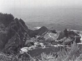
Big Sur Coast from McWay Falls
20 miles away
McWay Falls in Julia Pfeiffer Burns State Park is an 80-foot waterfall that drops directly onto a cove beach, an unusual configuration created by the uplift of the Santa Lucia Range that left the cany...

Pinnacles National Park
43 miles away
Volcanic spires and talus caves, one of the best places to watch California condors soar.