

Pfeiffer Beach
Sycamore Canyon Road
Big Sur, CA
A hidden Big Sur cove where the sand runs purple and, for a few weeks each winter, the setting sun fires a beam straight through a sea arch.
Pfeiffer Beach is Big Sur's worst-kept secret, a cove reached down a narrow canyon road that carries no highway sign, so that only those who know to look for it find their way in. The reward at the bottom is a wild, wind-scoured beach strewn with dramatic offshore rocks and arches, the Santa Lucia Mountains falling straight into the Pacific behind.
Two things make it unforgettable. The sand here runs streaked with purple, a real mineral color that intensifies after rain, and one of the offshore rocks holds a sea arch known as the Keyhole. For a short window each winter, the setting sun lines up perfectly and fires a blazing beam of light straight through that arch, drawing photographers from around the world.
What Travelers Love
- The streaks of genuinely purple sand, especially after rain washes fresh grains down the bluff
- The offshore rock formations and arches with the surf thundering through them
- Keyhole Arch, and the beam of sunlight that shines through it around the winter solstice
- The feeling of a hidden beach, reached down an unsigned canyon most drivers miss
Worth Knowing
- Sycamore Canyon Road is narrow, unmarked, and not suited to large vehicles; watch for the turn just south of the Big Sur ranger station
- There is a day-use fee and limited parking that fills fast, especially in winter for the arch
- The surf is powerful and the water cold; this is a beach for walking and watching, not swimming
- The famous sun beam only aligns with the arch for a short window in December, and needs a clear sky
Learn about Pfeiffer Beach
Why the sand is purple
The purple is not a trick of the light. The bluffs above the beach hold veins of a manganese garnet, and as the rock erodes, grains of the purple mineral wash down onto the sand and collect in swirls and streaks, especially in the low spots and after a rain has carried a fresh load down the slope.
On a dry, wind-scoured day the purple can be faint, mixed into the paler sand. After a winter storm it can be vivid, ribbons of lavender and deep violet running across the beach. It is one of only a handful of purple-sand beaches anywhere, and entirely natural.
The Keyhole and the winter sun
Just offshore stands a cluster of tall rocks, and one of them is pierced by an arch known as the Keyhole. Through most of the year it is simply a handsome sea arch with the surf surging through it. But around the winter solstice, as the sun drops far to the southwest, it aligns with the opening.
For a few minutes near sunset on the right clear days in December, the light pours through the arch in a sharp golden beam, striking the water and spray inside. Photographers gather well before sunset to claim a spot, and when the sky cooperates the effect is spectacular. Cloud or fog can hide it entirely, which is part of the draw for those who chase it.
The Big Sur coast
Pfeiffer Beach is one small piece of the larger Big Sur, the roughly ninety miles of coast where the Santa Lucia Mountains meet the sea in a wall of cliffs, redwood canyons, and hidden coves. This is a land of fog and wind and enormous surf, thinly settled, that has drawn writers and artists for a century for its raw beauty and isolation.
The beach takes its name, like the nearby state park, from the Pfeiffer family, homesteaders who settled this rugged country in the 1800s. The whole coast was and remains part of the homeland of the Esselen and Salinan peoples, whose deep history here long predates the roadside pull-offs of Highway 1.
When to go
December is the marquee season, for the sun beam through the Keyhole, though it comes with crowds and demands a clear evening. The rest of winter and early spring bring the most vivid purple sand, fed by the rains, and dramatic storm surf. Summer is milder but often draped in coastal fog, which can be beautiful in its own right.
Whenever you come, arrive with time to spare for the narrow canyon drive and the limited parking, and stay for sunset, when this west-facing cove is at its finest. Bring a windbreaker; Pfeiffer Beach is almost always breezy.
Closest Boutels
The closest Boutel™ stays, so you can turn this stop into an overnight. Each is a place we chose through independent editorial review, never a paid placement.
Tradewinds Carmel
BoutelMission Street at 3rd Avenue, Carmel-by-the-Sea, CA
23 miles away|Learn More ›
Details
Big Sur, CA
Frequently asked questions
What is Pfeiffer Beach?
Pfeiffer Beach is a hidden gem on California's Big Sur coast, a stunning and secluded beach known for its dramatic rock formations, most famously Keyhole Arch, and its striking purple-tinged sand, colored by manganese minerals washing down from the surrounding hills. Tucked at the end of a narrow, easy-to-miss road, the beach offers wild, rugged beauty, crashing surf, and a sense of discovery. Especially magical at sunset, when light beams through Keyhole Arch during certain times of year, Pfeiffer Beach is a beloved and photogenic Big Sur treasure.
How do you get to Pfeiffer Beach?
Pfeiffer Beach is reached via the narrow, unmarked Sycamore Canyon Road off Highway 1 in Big Sur, an easy-to-miss turnoff that winds down a couple of miles to a parking area, where a short walk leads to the beach. The road is narrow and not suited to large vehicles or RVs. There is a day-use fee, and parking is limited, filling quickly on nice days, so arriving early is wise. Because the turnoff is unmarked and Highway 1 can have closures, knowing the route and checking road conditions ahead helps.
What safety precautions should I take at Pfeiffer Beach?
Like much of the Big Sur coast, Pfeiffer Beach has powerful surf, cold water, and dangerous sneaker waves and rip currents, so swimming is not advised, and you should never turn your back on the ocean, keep well back from the water's edge, and watch children closely, since unexpected large waves can sweep people off rocks or the sand. The rocks can be slippery. Wind and cold are common, so bring layers. Enjoying the beach's beauty from a safe distance from the surf keeps a visit safe.
When is the best time to visit Pfeiffer Beach?
Sunset is the magical time, especially in winter when the sun aligns to beam light through Keyhole Arch, creating a famous photographic spectacle, though the beach is beautiful any clear day. Clear afternoons offer the best light and views, while coastal fog can roll in. Arriving early or on a weekday helps with the limited parking. Bring layers, as it is often windy and cool. For the iconic arch-light photos, aim for a clear winter sunset, but any clear day rewards a visit to this stunning beach.
What is near Pfeiffer Beach?
Pfeiffer Beach is on the Big Sur coast, near the redwoods and river of Pfeiffer Big Sur State Park, the iconic McWay Falls in Julia Pfeiffer Burns State Park, the famous Bixby Creek Bridge, and the scenic overlooks of Highway 1, with Carmel-by-the-Sea to the north and Hearst Castle to the south. That makes Pfeiffer Beach a hidden highlight to combine with Big Sur's redwoods, waterfalls, bridges, and breathtaking coastal scenery on a Central Coast California road trip.
Nearby

Pfeiffer Big Sur State Park
2.0 miles away
A thousand-acre canyon of old-growth coast redwoods along the Big Sur River, a cool green pocket right off Highway 1 in the heart of Big Sur.
Big Sur Kelp Forest and Marine Protected Area
5.4 miles away
The Big Sur coastline lies within a network of marine protected areas, and the cold, upwelling-driven water that runs along the California coast supports kelp forest ecosystems of exceptional biodiver...

Julia Pfeiffer Burns State Park
9.7 miles away
McWay Falls in Julia Pfeiffer Burns State Park drops 80 feet from a redwood canyon into an isolated cove that cannot be accessed from any direction on land.
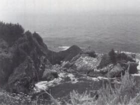
Big Sur Coast from McWay Falls
9.8 miles away
McWay Falls in Julia Pfeiffer Burns State Park is an 80-foot waterfall that drops directly onto a cove beach, an unusual configuration created by the uplift of the Santa Lucia Range that left the cany...

Bixby Creek Bridge Viewpoint
10 miles away
Bixby Creek Bridge is a 714-foot concrete open-spandrel arch bridge completed in 1932, built as part of the original Highway 1 coastal road project.
Garrapata State Park
17 miles away
Garrapata has no big sign and no entrance kiosk, just numbered gates and gravel pullouts along a two mile stretch of Highway 1 about seven miles south of Carmel. That is why most people miss it.

Pinnacles National Park
41 miles away
Volcanic spires and talus caves, one of the best places to watch California condors soar.