
Antietam National Battlefield
5831 Dunker Church Rd, Sharpsburg, MD
Sharpsburg, MD
Rolling farm fields in western Maryland where the single bloodiest day in American history unfolded, and where the war's course turned toward emancipation.
On September 17, 1862, the farm fields around Sharpsburg became the site of the bloodiest single day in American history. In roughly twelve hours of fighting along Antietam Creek, the Union and Confederate armies suffered around 23,000 casualties, more Americans killed, wounded, or missing in one day than on any other in the nation's history. The battle ended Confederate general Robert E. Lee's first invasion of the North.
What that terrible day made possible echoed far beyond the field. The battle gave President Abraham Lincoln the moment he had been waiting for, and days later he issued the preliminary Emancipation Proclamation, reshaping the war into a struggle to end slavery. Today the battlefield is one of the best-preserved in the country, its lanes, fences, and farm buildings restored so faithfully that the ground itself tells the story.
What Travelers Love
- The preserved farm landscape, so intact you can read the battle across the rolling fields
- The stark white Dunker Church, an unlikely centerpiece of some of the fiercest fighting
- Standing on the sunken farm lane known as Bloody Lane and the stone Burnside Bridge
- The quiet, powerful atmosphere, far less crowded than better-known battlefields
Worth Knowing
- This is a place of remembrance where thousands died; visitors treat it with quiet respect
- The self-guided auto tour is the best way to see the whole field; allow a good half day
- Wear sturdy shoes if you plan to walk the trails at Bloody Lane or down to Burnside Bridge
- The visitor center orients the whole battle before you set out, so start there
Learn about Antietam National Battlefield
The bloodiest day
The fighting on September 17, 1862, unfolded in three great phases across a single morning and afternoon. It opened at dawn in a cornfield and the woods around the small white Dunker Church, where lines of soldiers advanced and fell back across the same ground again and again. By late morning the killing had shifted to a sunken farm road, worn low by years of wagon traffic, where a Confederate line held for hours against repeated Union assaults.
That sunken road earned the name Bloody Lane for the toll taken there. In the afternoon the battle moved to a stone bridge over Antietam Creek, where a small Confederate force held off a much larger Union effort to cross for hours before the bridge was finally taken. By nightfall the two exhausted armies remained on the field, and the scale of the loss, around 23,000 casualties in a day, was almost beyond comprehension.
Emancipation and the meaning of the battle
In the strict military sense the battle was inconclusive; both armies were battered, and Lee's forces withdrew across the Potomac into Virginia the following night. But the fact that Lee's invasion of the North had been turned back gave the outcome enormous political weight. Lincoln had drafted a proclamation to free enslaved people in the rebelling states and had been waiting for a Union success before announcing it.
Five days after the battle, Lincoln issued the preliminary Emancipation Proclamation, declaring that enslaved people in the Confederate states would be free as of January 1, 1863. It transformed the purpose of the war and discouraged European powers from recognizing the Confederacy. What happened in these fields, in other words, helped set the nation on the road to ending slavery, which is why the ground is remembered far beyond its military story.
Walking the field today
The battlefield is remarkably intact. A self-guided auto tour links the major sites in the order the fighting unfolded, from the cornfield and the Dunker Church to Bloody Lane and Burnside Bridge, with pullouts, monuments, and interpretive markers along the way. Walking trails let you stand on the sunken lane and descend to the stone bridge and the creek it spans.
The visitor center is the place to begin, with exhibits, a film, and rangers who can frame the day before you drive it. Because Antietam draws far smaller crowds than some famous battlefields, it often feels quiet and contemplative, a landscape of split-rail fences, stone farm buildings, and open fields where the weight of what happened settles over you as you walk.
The land, the town, and the wider region
The preserved farm landscape is part of what makes Antietam so powerful. The National Park Service and its partners have worked to restore fields, fences, orchards, and the small white Dunker Church, so the terrain looks much as it did in 1862. Deer graze the meadows, hawks circle the ridges, and on a still evening the field can feel timeless.
The nearby town of Sharpsburg is a quiet crossroads community with deep ties to the battle. Just beyond, the Potomac River, the historic C&O Canal towpath, and the storied town of Harpers Ferry offer more history and scenery within a short drive, making the battlefield an anchor for a broader day in the mountains of western Maryland.
Closest Boutels
The closest Boutel™ stays, so you can turn this stop into an overnight. Each is a place we chose through independent editorial review, never a paid placement.
Details
Sharpsburg, MD
Frequently asked questions
What is Antietam National Battlefield?
Antietam National Battlefield, near Sharpsburg in western Maryland, preserves the site of the Battle of Antietam, fought on September 17, 1862, the bloodiest single day in American history. This pivotal Civil War battle helped pave the way for the Emancipation Proclamation. Beautifully preserved and set in a rolling rural landscape, the battlefield offers a moving, reflective experience, allowing visitors to walk the ground where the terrible events unfolded and to grasp the war's staggering human cost.
What can you see at Antietam National Battlefield?
Begin at the visitor center, with its film and museum, then follow the auto-tour route, on foot or by car, to the battlefield's iconic sites, including the humble Dunker Church, the Sunken Road known as Bloody Lane, and the stone Burnside Bridge, along with the many monuments across the fields. Ranger programs deepen the experience. The largely unspoiled landscape makes it easier to picture the battle and reflect on its meaning.
When is the best time to visit Antietam National Battlefield?
Spring through fall offers the most comfortable weather for exploring the battlefield on foot and by car, with autumn especially beautiful and resonant near the September anniversary of the battle. A clear day is ideal for the driving tour and walks. Allow at least a half day to take in the visitor center, the tour route, and the key sites at a thoughtful pace, and consider a ranger program for richer historical context.
What should I know before visiting Antietam?
There is an entrance fee, and it is worth starting at the visitor center to orient yourself with the film and exhibits before touring. Wear comfortable shoes and bring water if you plan to walk the sites, since some involve short walks across open ground. This is a solemn place commemorating great loss, so approach it with respect. Allowing unhurried time lets the significance of the ground and its stories sink in.
What is near Antietam National Battlefield?
The battlefield lies near Sharpsburg in western Maryland, close to the historic C&O Canal along the Potomac River and within easy reach of Harpers Ferry, West Virginia, another key Civil War and historic site at the confluence of the Potomac and Shenandoah rivers. The scenic countryside and small towns of western Maryland surround it. That makes Antietam an easy and meaningful stop on a broader tour of the region's rich Civil War history.
Nearby
Washington Monument State Park
6.8 miles away
A small monument with a big payoff for the effort. Local farmers built this squat stone tower on South Mountain in one day in 1827, the first completed monument to George Washington anywhere.
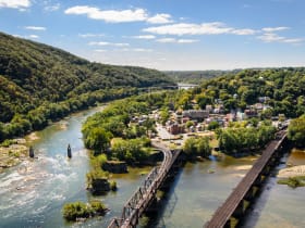
Harpers Ferry Lower Town
10 miles away
Harpers Ferry turns history into something kids can walk through.
The Point at Harpers Ferry
10 miles away
For the classic Harpers Ferry view in just a few minutes, walk to the Point at the very tip of the lower town, where the Shenandoah River empties into the Potomac.

Jefferson Rock
10 miles away
Most day visitors stay down in the lower town and never make the short climb to the best view in Harpers Ferry.

Appalachian Trail at Harpers Ferry
11 miles away
Harpers Ferry is the spiritual halfway house of the Appalachian Trail, and you can walk a piece of it easily.
Hollywood Casino at Charles Town Races
14 miles away
Live horse racing makes an unusual family outing, and Charles Town has run it since 1933.

National Museum of Civil War Medicine
18 miles away
Frederick has a big Civil War story that has nothing to do with a battlefield.

Skyline Drive
46 miles away
The 105-mile scenic drive along the Blue Ridge crest through Shenandoah National Park, a National Historic Landmark with seventy-five overlooks and famous fall color.