
Ten Sleep Canyon and the Cloud Peak Skyway
Wyoming
Cloud Peak Skyway, Wyoming
Some drives ease you into the mountains. The Cloud Peak Skyway grabs you by the collar. Rolling east out of the little ranch town of Ten Sleep, US Highway 16 dives straight into Ten Sleep Canyon, a deep slot in the Bighorn Mountains walled by pale cliffs of limestone and dolomite that lean in close on both sides. Climbers cling to those walls like colorful specks, a creek tumbles alongside the road, and the pavement just keeps climbing.
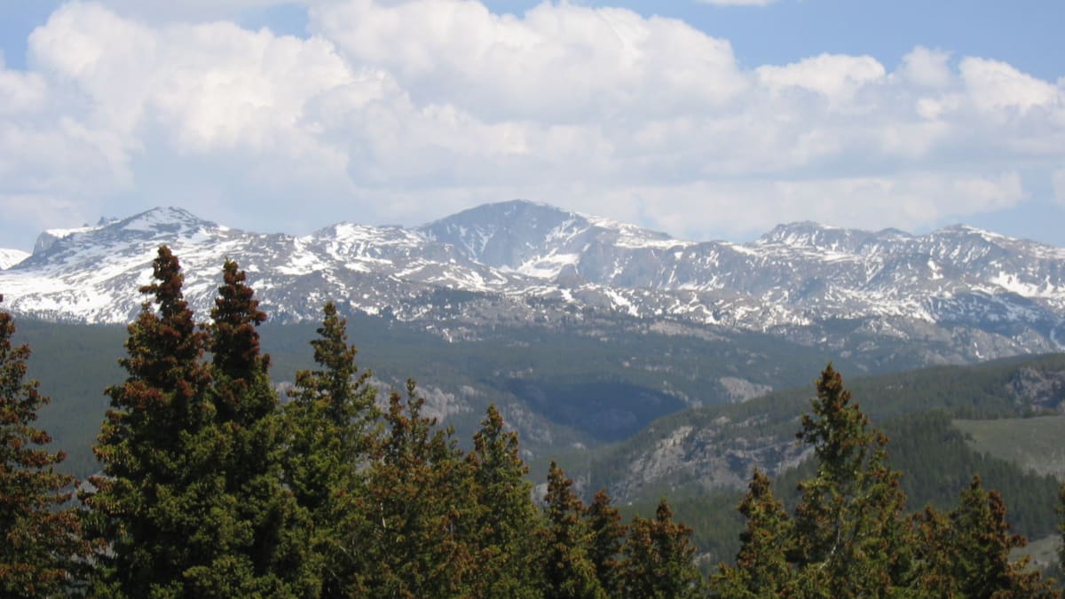
By the time you crest Powder River Pass at 9,666 feet, the dry sagebrush of the lowlands is long gone, traded for cool spruce forest, alpine lakes, and the snowy shoulders of 13,167-foot Cloud Peak, the tallest summit in the range. About 47 miles all told, from Ten Sleep to the frontier town of Buffalo, this is a Wyoming State Scenic Byway, the officially recognized Cloud Peak Skyway, and one of the great high-country crossings in the American West.
Learn about Ten Sleep Canyon and the Cloud Peak Skyway
The Road
The Cloud Peak Skyway is the stretch of US Highway 16 that crosses the southern Bighorn Mountains between Ten Sleep on the west and Buffalo on the east. It runs about 47 miles, and in that distance it lifts you from roughly 4,200 feet in the sagebrush basin to 9,666 feet at Powder River Pass, then eases back down the other side. It is a paved, two-lane federal highway the whole way, so any passenger car can make the crossing, but the grade is real and the elevation is high enough that you feel it.
The drive is a story in three acts. First comes Ten Sleep Canyon, a dramatic gorge where sheer cliffs of pale limestone and dolomite rise straight from the roadside. This is world-class rock climbing country, and on a warm day you will spot climbers on the walls and their tents in the pullouts. Then the road tops out in the high country, a broad green roof of alpine meadow, spruce forest, and cold blue lakes gathered beneath Cloud Peak and the Cloud Peak Wilderness. Finally, on the east side, it winds down the long forested slope toward Buffalo and the plains beyond.
There is no rushing a road like this, and you would not want to. Meadowlark Lake offers an easy place to stretch your legs and take in the water and peaks. West Tensleep Lake, reached by a good gravel spur, is the main jumping-off point for hikes into the Cloud Peak Wilderness. Overlooks along the way frame the canyon behind you and the mountains ahead. Give yourself a good half day, pack a jacket even in summer, and let the mountains set the pace.
How to Get There
The Cloud Peak Skyway is easy to find because it is simply the mountain stretch of US Highway 16, a major cross-state route. Coming from the east, most travelers reach it through Buffalo, Wyoming, which sits right at the junction of Interstate 25 and Interstate 90. From Buffalo you head west on US-16 and begin climbing into the Bighorns almost at once, so the scenery starts within minutes of leaving town.
Coming from the west, the gateway is the ranch town of Ten Sleep, reached on US-16 from Worland and the Bighorn Basin. As you leave Ten Sleep heading east, the road drops you straight into Ten Sleep Canyon, so the most dramatic scenery greets you first. Many travelers like this direction because the canyon walls fill the windshield before you have even settled into the drive.
Either approach is a fine choice, and plenty of road-trippers drive the whole thing one way as part of a longer loop through the Bighorns. Fuel up in Ten Sleep or Buffalo before you start, because once you are up in the mountains, services are few and far between.
History
People have crossed the southern Bighorns on foot and horseback for a very long time. The town of Ten Sleep takes its name from an old Native American way of measuring distance by the number of nights, or sleeps, a journey took. The settlement sat roughly ten sleeps from major camps in several directions, a natural waypoint in the middle of a big country. When ranchers and freighters later needed a wagon route over the mountains, they followed the same logic the land had always offered, up through the canyon and across the high pass.
The modern highway grew out of those early crossings. US Highway 16 was commissioned in 1926 as part of the original national system of numbered federal highways, and its mountain segment over Powder River Pass was gradually improved and paved through the following decades into the all-season route we drive today. It linked the farm and ranch country of the Bighorn Basin with the towns along the eastern front of the range and the plains beyond.
Wyoming later recognized the mountain stretch as an official state scenic byway, giving it the name the Cloud Peak Skyway Scenic Byway in honor of the great summit it passes beneath. The designation celebrates the road's rare combination of deep canyon, high alpine pass, and wilderness gateway, all strung along one 47-mile crossing. Much of the route travels through Bighorn National Forest, which was set aside in 1897 as one of the earliest national forest reserves in the country, so the wild character the byway honors has been protected for well over a century.
The Cloud Peak Wilderness at the road's high point was formally protected by Congress in 1984, safeguarding nearly 190,000 acres of granite peaks, glacial lakes, and tundra around Cloud Peak itself. The name Powder River, given to both the pass and the river that drains eastward from it, is said to come from the fine, powder-like soil along its banks, a name that echoes through Wyoming history from the fur trade to the cattle-country conflicts of the late 1800s.
Little-Known Facts
- Ten Sleep got its name from a Native American method of measuring distance in nights of travel. The site sat about ten sleeps, or ten days' journey, from important camps, making it a natural waypoint in the middle of a very large country.
- Ten Sleep Canyon is one of the premier sport-climbing destinations in the United States, with thousands of bolted routes on its pocketed limestone and dolomite walls. Climbers travel from around the world to test themselves on the rock right above the highway.
- Powder River Pass tops out at 9,666 feet, making the Cloud Peak Skyway one of the highest paved highway crossings in Wyoming and one of the loftiest all-season passes in the northern Rockies.
- Cloud Peak, visible from the high country, rises to 13,167 feet and is the tallest mountain in the entire Bighorn Range. It anchors the Cloud Peak Wilderness, protected by Congress in 1984.
- The limestone and dolomite that form the canyon walls were laid down as ocean sediments hundreds of millions of years ago, back when a shallow sea covered what is now high, dry Wyoming.
- Bighorn National Forest, which the byway crosses, was established in 1897 as one of the very first national forest reserves in the country, decades before the Forest Service itself existed.
- Crazy Woman Canyon, a rugged side gorge near the east end of the drive, is famous for a narrow, boulder-strewn back road that squeezes through towering rock walls. It is a rough, unpaved route best left to high-clearance and four-wheel-drive vehicles, quite unlike the smooth pavement of US-16.
- The Powder River that gives the pass its name runs through some of the most storied cattle-country history in the American West, from the fur-trade era to the range conflicts of the 1890s.
Along the Route
Ten Sleep Canyon
Just east of Ten Sleep, US-16 plunges into this dramatic gorge, where cliffs of pale limestone and dolomite rise hundreds of feet straight from the roadside. The canyon is one of the finest sport-climbing areas in the country, so expect to see climbers dotting the walls and creek water tumbling alongside the pavement. Pullouts let you stop safely to crane your neck and watch.
Ten Sleep Fish Hatchery
A short spur off the canyon road leads to this state fish hatchery, tucked in a green pocket where cold spring water pours from the mountainside. It is a quiet, family-friendly stop where you can watch trout in the rearing ponds and learn how the state stocks streams and lakes across the region. The setting alone, cliffs above and clear water below, makes it worth the brief detour.
Bighorn National Forest
The Cloud Peak Skyway spends most of its length inside this million-acre national forest, one of the oldest in the country. As the road climbs out of the canyon, sagebrush gives way to cool spruce and fir, alpine meadows, and cold blue lakes. This is the wild heart of the drive, full of trailheads, campgrounds, and views toward the high peaks.
Meadowlark Lake
High in the mountains, Meadowlark Lake spreads out beside the highway, a cool alpine reservoir ringed by forest and framed by peaks. It is the easiest place on the drive to stop, stretch, and take in the water, with a lodge, boat access, and picnic spots nearby. On a still morning the surrounding summits mirror perfectly on its surface.
West Tensleep Lake Trailhead
A good gravel spur road climbs north from US-16 to this trailhead, the main gateway into the Cloud Peak Wilderness. From here hikers set out for glacial lakes and the flanks of Cloud Peak itself, the tallest summit in the Bighorns. Even if you only walk a short way, the alpine lake and towering peaks reward the side trip.
Powder River Pass
The high point of the whole crossing, Powder River Pass tops out at 9,666 feet, one of the loftiest all-season highway summits in Wyoming. Up here the world opens into rolling alpine tundra and wide sky, with Cloud Peak and its neighbors filling the horizon. Pack a jacket, because it can be cool and windy at the top even on a summer afternoon.
Crazy Woman Canyon
Near the east end of the drive, a rugged side road drops off US-16 into this narrow gorge, squeezing between towering rock walls along a tumbling creek. It is a spectacular place, but the road through it is rough, unpaved, and steep, best left to high-clearance and four-wheel-drive vehicles when conditions are dry. Most travelers admire it as a detour for the well-prepared and stay on the smooth pavement of US-16 toward Buffalo.
Details
Ten Sleep to Buffalo
Frequently asked questions
What is the Cloud Peak Skyway, and is it an official scenic byway?
The Cloud Peak Skyway is the mountain stretch of US Highway 16 that crosses the southern Bighorn Mountains between Ten Sleep and Buffalo, Wyoming. It is an officially recognized Wyoming State Scenic Byway, formally called the Cloud Peak Skyway Scenic Byway, named for 13,167-foot Cloud Peak, the tallest mountain in the range, which the road passes beneath.
How long is the Cloud Peak Skyway, and how long does it take to drive?
The scenic mountain crossing runs about 47 miles along US-16 between Ten Sleep and Buffalo. Driven straight through, it takes a little over an hour, but the elevation, curves, and scenery invite a slower pace. Most travelers give it at least a half day so they can stop at Ten Sleep Canyon, Meadowlark Lake, Powder River Pass, and the wilderness trailheads.
What are the must-see stops along the Cloud Peak Skyway?
Traveling east from Ten Sleep, the highlights include Ten Sleep Canyon with its famous climbing walls, the Ten Sleep Fish Hatchery, alpine Meadowlark Lake, the West Tensleep Lake trailhead into the Cloud Peak Wilderness, and 9,666-foot Powder River Pass at the top. Near the east end, rugged Crazy Woman Canyon offers a dramatic side trip for well-prepared drivers before the road descends to Buffalo.
Is the Cloud Peak Skyway free to drive?
Yes. The Cloud Peak Skyway is simply US Highway 16, a public federal highway, so driving it is free and requires no pass or fee. Some developed campgrounds and day-use sites in Bighorn National Forest along the route may charge a small fee, but the drive itself costs nothing.
What is the best time of day and year to drive the Cloud Peak Skyway?
Summer and early fall are the finest seasons, when the high country is green, the wildflowers bloom, and the mountain lakes are open and inviting. Morning light is lovely on Ten Sleep Canyon, while late afternoon glows warm across the alpine meadows near the pass. The road is open year-round, but the mountains are at their most welcoming from roughly June through September.
Is the Cloud Peak Skyway open year-round or does it close in winter?
US Highway 16 is a main, plowed route, so the Cloud Peak Skyway stays open through the year, unlike some high mountain byways that close entirely in winter. That said, this is a genuine mountain crossing over a 9,666-foot pass, so heavy winter storms can bring snow, ice, and occasional temporary closures at Powder River Pass. Always check current road and weather conditions before a cold-season drive.
Do you need four-wheel drive to drive the Cloud Peak Skyway?
No. US-16 over the Bighorns is a paved, two-lane federal highway that any passenger car can handle in good weather. The one exception is the side trip through Crazy Woman Canyon, a rough, steep, unpaved back road that is best left to high-clearance and four-wheel-drive vehicles. Stay on US-16 and no special vehicle is needed.
What are the winter driving conditions on the Cloud Peak Skyway?
Because it crosses a high mountain pass, the Cloud Peak Skyway can see snow and ice from fall through spring, and mountain weather changes fast at this altitude. The route is plowed and maintained as a main highway, but storms can make Powder River Pass slick and occasionally force a temporary closure. In the colder months, carry warm gear, watch the forecast, and be ready to turn back if a storm rolls in.
Are there gas stations and services along the Cloud Peak Skyway?
Services are limited once you leave the valley towns, so plan ahead. Fill up in Ten Sleep on the west end or Buffalo on the east end before you start, since the mountain stretch has only scattered lodges and campgrounds and no full service towns in between. Meadowlark Lodge near the lake is the main developed stop up high. Carry water, snacks, and a full tank.
Is there cell phone service on the Cloud Peak Skyway?
Cell coverage is spotty to nonexistent through much of the mountain crossing, especially deep in Ten Sleep Canyon and up near Powder River Pass. Do not count on a signal for navigation or emergencies once you leave Ten Sleep or Buffalo. Download maps ahead of time, tell someone your plans, and treat the drive as a genuine backcountry outing.
Nearby

Ten Sleep Canyon and the Cloud Peak Skyway
0.0 miles away
The Cloud Peak Skyway climbs from the ranch town of Ten Sleep up through Ten Sleep Canyon, a deep cut walled in pale limestone cliffs, then over 9,666-foot Powder River Pass and across the high green...

Bighorn National Forest
11 miles away
The Bighorn National Forest is a million-acre range rising straight above Ten Sleep, where a short climb east of town on US 16 (the Cloud Peak Skyway) carries you from red-rock canyon to alpine lakes...
Shell Canyon and Shell Falls
30 miles away
Shell Canyon on US-14 east of Greybull is a 10-mile slot through Precambrian granite and limestone where Shell Creek drops 120 feet over a hard granite ledge at Shell Falls.

Medicine Wheel National Historic Landmark
56 miles away
Medicine Wheel is a prehistoric stone circle 80 feet in diameter on a wind-scoured ridge at 9,642 feet in the Bighorn Mountains, reached by a 1.5-mile walk from a locked gate.