

Talimena National Scenic Byway
Oklahoma & Arkansas
Most highways cut through the low country and let the mountains stay off in the distance. The Talimena National Scenic Byway does the opposite. For about fifty-four miles it climbs up onto the long, parallel ridgetops of the Ouachita Mountains and simply stays there, running the spine of Winding Stair Mountain and then Rich Mountain with the forested valleys falling away on both sides. It connects Talihina, Oklahoma, on the west with Mena, Arkansas, on the east, and it is one of very few roads in the country built for no other reason than the view.
This is a drive the federal government singled out for the whole nation, a National Scenic Byway that stitches two states together along one high, winding ridge. In autumn the hardwood forest turns to gold, orange, and deep crimson, and cars line up at the overlooks to take it in. But the byway rewards every season, a slow, curling ribbon of pavement that hands you a fresh panorama at nearly every pull-out and makes a memorable approach to any stay in the Ouachitas.
Learn about Talimena National Scenic Byway
The Road
The byway is a two-lane mountain highway that carries two numbers, Oklahoma State Highway 1 on the west side and Arkansas Highway 88 on the east, meeting at the state line up on the ridge. It runs roughly fifty-four miles between Talihina and Mena, and rather than crossing the mountains it rides along the very top of them. Winding Stair Mountain and Rich Mountain both crest near twenty-six hundred feet, and the road holds that high line for miles, which is why the views open up on both sides at once.
Driving it is a leisurely, curling affair. The pavement bends and climbs and dips with the shape of the ridge, and the posted pace is unhurried, which happens to be exactly right for a road like this. More than twenty scenic vista pull-outs are spaced along the route, so you can ease off the highway, step out, and look for miles across the parallel folds of the Ouachitas without holding up the car behind you. Some grades along the way are steep, so it pays to keep an easy speed and enjoy the ride.
What sets the Talimena apart is that the scenery is the whole point. The road threads through the Ouachita National Forest the entire way, and many of the forests on these ridgetops are stunted, hard to log, and were simply left alone, so pockets of true old-growth timber still stand beside the pavement. Trailheads, picnic spots, and a couple of parks open right off the byway. In fall the hardwoods put on the show the drive is famous for, but the long green tunnels of summer and the bare, blue-distance views of winter have their own quiet pull.
How to Get There
The western gateway is Talihina, Oklahoma, a small town in the Ouachitas about ninety miles east of McAlester. Coming from the Oklahoma City area, take Interstate 40 east to McAlester, then follow U.S. Highway 271 south and east into Talihina. The byway begins just outside town at Talimena State Park, where a trailhead and the first ridgeline overlook mark the start of the climb. From there the road heads east and up onto Winding Stair Mountain.
The eastern gateway is Mena, Arkansas, on the far side of Rich Mountain. Coming from Fort Smith, drive south on U.S. Highway 71 to Mena, where Arkansas Highway 88 leads west out of town and climbs toward Queen Wilhelmina State Park and the state line. Many travelers coming from the Dallas and Fort Worth area also reach Mena by way of U.S. Highway 271 and U.S. Highway 59 through eastern Oklahoma.
Either end makes a fine starting point, and the drive is just as good in both directions. A common plan is to begin in Talihina, climb the byway west to east, and come down into Mena, then loop back through the valley towns on a lower highway so you see the mountains from below as well as above. Fuel up before you start, since Talihina and Mena are the places to fill the tank and there are no services up on the mountain itself.
History
The Talimena is one of the few American highways built purely to show off the country it crosses. Its bones go back to the 1930s, when crews from the Civilian Conservation Corps carved a pair of rough truck routes along these ridgetops during the Depression. Those work roads followed the high line of Winding Stair and Rich mountains, and decades later the modern scenic drive was laid over roughly the same path, connecting the two into one continuous ridge road.
The paved highway itself was built with federal and state funds through the middle 1960s and opened in 1969, at a cost of around seven million dollars split among the U.S. government and the states of Oklahoma and Arkansas. It was dedicated on June 7, 1970, in a ceremony led by Luci Baines Johnson Nugent, a daughter of President Lyndon B. Johnson. Oklahoma has long described it as the only highway in the state built specifically for scenic driving rather than to get people from one place to another.
Honors gathered over the years. The route was recognized as a National Forest Scenic Byway in February 1989, since it runs through the Ouachita National Forest the whole way. Arkansas named its portion a state scenic byway in 1998, and Oklahoma did the same for its side in 2002. The crowning moment came on September 22, 2005, when the Federal Highway Administration designated the full corridor a National Scenic Byway, recognizing the road's outstanding scenic and recreational qualities across both states.
The mountains the road rides are far older than any of this. The Ouachitas run east and west, unusual for American ranges, and their long parallel ridges were pushed up hundreds of millions of years ago and then worn down by time. Human history layers over the land as well. Talimena State Park at the western end preserves a stretch of the Old Military Road that dates to 1832, a route once traveled by soldiers and by Choctaw families during the forced removals of that era. The byway's own name is a simple blend of its two anchor towns, Talihina and Mena.
Little-Known Facts
- The Talimena is one of the only highways in the United States built specifically for scenic driving rather than to connect two places, and Oklahoma calls it the only road in the state made for that purpose.
- The road follows a pair of ridgetop truck routes first cut by the Civilian Conservation Corps in the 1930s, so today's smooth pavement traces work roads carved by hand during the Great Depression.
- It carries two different highway numbers, Oklahoma State Highway 1 and Arkansas Highway 88, which meet at the state line high on the ridge between Winding Stair and Rich mountains.
- The byway was dedicated on June 7, 1970, by Luci Baines Johnson Nugent, a daughter of President Lyndon B. Johnson.
- Rich Mountain, which the eastern half of the drive climbs, tops out around 2,681 feet and is the second-highest peak in all of Arkansas.
- The Ouachita Mountains run east and west instead of north and south, which is rare for ranges in North America, and the byway rides the long, parallel spines this odd geology created.
- Because the ridgetop timber was stunted and hard to log, some of the forest along the road was never cut and survives as genuine old growth right beside the pavement.
- Queen Wilhelmina State Park near the eastern end is home to the Wonder House, a rock cottage finished in 1931 that is built on nine different levels while looking from the outside like a simple two-story stone house.
Along the Route: Oklahoma
Talimena State Park
Talimena State Park sits at the western foot of the byway, just outside Talihina, and marks the official start of the climb. A short trailhead walk leads up to the first ridgeline overlook, a ten-minute stroll that rewards you with a panoramic look east into the mountains you are about to drive. The park also protects a preserved stretch of the Old Military Road, a route dating to 1832 that once carried soldiers and Choctaw families across these hills.
Winding Stair Mountain
Winding Stair Mountain carries the first long stretch of the byway, a high, curving ridge that gives the mountain its name and the road its most sinuous curves. Much of it lies within the Winding Stair Mountain National Recreation and Wilderness Area, a large tract of the Ouachita National Forest set aside for hiking, camping, and quiet. Overlooks near the crest open onto miles of parallel green ridges rolling off to the horizon.
Horse Thief Spring
Horse Thief Spring is a shaded rest stop and trailhead along the Oklahoma side of the byway, named for the outlaws who once used the remote high country to hide stolen horses. A cool spring bubbles up here beneath the trees, and a picnic area makes it an easy place to stretch your legs partway through the drive. It also connects to the Ouachita National Recreation Trail, which threads for miles through the surrounding forest.
Robert S. Kerr Arboretum
The Robert S. Kerr Memorial Arboretum is a small forest study area set right along the byway, named for the Oklahoma senator and governor who championed the Ouachita National Forest. Short interpretive nature trails loop through the trees, letting you walk into the woods the highway otherwise only frames from the car. It is a fine place to learn the names of the oaks, hickories, and pines that paint the ridgetops each autumn.
Kerr Nature Center
The Kerr Nature Center sits beside the arboretum near the Oklahoma end of the high country, an interpretive stop that helps visitors read the forest around them. Displays and easy walking paths explain the plants, animals, and long geologic story of the Ouachita Mountains. It marks roughly the last major pull-out before the byway carries you across the state line into Arkansas.
Along the Route: Arkansas
Rich Mountain
Rich Mountain is the great high ridge of the Arkansas half of the drive, cresting around 2,681 feet as the second-highest peak in the state. The byway rides its long, level ridgetop for miles, where cooler air and sweeping views once drew ridgetop farmers up from the valleys in the 1880s. On a clear day the overlooks here reach across rank after rank of blue Ouachita ridges.
Queen Wilhelmina State Park
Queen Wilhelmina State Park crowns Rich Mountain near the eastern end of the byway and serves as its Arkansas centerpiece. A historic summit lodge, sometimes called the Castle in the Sky, makes a base for exploring, and trails run along the crest to overlooks that stretch for miles. Watch for hawks riding the ridge winds, and in fall for the migrating kettles of broadwings that pass over the range.
Wonder House
The Wonder House stands on the grounds of Queen Wilhelmina State Park, an eccentric rock cottage finished in 1931 by an amateur builder named Carlos Hill. From the outside it looks like a plain two-story stone house, but inside it is built across nine separate levels, tucked into the slope of Rich Mountain. It is one of five such houses Hill raised on the mountain and the only one still standing, now listed on the National Register of Historic Places.
Mena
Mena is the eastern anchor of the byway, a small Ouachita Mountain town where Arkansas Highway 88 comes down off Rich Mountain. It is the place to fuel up, find a meal, and rest before or after the drive, since there are no services up on the ridge itself. The town also sits along the historic Kansas City Southern railway line and makes a friendly gateway to the surrounding forest.
Details
Talihina to Mena
Frequently asked questions
When was the Talimena Scenic Drive designated a National Scenic Byway?
The Federal Highway Administration designated the full Talimena corridor a National Scenic Byway on September 22, 2005. Before that, it was recognized as a National Forest Scenic Byway in February 1989, and both states named their portions state scenic byways, Arkansas in 1998 and Oklahoma in 2002. The road first opened to traffic in 1969 and was dedicated in 1970.
How long is the Talimena National Scenic Byway, and how long does it take to drive?
The byway runs about fifty-four miles between Talihina, Oklahoma, and Mena, Arkansas, following Oklahoma Highway 1 and Arkansas Highway 88 along the mountain ridgetops. Driven straight through, it takes roughly ninety minutes without stopping. Most travelers give it half a day or more so they can pause at the many overlooks, walk a trail or two, and enjoy the parks along the way.
What are the must-see stops along the Talimena Scenic Drive?
On the Oklahoma side, Talimena State Park marks the western start with its first ridgeline overlook, and Winding Stair Mountain, Horse Thief Spring, and the Robert S. Kerr Memorial Arboretum follow along the crest. Crossing into Arkansas, Rich Mountain and Queen Wilhelmina State Park, home to the historic Wonder House, anchor the eastern end. More than twenty scenic pull-outs between them make it easy to stop and take in the views.
Is the Talimena National Scenic Byway free to drive?
Yes. The byway is a public highway, so driving it and stopping at the scenic overlooks costs nothing. Some state parks and recreation areas along the route may charge for camping or certain facilities, but the drive itself and its many pull-outs are free to enjoy.
What is the best time of day or year to drive the Talimena Scenic Drive?
The byway is best known for fall color, when the hardwood forest turns gold, orange, and crimson, with the peak usually arriving in late October and into November. Spring and summer bring lush green ridges and mild weather, and clear winter days offer long blue-distance views through the bare trees. For soft light and quiet overlooks, early morning and the hours near sunset are especially rewarding any time of year.
Is the Talimena National Scenic Byway open year-round?
Yes. The byway is a paved highway that stays open throughout the year. It sits at a higher elevation than the surrounding country, so it can see occasional snow or ice in winter, and short sections may close briefly during a storm until crews clear them. It is always wise to check current road and weather conditions before heading up in the colder months.
Do you need four-wheel drive to drive the Talimena Scenic Drive?
No. The entire byway is paved, and any passenger car handles it well. The route does include some steep grades and plenty of curves as it climbs and follows the ridgetops, so a well-maintained vehicle and easy driving are all you need. Four-wheel drive and high clearance are not required.
What are the winter driving conditions on the Talimena Scenic Drive?
Because the road runs along high mountain ridges, it can be colder and more prone to ice and snow than the valleys below, especially in the shaded curves. Most of the year it drives easily, but during and just after a winter storm the pavement can be slick, so it is best to wait for conditions to clear and give crews time to treat the road. Check the forecast and road reports before you set out in winter.
Are there gas stations and services along the byway?
Plan to fuel up before you start, because there are no gas stations or stores up on the mountain itself. Talihina at the western end and Mena at the eastern end are the places to fill the tank, grab food, and use restrooms. Once you are on the ridge, the byway is all forest and overlooks, so it is smart to begin with a full tank and any snacks or water you may want.
Is there cell phone service on the Talimena Scenic Drive?
Cell service is spotty along much of the byway, since the road runs through remote national forest high on the ridgetops. You may find a signal near the towns at either end or at some higher overlooks, but expect long stretches with little or no coverage. It is wise to download any maps you need ahead of time and to let someone know your plans before you head up.
Why do the Ouachita Mountains run east and west?
Unlike most North American ranges, which trend north and south, the Ouachita Mountains run east and west. They were pushed up hundreds of millions of years ago when ancient landmasses collided, folding the rock into the long, parallel ridges you see today, and then were worn down over vast stretches of time. The Talimena byway rides the top of those unusual ridges, which is why its overlooks reveal rank after rank of mountains marching off in straight, parallel lines.
Nearby

Talimena National Scenic Byway
0.7 miles away
Talimena Byway western trailhead: in Talihina, OK on US-271 at Talimena State Park (lat 34.739, lng -94.992). Free.
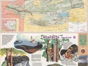
Ouachita National Forest
17 miles away
Talimena National Scenic Byway: US-271 from Talihina, OK to Mena, AR - 62 miles on a mountain ridgeline, free to drive, best in October.
Heavener Runestone State Park
22 miles away
Heavener Runestone State Park: 4 miles north of Heavener on OK-59, 10 miles south of Poteau. Free with park entry.
Robbers Cave State Park
27 miles away
Robbers Cave State Park: about 5 miles north of Wilburton on OK-2 in Latimer County. Park entry is free; a short but rocky climb leads up to the cave itself, so wear sturdy shoes.