
South Platte River Corridor
920 S Clay St, Denver, CO
Denver, CO
A once-forgotten river reborn as Denver's green spine, where a downtown trail threads parks, whitewater chutes, and the spot where the city began.
The South Platte River Corridor is the green spine of Denver, a ribbon of parks and trails following the river through the heart of the city. Once a neglected, industrial waterway, the river has been reclaimed over recent decades into a beloved public space where the city comes to walk, ride, paddle, and cool off.
At the corridor's heart is Confluence Park, where the South Platte meets Cherry Creek, the very spot where Denver was founded during the gold rush. Today constructed whitewater chutes there draw tubers and kayakers, and a network of paved trails radiates out along the river for miles, connecting neighborhoods, parks, and the wider Front Range trail system.
What Travelers Love
- A long, connected trail for walking, running, and biking through the city
- Confluence Park, where Denver was founded, with its whitewater chutes
- Tubing, kayaking, and wading on hot summer days
- Green riverfront space and public art woven through downtown
Worth Knowing
- The trail is a shared path, so watch for fast cyclists if you are walking
- River flow and water quality change with the season and storms, so use good judgment before getting in
- It connects to a large regional trail network, so you can go as far as you like
- Confluence Park is a lively hub, busiest on warm weekends
Learn about South Platte River Corridor
A river reborn
For much of Denver's history the South Platte was treated as a back alley, lined with rail yards and industry and prone to damaging floods. Beginning in the twentieth century, the city and its partners set about restoring the river, cleaning it up, taming its floods, and building parks and trails along its banks.
That long effort transformed the corridor into one of Denver's signature amenities, a place where nature and city meet. Herons and ducks now share the water with tubers, cottonwoods shade the banks, and the river that the city once turned its back on has become a front porch.
Confluence Park and the birthplace of Denver
Confluence Park marks the meeting of the South Platte River and Cherry Creek, the site where prospectors settled during the Pikes Peak gold rush and Denver was born. Today the park is a lively urban beach and gathering place at the edge of downtown.
Engineered whitewater chutes here turn the river into a playground, where kayakers practice, tubers ride the current, and people wade and sunbathe on warm days. Steps lead down to the water, and the surrounding trails and bridges make it a hub of city life, especially in summer.
Trails along the water
The South Platte trail runs for many miles through the metro area, a paved path popular with cyclists, runners, and walkers. It threads downtown, riverfront neighborhoods, and a string of parks, and connects to Cherry Creek and other trails to form an extensive regional network.
This makes the corridor as much a transportation route as a recreation space, letting people move across the city under their own power along the green river bottom. A short stroll or a long ride, the trail offers a car-free way to see Denver from its riverside.
Nature, history, and the seasons
The corridor lies within the traditional lands of the Cheyenne, Arapaho, and Ute peoples, who knew this river junction long before the gold seekers arrived. The restored riverbanks now host cottonwoods, waterfowl, herons, and other wildlife that have returned as the water and habitat improved.
Summer is the liveliest season, when the water play at Confluence Park draws crowds and the trails fill with riders and walkers. Spring greens the banks, autumn gilds the cottonwoods, and even in winter the plowed trails offer crisp walks and rides along the quiet river through the city.
Closest Boutels
The closest Boutel™ stays, so you can turn this stop into an overnight. Each is a place we chose through independent editorial review, never a paid placement.
Details
Denver, CO
Frequently asked questions
What is the South Platte River Corridor?
The South Platte River Corridor refers to the scenic and recreational greenway following the South Platte River as it flows through Colorado, including a beloved trail system through the Denver metro area and beyond. The river and its corridor offer a ribbon of parks, trails, natural areas, and wildlife habitat winding through the city and out across the plains. Popular for walking, biking, birdwatching, fishing, and paddling, the South Platte River Corridor provides an accessible green escape and recreation route, connecting communities and natural areas while offering a pleasant way to enjoy the river, its wildlife, and the outdoors in Colorado.
What can you do along the South Platte River Corridor?
You can walk, jog, bike, or skate the paved trails that follow the river, birdwatch and look for wildlife along the natural areas and wetlands, fish in the river, paddle or tube on suitable stretches, picnic in the riverside parks, and enjoy access to attractions and neighborhoods connected by the corridor. In the Denver area, the greenway links many parks and points of interest. With its accessible trails, wildlife, water recreation, and green spaces, the South Platte River Corridor offers a versatile and enjoyable way to experience the outdoors and the river through Colorado's cities and plains.
Is the South Platte River Corridor good for biking?
Yes, the South Platte River Corridor, especially its greenway trail through the Denver metro area, is popular for biking, offering a mostly flat, paved, and scenic route along the river that connects parks, neighborhoods, and other trails, making it a favorite for cyclists and commuters alike. The trail links to a broader network of paths in the region. Cyclists should share the path courteously with pedestrians and follow any posted rules. With its easy terrain, river scenery, and connections, the corridor provides a wonderful and accessible route for biking and exploring the area by bike.
When is the best time to visit the South Platte River Corridor?
The corridor is enjoyable year-round in Colorado's generally sunny climate, with spring through fall offering the most pleasant weather for walking, biking, and water activities, and mornings and evenings especially nice for cooler temperatures and wildlife. Fall brings lovely color along the river. Summer can be hot, so early or late outings are best, and winter is cooler but the trails often remain usable. For the best combination of comfortable weather and full recreation, aim for spring through fall, enjoying the river corridor's trails and green spaces in the milder seasons.
What is near the South Platte River Corridor?
The South Platte River Corridor runs through the Denver metro area and across parts of Colorado, near downtown Denver with its many attractions, the RiNo Arts District, parks and natural areas along the river, and within reach of the Front Range foothills and mountains to the west. That makes the South Platte River Corridor an accessible green route to combine with the attractions of Denver and the Front Range on a visit to Colorado, offering trails, wildlife, and river recreation through the heart of the region.
Nearby

Casa Bonita
4.0 miles away
Behind a pink stucco tower on West Colfax hides a cavernous Mexican restaurant where cliff divers plunge from a 30-foot indoor waterfall while you eat.
Denver RiNo Arts District
4.9 miles away
The River North (RiNo) Arts District in Denver is a warehouse neighborhood that converted into a concentrated arts and food destination between 2010 and 2020.
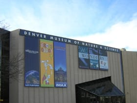
Denver Museum of Nature and Science
5.3 miles away
The Denver Museum of Nature and Science in City Park has one of the most comprehensive dinosaur halls in the country, with full-scale mounted skeletons of Diplodocus, Stegosaurus, and Triceratops from...
Dinosaur Ridge
9.5 miles away
Dinosaur Ridge in Morrison, 15 miles west of Denver, has actual dinosaur footprints and bones exposed in the roadcut along a 1-mile paved road - not a museum exhibit, but the actual formation where th...
Red Rocks Amphitheatre
10 miles away
Red Rocks Park is free to enter when no concert is scheduled - the park opens at 5 AM and closes at 11 PM.

Lookout Mountain
12 miles away
Buffalo Bill Cody's grave and museum sit at 7,370 feet on Lookout Mountain above Golden, 20 miles west of Denver via I-70 and the Lariat Loop (CO-26).
Tiny Town and Railroad
13 miles away
In a canyon southwest of Morrison sits a whole village built at one-sixth scale, more than a hundred miniature buildings a small child can peer into at eye level, with a real steam-and-diesel train yo...

Mount Blue Sky Scenic Byway
18 miles away
Mount Blue Sky Scenic Byway is the highest paved road in North America, climbing from Idaho Springs to above 14,000 feet in about 28 miles.
Roxborough State Park
19 miles away
Half an hour south of Denver, slabs of brick-red sandstone tilt out of the ground at a steep angle, the same Fountain Formation rock as Red Rocks and Garden of the Gods but far quieter and with no cro...

Rocky Mountain National Park
54 miles away
Tundra, alpine lakes, and elk-filled meadows along Trail Ridge Road, the highest paved road in the country.