

Logan Canyon Scenic Byway
Utah
The Logan Canyon Scenic Byway climbs out of the college town of Logan and disappears into one of the most dramatic mountain corridors in northern Utah. For about forty miles, US Highway 89 traces the Logan River upstream through a deep limestone canyon, past towering gray cliffs, cool green fishing holes, and stands of aspen and fir, before topping out at a high mountain summit. Then the whole world opens up, and the impossibly blue water of Bear Lake fills the windshield below.
This is a road the country decided was worth protecting. The federal government named it a National Scenic Byway, an honor set aside for routes with scenery, recreation, and natural wonders too special to lose. Drive it slowly, with the windows down, and you understand why. Few short stretches of highway pack in this much beauty, from the river at the bottom of the canyon to the turquoise lake at the top.
Learn about Logan Canyon Scenic Byway
The Road
The byway is a two-lane, fully paved stretch of US-89 that runs about forty miles between the city of Logan and the shore of Bear Lake near Garden City. It begins at the mouth of the canyon on the east edge of Logan, sitting around 4,500 feet above sea level, and climbs steadily to the Bear Lake Summit at roughly 7,800 feet. That means you gain more than 3,000 feet of elevation along the way, so the air grows cooler and the forest changes as you climb.
The Logan River is your companion for the lower and middle miles, tumbling over rocks right beside the road and famous with anglers for its trout. Sheer limestone cliffs rise on both sides, and the canyon feels narrow and green and close. Turnouts, picnic spots, campgrounds, and trailheads appear again and again, so it is easy to pull over, stretch your legs, and listen to the water. Because the canyon twists and the river bends, the speed limit stays moderate, which is exactly the right pace for taking it all in.
The grand finale comes near the top. After the summit, the road reaches the Bear Lake Overlook, where the forest falls away and Bear Lake spreads out far below in a startling shade of turquoise. From there the byway drops down the far side of the mountains toward Garden City and the lakeshore, trading tight canyon walls for wide-open water and sky.
How to Get There
The most common way to drive the byway is from west to east, starting in Logan. Coming from Salt Lake City, take Interstate 15 north to Brigham City, then follow US-89 and US-91 north into Cache Valley and on to Logan. In town, stay on US-89 heading east, and the highway carries you straight into the mouth of Logan Canyon where the scenic byway begins.
You can also drive it the other direction, from Bear Lake down to Logan. If you are coming from the north through Idaho, US-89 runs south along the Bear Lake shore to Garden City, where the byway climbs west over the summit and descends into the canyon toward Logan. Either approach shows off the same scenery, just in reverse.
Logan is the natural home base for the drive, with the most services in the area and easy access to the canyon. Garden City, at the Bear Lake end, is a small resort town known for its raspberry shakes and makes a perfect place to end the trip and cool off by the water.
History
Logan Canyon has been a natural passage through the Bear River Range for a very long time. Long before any highway, Native peoples and later trappers and settlers used the canyon as a route between the fertile Cache Valley and the Bear Lake basin on the far side of the mountains. The name Cache Valley itself comes from the fur-trade era, when trappers cached, or hid, their supplies in the region.
A wagon road was pushed through the canyon in the late 1800s to link the growing farm towns of Cache Valley with the settlements around Bear Lake. Over the decades that rough track was widened, straightened, and eventually paved into the modern US-89 that travelers follow today. Much of the corridor lies within the Uinta-Wasatch-Cache National Forest, and the U.S. Forest Service helped shape the campgrounds, picnic areas, and trailheads that line the route.
The federal government recognized the drive as a National Scenic Byway in 2002, honoring the rare combination of canyon scenery, river recreation, forest, and the surprise of Bear Lake at the summit. That designation is part of the national scenic byways program, created to spotlight roads with outstanding scenic, natural, historic, cultural, or recreational value and to help protect them for future travelers.
The canyon has long been tied to nearby Utah State University in Logan. Generations of students, foresters, and scientists have studied its geology, its water, and its ancient trees, and the university helped run a forestry field station in the canyon that trained researchers who went on to work in wild places across the West.
Little-Known Facts
- The byway was named a National Scenic Byway in 2002, honoring the way a single road links a deep limestone canyon with the turquoise water of Bear Lake at its summit.
- The road climbs more than 3,000 feet, from about 4,500 feet at the canyon mouth in Logan to roughly 7,800 feet at the Bear Lake Summit, so the temperature and the forest change noticeably as you drive.
- Hidden in the canyon is the Jardine Juniper, a Rocky Mountain juniper thought to be around 3,000 years old, one of the oldest living trees of its kind, reachable only by a long round-trip hike.
- Bear Lake's famous turquoise color is not a trick of the light. It comes from tiny particles of calcium carbonate, a chalky mineral, suspended in the water that scatter sunlight and turn the lake a brilliant Caribbean blue.
- Bear Lake is home to several kinds of fish found nowhere else on Earth, including the Bonneville cisco, and it is one of the oldest lakes in North America.
- Ricks Spring, a roadside alcove partway up the canyon, pours out a large flow of water that vanishes under US-89 and into the Logan River. Its water actually comes from the Logan River higher up, seeping through the porous limestone rather than from a hidden underground source.
- The Wind Caves, a wind-carved arch and hollows high on the canyon wall, are one of the byway's signature hikes and are also called the Witch's Castle for their strange, sculpted shapes.
- Much of the canyon lies within the Uinta-Wasatch-Cache National Forest, and Logan Canyon has served as an outdoor classroom for Utah State University students studying forestry, wildlife, and water for well over a century.
Along the Route
Wind Caves (China Wall)
The Wind Caves are a set of wind-carved arches and hollows in the limestone high on the canyon's north wall, sometimes called the Witch's Castle for their strange, sculpted look. A popular trail switchbacks up from a pullout on US-89 to reach them, rewarding hikers with a triple arch and long views back down the canyon. The nearby China Wall is a tall, narrow fin of rock that forms part of the same dramatic cliff scenery.
Ricks Spring
About seventeen miles up the canyon, Ricks Spring pours out of a mossy limestone alcove right beside US-89, flows under the highway, and joins the Logan River below. It is one of the largest and most scenic springs along the drive and makes an easy roadside stop. Despite looking like water bubbling up from deep underground, its flow actually seeps in from the Logan River higher up through the porous rock, so it is best admired rather than used for drinking.
Tony Grove Lake
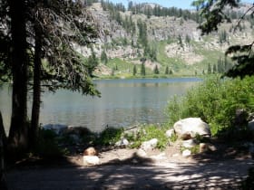
Tony Grove Lake sits high in an alpine basin reached by a paved side road that climbs several miles off the byway. The little glacier-carved lake is ringed by wildflower meadows in summer and framed by rocky peaks, and it serves as the trailhead for the long hike to the ancient Jardine Juniper. Because it sits well above the main highway, the air is cool and the setting feels like a hidden mountain world just off the main drive.
Franklin Basin
Near the top of the canyon, a gravel road turns off US-89 into Franklin Basin, a broad high-country valley loved for camping, fishing, wildflowers, and quiet forest drives. The junction is easy to spot from the byway, and the basin road leads deeper into the Bear River Range away from the crowds. It is a favorite jumping-off point for those who want to trade the paved highway for a slower ramble through the mountains.
Bear Lake Overlook (Limber Pine Trail)
Just past the Bear Lake Summit, the byway reaches an overlook where the forest suddenly parts and Bear Lake appears far below in a shock of turquoise. A parking area and rest stop here also mark the start of the Limber Pine Nature Trail, a gentle loop of a little over a mile that passes an enormous, ancient limber pine tree. This is the drive's classic photo stop, where the whole canyon climb pays off in one wide-open view.
Bear Lake State Park
The byway ends at the shore of Bear Lake, a huge, twenty-mile-long lake whose turquoise water comes from calcium carbonate suspended in it. Rendezvous Beach and the marina near Garden City offer swimming, boating, and the town's famous raspberry shakes. Several fish species here live nowhere else on Earth, and the lake is one of the oldest in North America, a fitting reward at the end of the climb through Logan Canyon.
Details
Logan and Bear Lake
Frequently asked questions
When was the Logan Canyon Scenic Byway designated a National Scenic Byway?
The Logan Canyon Scenic Byway was named a National Scenic Byway in 2002. The honor is part of the national scenic byways program, which recognizes roads with outstanding scenic, natural, recreational, historic, or cultural value. For Logan Canyon, the standout is the way a single stretch of US-89 links a deep limestone canyon with the turquoise water of Bear Lake.
How long is the Logan Canyon Scenic Byway, and how long does it take to drive?
The byway runs about forty miles along US-89 between Logan and the shore of Bear Lake near Garden City. Driven straight through, it takes roughly an hour, but most travelers give it much longer to stop at overlooks, trails, picnic areas, and the many spots along the Logan River.
What are the must-see stops along the Logan Canyon Scenic Byway?
Traveling east from Logan, the highlights include the Wind Caves and China Wall cliffs, roadside Ricks Spring, the alpine side trip to Tony Grove Lake, the turnoff into Franklin Basin, and the Bear Lake Overlook with its Limber Pine Nature Trail near the summit. The drive ends at Bear Lake itself, famous for its turquoise water and raspberry shakes in Garden City.
Is the Logan Canyon Scenic Byway free to drive?
Yes. Driving the byway is free, since US-89 is a public highway. Some developed sites along the way, such as certain campgrounds, trailhead parking, or the day-use beach at Bear Lake State Park, may charge a fee. But simply driving the road and stopping at pullouts and overlooks costs nothing.
What is the best time of day or year to drive the byway?
Summer and early fall are the most popular seasons. Summer brings warm days, wildflowers at Tony Grove, and swimming at Bear Lake, while late September and early October light up the canyon with golden aspens and red maples. Morning and evening offer softer light and fewer cars, and the Bear Lake Overlook is especially beautiful when the low sun deepens the lake's blue.
Is the Logan Canyon Scenic Byway open year-round?
Yes. US-89 through Logan Canyon is a main highway that is plowed and kept open all winter, so the byway itself does not close seasonally. Winter storms can still bring snow and ice, especially near the higher summit, so conditions can change quickly in the cold months. Side roads such as the drive up to Tony Grove Lake and into Franklin Basin do close or go unplowed in winter.
Do you need four-wheel drive to drive the Logan Canyon Scenic Byway?
No. The byway is fully paved along US-89, and any ordinary passenger car handles it easily. Four-wheel drive or high clearance is only helpful for exploring some of the gravel side roads, such as Franklin Basin, not for the main scenic drive.
What are the winter driving conditions like on the byway?
In winter the canyon can see snow, ice, and slush, and the higher stretch near the Bear Lake Summit is the most likely to be slick. The highway is plowed and treated, but it is smart to check current road and weather conditions before you set out, carry winter tires or chains in a storm, and slow down on the curves. Snow can linger at the summit even when the valleys below are clear.
Where can I get gas along the byway, and are there long remote stretches?
Fuel up in Logan before you enter the canyon, and you can fill up again in Garden City at the Bear Lake end. Between the two, the roughly forty miles through the canyon have no gas stations, so top off your tank at one end or the other. It is not a dangerous stretch, but there are few services in the canyon itself, so start with plenty of fuel.
Will I see moose or other wildlife along the drive?
Very possibly. Logan Canyon is prime habitat for moose, which are often spotted in the willows along the Logan River, and you may also see mule deer, elk, and many birds. Moose are large and can be unpredictable, so watch for them near the road at dawn and dusk, keep your distance, and never approach one. Slowing down in the curves helps protect both you and the wildlife.
Nearby
Logan Canyon Scenic Byway
0.1 miles away
Logan Canyon is a dramatic limestone canyon carved by the Logan River, one of the most scenic mountain drives in northern Utah.
Bear Lake State Park
12 miles away
Bear Lake is 20 miles long, 8 miles wide, and its unusual turquoise color comes from calcium carbonate particles suspended in the water. The lake has five species of fish found nowhere else on earth.
Hardware Ranch Wildlife Management Area
15 miles away
Hardware Ranch is a state wildlife management area in Blacksmith Fork Canyon where 600-700 wild elk concentrate in winter to eat hay provided by wildlife managers.

Minnetonka Cave
18 miles away
Minnetonka Cave is a cool, easy-to-reach cave tour high in Cache National Forest above St. Charles.