

Lake Tahoe East Shore Trail
Tunnel Creek Rd trailhead, NV-28
Incline Village, NV
A ten-foot-wide ribbon of pavement that carries you safely along the wildest, bluest edge of Lake Tahoe, from Incline Village down to the granite coves of Sand Harbor.
For years the only way to walk or bike between Incline Village and the beautiful coves at Sand Harbor was along the narrow, curving shoulder of Highway 28, dodging traffic with the lake dropping away below. People did it anyway, because this stretch of the Nevada shore is stunning, but it was genuinely dangerous, and cars parked crookedly along the road made it worse. The East Shore Trail was built to fix that, and in doing so it opened one of Tahoe's finest walks to everyone.
Opened in the summer of 2019 after years of planning and fundraising, the trail is a ten-foot-wide paved path that runs about three miles from Incline Village to Sand Harbor State Park, safely separated from the highway. It has been called one of the most beautiful bikeways in the country, and it earns the title: the whole way it hangs above water so clear and blue it looks tropical, with the Sierra crest rising across the lake.
What Travelers Love
- Some of the most jaw-dropping lake views anywhere in Tahoe, right from a flat, easy paved path
- Reaching quiet coves and boulder-strewn beaches like Hidden Beach that are otherwise hard to get to
- A wide, smooth surface that works for a stroller, a wheelchair, a cruiser bike, or an easy walk
- Interpretive stops that explain the lake's geology, forest, and wildlife as you go
Worth Knowing
- The path is popular and parking at Incline Village and Sand Harbor fills early on warm days, so arrive in the morning or use the shuttle
- The first half mile climbs a bit before leveling off, and the rest is gentle, so most people manage it easily
- There is little shade and the pavement gets hot, which can burn a dog's paws in summer, so bring water and time your visit
- It is an out-and-back, so the full round trip is about six miles unless you turn around sooner
Learn about Lake Tahoe East Shore Trail
A trail built to save lives and open the shore
The East Shore Trail is that rare piece of infrastructure that is also a destination. It grew out of a real safety problem: the shoulder of Highway 28 had become a magnet for people trying to reach the lake, and the mix of pedestrians, cyclists, and fast mountain traffic on a road with almost no room to spare was a wreck waiting to happen. A coalition of state parks, the Tahoe Transportation District, the Forest Service, Washoe County, and the nonprofit Tahoe Fund came together to build a proper path instead.
It took a major federal grant of roughly twelve and a half million dollars, plus more than a million in private donations, to make it happen, and the care shows. The path is engineered to shed water away from the lake so runoff does not carry sediment into Tahoe's famously clear depths, part of the long regional effort to keep the water blue. What could have been a plain sidewalk became a thoughtful, sustainable trail that people now travel from far away just to experience.
What you see along the way
The path threads along the mountainside above the shore, and almost the entire route is a lake view. Interpretive panels set along the way explain what you are looking at, from the granite that forms Tahoe's basin to the pines, chipmunks, and ospreys that live here, so an easy walk turns into a small lesson in the natural history of the lake. Benches and vista points give you excuse after excuse to stop and just look.
The real treasures are the beaches. Short spur paths drop down to a string of coves, including Hidden Beach, a longtime local favorite of sand and huge granite boulders that had been awkward and unsafe to reach before the trail existed. There are many places to scramble down to the water's edge, dip your feet in the cold, clear lake, or spread out on a warm rock, then climb back up and carry on toward Sand Harbor.
At the south end the trail delivers you to Sand Harbor, the crown jewel of Lake Tahoe Nevada State Park, with its curving white-sand beach, shallow turquoise shallows, and the smooth boulders that make it one of the most photographed spots on the entire lake.
Walking or rolling the trail
Because it is fully paved, ten feet wide, and built to accessibility standards, the East Shore Trail welcomes just about everyone: walkers, runners, families with strollers, wheelchair users, and cyclists all share it. The grade is gentle after a short climb near the Incline Village end, so it is an easy outing rather than a hard hike, which is a big part of why it is so beloved.
The main trailheads are at Incline Village, near the Tunnel Creek area with its cafe and bike rentals, and at Sand Harbor to the south. It is out-and-back, so you can turn around whenever you like, or ride one way and shuttle back. Because it is so popular, the parking lots fill early on summer days, so come in the morning, ride a bike in, or take the seasonal shuttle. Plans are underway to extend the trail farther south toward Spooner Summit, which will one day make this beautiful stretch of shoreline even longer to explore.
Closest Boutels
The closest Boutel™ stays, so you can turn this stop into an overnight. Each is a place we chose through independent editorial review, never a paid placement.
Details
Incline Village, NV
Frequently asked questions
What is the Lake Tahoe East Shore Trail?
The Lake Tahoe East Shore Trail, on the Nevada side of Lake Tahoe, is a beautiful paved shared-use path winding along the lake's eastern shore, offering stunning views of the clear blue water and easy access to hidden coves and beaches. The scenic trail links Incline Village toward Sand Harbor, carrying walkers, runners, and cyclists along the forested shoreline past overlooks, boulders, and turquoise coves, with an accessible, family-friendly grade and breathtaking Tahoe scenery throughout. A wonderful way to experience the beauty of the eastern shore without a car, it delights visitors of all ages. With its lakeside path and views, the Lake Tahoe East Shore Trail offers a delightful destination in Nevada.
What can you do on the Lake Tahoe East Shore Trail?
You can walk, run, or bike the scenic paved trail along the eastern shore, stop at overlooks for stunning views of Lake Tahoe's clear blue water, access hidden coves and beaches along the way, photograph the scenery, and enjoy an easy, car-free way to explore the shoreline. The lakeside path, the breathtaking views, the access to coves and beaches, and the family-friendly, accessible grade are the draws, making it a favorite for a scenic stroll or ride. It connects toward Sand Harbor. With its scenic path and views, the Lake Tahoe East Shore Trail offers a rewarding experience in Nevada.
Is the Lake Tahoe East Shore Trail good for families?
Yes, the Lake Tahoe East Shore Trail is excellent for families, thanks to its smooth, paved, relatively gentle grade that welcomes walkers, cyclists, and strollers, along with stunning lake views and access to coves and beaches that delight children. The accessible, car-free path lets families enjoy Tahoe's beauty easily and safely, away from road traffic. As with any lakeside trail, watching children near the water and rocks and bringing sun protection and water are wise. With its accessible paved path and views, the Lake Tahoe East Shore Trail makes a wonderful family destination in Nevada.
When is the best time to use the Lake Tahoe East Shore Trail?
The warm months of late spring through fall offer the best conditions for walking and biking the trail, with summer ideal for pairing the trail with a swim in the coves, though it is busiest then, so arriving early helps with parking, and fall offering pleasant weather and fewer crowds. Snow can close or cover the trail in winter. Mornings are lovely and less crowded. For the best weather and lake access, aim for late spring through fall, arriving early in summer, on the Lake Tahoe East Shore Trail in Nevada.
What is near the Lake Tahoe East Shore Trail?
The Lake Tahoe East Shore Trail runs along the Nevada eastern shore of Lake Tahoe between Incline Village and Sand Harbor, within reach of Sand Harbor State Park, Lake Tahoe Nevada State Park, Cave Rock, and the Reno and Carson City areas. That makes the Lake Tahoe East Shore Trail a delightful stop to combine with Sand Harbor State Park and the other attractions of the Lake Tahoe eastern shore on a visit to Nevada.
Nearby

Sand Harbor State Park
2.4 miles away
Lake Tahoe's most beloved beach, a cove of pale sand, glass-clear turquoise water, and rounded granite boulders you can swim out to and climb.

Lake Tahoe Nevada State Park
2.5 miles away
Lake Tahoe is the largest alpine lake in North America by volume, holding enough water to flood the entire state of California to a depth of 14 inches.

Kings Beach
5.0 miles away
Kings Beach is the largest public sand beach on Lake Tahoe's sunny North Shore, and one of the warmest, gentlest places to swim in a lake famous for being cold.

Tahoe Vista Beach
6.5 miles away
A cluster of sandy public beaches on Lake Tahoe's sunny, quieter north shore, with clear alpine water, pine-shaded picnic groves, and big views south across the lake to the Sierra peaks.
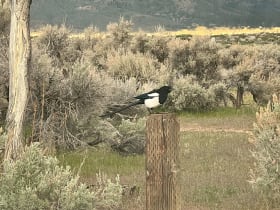
Washoe Lake State Park
9.4 miles away
Washoe Lake State Park sits in Washoe Valley just off US-395, roughly 5 miles north of Carson City and about 18 miles south of Reno.
Burton Creek State Park
10 miles away
Lake Tahoe's quiet secret: at nearly two thousand acres this is the lake's largest state park, yet it sits so hidden in the hills behind Tahoe City that most visitors never find it.
Nevada State Railroad Museum
10 miles away
The Nevada State Railroad Museum preserves the history of Nevada's railroads with a focus on the Virginia and Truckee Railroad, the narrow-gauge line that connected the Comstock Lode mines to the Cars...

Lake Tahoe
11 miles away
A deep cobalt alpine lake on the Nevada-California line, ringed by Sierra granite and sacred to the Washoe as da'aw.

Cave Rock
13 miles away
Cave Rock sits on US-50 along Lake Tahoe's east shore, a few miles south of Glenbrook and about 7 miles north of Stateline.
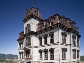
Fourth Ward School Museum
16 miles away
The last four-story wooden schoolhouse of its kind standing in America, built in 1876 at the height of the Comstock silver boom, anchors the south end of Virginia City's historic C Street.

Piper's Opera House
16 miles away
The grand 1885 music hall of the silver-boom Comstock, where Mark Twain lectured and Lily Langtry sang, with a springy old stage still standing.

Virginia City
16 miles away
The silver city that helped bankroll the Union, gave Mark Twain his pen name, and never quite let go of its boomtown swagger.
Genoa Bar and Saloon
17 miles away
The Genoa Bar and Saloon has poured drinks continuously since 1853, giving it a strong claim as the oldest bar in Nevada, established 11 years before statehood in 1864.