

Grand Coulee Dam Overlook
Grand Coulee Dam Visitor Center, WA-155
Grand Coulee, WA
A wall of concrete a mile wide holds back the Columbia River, a monument to Depression-era ambition and a reminder of what that ambition cost.
Grand Coulee Dam is almost too big to take in. It stretches roughly a mile across the Columbia River, holds back a reservoir a hundred and fifty miles long, and contains enough concrete to be counted among the largest such structures on the planet. From the overlook it reads as a sheer gray cliff, humming with the power of the river it stopped.
It is a genuine wonder of engineering and a centerpiece of the Depression-era effort to remake the American West with dams and irrigation. It is also a place with a hard second story, because the same dam that lit cities and watered farms drowned ancient fishing grounds and shut the salmon out of the upper Columbia forever.
What Travelers Love
- The staggering scale of the dam, one of the largest concrete structures ever built
- The visitor center exhibits on how it was built during the Great Depression
- The summer nighttime laser light show projected onto the face of the dam
- The broad view up Lake Roosevelt, the 150-mile reservoir behind it
Worth Knowing
- The laser light show runs only in the warm months after dark; check the season before planning an evening around it
- This is remote high desert, hot in summer and cold in winter, with long drives between towns
- The dam's story is not only one of triumph; it flooded Native fishing grounds and ended the salmon runs upstream, which the site's history now acknowledges
- Free dam tours are sometimes offered but can change with security and staffing, so confirm at the visitor center
Learn about Grand Coulee Dam Overlook
Building the dam
Construction began in 1933, in the depths of the Great Depression, and the dam was completed in 1942. It took millions of cubic yards of concrete, stacked to the height of a skyscraper and a mile wide, and it put thousands of people to work in a remote stretch of desert canyon.
The dam anchors the Columbia Basin Project, a vast system of pumps, reservoirs, and thousands of miles of canals that turned dry shrub-steppe into some of the most productive farmland in the state. For decades Grand Coulee has been one of the largest producers of hydroelectric power in the United States.
Lake Roosevelt and the Columbia Basin
Behind the dam, the Columbia backs up into Franklin D. Roosevelt Lake, a reservoir stretching roughly a hundred and fifty miles upstream toward the Canadian border. Today it is a national recreation area, with boating, camping, and long stretches of quiet shoreline.
Water pumped up from the reservoir feeds the irrigation project that greened the basin, so the dam is not only a wall across the river but the engine of an entire agricultural landscape spreading out to the south.
Kettle Falls and the Ceremony of Tears
For more than ten thousand years, the peoples of the upper Columbia, among them the Colville, Spokane, Sanpoil, Nespelem, and Lakes tribes, lived along this river and depended on its salmon. Kettle Falls, upstream of the dam, was one of the greatest salmon fisheries on the Columbia, a gathering and trading place for many nations.
When Lake Roosevelt rose in 1940, it drowned Kettle Falls. A final gathering there, remembered as the Ceremony of Tears, drew thousands of people. The dam blocked the salmon from the entire upper river, ending runs that had sustained those communities since time out of mind, and displaced families from lands along the river. Descendant tribes have pursued recognition and compensation for that loss, and efforts to one day return salmon above the dam continue today.
Seeing the dam and the country
The visitor center on the Washington side has the exhibits and the best vantage, and in summer the dam becomes a screen for a nighttime laser light show telling the river's story on its enormous face. By day, overlooks take in the spillway, the powerhouses, and the reservoir beyond.
The surrounding scablands and coulees, all shaped by the same Ice Age floods that carved nearby Dry Falls, make the dam one stop on a landscape full of outsized geology and outsized human ambition.
Closest Boutels
The closest Boutel™ stays, so you can turn this stop into an overnight. Each is a place we chose through independent editorial review, never a paid placement.
Details
Grand Coulee, WA
Frequently asked questions
What is the Grand Coulee Dam Overlook?
The Grand Coulee Dam Overlook, in eastern Washington, offers impressive views of the Grand Coulee Dam, one of the largest concrete structures in the world and among the biggest hydroelectric power producers in the United States. Spanning the Columbia River, this massive dam is an engineering marvel of staggering scale, and the overlook lets visitors take in its immense size and the surrounding Columbia River and coulee landscape. The dam is also famous for the spectacular laser light show projected onto its face on summer nights. From the overlook, visitors can appreciate the awe-inspiring scale of the Grand Coulee Dam and its dramatic setting in eastern Washington.
What can you see at the Grand Coulee Dam Overlook?
From the Grand Coulee Dam Overlook, you can take in sweeping views of the enormous Grand Coulee Dam spanning the Columbia River, appreciating its staggering scale as one of the largest concrete structures in the world, along with the river, the reservoir of Lake Roosevelt behind it, and the dramatic coulee landscape. On summer evenings, you can watch the famous laser light show projected onto the dam. The immense size of the structure is awe-inspiring. With its impressive views of the massive dam, the river, and, in summer, the laser light show, the Grand Coulee Dam Overlook offers a memorable stop in eastern Washington.
What is the laser light show at Grand Coulee Dam?
The Grand Coulee Dam is famous for a spectacular laser light show projected onto the huge face of the dam on summer nights, a free evening spectacle that uses the enormous dam as a giant screen for colorful laser images and storytelling about the region, the river, and the dam's history. The show is a beloved highlight for summer visitors, typically running nightly during the warm-weather season. Because it runs seasonally and on a schedule, checking the current dates and times before you go is wise. Watching the laser light show illuminate the massive dam after dark is a memorable experience at Grand Coulee.
When is the best time to visit the Grand Coulee Dam Overlook?
Summer is the best time if you want to see the famous laser light show, which runs on summer evenings, and the warm season offers pleasant conditions for enjoying the overlook, though summer days can be hot in eastern Washington. Spring and fall offer comfortable weather for viewing the dam, while winter is cold and the light show is not running. For the full experience including the laser show, aim for a summer evening, checking the current show schedule, while any season offers impressive views of the massive dam from the Grand Coulee Dam Overlook.
What is near the Grand Coulee Dam Overlook?
The Grand Coulee Dam Overlook is in eastern Washington, near the Grand Coulee Dam Visitor Center, the town of Grand Coulee, Lake Roosevelt National Recreation Area behind the dam, Banks Lake, and the dramatic Dry Falls and Channeled Scablands to the south. That makes the Grand Coulee Dam Overlook a memorable stop to combine with the dam's visitor center, Lake Roosevelt, Dry Falls, and the other attractions of eastern Washington on a visit to the state.
Nearby

Grand Coulee Dam Visitor Center
1.9 miles away
This free federal visitor center sits at the base of Grand Coulee Dam, the largest concrete structure and biggest hydroelectric plant in the United States, nearly a mile long and holding three times t...
Banks Lake
7.3 miles away
A 27-mile reservoir filling the Ice-Age-carved Grand Coulee just south of Coulee Dam, guarded by the huge basalt butte of Steamboat Rock.
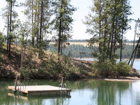
Lake Roosevelt National Recreation Area
29 miles away
A 130-mile lake held behind Grand Coulee Dam, the largest concrete structure in North America, winding through eastern Washington's open Columbia country.