
Banks Lake
State Route 155, Grand Coulee
Coulee Dam, WA
A long blue reservoir laid down the floor of a canyon the Ice-Age floods carved, with the huge basalt butte of Steamboat Rock rising like a ship out of the water.
Banks Lake looks like it has been here forever, but it is barely older than the freeway. The 27-mile reservoir sits in the floor of the upper Grand Coulee, a mighty canyon that the Ice-Age floods scoured out of solid basalt thousands of years ago, then abandoned. For centuries the coulee was a dry, dramatic scar across the plateau. Then, in 1953, engineers pumped water up out of the Columbia River, dammed both ends of the old canyon with earthen dams, and let it fill. The reservoir was named for Frank A. Banks, the man who ran construction of nearby Grand Coulee Dam.
The result is one of the most striking bodies of water in the Northwest: a long, deep-blue lake pinched between sheer rock walls, with the huge butte of Steamboat Rock rising straight out of it. It works for a living, storing and evening out the water that irrigates hundreds of thousands of acres of the Columbia Basin, but it is also a playground for anglers, boaters, and campers, and a front-row seat to a landscape written by ice and flood.
What Travelers Love
- Steamboat Rock, a mile-long basalt butte 800 feet high that looms over the water like a battleship
- Big, open water for fishing, boating, paddling, and swimming, with walleye, bass, trout, and perch
- Dramatic canyon scenery carved by the Ice-Age floods, some of the most powerful the earth has ever seen
- Long, quiet drives along the coulee walls with pull-offs, coves, and views the whole way
Worth Knowing
- This is high desert country, hot and sunny in summer and cold in winter, so bring sun cover and water and expect big temperature swings
- Facilities cluster at the state park and boat launches along the lake, but stretches of shoreline have no services, so fuel and stock up in town first
- Winds can pick up fast on such open water, so small boats and paddlers should watch the sky and stay near shore in a blow
- Grand Coulee Dam and its summer laser light show are a short drive north and make an easy pairing with a lake day
Learn about Banks Lake
A canyon the floods carved
The story of Banks Lake really starts around sixteen million years ago, when enormous lava flows spread across this part of Washington and hardened into layer upon layer of black basalt. Much later, near the end of the last Ice Age, an ice dam far to the northeast held back a vast lake, and when that dam broke it released a wall of water so huge it is hard to picture. These Ice-Age floods roared across eastern Washington again and again, tearing at the basalt and carving out the strange, stripped country called the channeled scablands.
The Grand Coulee is the grandest scar the floods left behind, the largest coulee on the whole Columbia Plateau and one of the finest examples anywhere of a canyon cut by a giant, retreating waterfall. Steamboat Rock is a piece of the old plateau the floods could not wash away, an island of basalt left standing in the middle of the torrent. Today Banks Lake and Steamboat Rock are stops on the Ice Age Floods National Geologic Trail, which strings together the best places to read this astonishing chapter of the earth's story.
How a dry canyon became a lake
By the time the floods were done, the upper Grand Coulee was a dry, sheer-walled trench, spectacular but empty. That changed with the Columbia Basin Project, the huge federal effort to bring water to the arid farmland of central Washington. Grand Coulee Dam, finished in the early 1940s, could generate power and lift Columbia River water, but the region needed a place to store that water and release it steadily to the irrigation canals.
The old coulee was the perfect natural tank. Engineers built an earthen dam at each end of the upper coulee, pumped Columbia River water up into it, and by 1953 had filled the valley floor to create a reservoir 27 miles long. Water from Banks Lake now feeds an irrigation system that waters well over half a million acres, growing dozens of different crops across land that was once bone-dry sagebrush. It is a rare thing to stand on a beach and know the whole lake is, in a sense, a machine.
On the water and along the walls
For visitors, Banks Lake is first and foremost open water in a place that has very little of it. Anglers come for walleye, smallmouth and largemouth bass, yellow perch, rainbow trout, and kokanee, and the lake has a strong reputation among Washington fishermen. Boaters, paddlers, and swimmers spread out across coves and along the base of the cliffs, and boat launches and beaches are dotted down its length.
The hub of it all is Steamboat Rock State Park, a large park near the north end of the lake with camping, sandy swimming beaches, and trails, including a climb up onto the flat top of Steamboat Rock itself for a view straight down the coulee. State Route 155 runs the length of the east side, so even without a boat you can drive the canyon, stop at pull-offs, and watch the light change on the basalt through the day.
Because this is high desert, weather is part of the experience. Summers are hot and bright, winters cold, and wind can turn the flat water choppy in a hurry, so it pays to keep an eye on the sky. A little planning turns Banks Lake into a full, easy day of swimming, casting, and canyon-gazing.
Visiting Banks Lake
Banks Lake stretches south from the towns of Grand Coulee and Coulee Dam down to Coulee City, with State Route 155 tracing the northern half past Steamboat Rock. The state park and the main launches are your best bets for beaches, restrooms, and easy water access, while long reaches of shoreline in between have nothing at all, so top off fuel and pick up water and food in town before you settle in.
It pairs naturally with Grand Coulee Dam just to the north, one of the largest concrete structures ever built, whose visitor center and summer laser light show are a memorable evening after a day on the lake. Farther south, Dry Falls marks the spot where the floods once poured over a cliff many times wider than Niagara, now silent and dry. Together they make the Grand Coulee one of the great, under-visited road-trip stretches in the West: enormous scenery, a good swim, and a geologic story most people have never heard.
Closest Boutels
The closest Boutel™ stays, so you can turn this stop into an overnight. Each is a place we chose through independent editorial review, never a paid placement.
Details
Coulee Dam, WA
Frequently asked questions
What is Banks Lake?
Banks Lake, in the Grand Coulee of eastern Washington, is a large and scenic reservoir set dramatically between the towering basalt cliffs of the ancient coulee, carved by the Ice Age floods. Created by pumping water uphill from the Columbia River at Grand Coulee Dam for irrigation, the lake stretches for miles and offers excellent boating, fishing, swimming, and water recreation amid striking scablands scenery. The impressive Steamboat Rock, a massive butte, rises within the lake at Steamboat Rock State Park. With its clear waters, dramatic coulee setting, boating, and fishing, Banks Lake offers a scenic and popular outdoor recreation destination in the Ice Age floods country of eastern Washington.
What can you do at Banks Lake?
You can boat, water ski, kayak, paddleboard, and fish for bass, walleye, and other species on the reservoir, swim, camp at lakeside sites including at Steamboat Rock State Park, hike trails such as the route up Steamboat Rock for panoramic views, and enjoy the dramatic coulee scenery. The lake is a popular fishing and boating destination. Steamboat Rock is a highlight for hikers. With its boating, fishing, swimming, camping, and hiking amid the striking basalt cliffs of the Grand Coulee, Banks Lake offers a scenic and versatile outdoor experience in eastern Washington.
What safety tips apply at Banks Lake?
On the water, always wear a life jacket while boating or paddling, be aware that winds can create hazardous waves on the large reservoir, and watch for changing weather and boat traffic. When swimming, be mindful of drop-offs and watch children closely. On the trails, including the climb up Steamboat Rock, watch your footing, stay back from cliff edges, carry water and sun protection for the exposed terrain, and watch for rattlesnakes in warm weather. Being mindful of water safety, wind, the sun and heat, and wildlife ensures a safe and enjoyable visit to Banks Lake.
When is the best time to visit Banks Lake?
Late spring through early fall is the prime season for boating, fishing, swimming, and camping in the warm weather, with summer popular for water recreation despite the heat, while spring brings wildflowers and green to the coulee and fall offers pleasant temperatures for hiking and fishing. Winter is cold and quiet. For water recreation and camping, aim for late spring through summer, and for comfortable hiking with fewer crowds, the shoulder seasons are lovely. The lake's recreation and scenery make it most rewarding in the warmer months at Banks Lake.
What is near Banks Lake?
Banks Lake is in the Grand Coulee of eastern Washington, near Steamboat Rock State Park, the Grand Coulee Dam and Lake Roosevelt to the north, the dramatic Dry Falls and Sun Lakes-Dry Falls State Park to the south, and the Lake Lenore Caves. That makes Banks Lake a scenic recreational stop to combine with Steamboat Rock, the Grand Coulee Dam, Dry Falls, and the other Ice Age floods attractions of eastern Washington on a visit to the state.
Nearby

Grand Coulee Dam Visitor Center
9.6 miles away
This free federal visitor center sits at the base of Grand Coulee Dam, the largest concrete structure and biggest hydroelectric plant in the United States, nearly a mile long and holding three times t...
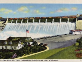
Grand Coulee Dam Overlook
9.6 miles away
The overlook and visitor center sit just off SR-155 on the west side of the dam near the town of Coulee Dam.
Dry Falls State Park
21 miles away
Dry Falls in the Columbia Basin is the remnant of a cataract that formed during the Missoula Floods, a series of catastrophic ice age flooding events between roughly 15,000 and 13,000 years ago.