Grand Canyon
Bright Angel Trail, Grand Canyon Village, AZ
Grand Canyon Village, AZ
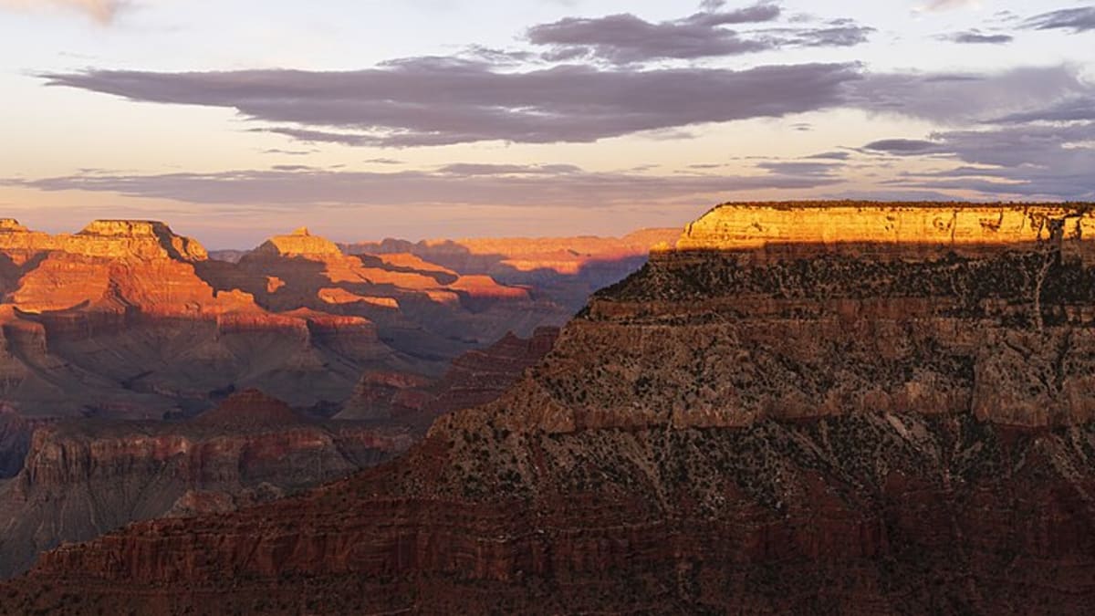
A mile-deep canyon so vast it reads as a whole country of stone, with the green thread of the Colorado River winding a vertical mile below the rim.
The Grand Canyon is one of those places that no photograph quite prepares you for. It runs some 277 river miles across northern Arizona, reaches roughly a mile deep, and stretches up to about eighteen miles from rim to rim, a scale the eye struggles to hold. Down at the bottom, the Colorado River that carved all of it looks like a thin green ribbon.
What makes the canyon so striking is not just its size but its stripes. The walls are stacked in bands of red, cream, gray, and rust, each a distinct layer of rock, and together they lay bare something like two billion years of Earth's history in a single view. It is a landscape sacred to the tribes who have lived in and around it for many generations, and a place people travel from all over the world simply to stand and look.
What Travelers Love
- Standing at the rim for the first time, when the scale of the canyon lands all at once
- Watching the layered walls shift from rose to gold to violet as the sun moves
- Walking a stretch of the Rim Trail or dropping a short way down Bright Angel for a canyon-in perspective
- The hush and the deep-black night sky far from any city glow
Worth Knowing
- The canyon is a desert on top and hotter still at the bottom, so carry far more water than you think you need
- Going down is the easy half; climbing back out in the heat is where hikers get into trouble, so turn around early
- Stay behind railings and away from soft rim edges, especially for photos
- The South Rim is open year round while the North Rim closes for winter snow, so check conditions before you go
Learn about Grand Canyon
The people of the canyon
The Grand Canyon has been home to Native peoples for thousands of years, and eleven tribes hold ties to it today, among them the Havasupai, Hualapai, Hopi, Navajo (Diné), Zuni, and Southern Paiute. The Havasupai, whose name means people of the blue-green water, still live deep within a side canyon of the gorge, the only community inside the canyon itself. To the Hopi, the canyon is a sacred place bound up in their story of emergence into this world.
The Ancestral Puebloan peoples farmed the rims and inner terraces long ago, leaving granaries, dwellings, and rock art still visible in places. When the National Park was established in 1919 much of this land was taken from the tribes, and the history of that loss is part of the canyon's story too. Today the tribes remain active partners in caring for the canyon, and the Havasupai, Hualapai, and Navajo lands border or lie within it.
How the canyon was carved
The Colorado River did the cutting. Over roughly the last five to six million years the river sliced downward through the Colorado Plateau as the whole region slowly rose, and the running water, grinding sand and gravel, wore the rock away far faster than it could heal. Rain, frost, and side streams widened the gorge from there, which is why the canyon is so much broader than the river that made it.
The layers you see are older by far than the canyon itself. Near the top sits the pale Kaibab Limestone, laid down under an ancient sea, and the bands step down through sandstones and shales to the dark, twisted Vishnu Schist at the very bottom, close to two billion years old. Reading the wall from rim to river is like turning the pages of the planet's history in order, which is exactly why geologists come here from around the world.
Wildlife on the rim and below
The canyon is really several worlds stacked on top of each other. The forested rims hold ponderosa pine, mule deer, elk, and the tassel-eared Abert's and Kaibab squirrels, while California condors, the largest land birds in North America, ride the updrafts along the walls after being brought back from the edge of extinction. Watch the rim edges for these huge black birds with numbered wing tags.
Drop toward the river and the country turns to desert, with pinyon and juniper giving way to cactus, lizards, and bighorn sheep picking along the ledges. The inner canyon is home to rattlesnakes and the small pink Grand Canyon rattlesnake found nowhere else, along with ringtails, an elusive relative of the raccoon that comes out after dark. Each descent is like traveling from Canada to Mexico in the span of a single mile.
Season by season
Spring and fall are the sweet spots on the South Rim, with mild days, cool nights, and thinner crowds than the peak of summer. This is the best time for a hike below the rim, when the inner canyon is warm but not dangerous.
Summer brings the biggest crowds and real heat, especially down in the gorge where temperatures can climb well past what the rim ever feels, and afternoon thunderstorms roll in during the monsoon. Fall quiets down and the light turns golden, while winter dusts the South Rim in snow, red rock against white, one of the canyon's most beautiful and least crowded looks. The North Rim, higher and snowier, closes through the cold months entirely.
Closest Boutels
The closest Boutel™ stays, so you can turn this stop into an overnight. Each is a place we chose through independent editorial review, never a paid placement.
Details
Grand Canyon Village, AZ
Frequently asked questions
What is the Grand Canyon?
The Grand Canyon, in northern Arizona, is one of the most awe-inspiring natural wonders on Earth and a UNESCO World Heritage Site. Carved over millions of years by the Colorado River, it stretches some 277 miles long, up to 18 miles wide, and a mile deep, revealing colorful layers of rock that record billions of years of geologic history. Protected as a national park, its immense scale, dramatic vistas, and ever-changing light draw millions of visitors seeking one of the planet's grandest and most humbling landscapes.
What is the difference between the South Rim and North Rim?
The South Rim is the most popular and accessible part of the park, open year-round with the most viewpoints, services, lodging, and shuttle access, and it holds the classic Grand Canyon Village. The North Rim is higher, cooler, more remote, and forested, offering a quieter experience with fewer crowds, but it is only open seasonally, roughly mid-spring through fall, and closes in winter due to snow. Though they face each other, driving between them takes several hours around the canyon.
What safety precautions should I take at the Grand Canyon?
Stay well back from unfenced edges, keep a firm hold on children, and never climb over railings for photos, since falls are a real danger. If hiking below the rim, do not attempt to reach the river and return in a single day, as the strenuous climb back in extreme heat causes many rescues and deaths; turn around with plenty of energy and water left. Carry ample water, salty snacks, sun protection, and check the weather, as conditions vary sharply by season and elevation.
When is the best time to visit the Grand Canyon?
Spring and fall offer the most pleasant temperatures and smaller crowds than the busy summer, when the South Rim can be very crowded and the inner canyon dangerously hot. The North Rim is only open roughly mid-spring through fall. Winter brings snow, quiet, and beautiful scenery to the South Rim, which stays open. Sunrise and sunset are magical times when the canyon glows. Whenever you visit, arriving early helps with parking and beats the midday crowds.
What is near the Grand Canyon?
The Grand Canyon's South Rim is within reach of Flagstaff, Williams on historic Route 66, and the Grand Canyon Railway, while the eastern entrance connects to Desert View, the Navajo lands, and the Page area with Horseshoe Bend, Antelope Canyon, and Lake Powell. Sedona's red rocks lie to the south. That makes the Grand Canyon the centerpiece of a northern Arizona road trip rich with natural wonders, historic towns, and Native cultural sites.
Nearby
Bright Angel Trail
3.9 miles away
Bright Angel Trail is the most accessible canyon trail, built along an ancient Havasupai route. The first rest house (3 miles, 2,120-foot drop) is the safe turnaround for day hikers.

El Tovar Hotel, Grand Canyon South Rim
3.9 miles away
El Tovar (1905) is a National Historic Landmark and was the premiere tourist hotel in the American West when it opened.

Grand Canyon South Rim
3.9 miles away
The South Rim of the Grand Canyon receives about 5 million visitors per year and is accessible year-round. The Rim Trail runs 13 miles along the canyon edge with free shuttle access to viewpoints.

Cape Royal
6.6 miles away
Cape Royal Road on the North Rim goes to several overlooks including Walhalla Glades (Ancestral Puebloan ruins), Angel's Window (a natural arch in the canyon rim), and the Cape Royal overlook itself.

Grand Canyon North Rim
7.6 miles away
The North Rim is 10 miles across the canyon from the South Rim but 220 miles by road.
Desert View Watchtower
17 miles away
The Desert View Watchtower at Grand Canyon's east entrance was designed by architect Mary Colter in 1932 to mimic ancestral Puebloan towers.