
Cochise Stronghold
E Stronghold Canyon Rd, St David, AZ
St David, AZ
A natural fortress of stacked granite domes and boulders where the Apache leader Cochise held out for years and where his people are said to have buried him in secret.
Cochise Stronghold is a wild jumble of granite domes, spires, and house-sized boulders in the Dragoon Mountains of southeastern Arizona. A trail climbs through the maze of rock and oak into the canyon that gave the Apache leader Cochise a natural fortress, a place so defensible that he and his band held out here through years of conflict in the 1860s and 1870s. It remains a quiet, powerful landscape wrapped in Apache history.
The rounded boulders that make the Stronghold so distinctive are weathered granite, an ancient rock that cooled deep underground and was slowly exposed and rounded over millions of years. When Cochise died in 1874, the Chiricahua Apache buried him somewhere in these rocks in secret, and the location has never been found, which only deepens the sense of mystery that hangs over the place.
What Travelers Love
- A trail winding among enormous rounded granite boulders and hidden hollows
- The deep sense of history in a place tied so closely to Cochise
- Excellent birding and quiet camping in an oak-and-juniper canyon
- Sweeping views out over the Sulphur Springs Valley from the ridge
Worth Knowing
- The main trail climbs to a divide and can be strenuous, so carry water and pace yourself
- This is sacred ground to the Apache, so treat it with respect and stay on trails
- Summer brings heat and monsoon storms, so hike early and watch the weather
- It is a quiet, remote spot with limited services, so come prepared
Learn about Cochise Stronghold
Cochise and the Chiricahua Apache
Cochise was a leader of the Chiricahua Apache, whose homeland spread across the mountains and valleys of southeastern Arizona. In the 1860s a misunderstanding and the killing of his relatives set off years of conflict between his band and the United States Army, and Cochise used the Dragoon Mountains as a base, retreating into this maze of granite where soldiers could not easily follow.
In 1872 Cochise made peace through the efforts of the frontiersman Tom Jeffords, one of the few white men he trusted, and secured a reservation in his homeland. He died in 1874, and his people buried him somewhere in the Stronghold, riding their horses back and forth over the ground to hide the site. The location was never revealed, and it has never been found. The Chiricahua Apache remain a living people, and this place is central to their history.
A fortress of granite
The boulders of Cochise Stronghold are granite, a hard rock that formed when molten material cooled slowly deep underground tens of millions of years ago. As the softer rock and soil above it wore away, the granite was exposed at the surface, where weathering rounded its edges and split it along natural cracks into the domes and stacked boulders you see today.
The result is a landscape that reads like a fortress, with narrow passages, hidden hollows, and high vantage points from which a small band could watch the valleys on both sides of the range. The main trail climbs through this rock from the western canyon up to a divide and can continue over to the eastern side, offering wide views and a real feel for why Cochise chose it.
Wildlife in the oak and granite
The canyons of the Stronghold are shaded by Emory oak, juniper, and manzanita, with a seasonal creek that draws wildlife into the rocks. It is a fine place for birding, with acorn woodpeckers, jays, and a variety of songbirds among the oaks, and raptors riding the updrafts along the ridges.
Larger animals move through the range as well, including white-tailed deer, javelina, coyote, and the occasional mountain lion, along with reptiles that sun themselves on the warm granite. The mix of grassland below and oak woodland above supports more life than the dry surroundings might suggest, and quiet visitors often see more than they expect.
Season by season
Spring is mild and green, with wildflowers on the slopes and returning migrant birds, one of the finest times to hike the rocks. Summer is hot in the lowlands, though the canyon shade offers relief, and the July and August monsoon storms bring dramatic afternoon thunder, sudden rain, and the greening of the range, so lightning and flash floods call for an early start and a watchful eye on the sky.
Fall brings crisp air, thinner crowds, and clear skies, an excellent and comfortable stretch for hiking and camping. Winter is cool and quiet, with cold nights and the occasional dusting of snow on the higher rocks, but many days are bright and pleasant for a walk among the boulders.
Closest Boutels
The closest Boutel™ stays, so you can turn this stop into an overnight. Each is a place we chose through independent editorial review, never a paid placement.
Details
St David, AZ
Frequently asked questions
What is Cochise Stronghold?
Cochise Stronghold, in the rugged Dragoon Mountains of southeastern Arizona, is a dramatic natural fortress of towering granite domes, boulders, and canyons that served as a refuge for the famed Chiricahua Apache leader Cochise and his people in the 1860s and 1870s. This wild, boulder-strewn landscape, where Cochise is believed to be secretly buried, offers scenic hiking, camping, and rock climbing amid oak woodland and sweeping views. Both historically significant and strikingly beautiful, Cochise Stronghold is a remote and rewarding destination for those seeking nature, solitude, and a connection to Apache history.
What can you do at Cochise Stronghold?
You can hike trails that wind through the granite domes and oak woodlands, including a scenic trail over a saddle between the east and west sides of the stronghold, camp in the peaceful campground, rock climb on the celebrated granite, birdwatch, and take in the dramatic boulder scenery and views. Interpretive information shares the area's Apache history. The combination of striking rock formations, quiet wilderness, and deep historical significance makes Cochise Stronghold a special place for hikers, climbers, campers, and history-minded visitors alike.
What is the history of Cochise Stronghold?
Cochise Stronghold takes its name from the legendary Chiricahua Apache chief Cochise, who used its natural rock fortress of domes and canyons as a stronghold and refuge for his people during the conflicts with the U.S. Army in the mid-nineteenth century. The rugged terrain made it nearly impregnable. After Cochise died in the 1870s, he was reportedly buried somewhere in these mountains in a secret location known only to his people. This poignant history gives the beautiful landscape a deep and powerful cultural resonance for visitors.
What should I know before visiting Cochise Stronghold?
Cochise Stronghold is remote, so come prepared with plenty of water, food, and fuel, since services are limited and cell coverage is spotty. Wear sturdy shoes for the rocky trails, carry sun protection, and watch for wildlife like snakes in warm weather. The access roads can be rough in spots, so check conditions. Tell someone your plans, stay on trails, and respect the site's cultural and historical significance. Being self-sufficient and cautious lets you safely enjoy this rugged and beautiful backcountry destination.
When is the best time to visit Cochise Stronghold?
Spring and fall offer the most comfortable temperatures for hiking and camping, while summer is warmer with afternoon storms, though the elevation moderates the heat somewhat, and winter is cool with occasional cold snaps. The oak woodlands and granite are beautiful year-round. Mornings are ideal for hiking. Because it is remote, plan supplies ahead in any season. The milder shoulder seasons of spring and fall provide the best balance of pleasant weather and scenery for exploring this rugged and historic mountain stronghold.
What is near Cochise Stronghold?
Cochise Stronghold is in the Dragoon Mountains of southeastern Arizona, near the towns of Benson and Willcox, with Chiricahua National Monument, Kartchner Caverns, the Wild West town of Tombstone, and the copper town of Bisbee all within reach, along with the region's wine country. That makes Cochise Stronghold a scenic and historically rich stop to combine with the caverns, Wild West towns, sky-island monuments, and wineries of southeastern Arizona on a road trip through this remote and beautiful region.
Nearby
Kartchner Caverns State Park
13 miles away
Kartchner Caverns near Benson is a living cave with formations still growing, because water still seeps through the limestone above and deposits calcium carbonate on the existing structures.
Boothill Graveyard
15 miles away
The most famous Old West cemetery in the world, where the O.K. Corral dead lie under wooden markers and blunt, dark-humored epitaphs.
Tombstone Courthouse State Historic Park
16 miles away
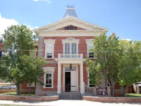
The 1882 Victorian brick courthouse anchored Tombstone's law-and-order side during the silver boom, and it now holds the town's history in one compact, self-guided building.

Tombstone
16 miles away
The town too tough to die, where the most famous gunfight of the Old West still echoes down a boardwalk-lined street.

Saguaro National Park
39 miles away
Forests of the giant saguaro cactus, symbol of the American West, on both sides of Tucson.