
Sandstone Bluffs Overlook
NM-117, Grants, NM
Grants, NM
A high shelf of pale sandstone that drops off into a vast black sea of lava, one of the great long views in western New Mexico.
Sandstone Bluffs Overlook is exactly what its name promises, a broad shelf of pale, wind-carved sandstone that ends in a cliff looking out over El Malpais, one of the largest and youngest lava fields in the American Southwest. From the rim you take in miles of black basalt spreading toward distant mesas, a landscape so raw it looks freshly poured.
The malpais, Spanish for badland, is a jumble of ropy and blocky lava that erupted from vents and volcanoes to the south, some of it only a few thousand years old, young enough that Ancestral Puebloan and later peoples watched flows like it and carried the memory in story. Standing on the cool sandstone above that dark sea, with the wind moving over the rim, is one of the simplest and most rewarding stops in this corner of New Mexico.
What Travelers Love
- The sudden, sweeping view off the cliff edge across miles of black lava
- Wandering the open sandstone slabs, pocked with rainwater pools after storms
- Sunset, when the low light turns the lava fields deep violet and the sandstone gold
- How quiet and uncrowded it stays compared with the state's famous overlooks
Worth Knowing
- There are no railings, and the drop-offs are sheer, so keep well back from the edge and watch children closely
- The slickrock can be slippery when wet or icy, and the wind on the rim can be strong
- Bring water and sun protection; there is little shade on the exposed sandstone
- The access road is unpaved but usually passable for cars in dry weather, and can turn muddy after rain or snow
Learn about Sandstone Bluffs Overlook
A sandstone rim above a lava sea
The overlook stands on a formation of buff and cream-colored sandstone, rock laid down as ancient dunes and shallow seas long before the lava ever flowed. Wind and water have carved the surface into low domes, shallow basins, and rounded slabs that hold rainwater in clear pools after a storm, small pockets of life on the bare stone.
From the edge, the land falls away into the malpais, and the contrast is the whole point, soft pale rock giving way to hard black lava. On a clear day the view runs for many miles across the flows to the mesas and volcanic necks on the horizon, and the Continental Divide runs through this country, the line that decides whether a raindrop ends in the Atlantic or the Pacific.
How the malpais was made
The black country below the bluffs is a record of eruptions that unfolded over tens of thousands of years, with some of the youngest flows only a few thousand years old, among the most recent volcanic activity in New Mexico. Lava welled up from vents and shield volcanoes to the south and spread north across the basin, cooling into ropy pahoehoe, jagged aa, collapsed lava tubes, and cinder cones.
Because the flows are so young, they have barely begun to break down into soil, so the malpais stays stark and dark, dotted with hardy junipers and wildflowers that find footholds in the cracks. The people of Acoma and Zuni Pueblos, whose ancestral lands surround this country, hold long knowledge of the malpais and its trails, and their oral histories carry the memory of a land that once burned.
Light, weather, and the long view
This is above all a place to time with the light. In the flat glare of midday the lava reads as an even black expanse, but as the sun drops the flows take on texture and shadow, the sandstone glows warm, and the whole scene turns violet and gold. Sunrise and sunset are the payoff hours here.
Weather makes the overlook feel bigger than it is. Summer thunderstorms build over the mesas and trail curtains of rain across the badland, winter dusts the black rock with snow, and the wind is nearly always present on the exposed rim. Because the sandstone is open and unfenced, keeping a safe distance from the edge and watching the sky are simply part of a visit here.
Part of the wider El Malpais country
Sandstone Bluffs is one stop along NM-117, the scenic road that traces the eastern edge of El Malpais National Monument. Further along the same route lies La Ventana, one of the largest natural arches in New Mexico, and beyond it the country of lava tubes, ice caves, and the old CCC-era ranger station.
Grants, just to the north on old Route 66 and Interstate 40, makes the natural base, a former uranium and mining town that now serves as the gateway to the malpais. Pairing the overlook with a stop at La Ventana Arch and a drive across the flows turns a quick pull-off into a proper half-day in one of the state's most underrated landscapes.
Closest Boutels
The closest Boutel™ stays, so you can turn this stop into an overnight. Each is a place we chose through independent editorial review, never a paid placement.
Details
Grants, NM
Frequently asked questions
What is the Sandstone Bluffs Overlook?
The Sandstone Bluffs Overlook, in El Malpais National Monument near Grants in western New Mexico, is a spectacular viewpoint perched atop sandstone cliffs offering sweeping panoramic views over the vast, rugged lava flows of El Malpais and the surrounding high-desert landscape, with the prominent Mount Taylor rising in the distance. From this dramatic vantage point, visitors can take in the striking contrast between the black volcanic terrain and the pale sandstone, appreciate the immense scale of the ancient lava fields, and enjoy beautiful scenery, especially at sunrise and sunset. Easily accessible, the Sandstone Bluffs Overlook is a scenic highlight of El Malpais, providing an unforgettable perspective on this remarkable volcanic landscape.
What can you see and do at the Sandstone Bluffs Overlook?
You can take in sweeping panoramic views over the vast lava flows of El Malpais, the surrounding high desert, and distant Mount Taylor, photograph the dramatic scenery, especially stunning in the golden light of morning and evening, walk along the sandstone bluff top to different vantage points, and appreciate the immense scale and geology of the volcanic landscape. It is an easy, rewarding stop reached by a short drive and walk. The overlook is a favorite for sunset. With its spectacular views over the lava fields and easy access, the Sandstone Bluffs Overlook offers a scenic highlight of visiting El Malpais National Monument.
What safety tips apply at the Sandstone Bluffs Overlook?
The overlook sits atop sandstone cliffs with steep, unfenced edges and drop-offs, so stay back from the edges, watch your footing on the uneven rock, and keep children close, as falls would be dangerous. The high-desert setting is exposed to sun and can be hot, so bring water and sun protection, and be aware of afternoon thunderstorms with lightning on the exposed bluff. Wear sturdy shoes for the rocky terrain. Being cautious near the cliff edges, prepared for the sun and heat, and mindful of storms ensures a safe visit to enjoy the views at the Sandstone Bluffs Overlook.
When is the best time to visit the Sandstone Bluffs Overlook?
Sunrise and sunset are the most spectacular times, when the low, golden light dramatizes the lava fields, sandstone, and Mount Taylor, making for stunning views and photography, while spring and fall offer the most comfortable temperatures overall, and summer can be hot with afternoon storms, so early or late visits are best. Winter is cold but the views remain beautiful. Clear days offer the best visibility. For the most beautiful light and comfortable weather, aim for sunrise or sunset on a clear day in the milder seasons at the Sandstone Bluffs Overlook.
What is near the Sandstone Bluffs Overlook?
The Sandstone Bluffs Overlook is within El Malpais National Monument near Grants in western New Mexico, close to La Ventana Arch, the monument's lava tubes and flows, the El Morro National Monument, the New Mexico Mining Museum in Grants, and within reach of Acoma Pueblo and the historic Route 66 corridor. That makes the Sandstone Bluffs Overlook a scenic stop to combine with La Ventana Arch, El Morro, Acoma Pueblo, and the other attractions of western New Mexico on a visit to the state.
Nearby
El Malpais National Monument
3.5 miles away
The youngest lava flows at El Malpais are geologically fresh, meaning the rock surface is still sharp and unstable in places.
El Malpais Lava Tubes and La Ventana Arch
11 miles away
Malpais means badlands, and the Spanish were not being poetic. The lava here is jagged basalt that will shred boots and hands, which is exactly why so few people venture past the overlooks.
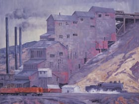
New Mexico Mining Museum
15 miles away
This is a surprise hit with kids who like the idea of going underground.