
El Malpais National Monument
1900 E Santa Fe Ave, Grants, NM
Grants, NM
A raw, black expanse of lava flows and cinder cones so young the land still looks freshly poured.
El Malpais National Monument protects one of the great volcanic landscapes of the American Southwest, a vast field of black lava flows, cinder cones, and lava tubes south of Grants. The name comes from the Spanish for the badlands, a fitting description for terrain so rugged and broken that early travelers found it nearly impassable. Some of the flows are geologically very young, so recent that the land still looks freshly made.
Yet this seemingly barren country is threaded with human history. Ancient Native trails cross the lava, marked by stone cairns, connecting the pueblos and villages of the region for centuries. Ancestral Puebloan people and their descendants have known this land intimately for a very long time, and it remains significant to the living Pueblos and to the Navajo Nation. To walk here is to cross a landscape that is at once raw geology and deep human story.
What Travelers Love
- The stark, otherworldly expanse of black lava flows stretching to the horizon
- Hiking historic Native trails marked by rock cairns across the lava
- Cinder cones, lava tubes, and other signs of recent volcanic activity
- Ancient, gnarled trees that have taken root in the barren rock over centuries
Worth Knowing
- The lava is sharp and uneven, so wear sturdy boots and go slowly to protect your feet and ankles
- It is easy to lose your way on the featureless flows, so follow the cairns and carry a map and plenty of water
- There is little shade and no water out on the lava, so plan carefully, especially in warm months
- This is a sacred landscape to nearby Pueblo and Navajo communities, so treat it and any cultural sites with respect
Learn about El Malpais National Monument
A young volcanic landscape
El Malpais records a long chapter of volcanic activity, with lava flows of many different ages layered across the region. The youngest flows are among the most recent in the area, so fresh that vegetation has barely begun to take hold and the surface still shows the ropy, jagged textures of cooling lava. Cinder cones mark the vents where fiery fountains once built hills of loose volcanic rock.
Beneath the flows run lava tubes, tunnels left where molten rock drained out from under a hardened crust, some of them floored with ice that lasts through the year. Aboveground, the lava freezes in place the shapes of its final moments: pressure ridges, collapsed tubes, and fields of broken black rock. It is a place where the processes that build the earth feel close enough to touch.
Ancient trails and living traditions
For centuries, Native people found ways across this forbidding country, and the monument preserves stretches of ancient trails marked by rock cairns that guided travelers over the lava. These routes linked communities across the region and carried trade, ceremony, and daily life. The Ancestral Puebloan people knew this land deeply, and their descendants in the modern Pueblos of Acoma, Laguna, and Zuni maintain enduring ties to it.
The Navajo Nation also holds this country as part of its homeland, and stories tied to the lava live on in Native traditions that explain its origins and meaning. The monument works in partnership with these communities to protect both the landscape and its cultural significance. Visitors are asked to walk lightly, stay on trails, and treat any signs of past habitation with care.
Trees, wildlife, and life on the lava
Life takes hold slowly on the lava, and what survives is all the more remarkable. Ancient junipers and ponderosa pines root in cracks and hollows, some of them among the oldest trees in the region, twisted and hardened by centuries of hard living. Mosses, lichens, and hardy shrubs gradually colonize the black rock, beginning the long work of turning stone into soil.
Wildlife includes mule deer, elk, coyotes, and mountain lions in the surrounding country, along with bats that roost in the lava tubes and a range of desert birds and reptiles among the flows. The mix of lava, sandstone, and forest edge creates varied habitat, so a patient visitor can see far more life than the barren look of the lava first suggests.
Seasons and exploring the monument
Spring and fall offer the best conditions for hiking the lava, with mild temperatures and clear skies. Summer is hot, and the black rock soaks up the sun, so early starts and plenty of water are essential, though the afternoon monsoon storms bring dramatic clouds and can green the land. Winter is cold and can dust the black flows with startling white snow.
The monument rewards a bit of planning. Trails like the one that crosses the lava following the ancient cairns require good footwear and navigation, while overlooks and shorter walks give a taste of the landscape for less effort. Whatever the season, the combination of young volcanic rock, ancient trees, and deep human history makes El Malpais one of the most quietly extraordinary places in New Mexico.
Closest Boutels
The closest Boutel™ stays, so you can turn this stop into an overnight. Each is a place we chose through independent editorial review, never a paid placement.
Details
Grants, NM
Frequently asked questions
What is El Malpais National Monument?
El Malpais National Monument, near Grants in western New Mexico, protects a dramatic and rugged volcanic landscape whose name means the badlands in Spanish. The monument features vast lava flows, cinder cones, lava tube caves, sandstone bluffs, and natural arches, created by volcanic eruptions over thousands of years, the most recent relatively young in geologic terms. Along with its striking geology, El Malpais holds cultural significance for the region's Native peoples and features ancient trails and sites. Offering hiking, caving, scenic overlooks, and otherworldly volcanic scenery, El Malpais National Monument is a fascinating and rugged natural destination in the high desert of western New Mexico.
What can you do at El Malpais National Monument?
You can hike across the rugged lava flows on marked routes, explore lava tube caves with proper preparation, see the beautiful La Ventana natural arch, take in views from the Sandstone Bluffs Overlook, visit ancient sites and trails, and marvel at the volcanic scenery and dark night skies. The terrain is rough and challenging in places, rewarding adventurous visitors. The visitor centers offer information and, for caves, permits. With its lava flows, caves, arches, overlooks, and striking volcanic landscape, El Malpais National Monument offers a rugged and memorable outdoor experience for hikers and explorers in western New Mexico.
What safety precautions should I take at El Malpais National Monument?
The lava terrain is extremely rough, sharp, and uneven, so wear sturdy boots, watch your footing, and be prepared for slow, difficult hiking where it is easy to twist an ankle or get disoriented, so carry a map, plenty of water, and sun protection, as the high desert is hot and exposed with little shade. Exploring lava tube caves requires a free permit, proper gear including a helmet and multiple light sources, and caution. Cell service is limited. Being well-prepared for the rugged terrain, heat, and cave conditions, and telling someone your plans, ensures a safe visit.
When is the best time to visit El Malpais National Monument?
Spring and fall offer the most comfortable temperatures for hiking the rugged lava terrain, avoiding the heat of summer and the cold of winter, making them the prime seasons, while summer can be hot with afternoon storms, so early starts with water are best, and winter is cold with possible snow and ice on the lava. The caves stay cool year-round. The dark skies make any clear night wonderful for stargazing. For the best combination of comfortable weather and safe hiking on the volcanic terrain, aim for spring or fall at El Malpais National Monument.
What is near El Malpais National Monument?
El Malpais National Monument is near Grants in western New Mexico, close to the El Morro National Monument with its inscription rock, the Sandstone Bluffs Overlook and La Ventana Arch within and near the monument, the New Mexico Mining Museum in Grants, and within reach of Acoma Pueblo, the Zuni Mountains, and the historic Route 66 corridor. That makes El Malpais National Monument a rugged natural stop to combine with El Morro, Acoma Pueblo, Grants, and the other attractions of western New Mexico on a visit to the state.
Nearby
Sandstone Bluffs Overlook
3.5 miles away
Pull off NM-117, follow the short paved path to the overlook. The entire visit takes 15 minutes. No fee for the overlook.
El Malpais Lava Tubes and La Ventana Arch
7.3 miles away
Malpais means badlands, and the Spanish were not being poetic. The lava here is jagged basalt that will shred boots and hands, which is exactly why so few people venture past the overlooks.
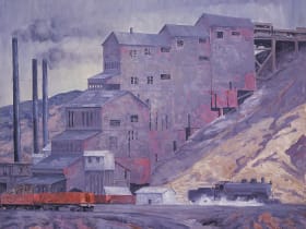
New Mexico Mining Museum
18 miles away
This is a surprise hit with kids who like the idea of going underground.