

Salmon Creek Falls
Highway 1
Gorda, CA
One of the few big Big Sur waterfalls you can reach in fifteen minutes, and the doorway to a deep coastal wilderness behind it.
Most of Big Sur's famous waterfalls make you work for them or admire them from a distance. Salmon Creek Falls is the rare exception, a tall cascade you can reach in about fifteen minutes from the pavement. From a pull-off on a sharp bend of Highway 1 near the southern end of Big Sur, a short trail leads up to a wide curtain of water dropping roughly 120 feet over the rock.
The falls are only the front porch. Behind them, the Salmon Creek Trail climbs into the Silver Peak Wilderness, a rugged, lightly traveled corner of Los Padres National Forest where backpackers string together long loops through steep canyons. You can taste that wildness in a quarter mile or lose yourself in it for days.
What Travelers Love
- A roughly 120-foot waterfall reachable by a quarter-mile walk from the highway
- Scrambling up to the base to feel the spray coming off the falls
- A quick, free stop that packs in real Big Sur scenery
- The trailhead into the wild Silver Peak Wilderness for those who want to keep going
Worth Knowing
- The falls run strongest in winter and after rain, and can thin by late summer, though the creek flows year round
- The short path to the base is rocky and involves some scrambling over boulders
- Poison oak grows thick along the trail, so stay on the path and watch what you brush
- Parking is a small pull-off on a horseshoe bend of Highway 1, so arrive early on busy weekends
Learn about Salmon Creek Falls
The waterfall and the wilderness behind it
Salmon Creek drops out of the Santa Lucia Mountains and spills over a rock face close enough to the highway that you can hear it from your car on a wet day. A short, rocky path leads to the base, where the water fans across the boulders and throws spray into the air.
For those who want more, the Salmon Creek Trail continues up the canyon into the Silver Peak Wilderness, linking with the Buckeye and Cruickshank trails to form a demanding backcountry loop. It is steep, remote country with loose footing and thick brush, the kind of place that reminds you how wild this coast still is just out of sight of the road.
How the Big Sur coast was made
The Santa Lucia Range that Salmon Creek tumbles out of is one of the steepest coastal mountain fronts in the lower forty-eight, thrust up where the Pacific and North American plates grind past each other along the San Andreas system. The mountains rise so fast from the sea that creeks like this one have little room to slow down, so they arrive at the coast as waterfalls rather than lazy rivers.
This southern stretch of Big Sur is younger and rawer feeling than the redwood canyons to the north, a country of hard rock, chaparral, and sudden drops to the water.
Wildlife and plants
The canyon is classic Big Sur backcountry, home to black-tailed deer, bobcats, and the occasional mountain lion, with California condors sometimes riding the thermals overhead after their long recovery on this coast. Steller's jays and acorn woodpeckers work the oaks, and the creek supports frogs and, in wetter years, the fish the falls are named for.
The trailside plants are a lesson in coastal California: coast live oak, bay laurel, sticky monkeyflower, and, unmistakably, plenty of poison oak, which turns brilliant red in fall.
When to go
Come in the wet season, roughly December through spring, to see the falls at full force and the hills at their greenest. By late summer the flow drops, though the creek keeps running. Mornings are often foggy on this coast before the sun burns through.
As with anything in Big Sur, check Highway 1 conditions first, since storms and slides can close the road for long stretches. Bring sturdy shoes for the boulder scramble and water if you plan to push beyond the falls.
Closest Boutels
The closest Boutel™ stays, so you can turn this stop into an overnight. Each is a place we chose through independent editorial review, never a paid placement.
Details
Gorda, CA
Frequently asked questions
What is Salmon Creek Falls?
Salmon Creek Falls is a beautiful waterfall on the southern Big Sur coast of California, where Salmon Creek tumbles dramatically over rocks in a lush canyon just a short distance from Highway 1. One of the more accessible waterfalls in the Big Sur region, it can be glimpsed from near the road and reached by a short hike, cascading impressively when flowing well. Set amid the rugged coastal mountains near the southern gateway to Big Sur, Salmon Creek Falls offers a refreshing and scenic stop for travelers exploring this spectacular stretch of the California coast.
How do you get to Salmon Creek Falls?
Salmon Creek Falls is near Highway 1 on the southern Big Sur coast, with a trailhead at a pullout, and the falls can be partly seen from near the road, while a short but somewhat rocky trail leads closer to their base. The walk is relatively brief but involves uneven terrain, so wear sturdy shoes and watch your footing. Because it is close to the highway, it makes an easy stop, though parking is limited. Checking Highway 1 road conditions before you go is wise, as closures can occur in Big Sur.
When is the best time to visit Salmon Creek Falls?
The falls are most impressive in the wetter months and after rains, typically winter and spring, when the creek runs full and the waterfall thunders, while by late summer and fall the flow can diminish significantly. Spring also brings green canyon scenery. So for the most dramatic waterfall, aim for the rainy season or shortly after storms, keeping in mind that heavy rains can also affect Highway 1. Checking recent conditions and road status before you go helps ensure both good flow and safe access.
What safety tips apply at Salmon Creek Falls?
The trail and rocks around the falls can be uneven, wet, and slippery, so wear sturdy shoes, watch your footing, and use caution when scrambling near the water, avoiding climbing on slick rocks near the cascade. Keep children close. Flows can be powerful after heavy rain, so do not get too close to the rushing water. The parking pullout is along Highway 1, so be careful of traffic. Taking care on the rocky, slippery terrain and near the fast water keeps a visit to the falls safe.
What is near Salmon Creek Falls?
Salmon Creek Falls is on the southern Big Sur coast, near Ragged Point, the elephant seal rookery at Piedras Blancas, and Hearst Castle in San Simeon to the south, with the jade-strewn coves and beaches of southern Big Sur and the redwoods and waterfalls farther north along Highway 1. That makes Salmon Creek Falls a refreshing stop to combine with Ragged Point, the elephant seals, Hearst Castle, and the dramatic coastal scenery of southern Big Sur and the Central Coast on a California road trip.
Nearby
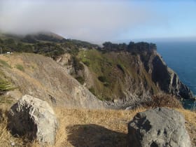
Ragged Point
1.9 miles away
Ragged Point marks the spot where the gentle coast around San Simeon gives way to the steep, dramatic Big Sur shoreline heading north.
Elephant Seal Vista Point
6.0 miles away
The Piedras Blancas elephant seal rookery on Highway 1 north of San Simeon is one of the largest accessible elephant seal haul-out sites in the world.
Hearst Castle
8.4 miles away
Hearst Castle is one of the most unusual buildings in the United States - a 165-room hilltop estate built by newspaper magnate William Randolph Hearst and architect Julia Morgan beginning in 1919, nev...
Jade Cove
15 miles away
The seafloor off this stretch of Big Sur holds nephrite jade, and the surf breaks it loose and rolls it up onto the cove among the ordinary beach stones.
Moonstone Beach Boardwalk
16 miles away
A mostly level, mile-long clifftop boardwalk along Cambria's shore, over marine-sanctuary tide pools and driftwood coves, with beachcombing for the smooth moonstones that name the beach.
Fiscalini Ranch Preserve
17 miles away
A 430-acre coastal preserve at Cambria that the town saved from development in 2000, with a mile of ocean bluff trail and one of the last native Monterey pine forests on earth.

Pinnacles National Park
53 miles away
Volcanic spires and talus caves, one of the best places to watch California condors soar.