

Sahalie and Koosah Falls
OR-126 (McKenzie Hwy)
McKenzie Bridge, OR
Two thundering waterfalls on the turquoise upper McKenzie, born where lava once dammed the river, linked by a short forest loop through deep old growth.
Sahalie and Koosah are two of the biggest, loudest waterfalls on the upper McKenzie River, and they sit close enough together that a single short loop links them both. Sahalie is the taller and more thunderous of the pair, a wall of white water throwing spray into the forest, while Koosah drops a little downstream into a deep, plunging pool. Between them runs the McKenzie itself, cold and startlingly clear.
What gives the two falls their special quality is where the water comes from and what it pours over. This is spring-fed river, filtered slowly through porous volcanic rock upstream, which is why it runs so clean and cold and holds that faint turquoise cast. And the ledges the water plunges over are the frozen edge of an ancient lava flow, so the whole scene is a story of fire and water written into the landscape.
What Travelers Love
- Two large, powerful waterfalls within an easy walk of each other
- The turquoise color of the cold, spring-fed McKenzie River
- A short forested loop through deep old-growth Douglas fir and mossy understory
- How much drama the falls deliver for how little walking they require
Worth Knowing
- The viewpoints sit above steep drops, so keep behind the railings and keep children and dogs close, as the wet rock is slippery
- Spray keeps the trail and overlooks damp, so shoes with good grip help, especially in cold weather
- Sahalie Falls is reachable right from the parking area, but the full loop to Koosah and back involves real trail and some ups and downs
- The river is dangerously cold and fast here, so this is a place to look, not to wade or swim
Learn about Sahalie and Koosah Falls
Born of a lava dam
Both falls owe their existence to volcanic eruptions. Roughly three thousand years ago, thick flows of lava poured down from vents near the Cascade crest, in the Belknap Crater area, and spread into this stretch of the McKenzie valley. The lava dammed the river, backed up the water that became Clear Lake upstream, and left a series of hard rock lips across the river's path.
Sahalie and Koosah are where the river spills over the ends of those old flows. Sahalie is the higher of the two, a broad, roaring cascade dropping around a hundred feet over the lava rim, and Koosah, a short way downstream, plunges roughly seventy feet into a deep pool. In between, the river slides fast and green between mossy banks of the same dark rock.
The lava that made the falls also shapes the river's character. Upstream at Clear Lake, that same porous volcanic ground filters and stores cold groundwater, and even preserves a ghostly drowned forest of trees killed when the lava first dammed the valley. It is all one connected story, and Sahalie and Koosah are its most dramatic chapter.
Names from a trade language
The names of the two falls come from Chinook Jargon, the trade language once spoken across the Pacific Northwest that let peoples of many different nations exchange news and goods. Sahalie carries the sense of high, up above, or heaven, a fitting name for the taller falls, and Koosah carries the sense of sky. The names honor a shared regional history rather than any single language.
This upper McKenzie country was long a place of travel and trade among Native peoples, including the Molalla, Kalapuya, and neighboring nations, who moved through these mountains to gather huckleberries in the high country, to hunt, and to reach the obsidian sources near the volcanic crest. The Cascades here were a shared, well-traveled crossroads laced with trails.
Those connections continue through living communities today, among them the Confederated Tribes of Grand Ronde and the Confederated Tribes of Warm Springs, whose members include descendants of the peoples of this region. The names on the falls are a small, everyday reminder that this land has been known, named, and traveled for a very long time.
The old-growth forest
The loop that links the two falls runs through classic upper-Cascade old growth. Tall Douglas fir and western hemlock rise over a deep green floor of moss, sword fern, and huckleberry, and the constant spray from the falls keeps the whole gorge lush and dripping. It is a forest that feels ancient and cool even on a hot summer day.
The cold, clean river is the heart of the ecosystem. Watch the midstream rocks and you may spot the American dipper, a small slate-gray bird that bobs on the stones and then walks straight underwater to hunt insects on the river bottom, one of the signature birds of fast Northwest streams. Overhead, the forest holds woodpeckers, owls, and the usual mountain songbirds.
Along the wet edges look for salamanders and newts in the leaf litter, and in the woods around the falls the usual Cascade residents, black-tailed deer, and the occasional sign of elk or bear, keep mostly out of sight. The river itself is far too cold and swift to be a swimming spot here, and it is best appreciated from the banks.
Season by season
Spring is the falls at their most powerful, fed by snowmelt from the high Cascades, and the forest turns vivid green. The trails run wet and the spray is heavy, so good footing matters, but the sheer volume of water is spectacular.
Summer is the easiest and busiest time to visit, with warm, dry weather and the full loop in comfortable shape. Because so much of the McKenzie's flow is spring-fed, the falls keep running strong even through the dry months, so they do not thin out the way many Oregon waterfalls do.
Fall brings cooler air, thinner crowds, and touches of color from the vine maple and bigleaf maple along the river, a quiet and lovely time to walk the loop as the rains return.
Winter can be striking, with mist freezing onto the rocks and railings and snow dusting the old growth, but the access road over the higher country is subject to snow and the trail turns icy near the water. Check conditions before a cold-weather visit and tread carefully.
Closest Boutels
The closest Boutel™ stays, so you can turn this stop into an overnight. Each is a place we chose through independent editorial review, never a paid placement.
Details
McKenzie Bridge, OR
Frequently asked questions
What is the difference between Sahalie and Koosah Falls?
They are two waterfalls a short distance apart on the same wild stretch of the McKenzie River, linked by an easy loop trail. Sahalie is the taller of the pair at around a hundred feet and thunders into a misty gorge, while Koosah drops about seventy feet a little downstream into a deep pool. Seeing both on the loop, with the brilliant blue-green river between them, is the classic outing.
How long is the Sahalie and Koosah Falls loop?
The full loop connecting both falls along the river is roughly two and a half miles with only modest elevation change, an easy, family-friendly walk of an hour or two through mossy old forest. If you only have a few minutes, a paved, accessible path leads from the parking area straight to the Sahalie viewpoint, one of the loudest, mistiest overlooks in the state.
Is Sahalie and Koosah Falls open year-round?
Yes. Unlike some Cascade waterfalls reached by seasonally closed mountain roads, these falls sit on an open highway and can be visited any time of year, and they are spectacular in every season, from full spring flow to snow-dusted winter. The best conditions are generally late spring through fall, and parking can be tighter in the busy summer months.
Are the viewpoints safe, especially for kids?
Mostly, but with a real caution: some of the overlooks along the trail have steep drops to the river and no protective railing, so keep a close hold on children and stay back from the edges, especially where the rock is wet and slick from the mist. The main Sahalie observation deck near the parking lot is railed and safe, and the loop is otherwise a gentle, well-maintained walk.
What should I know before visiting Sahalie and Koosah Falls?
Parking at the falls is free, and leashed dogs are welcome, though the lots can fill on warm summer weekends, so an early arrival helps. Wear shoes with grip, since the mossy, misty trail stays damp, and follow the little side paths off the main loop, which lead to some of the best hidden viewpoints of the river and falls.
Nearby
Tamolitch Falls (Blue Pool)
9.6 miles away
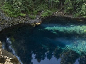
The McKenzie River disappears entirely into a porous lava field 1.5 miles upstream from Tamolitch and travels underground the whole way.

Proxy Falls
12 miles away
Proxy Falls is a pair of side-by-side waterfalls just off Hwy 242, accessible via a 1.6-mile loop through old-growth hemlock and Douglas fir. Most drivers on McKenzie Pass miss the small trailhead.

Dee Wright Observatory, McKenzie Pass
12 miles away
The Dee Wright Observatory was built in 1935 by the Civilian Conservation Corps from the same lava rubble covering McKenzie Pass, making the structure nearly invisible against the black rock field.