
Dee Wright Observatory
McKenzie Hwy (OR-242), Sisters, OR
Sisters, OR
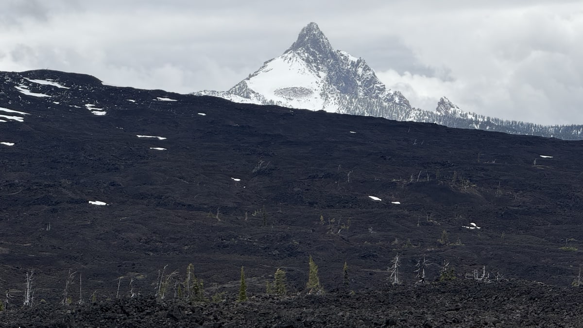
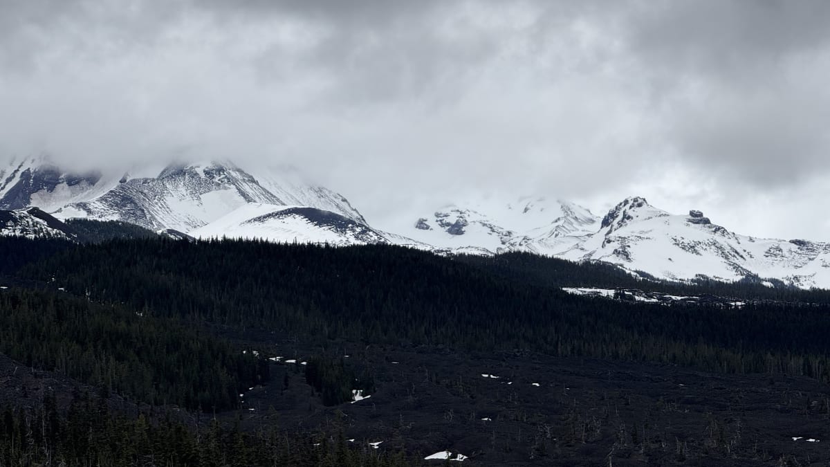
A squat stone shelter built from black lava on the summit of McKenzie Pass, with windows aimed like gunsights at the Cascade volcanoes, standing in the middle of a hardened sea of lava.
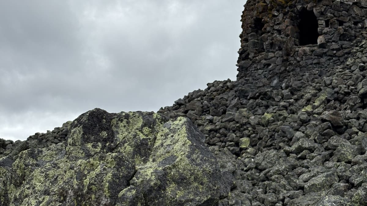
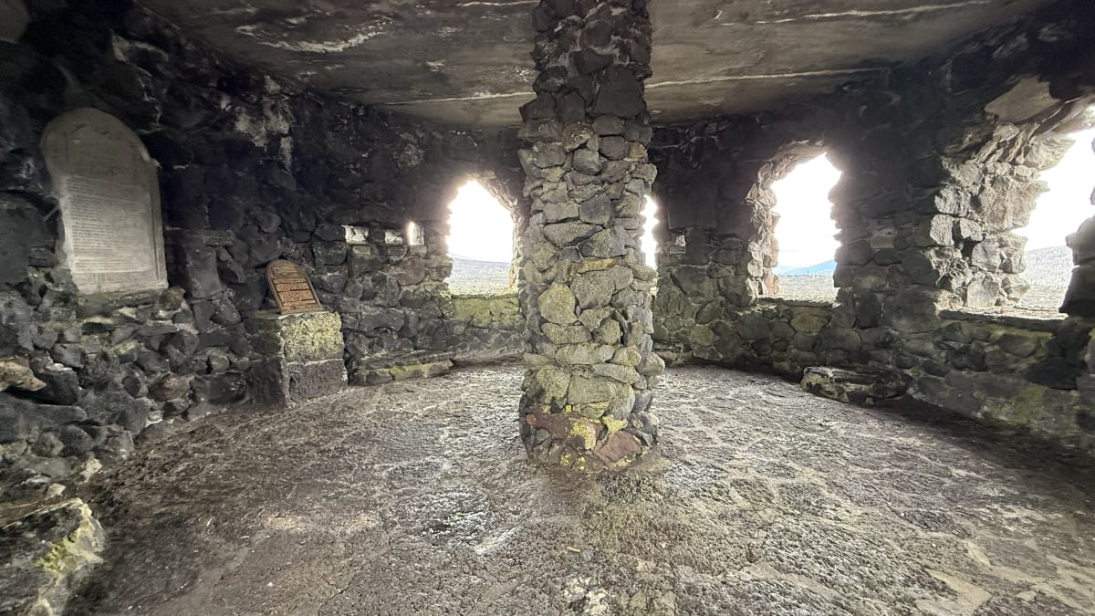
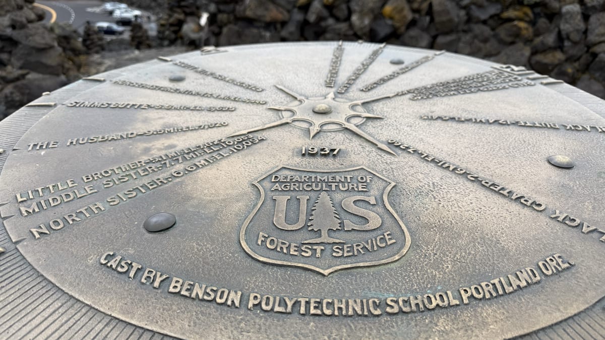
The Dee Wright Observatory is a low, castle-like shelter built entirely of black lava rock, standing at the summit of McKenzie Pass in the central Oregon Cascades. Its walls are cut with windows, and each window is aimed at a particular peak, so that you step to an opening and a named volcano appears framed within it like a portrait. A spiral stair leads up to an open roof, where a bronze dial helps you pick out the ring of Cascade summits laid out around you.
What makes the whole scene surreal is the ground it stands on. The observatory does not sit beside the lava; it sits in it, in the middle of a wide field of hardened, tumbled black rock that runs off toward the mountains in every direction. Built by hand during the Great Depression, from the very stone it overlooks, it is one of the most striking small structures in the Oregon high country.
What Travelers Love
- A 360-degree view of the Cascade volcanoes from the roof deck, with a bronze dial that names each peak
- The observatory's own lava-tube windows, each one framing a specific mountain like a picture
- Standing in the middle of a vast, black, jagged lava flow that stretches to the horizon
- The short Lava River interpretive trail that loops out onto the flow from the base of the shelter
Worth Knowing
- The OR-242 road over the pass is closed to cars for much of the year and typically opens only for the warmer months, so check before you go
- It sits above a mile in elevation; weather can turn cold, windy, and sudden even in summer
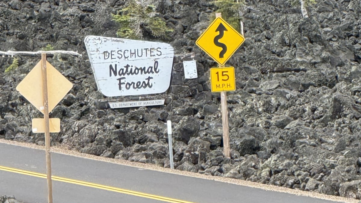
- The narrow, sharply winding highway is not suited to large RVs or trailers
- There is little shade on the exposed lava, so bring sun protection and water
Learn about Dee Wright Observatory
Built by hand in the Depression
The observatory was completed in 1935 by a crew of the Civilian Conservation Corps, the New Deal work program that put young men to labor on public lands across the country during the Great Depression. Working from a nearby camp, the crew raised the shelter from basaltic andesite lava gathered right at the site, fitting the dark, rough stone into thick walls and a squat tower that seem to grow out of the flow itself.
It carries the name of Dee Wright, the foreman who led the early work. Wright was a longtime Forest Service packer and guide with decades of experience in this rugged mountain country, and he oversaw the start of the project but died the year before it was finished. Naming the finished observatory for him honored a man who had spent much of his life in these mountains and did not live to see the work completed.
The result is both a viewpoint and a piece of craftsmanship. The builders cut the windows deliberately, angling each toward a specific Cascade peak so that the shelter itself teaches you the skyline. On the roof they set a bronze dial, sometimes called a peak finder, that names the surrounding summits and features, turning a rest stop on a mountain road into a guided lesson in the volcanoes ringing the horizon.
A road older than the observatory
The pass the observatory guards was a route long before any road climbed it. For generations, Native peoples crossed the Cascades through this high country, and an old foot trail is understood to have skirted the southern edge of the lava field. This is a meeting-ground of homelands, near the traditional territories of peoples including the Molalla to the west and the Northern Paiute and Klamath country to the east and south, and the volcanic uplands were a source of obsidian, the sharp volcanic glass prized for tools and traded widely. Sources differ on the details of who traveled and used these grounds, so it is best held as a landscape long known and used by many, rather than reduced to a single tidy story.
By the 1860s the route had become a rough wagon road, pushed across the difficult lava beds to link the Willamette Valley with central Oregon. That early crossing evolved into the highway you drive today, the narrow, twisting OR-242 that threads over the pass. Because it climbs so high and lies under deep snow through the colder half of the year, the road is gated shut for much of it and typically opens only for the warm months, which is part of why reaching the observatory feels like a small seasonal event.
The lava all around
The black rock that surrounds the observatory is young, geologically speaking, the product of eruptions that sent lava spreading across this part of the Cascades in the relatively recent past. The flows here are among the freshest-looking in Oregon, still raw and sharp-edged, with almost no soil and only scattered plants managing to take hold on the tumbled stone.
From the base of the observatory, a short paved interpretive path, the Lava River trail, loops out onto the flow so you can walk among the frozen ripples, ropey folds, and jagged blocks up close. Signs along the way explain what you are seeing and how the molten rock behaved as it cooled.
Standing out there, ringed by dark rock with snow-capped volcanoes rising beyond it, you get a rare, unfiltered look at how this whole landscape was made. The Cascades are a chain of volcanoes, and few places let you feel that fact as directly as a lava field with a shelter built from its own stone at the center of it.
Season by season
Because of the road closure, most people visit in the warm months, when OR-242 is open over the pass. Summer brings clear, wide views of the Cascade peaks, wildflowers scattered in pockets among the rock, and long daylight, though the exposed lava can grow hot and there is little shade.
Early and late in the open season, the shoulder weeks after the gate lifts and before it closes again, tend to be quieter and cooler, with fresh snow often still clinging to the higher volcanoes for a striking contrast against the black rock.
Through the cold half of the year the pass is buried in snow and shut to cars, and the observatory sits alone in the winter high country. That is why timing matters more here than at almost any other Oregon gem, and why it is worth checking the road's status before setting out.
Closest Boutels
The closest Boutel™ stays, so you can turn this stop into an overnight. Each is a place we chose through independent editorial review, never a paid placement.
Details
Sisters, OR
Frequently asked questions
When is the Dee Wright Observatory open?
Only in the warmer months, because the mountain highway that reaches it is closed by snow for much of the year. The McKenzie Highway over the pass typically opens sometime in June and closes again by early November, so the observatory can only be visited in that window. Always check current road status before making the drive, since the exact opening shifts from year to year with the snow.
What can you see from the Dee Wright Observatory?
A remarkable amount. The stone observatory sits at the summit of McKenzie Pass amid a vast black lava field, and its window openings and bronze peak-finder frame a ring of Cascade volcanoes, from Mount Washington and the Three Sisters to distant Mount Jefferson and even Mount Hood far to the north on a clear day. The moonscape of lava all around is so otherworldly that astronauts once trained on it.
Is there anything to do at the observatory besides the view?
Yes. The observatory itself, hand-built of lava rock by the Civilian Conservation Corps in the 1930s, is worth exploring, and a short paved interpretive trail loops out into the lava flow so you can walk among the strange black rock up close. Together they make a fascinating half-hour or so at the top of the pass.
Can I drive an RV or trailer to Dee Wright Observatory?
It is not recommended. The McKenzie Highway is a narrow, winding, historic mountain road that is not suited to long RVs or vehicles towing trailers, so a smaller vehicle is far better for the drive up to the pass. Take the curves slowly and enjoy the scenery.
What should I bring, and when is the best time to go?
Since the black lava field is fully exposed with no shade and the dark rock soaks up heat, the observatory can get surprisingly hot on a sunny afternoon, so mornings are more comfortable and sun protection, a hat, and plenty of water are smart. It sits above 5,000 feet, so bring a layer too, as it can be cool and breezy even in summer. Clear days give the best views of the surrounding peaks.
Nearby

Proxy Falls
9.5 miles away
Proxy Falls is a pair of side-by-side waterfalls just off Hwy 242, accessible via a 1.6-mile loop through old-growth hemlock and Douglas fir. Most drivers on McKenzie Pass miss the small trailhead.

Sahalie and Koosah Falls
12 miles away
Sahalie Falls drops 100 feet and Koosah Falls drops 70 feet on the upper McKenzie River within half a mile of each other, both fed by water that surfaces from Clear Lake above.
Tamolitch Falls (Blue Pool)
14 miles away
The McKenzie River disappears entirely into a porous lava field 1.5 miles upstream from Tamolitch and travels underground the whole way.

Tumalo Falls
19 miles away
A ninety-seven-foot Cascade waterfall in Deschutes National Forest west of Bend, reached by a short quarter-mile walk from the lot to a viewing platform.