
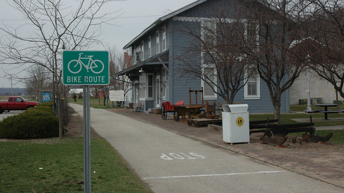
Root River State Trail
201 Ridgeview Ln S, Lanesboro, MN
Lanesboro, MN
A smooth paved rail-trail that follows a clear trout river through the wooded limestone bluffs of Minnesota's driftless country.
The Root River State Trail is a paved path built on an old railroad grade that follows the Root River through the deep valleys of southeast Minnesota. Because it rides the former rail line, it stays gently graded and nearly flat even as the land around it rises into steep, wooded bluffs, which makes for easy, unhurried riding for all ages.
The trail threads together a handful of small towns that grew up along the railroad, with the village of Lanesboro as its lively center. Along the way it passes limestone cliffs, trout water, farm fields, and the kind of quiet river scenery that has made this stretch of Minnesota a favorite for cyclists and paddlers alike.
What Travelers Love
- A flat, paved rail-trail that ties together a string of small historic towns
- Riding beside a clear trout stream under limestone bluffs
- Lanesboro's walkable Main Street, professional theater, and river dam
- The driftless landscape of steep wooded hills that the glaciers never flattened
Worth Knowing
- Bike rentals and outfitters are easy to find in Lanesboro if you arrive without gear
- The trail links to the Harmony-Preston Valley segment, adding more miles and a longer ride
- Fall color along the river valley is a highlight, so expect more company on autumn weekends
- Sections can flood after heavy rain, so check trail status before a spring visit
Learn about Root River State Trail
The driftless land the glaciers missed
Southeast Minnesota belongs to a region geologists call the Driftless Area, a pocket of the Upper Midwest that the last great ice sheets flowed around rather than over. Without glaciers to grind the land flat, rivers had free rein to carve deep, branching valleys into the old limestone bedrock, leaving the steep bluffs, rock outcrops, and spring-fed streams that define this country.
The Root River is the artery of that landscape. Fed by cold springs, it runs clear enough to hold trout, and it has cut the broad valley that the trail now follows. The limestone underfoot is riddled with caves, sinkholes, and springs, the marks of water working slowly through soluble rock over long stretches of time.
Dakota homeland and the coming of the railroad
This river valley lies within the homeland of the Dakota, part of the wider Mni Sota Makoce from which the state takes its name. The Dakota lived and hunted through these bluffs and along the Root River long before the towns and the railroad arrived, and this region carries their history through the treaty era and the upheavals of the mid-1800s.
In the decades after the land was ceded, settlers moved in and a railroad was pushed up the valley to carry grain and passengers. The little towns strung along the line, Lanesboro among them, grew around the depots. When the trains stopped running, the abandoned grade was reborn as this trail, so the smooth path riders enjoy today traces the exact route the trains once took.
Lanesboro and the towns along the line
Lanesboro sits at the heart of the trail, a small town with a dam on the Root River, a restored Main Street of brick storefronts, and a well-regarded professional theater that draws visitors from across the region. It has embraced its role as a cycling and arts hub without losing the feel of a quiet river town, and it makes an easy place to rent a bike, eat, and stay.
The trail links Lanesboro to neighbors like Fountain, Whalan, Peterson, Rushford, and Houston, each a small stop with its own character. A branch known as the Harmony-Preston Valley Trail spurs off toward the south, adding miles and connecting to the Amish farm country around Harmony, where roadside stands and horse-drawn buggies are part of the landscape.
Wildlife, water, and the seasons
The Root River valley is rich with life. Bald eagles and hawks ride the thermals above the bluffs, wild turkeys and white-tailed deer move through the woods, and the cold, clear water supports trout that draw anglers from across the Midwest. Songbirds fill the riverside brush, and in the wetter bottoms you may spot herons working the shallows.
Spring brings high, fast water and green returning to the valley. Summer is warm and leafy, ideal for a long day on the bike. Fall is the showpiece, when the bluffs light up in maple and oak color and the trail draws its biggest crowds. Winter quiets the valley and turns the trail over to skiers and the occasional snowshoe.
Closest Boutels
The closest Boutel™ stays, so you can turn this stop into an overnight. Each is a place we chose through independent editorial review, never a paid placement.
Black Hawk Motel & Suites
Honorable Mention720 Race St, Wisconsin Dells, WI
111 miles away|Learn More ›
Details
Lanesboro, MN
Frequently asked questions
What is the Root River State Trail?
The Root River State Trail, in the scenic bluff country of southeastern Minnesota, is a beloved paved rail-trail that winds for miles along the Root River through the dramatic driftless-region landscape of towering bluffs, forests, farmland, and charming small towns. Following a former railroad line, the flat, easy trail crosses old railroad bridges over the river and passes through picturesque villages like Lanesboro, making it a favorite for biking, walking, and enjoying the beautiful valley scenery. With its scenic river-valley route, historic bridges, and charming towns, the Root River State Trail offers a delightful destination in southeastern Minnesota.
What can you do on the Root River State Trail?
You can bike, walk, run, or in-line skate the paved trail through the beautiful Root River valley, cross historic railroad bridges over the river, pass through charming small towns like Lanesboro with their shops and eateries, watch for wildlife and birds along the river and bluffs, and enjoy the scenery, especially glorious in fall. In winter, portions may be used for skiing. The scenic, easy riding and the river-town stops are highlights. With its scenic rail-trail, bridges, and charming towns, the Root River State Trail offers a rewarding outdoor experience in southeastern Minnesota.
Is the Root River State Trail good for families?
Yes, the Root River State Trail is excellent for families, as its paved, mostly flat surface following an old railroad grade makes for easy, comfortable biking and walking for all ages and abilities, while the scenic river valley, historic bridges, and charming towns with ice cream and rest stops keep the ride enjoyable and manageable. Bike rentals are available in trail towns like Lanesboro. The gentle grade suits children and casual riders. With its easy paved path, scenery, and town stops, the Root River State Trail makes a wonderful family destination in southeastern Minnesota.
When is the best time to visit the Root River State Trail?
Late spring through fall is the prime time for biking and walking the trail, with summer offering lush greenery and pleasant weather, and fall bringing spectacular color to the bluffs and valley, a favorite time for the ride, while spring brings fresh green and wildflowers. Portions may be used for skiing in winter. The scenery is beautiful throughout the warm season. For the best combination of pleasant weather and scenery, aim for late spring through fall, with fall especially colorful, on the Root River State Trail in southeastern Minnesota.
What is near the Root River State Trail?
The Root River State Trail runs through the bluff country of southeastern Minnesota, passing through Lanesboro and other charming towns, within reach of Historic Forestville, Mystery Cave, Great River Bluffs and the Apple Blossom Drive, and the Mississippi River towns like Wabasha with the National Eagle Center. That makes the Root River State Trail a delightful stop to combine with Historic Forestville, Mystery Cave, and the other attractions of southeastern Minnesota's bluff country on a visit to the state.
Nearby
Mystery Cave
15 miles away
Mystery Cave: in Forestville and Mystery Cave State Park southwest of Lanesboro.
Historic Forestville
17 miles away
Historic Forestville: inside Forestville/Mystery Cave State Park, south of Spring Valley off MN-16 in the driftless southeast.
Dunning's Spring
30 miles away
Decorah sits in Iowa's Driftless corner, and Dunning's Spring is the quickest way to feel it.