
Rock Island State Park
82 Beach Rd, Rock Island, TN
Rock Island, TN
A rugged limestone gorge where the Caney Fork meets three rivers and water spills straight out of a cliff face in a broad, roaring curtain.
Rock Island State Park lies where the Caney Fork, Collins, and Rocky rivers converge in a deep limestone gorge at the head of Center Hill Lake, in the Upper Cumberland country of Middle Tennessee. The result is one of the most rugged and scenic river settings in the state, a place of towering rock walls, plunging water, sandy coves, and the ruins of a nineteenth-century industrial village all packed into a compact park.
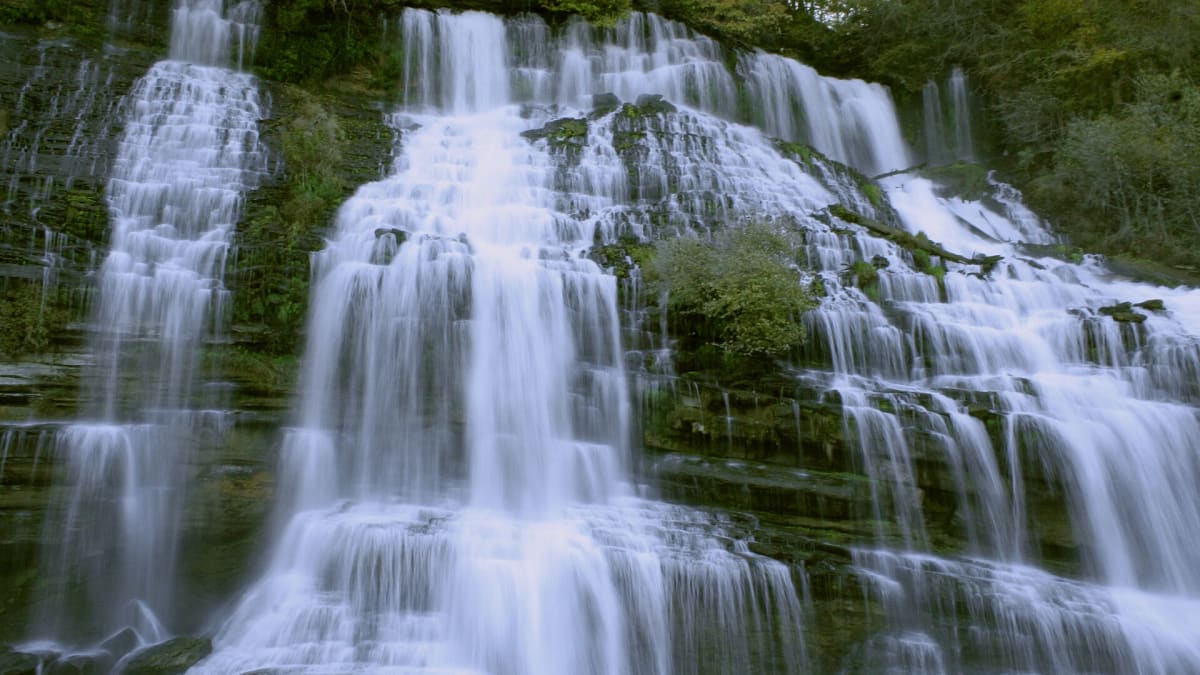
Its signature sight is Twin Falls, a broad curtain of water that appears to gush directly out of the gorge wall rather than over a stream bed. The falls owe their unusual look to the upstream Great Falls Dam, which sends water leaking and pouring through the porous limestone until it bursts out of the cliff face into the gorge below, a man-made accident of engineering that created one of Tennessee's most photographed waterfalls.
What Travelers Love
- The dramatic Twin Falls, where water pours straight out of the gorge wall
- Swimming and paddling in the calm sand-bottom coves below the gorge
- Exploring the ruins and channels of the old nineteenth-century cotton mill
- The rugged, boulder-strewn gorge scenery at the meeting of three rivers
Worth Knowing
- The gorge and river can rise fast and become dangerous when the upstream dam releases water, so obey posted warnings and horns
- Rocks along the river are slick, and there are strong currents, so swim only in designated areas
- The Twin Falls flow depends on releases and rainfall and can vary a great deal
- Trails into the gorge are rocky and steep in places, so wear sturdy shoes
Learn about Rock Island State Park
The story of Rock Island
This river country in the heart of the Cumberland Plateau country was long the homeland and hunting ground of Native peoples, including the Cherokee, whose lands stretched across much of what is now Tennessee before the forced removals of the 1830s carried most of the nation west on the Trail of Tears. Descendant nations continue in Oklahoma, and the Eastern Band of Cherokee remain in western North Carolina.
The gorge's water power drew industry in the nineteenth century. In the 1890s a large cotton mill, the Falls City Cotton Mill, was built at the head of the gorge to harness the rivers, and a small mill village grew up around it. The mill has long since closed, and its stone ruins, races, and channels still stand within the park, slowly being reclaimed by the forest.
In the early twentieth century the Great Falls Dam was built upstream to generate hydroelectric power, one of the earliest such dams in the region. It was that dam, and the way water seeps through the surrounding limestone, that gave rise to Twin Falls. The state later established the park to protect the gorge, the falls, the old mill, and the wild meeting of the three rivers.
The gorge and its waterfalls
The heart of the park is the gorge itself, a steep-walled canyon cut into ancient limestone by the rivers over long spans of time. Boulders the size of cars litter the riverbed, sheer rock faces rise on both sides, and the water can run from glassy calm to a churning torrent depending on upstream releases. Overlooks and trails give views down into the chasm.
Twin Falls is the showpiece, a wide, powerful cascade that spills out of the gorge wall when the upstream dam and porous rock feed water through the cliff. Below the gorge the rivers slow into sandy coves that are gentle enough for swimming and paddling, so the park offers both the drama of the falls and the ease of a river beach within a short walk of each other.
Wildlife and the river forest
The gorge and its slopes are cloaked in hardwood forest of oak, hickory, and maple, with mosses, ferns, and wildflowers thriving in the cool, damp shade near the water. The rivers themselves are rich, part of a Cumberland river system famous for its diversity of fish, mussels, and other aquatic life.
White-tailed deer, wild turkey, raccoon, and many songbirds live in the park, and herons and kingfishers work the river coves. The limestone gorge also draws birds of prey that ride the updrafts along the cliffs. The mix of open water, deep gorge, and forest packs a lot of habitat into a small area.
Season by season
Spring runs high and loud, when rains and dam releases swell the rivers and the falls, and wildflowers bloom across the gorge slopes. It is a fine time to see the water at its most powerful.
Summer is the busiest season, when the sandy coves draw swimmers and paddlers escaping the heat and the cabins fill up. Warm days and cool river water make it a favorite family time, though flows over the falls can drop.
Fall brings crisp air and turning color across the gorge, thinner crowds, and clear light for photographing the falls and the rock walls.
Winter is quiet and often dramatic, with heavier flows over the falls after rain and the bare trees opening up views into the gorge. Cold, wet rock can be slick, so footing matters on the river trails.
Closest Boutels
The closest Boutel™ stays, so you can turn this stop into an overnight. Each is a place we chose through independent editorial review, never a paid placement.
Sportsman's Lodge at Dale Hollow
Honorable Mention1201 Livingston Hwy, Byrdstown, TN
59 miles away|Learn More ›
Details
Rock Island, TN
Frequently asked questions
What is Rock Island State Park?
Rock Island State Park, in Middle Tennessee where the Caney Fork River meets the Cumberland Plateau, is a scenic park known for its dramatic waterfalls, rugged gorge, and river scenery. The park features the striking Great Falls, along with waterfalls that pour from a rock wall, a beautiful gorge, the Caney Fork River, and a lake, offering hiking, fishing, kayaking, and scenery, with a historic cotton mill nearby. Its powerful waterfalls and rugged beauty make it a beloved destination, though its waters demand respect. A scenic and dramatic river park, it delights visitors. With its waterfalls and gorge, Rock Island State Park offers a spectacular destination in Tennessee.
Is it safe to swim at Rock Island State Park?
Rock Island's waters can be extremely dangerous, with powerful, unpredictable currents, sudden water releases from an upstream dam that can raise the river rapidly, and areas where serious accidents and drownings have occurred, so swimming only at designated areas, heeding all warnings and horns signaling water releases, staying out of dangerous and posted areas, and watching children closely are absolutely essential. The gorge and falls are especially hazardous. Swimming only where allowed and heeding all warnings and water-release signals are essential for safety at Rock Island State Park in Tennessee.
What can you do at Rock Island State Park?
You can view the dramatic Great Falls and the waterfalls pouring from the rock wall, hike the trails, fish, kayak the challenging waters for the experienced, swim at designated areas, and take in the gorge and river scenery, with a historic cotton mill to see. The powerful waterfalls, the gorge scenery, the trails, and the river are the draws, though the waters demand great caution. The falls are the highlight, best enjoyed safely. With its scenery, Rock Island State Park offers a rewarding experience in Tennessee, when visited safely.
When is the best time to visit Rock Island State Park?
The mild months of spring through fall are pleasant for the trails, scenery, and designated swimming, with the waterfalls often fullest in spring, while the powerful waters always demand caution and attention to water-release warnings. Because water conditions can change suddenly with dam releases, checking current conditions and heeding all warnings before and during your visit are vital. For pleasant weather and scenery, aim for spring through fall, always minding the water, at Rock Island State Park in Tennessee.
What is near Rock Island State Park?
Rock Island State Park is in Middle Tennessee on the edge of the Cumberland Plateau, within reach of Fall Creek Falls State Park, Cumberland Caverns, the Cookeville-area waterfalls, and the routes across the Cumberland Plateau region. That makes Rock Island State Park a spectacular stop to combine with Fall Creek Falls State Park and the other attractions of Middle Tennessee on a visit to the state.
Outside the Park
Cumberland Caverns
10 miles away
Most people driving the plateau have no idea what is under their feet here.

Burgess Falls State Park
16 miles away
For a big waterfall payoff on a short stop, pull into Burgess Falls south of Cookeville.

Fall Creek Falls State Park
20 miles away
Fall Creek Falls is the headline: a 256-foot sheer plunge, the tallest free-falling waterfall in the eastern United States, best seen after rain when it truly thunders.