
Pikeville Cut-Through Overlook
Bob Amos Dr, Pikeville, KY
Pikeville, KY
A hilltop view over a mountain that engineers cut in half to move a river, a railroad, and a highway out of a flood-prone valley.
The Pikeville Cut-Through Overlook looks down on one of the most ambitious pieces of civil engineering ever undertaken in the mountains of Appalachia. Below the viewpoint, a huge gap has been carved clean through a mountain, and through that gap now run a river, a railroad, and a highway that once all crowded the flood-prone valley floor of the town.
Pikeville sat hemmed in by mountains and repeatedly ravaged by floods, its narrow valley shared by the Levisa Fork of the Big Sandy River, the rail line, and the road, all jammed together. The Cut-Through project, completed over years of blasting and digging, sliced through a mountain to give the river and railroad a new path, freeing the town from the water and leaving behind a monumental scar that the overlook lets you take in.
What Travelers Love
- Looking down into the enormous man-made gap cut through the mountain
- Grasping the scale of one of the largest earth-moving projects anywhere
- The layered mountain views over Pikeville and the Big Sandy country
- An easy roadside stop that explains how the whole valley was reshaped
Worth Knowing
- The overlook is outdoors and open to visitors, with parking nearby
- Bob Amos Park adjoins it, with trails and picnic areas
- The winding mountain roads reward careful driving in fog or rain
- It pairs with the Big Sandy Heritage Center to explain the region
Learn about Pikeville Cut-Through Overlook
A town boxed in by mountains and water
Pikeville lies deep in the folded mountains of eastern Kentucky, where flat ground is scarce and the valleys are narrow. For generations the town shared its cramped valley floor with the Levisa Fork of the Big Sandy River, the railroad, and the main road, all squeezed into the same low ribbon of land.
That crowding was more than an inconvenience. The river flooded repeatedly, drowning the downtown and choking off the room a growing town needed. By the mid-20th century it was clear that Pikeville could not thrive while it kept fighting the water, and civic leaders began to imagine a radical solution: move the river out of town altogether.
Cutting through a mountain
The answer became the Pikeville Cut-Through, a project that blasted and excavated a channel straight through a mountain to reroute the Levisa Fork, the railroad, and a highway along a new course outside the old valley. It is often cited as one of the largest earth-moving projects in the Western Hemisphere, a comparison sometimes made to the Panama Canal in the sheer volume of rock and earth removed.
Carried out over years beginning in the 1970s, the cut freed the downtown valley from the river and the tracks and opened up land that had never been usable. The overlook takes in the result: a mountain sliced open, with the relocated river and rail line running through the gap, and the reclaimed valley floor below now available for the town to grow into.
The reshaped town below
With the river and railroad moved, Pikeville gained space it had never had. The old valley floor, once flooded and clogged with tracks, became room for downtown development, and the town has grown into a regional hub of the eastern Kentucky coalfields, with a university, a medical center, and civic buildings on ground the project made usable.
From the overlook, the before and after are visible at once: the mountain with its enormous man-made gap, the relocated waterway threading through it, and the town spread out where floodwaters used to reach. It is a rare place where you can see, in a single view, how much a community was willing to move to change its own geography.
The Big Sandy and Hatfield-McCoy country
Pikeville sits in the Big Sandy valley of far eastern Kentucky, coal country whose steep hollows and winding roads have shaped a distinct Appalachian culture. This is also the land of the Hatfield and McCoy feud, the famous 19th-century family conflict that played out along the Kentucky and West Virginia border nearby, and heritage trails in the area trace those sites.
The wider region rewards a slow drive, with the Big Sandy Heritage Center in town telling the coalfield story and mountain roads leading to overlooks, rivers, and coal-camp towns. The Cut-Through Overlook is the ideal introduction, a single dramatic view that shows how thoroughly people have wrestled with these mountains to make a place to live.
Closest Boutels
The closest Boutel™ stays, so you can turn this stop into an overnight. Each is a place we chose through independent editorial review, never a paid placement.
Details
Pikeville, KY
Frequently asked questions
What is the Pikeville Cut-Through overlook?
The Pikeville Cut-Through overlook, in Pikeville in eastern Kentucky, offers views of one of the largest earth-moving engineering projects in the Western Hemisphere, a massive cut carved through a mountain to reroute a river, railroad, and highway. To solve chronic flooding and make room for growth, the city undertook the enormous Cut-Through project, slicing a huge channel through Peach Orchard Mountain and moving a staggering amount of earth and rock, a feat sometimes compared to the Panama Canal in scale. An overlook lets visitors take in the impressive man-made canyon and appreciate the remarkable engineering. With its massive engineering feat and views, the Pikeville Cut-Through overlook offers a fascinating destination in Kentucky.
What can you do at the Pikeville Cut-Through overlook?
You can take in the impressive views of the massive man-made cut through the mountain from the overlook, watch the rerouted river, railroad, and highway passing through the enormous channel, learn about the remarkable engineering project, and photograph the striking scene. The dramatic man-made canyon, the story of the huge engineering feat, and the views of the transformed landscape are the draws, making it a fascinating stop for those interested in engineering and the ingenuity behind the project. Its scale is genuinely impressive. With its engineering feat and views, the Pikeville Cut-Through overlook offers an engaging experience in Kentucky.
Why was the Pikeville Cut-Through built?
The Pikeville Cut-Through was built to solve chronic, damaging flooding and to create room for the city of Pikeville to grow, by carving an enormous channel through a mountain to reroute the Levisa Fork river, along with a railroad and highway, away from the city's cramped valley. The massive project moved a staggering amount of earth and rock over years, a feat of engineering compared in scale to great works like the Panama Canal, transforming the city's future. Understanding this ambitious purpose adds meaning to a visit to the Pikeville Cut-Through overlook in Kentucky.
When is the best time to visit the Pikeville Cut-Through overlook?
The mild months of spring through fall offer the most pleasant weather for enjoying the outdoor overlook and its views, with clear days best for taking in the scale of the cut and fall bringing lovely color to the surrounding mountains. The overlook is accessible year-round in fair weather. For the most pleasant weather and clear views of the engineering feat, aim for spring through fall at the Pikeville Cut-Through overlook in Kentucky.
What is near the Pikeville Cut-Through overlook?
The Pikeville Cut-Through overlook is in Pikeville in eastern Kentucky, within reach of Breaks Interstate Park on the Kentucky and Virginia border, the eastern Kentucky coalfields, the Appalachian mountain country, and the region's heritage sites. That makes the Pikeville Cut-Through overlook a fascinating stop to combine with Breaks Interstate Park and the other attractions of eastern Kentucky on a visit to the state.
Nearby
Big Sandy Heritage Center
1.7 miles away
Most travelers pass through Pikeville chasing the Cut-Through view and never find this one upstairs.
Breaks Interstate Park
19 miles away
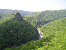
The Russell Fork River has spent millions of years sawing straight through Pine Mountain, and the result is the deepest gorge east of the Mississippi, over 1,000 feet in places and five miles long.

The Coal House
20 miles away
It is exactly what it sounds like, and it stops people in their tracks: a building made of coal.