

Monarch Pass
Colorado
Some drives ease you through the mountains. Monarch Pass hauls you straight up and over them. Here US Highway 50 leaves the ranch country around Salida and climbs, curve after curve, into the high peaks of the Sawatch Range until it tops out at 11,312 feet on the very spine of the continent. At the summit the trees fall away, the air thins, and Colorado's high country stacks up around you in every direction, ridge behind ridge behind ridge.
This is one of the great mountain crossings of the American West, the point where a major highway rides right over the Continental Divide, the invisible line that decides whether a raindrop ends up in the Atlantic or the Pacific. Unlike some of Colorado's famous passes, US 50 is a wide, plowed, year-round highway, so the drive is open in every season. It is a working road and a spectacular one at the same time, and an unforgettable way to travel between the towns of Salida and Gunnison.
Learn about Monarch Pass
The Road
Monarch Pass is the high point of US Highway 50 as it crosses central Colorado, a two-lane mountain highway that links the Arkansas River valley around Salida with the Gunnison country to the west. From the little crossroads town of Poncha Springs, the road bends southwest and begins a long, steady climb up Monarch Creek, gaining thousands of feet as it goes. The pass itself sits at 11,312 feet on the Continental Divide, which here also forms the boundary between Chaffee County on the east and Gunnison County on the west.
The driving experience is all about the climb and the descent. Heading west from Poncha Springs, the highway rises through thick spruce and fir forest, past the old mining site of Garfield and the Monarch Mountain ski area, tightening into switchbacks as it nears the top. At the summit you break out above treeline into a wide, wind-scoured saddle with a parking area, a gift shop, and long views down both sides of the divide. Then the road tips over and drops the other way, unwinding through the forest toward Sargents and the open valleys that lead on to Gunnison.
What makes the pass special is that it hands you a true high-alpine crossing without ever leaving the pavement. Big rigs and family cars share the same well-graded lanes, pullouts let you stop to catch your breath and the view, and the summit is a genuine destination, not just a sign you blow past. At better than eleven thousand feet the weather can turn in a hurry and the air holds far less oxygen than most travelers are used to, so the smart move is to slow down, take it easy, and give the mountains the respect they are due.
How to Get There
Monarch Pass sits on US Highway 50 in central Colorado, and the two main approaches come from the east and the west. Coming from Denver or Colorado Springs, the simplest route is to head to Salida. From Colorado Springs you can follow US 50 west the whole way, and from the Denver area many travelers come down through South Park on US 285 to Poncha Springs. Either way you meet US 50 at Poncha Springs, just west of Salida, and turn west to begin the climb toward the pass.
Coming from the west, from Grand Junction, Montrose, or the Gunnison area, you simply stay on US 50 and drive east. The highway carries you up through Sargents and the long forested grade to the summit, then down the far side into the Arkansas valley. Whichever direction you choose, US 50 does all the work, so there are no confusing turns to hunt for on the way to the top.
Because it is a major numbered highway rather than a back road, Monarch Pass is well signed and easy to find. Salida on the east and Gunnison on the west are the two natural staging towns, each with fuel, food, and lodging, and the pass sits roughly midway between them.
History
People have crossed this stretch of the Sawatch Range for a very long time. Long before any paved highway, the divide near Monarch was a route used by Ute people and later by prospectors and freighters drawn to the silver and mineral strikes of the 1870s and 1880s. A toll road first opened over the original crossing in 1880, in the middle of the silver boom, and the little settlement of Garfield on the east approach grew up as a mining and smelting camp in those same years.
The modern paved crossing took shape in the twentieth century. For years an earlier road climbed the divide by a slightly different line now known as Old Monarch Pass, a route that survives today as a scenic gravel road just to the north. The present highway alignment over Monarch Pass, carrying what became US Highway 50, was completed in the late 1930s to give central Colorado a dependable, plowed, year-round path across the mountains. That year-round reliability set it apart from higher, steeper passes nearby that close when the snow flies.
The summit stop grew into a landmark in the 1950s and 1960s. In 1954 a small gift shop and eatery opened at the top of the pass, and in 1966 an aerial tramway was built beside it, lifting visitors from the summit up to a viewpoint on the ridge above. Along with the Monarch Mountain ski area on the eastern approach, these turned a simple highway crossing into a place travelers stop on purpose rather than just drive over. The name itself comes from the mining days, borrowed from the Monarch mining district and the nearby camp of Monarch, once a busy silver settlement on the eastern slope.
It is worth being clear about one thing. US 50 over Monarch Pass is a major state and federal highway, not a specially designated scenic byway or All-American Road. It has never carried one of those formal national titles. What it offers instead is one of Colorado's most dramatic everyday drives, a genuine Continental Divide crossing on a road you can take in any season, which is exactly why so many travelers seek it out.
Little-Known Facts
- Monarch Pass tops out at 11,312 feet on the Continental Divide, the invisible ridge line that decides whether water flows toward the Atlantic or the Pacific. Rain falling on the east side heads eventually toward the Gulf of Mexico, and rain on the west side drains toward the Colorado River and the Pacific.
- Unlike Colorado's Independence Pass and some other high crossings that shut down for the winter, US 50 over Monarch is plowed and kept open year-round because it is a major highway, so it stays a dependable route even in the snowy months.
- An aerial tramway at the summit, built in 1966, carries visitors from the parking area up to a viewpoint on the ridge above the pass, where the panorama of the Sawatch Range opens up even wider.
- A toll road first crossed the divide here in 1880, during the silver boom, long before the present US 50 alignment was finished in the late 1930s.
- The pass sits right on the boundary between Chaffee County to the east and Gunnison County to the west, with the county line running along the same divide the highway crosses.
- An older route just to the north, now called Old Monarch Pass, is a scenic gravel road that once served as the main crossing before the present highway was built.
- The Continental Divide Trail and the Colorado Trail both cross US 50 near the summit, so long-distance hikers walking the spine of the Rockies pass right through the parking area on foot.
- Monarch Mountain, the ski area on the eastern approach, is known for reliable natural snowfall and sits at such high elevation that its season can run deep into spring.
Along the Route
Poncha Springs
Poncha Springs is the small crossroads town where the climb toward Monarch Pass really begins, sitting just west of Salida at the junction where US 285 meets US 50. It is a handy last stop for fuel, a snack, and a full tank before the long grade up the mountain. From here the highway bends southwest and starts gaining elevation almost right away, so it makes a natural launching point for the drive.
Garfield
Garfield is a tiny, near-ghost settlement along US 50 partway up the eastern climb, a quiet reminder of the mining and smelting camps that filled these valleys in the 1870s and 1880s. Only a handful of buildings remain beside the highway, tucked into the forest as the road tightens toward the pass. It is an easy place to notice how much history rides along an otherwise ordinary mountain highway.
Monarch Mountain Ski Area
Monarch Mountain is a ski area right on the eastern approach to the pass, known for deep natural snow and a high-elevation setting that keeps its season running long. In winter its lots and lifts hum with skiers just below the summit, and in the warmer months the surrounding peaks and trails draw hikers and mountain bikers. Sitting so near the top of the drive, it is often the last landmark before the highway breaks out above treeline.
Monarch Pass Summit and Continental Divide
The summit is the heart of the drive, an 11,312-foot saddle where US 50 rides directly over the Continental Divide. A parking area, a gift shop, and a viewpoint sit right at the top, and the Continental Divide and Colorado Trails cross the highway here, so you can step out and stand on the great watershed line of the continent. The air is noticeably thin and the weather turns fast, so take it slow and bring a warm layer even in summer.
Monarch Crest Tramway
The Monarch Crest Tramway lifts visitors from the summit parking area up an aerial cable to a viewpoint on the ridge above the pass. From the top the panorama of the Sawatch Range spreads out even wider than it does from the highway, a genuine bird's-eye look at the roof of the Rockies. The tramway runs seasonally in the warmer months, so it is a fair-weather add-on rather than a year-round stop.
Sargents
Sargents is a small community on the western descent, the first real settlement as the highway unwinds down from the pass toward the Gunnison country. It offers a quiet place to pause, stretch, and let brakes cool after the long grade off the summit. From here the road eases into more open valley country on the way to Gunnison.
Gunnison
Gunnison is the main hub town on the western end of the drive, a high mountain valley community with full services, a college, and a long ranching and outdoor-recreation tradition. It is the natural place to fuel up, eat, and rest at the western foot of the crossing, just as Salida anchors the eastern side. Beyond town the road continues toward the Black Canyon country and the western slope.
Details
Salida to Gunnison
Frequently asked questions
Is US 50 over Monarch Pass a designated scenic byway?
No. US Highway 50 over Monarch Pass is a major state and federal highway, not a formally designated scenic byway or All-American Road, and it has never carried one of those national titles. It is prized instead as one of Colorado's most dramatic everyday drives, a true Continental Divide crossing that stays open in every season.
How high is Monarch Pass, and how long does the drive take?
Monarch Pass tops out at 11,312 feet on the Continental Divide. The mountain crossing itself, from Poncha Springs on the east to Sargents on the west, is roughly thirty miles and takes about forty-five minutes to an hour of steady driving, though most travelers give it longer to stop at the summit and enjoy the views.
What are the must-see stops along Monarch Pass?
The clear highlight is the summit itself, where US 50 crosses the Continental Divide at 11,312 feet, with a gift shop, a viewpoint, and the Continental Divide and Colorado Trails right at the parking area. Other stops include the seasonal Monarch Crest Tramway up to a ridgetop viewpoint, the Monarch Mountain ski area on the eastern approach, and the old mining site of Garfield along the climb.
Is it free to drive over Monarch Pass?
Yes. Driving US 50 over Monarch Pass is free, since it is a public highway with no toll and no pass required. Some attractions at the summit, such as the aerial tramway, charge their own admission, and lift tickets apply at the Monarch Mountain ski area, but the drive across the pass costs nothing.
What is the best time of day or year to drive Monarch Pass?
The pass is beautiful year-round. Summer and early fall bring the mildest driving weather and the widest range of open trails and the seasonal tramway, while winter offers snowy alpine scenery and access to the Monarch Mountain ski area. Clear mornings tend to be calmest, since high-country afternoons can bring fast-moving storms, so an earlier start is often the safer choice in any season.
Is Monarch Pass open year-round?
Yes. Unlike some of Colorado's higher passes that close for the winter, US 50 over Monarch Pass is a major highway that is plowed and kept open all year. Winter storms can still bring snow, ice, and temporary traction or chain requirements, so check current road and weather conditions before you set out in the cold months.
Do you need four-wheel drive to cross Monarch Pass?
No. US 50 over Monarch Pass is a paved, well-maintained two-lane highway, and in good conditions a standard passenger car handles it fine. Four-wheel drive is not required, but in winter storms Colorado may post traction or chain laws, so carrying winter tires or chains and knowing how to use them is wise in the cold season.
What are the winter driving conditions on Monarch Pass?
In winter the pass can see heavy snow, ice, and blowing wind near the summit, and the state may enact traction or chain requirements during storms. The road is plowed and stays open, but conditions change quickly at this elevation, so slow down, leave extra room, carry warm clothing and emergency gear, and check current conditions before driving. Give plows and treatment time to work after a storm.
Where can I get fuel and food along the drive?
Plan your fuel and food around Salida on the east side and Gunnison on the west, the two hub towns at either foot of the crossing. Poncha Springs, just west of Salida, is a good last stop before the climb. At the summit itself there is only a gift shop, not full services, so top off your tank and grab what you need in town before heading over the pass.
How does the thin air at the summit affect visitors?
At 11,312 feet the air holds far less oxygen than most travelers are used to, so even a short walk at the summit can leave you short of breath, and some people feel lightheaded or headachy. Take it slow, drink water, and do not be surprised if you tire quickly. Bring a warm layer as well, since it can be cold and windy at the top even when it is warm in the valleys below.
Nearby

Monarch Pass
0.1 miles away
Monarch Pass carries US 50 over the Continental Divide at 11,312 feet, about 20 miles west of Salida, where the highway tops out above treeline with the peaks of the Sawatch Range stacking up in every...

St. Elmo Ghost Town
14 miles away
St. Elmo is one of the best-preserved ghost towns in Colorado, a full main street of weathered wooden storefronts left standing at 10,000 feet where a silver-and-gold boom died out after 1880.
Arkansas Headwaters Recreation Area
18 miles away
A 150-mile ribbon of the Arkansas River protected as a state recreation area, the most-rafted whitewater in the country, running from the high mountains toward the plains.
Salida Whitewater Park
18 miles away
A free downtown river park where about a quarter mile of the Arkansas River is shaped into standing surf waves and rapids, right along Salida's historic F Street district.
Mount Princeton Hot Springs
18 miles away
At the base of 14,197-foot Mount Princeton, natural hot water surfaces right in the bed of Chalk Creek, so you can build your own rock-lined soaking pool in the cold rushing stream a few feet away.

Independence Pass
39 miles away
Independence Pass at 12,095 feet on CO-82 between Leadville and Aspen is the highest paved mountain pass in the United States with two-way traffic, open roughly late May through early November.
Great Sand Dunes National Park
63 miles away
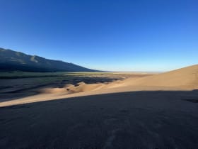
The tallest dunes in North America, piled against the Sangre de Cristo Mountains with a creek at their feet.