
Arkansas Headwaters Recreation Area
307 W Sackett Ave
Salida, CO
One hundred and fifty miles of the most-rafted whitewater in the country, dropping through granite canyons from the high mountains toward the plains.
The Arkansas River is born in the snowfields high above Leadville, and for its first 150 miles it falls fast and hard toward the plains, dropping more than four thousand feet as it goes. That plunging, boulder-strewn stretch is protected as the Arkansas Headwaters Recreation Area, and it has become the busiest whitewater river in the United States, with more commercial rafting trips run here than anywhere else in the country.
It is not one park you drive into and out of. It is a long green thread of public river that you follow by road, launching and pulling out at more than twenty-five sites strung along the highway from Leadville down through Buena Vista, Salida, and on to Cañon City. The joint headquarters and visitor center sits in Salida, a good place to get a map, a pass, and a read on the water before you put in.
What Travelers Love
- Rafting and kayaking runs for every level, from gentle family floats to Class IV and V rapids
- Roadside access to the water at more than two dozen boat launches, picnic sites, and river overlooks
- Some of the best river fishing in Colorado, on a Gold Medal stretch of the Arkansas
- The scale of it: a canyon river you can follow by car for a whole day, with mountains overhead the entire way
Worth Knowing
- A daily parks pass is required to use the river sites, sold at the Salida visitor center and at self-serve stations along the way
- Rapids run from easy Class II floats to serious Class IV and V water, so pick a section that matches your experience or go with a licensed outfitter
- The river is snowmelt cold and runs highest in late spring and early summer, then mellows through late summer, so the season shapes what you can do
- There are no services at most river sites, so bring water, sun protection, and everything you need before you leave town
Learn about Arkansas Headwaters Recreation Area
A river that falls off the mountains
What makes the upper Arkansas so exciting is simple: it drops. From the headwaters near Leadville down to Cañon City, the river loses about 4,650 feet of elevation, and all that falling water has to go somewhere. In the wide, open valley above Salida it runs quick but forgiving, with long Class II and III stretches that are perfect for a first raft trip or a family float. Then the land closes in and the river gets serious.
Below Salida the Arkansas squeezes into Bighorn Sheep Canyon and finally into the Royal Gorge, a narrow slot of granite walls where the water piles up into big Class IV and V rapids. Between the two extremes lies Browns Canyon, a stretch so wild and beautiful it was named a national monument in 2015. On a single day you can float glassy water under snow-capped peaks in the morning and watch expert boaters punch through standing waves in the afternoon.
From mining river to protected water
For most of its history this stretch of the Arkansas was working country. Ute people knew the valley long before settlers arrived, and later the river powered mining and ranching, with the railroad following the water down through Salida on its way to the mines of Leadville. As the towns quieted and rafting boomed, the river started drawing crowds of a different kind, and the pressure on its banks began to show.
In 1989 the state and federal land managers agreed to run the corridor together, and the recreation area was formally established in 1998 to protect the river and manage the flood of visitors. Today it is jointly cared for by Colorado Parks and Wildlife, the Bureau of Land Management, and the U.S. Forest Service, an unusual three-way partnership that keeps the water clean, the launches open, and the fishing among the best in the state.
More than rafting
The rapids get the headlines, but the recreation area is a whole outdoor world. The Arkansas here is a Gold Medal trout stream, a Colorado designation for the very best fishing water, and anglers wade the pocket water for brown and rainbow trout all season. The bighorn sheep that give one canyon its name graze the rocky slopes, and eagles, deer, and river otters share the corridor.
Along the banks you can hike, mountain bike, rock climb the canyon walls, or try your hand at gold panning in the shallows, a nod to the mining past. Dozens of picnic sites and simple campgrounds sit right at the water's edge, so you can make it a full day or a full week. In winter the crowds vanish and the river runs low and quiet under the peaks, a different kind of beautiful.
Visiting the recreation area
The easiest way to start is in Salida, where the joint visitor center hands out river maps, sells the required daily pass, and can tell you which sections are running well. From there the whole corridor is a short drive: Browns Canyon and the family floats lie upstream toward Buena Vista, and the bigger water waits downstream toward Cañon City and the Royal Gorge.
If you have never rafted, the smart move is to book with one of the licensed outfitters in Salida or Buena Vista, who supply the boat, the gear, and a guide who knows the river cold. If you bring your own boat, match the section to your skill honestly, since the water is cold and the rapids are real. Either way, give the Arkansas a full day. It is the kind of river you follow from the mountains toward the plains and remember for the rest of the trip.
Closest Boutels
The closest Boutel™ stays, so you can turn this stop into an overnight. Each is a place we chose through independent editorial review, never a paid placement.
Details
Salida, CO
Frequently asked questions
What is the Arkansas Headwaters Recreation Area?
The Arkansas Headwaters Recreation Area protects a scenic stretch of the upper Arkansas River in central Colorado, running through the beautiful mountain valley from around Leadville and Buena Vista down through Salida toward Cañon City. Renowned as one of the most popular whitewater rafting destinations in the country, the area offers world-class rafting and kayaking, along with excellent fishing, camping, hiking, and stunning scenery framed by the towering Collegiate Peaks and other mountains. Managed for recreation and conservation, the Arkansas Headwaters Recreation Area is a premier outdoor playground, drawing river enthusiasts, anglers, and nature lovers to the beautiful upper Arkansas River valley.
What can you do at the Arkansas Headwaters Recreation Area?
You can go whitewater rafting or kayaking on the famous rapids, including through the popular Browns Canyon National Monument, fish for trout in the gold-medal waters, camp at riverside sites, hike and bike the trails, picnic, and enjoy the beautiful mountain scenery. Guided rafting trips make the whitewater accessible for all levels, from gentle floats to exciting rapids. The area is a hub for river recreation. With its world-class rafting, excellent fishing, camping, and stunning scenery along the upper Arkansas River, the Arkansas Headwaters Recreation Area offers a premier outdoor destination in central Colorado.
What safety precautions should I take at the Arkansas Headwaters Recreation Area?
The Arkansas River can run swift, cold, and powerful, especially during spring and early summer snowmelt when flows peak, so whitewater rafting and kayaking should be done with proper skills, equipment, and often professional guides, and swimming in the fast river is dangerous. Always wear a life jacket on the water, be aware of the cold temperatures and strong current, and watch children closely near the river. Checking current river conditions and choosing trips suited to the flow and your ability, while using guides for whitewater, are essential for a safe experience on the Arkansas.
When is the best time to visit the Arkansas Headwaters Recreation Area?
Late spring and early summer bring the highest, most exciting whitewater flows from snowmelt, making it prime rafting season, though the water is powerful and cold, while mid to late summer offers a range of flows good for rafting of all levels, fishing, and family river fun, and fall brings pleasant weather and beautiful color. For big whitewater, aim for late spring through early summer with a guide, and for a range of activities and calmer conditions, summer is ideal. Checking current river conditions helps you plan the right experience for the season.
What is near the Arkansas Headwaters Recreation Area?
The recreation area follows the upper Arkansas River through central Colorado, near the towns of Buena Vista and Salida with their whitewater and mountain charm, the towering Collegiate Peaks, Browns Canyon National Monument, and within reach of Leadville to the north and the Royal Gorge near Cañon City downstream. That makes the Arkansas Headwaters Recreation Area a premier river-recreation destination to combine with Buena Vista, Salida, Browns Canyon, and the mountain attractions of central Colorado on a visit to the state.
Nearby
Salida Whitewater Park
0.7 miles away
A free downtown river park where about a quarter mile of the Arkansas River is shaped into standing surf waves and rapids, right along Salida's historic F Street district.

Monarch Pass
9.4 miles away
Monarch Pass carries US 50 over the Continental Divide at 11,312 feet, about 20 miles west of Salida, where the highway tops out above treeline with the peaks of the Sawatch Range stacking up in every...
Mount Princeton Hot Springs
17 miles away
At the base of 14,197-foot Mount Princeton, natural hot water surfaces right in the bed of Chalk Creek, so you can build your own rock-lined soaking pool in the cold rushing stream a few feet away.

St. Elmo Ghost Town
22 miles away
St. Elmo is one of the best-preserved ghost towns in Colorado, a full main street of weathered wooden storefronts left standing at 10,000 feet where a silver-and-gold boom died out after 1880.

Independence Pass
42 miles away
Independence Pass at 12,095 feet on CO-82 between Leadville and Aspen is the highest paved mountain pass in the United States with two-way traffic, open roughly late May through early November.
Great Sand Dunes National Park
55 miles away
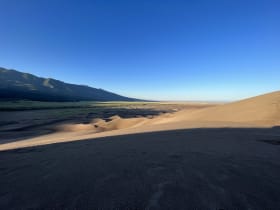
The tallest dunes in North America, piled against the Sangre de Cristo Mountains with a creek at their feet.