
Grand Staircase-Escalante National Monument
755 W Main St, Escalante, UT
Escalante, UT
A staircase of cliffs climbing across southern Utah, threaded with slot canyons, hidden waterfalls, and country you can walk for days without seeing another soul.
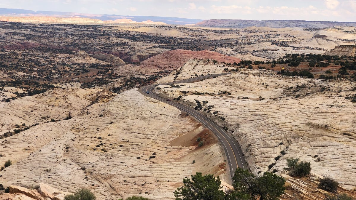
Grand Staircase-Escalante is one of the largest and wildest tracts of public land in the American West, an immense country of stepped cliffs, deep slot canyons, hidden waterfalls, and high plateaus that few travelers ever fully explore. Its name comes from a great sequence of cliffs that climb north across the land like a giant staircase, each riser a different band of colored rock, from the Chocolate Cliffs at the bottom to the Pink Cliffs of Bryce far above.
This is not a park of overlooks and easy loops so much as a place to wander into. Roads are few and mostly dirt, services are thin, and the reward for a little effort is a canyon all to yourself. Threaded through it is Scenic Byway 12, widely called one of the most beautiful drives in the country, linking the small ranching towns of Escalante and Boulder.
What Travelers Love
- Slot canyons where the walls close in to a shoulder's width and the light turns gold
- Hidden waterfalls and pools tucked in the desert, like Lower Calf Creek Falls
- The scenic drive over Highway 12, one of the great roads in America
- The sheer wildness and quiet of one of the least-developed places in the country
Worth Knowing
- This is remote backcountry; carry plenty of water, tell someone your plans, and check conditions
- Flash floods are a deadly risk in slot canyons, so never enter when storms are possible upstream
- Many roads are dirt and can turn to impassable mud when wet, so watch the forecast
- Cell service is scarce; download maps and plan your fuel before heading out
Learn about Grand Staircase-Escalante National Monument
Reading the Grand Staircase
The Grand Staircase is a giant flight of cliffs and terraces that steps up more than a mile in elevation over roughly a hundred miles, from the depths of the Grand Canyon far to the south up to the rim country near Bryce. Geologists prize it because the layers are so cleanly exposed, one atop another, that you can read hundreds of millions of years of the earth's history simply by walking or driving from the bottom step to the top.
Each cliff band is named for its color, the Chocolate, Vermilion, White, Gray, and Pink Cliffs, and each records a different ancient world of seas, deserts, and river deltas. The Escalante half of the monument, cut by the Escalante River and its side canyons, is where much of that rock has been carved into the slots, arches, and hidden falls that draw hikers today.
A long human story
People have lived in and traveled this country for thousands of years. The Ancestral Puebloan and Fremont peoples farmed the canyon bottoms and mesa tops, and their granaries, dwellings, and rock art still survive in quiet corners of the monument. This is the ancestral homeland of the Southern Paiute and Ute peoples as well, whose descendants remain in the region and hold deep ties to the land. Please leave every site and artifact exactly as you find it.
The Escalante River was among the last rivers in the lower forty-eight to be found and named by American explorers, a measure of how remote this country stayed. Mormon settlers reached the area in the 1870s and founded the little towns of Escalante and Boulder, ranching and farming in the narrow valleys. Boulder was so isolated that mail came in by mule train into the twentieth century, and a paved road did not connect it to the outside world until the 1980s.
Slots, falls, and the great drive
The most beloved way in is the hike to Lower Calf Creek Falls, an easy walk up a green side canyon to a tall, cool waterfall dropping into a pool, past hanging gardens and ancient rock art on the cliffs. Elsewhere the Escalante country hides famous narrow slots, where the sandstone walls squeeze so close you turn sideways and the sky becomes a thin ribbon overhead. Some are short and gentle, others demand real skill and route-finding.
For those who would rather ride than walk, Scenic Byway 12 threads the whole region, climbing over a knife-edge ridge with drop-offs on both sides, winding through red rock and aspen, and opening onto vast overlooks. It is a destination in itself, and many visitors experience the monument mostly from its pullouts and short spur trails, which is a fine way to see it.
Wildlife, seasons, and solitude
For all its bare stone, the monument teems with life. Mule deer, pronghorn, and desert bighorn range the country, coyotes and foxes hunt the flats, and mountain lions move unseen through the canyons. Golden eagles and peregrine falcons ride the cliffs, and the streams support cottonwoods, hanging gardens of ferns, and the occasional beaver.
Spring and fall are the prime seasons, with mild days and manageable water in the canyons, while summer brings fierce heat and the very real danger of flash floods during monsoon storms. Winter is cold and quiet, with snow on the higher plateaus and few visitors. In every season, the defining experience here is solitude, the chance to stand in a great empty landscape with only the wind for company.
Closest Boutels
The closest Boutel™ stays, so you can turn this stop into an overnight. Each is a place we chose through independent editorial review, never a paid placement.
Details
Escalante, UT
Frequently asked questions
What is Grand Staircase-Escalante National Monument?
It is a vast, rugged, and remote national monument in southern Utah, protecting an immense landscape of canyons, slot canyons, cliffs, arches, hoodoos, and the colorful tiers of rock that give the grand staircase its name. Wild and largely undeveloped, it is a paradise for adventurous, self-sufficient explorers who want to experience the red-rock desert far from crowds. From easy hoodoo wanders to challenging slot canyons, it offers some of the most spectacular backcountry in the Southwest.
What are the best things to do in Grand Staircase-Escalante?
Highlights include wandering among the whimsical hoodoos and small arches of Devil's Garden, an easy and family-friendly spot off Hole-in-the-Rock Road, and hiking famous slot canyons like Peek-a-Boo, Spooky, and the striped Zebra Slot. Waterfalls such as Lower Calf Creek Falls and scenic drives round out the options. The range means you can find gentle exploring or serious adventure, but many of the best sights lie down unpaved backroads.
How dangerous are flash floods and the backroads here?
Both demand real caution. Slot canyons and washes are prone to sudden, deadly flash floods, so it is critical to check the weather and never enter them when rain is possible anywhere upstream. The monument's dirt roads, including Hole-in-the-Rock Road, can turn to impassable mud when wet, stranding even four-wheel-drive vehicles, so check road conditions before heading out. This is remote country where preparation and weather awareness are matters of safety, not convenience.
When is the best time to visit Grand Staircase-Escalante?
Spring and fall, roughly April into early June and September through October, offer the most pleasant temperatures, since summer brings dangerous desert heat. The soft light of early morning and late afternoon is beautiful on the red sandstone. Whatever the season, watch the weather closely for storms that trigger flash floods and muddy roads, and plan around them, since conditions here change fast and can turn hazardous.
What should I know before exploring Grand Staircase-Escalante?
This is genuinely remote wilderness with few services, little water, no shade, and unreliable cell coverage, so come fully self-sufficient: carry ample water, food, and fuel, bring a good map and navigation tools, and tell someone your plans. A high-clearance or four-wheel-drive vehicle helps on many backroads in dry conditions. Know your route and your limits, respect the weather, and treat the fragile desert with care by staying on established routes where possible.
Nearby

Glen Canyon National Recreation Area
17 miles away
Glen Canyon NRA encompasses Lake Powell, the second-largest man-made reservoir in the US. The reservoir is surrounded by canyon walls of Navajo Sandstone.

Horseshoe Bend
29 miles away
Horseshoe Bend is a 270-degree meander of the Colorado River visible from a sandstone cliff 1,100 feet above the water.

UT-12 Scenic Byway
29 miles away
Utah Highway 12 runs 124 miles from US-89 near Panguitch to Torrey near Capitol Reef, crossing five distinct geological formations and three national park corridors.

Kodachrome Basin State Park
30 miles away
Kodachrome Basin has 67 solid rock spires (called "sand pipes") rising from a basin floor of red and white sandstone.

Bryce Canyon National Park
43 miles away
The largest concentration of hoodoos on Earth, a natural amphitheater of orange and pink stone spires.