

Fremont Indian State Park
13536-12320 Clear Creek Canyon Rd, Sevier, UT
Sevier, UT
The site of one of the largest Fremont villages ever discovered, its canyon walls covered in ancient rock art and its story told in a museum full of what the diggers found.
Fremont Indian State Park preserves the site of one of the largest villages of the Fremont people ever discovered, a community that lived and farmed in Clear Creek Canyon roughly a thousand years ago. The village came to light in the 1980s when highway construction cut through the canyon, and archaeologists rushed to excavate before the road was built, recovering an extraordinary trove of pottery, tools, jewelry, and food remains.
That rescued material now fills the park's museum, telling the story of the Fremont in vivid detail, while the canyon walls all around hold hundreds of their pictographs and petroglyphs, painted and pecked images of people, animals, and symbols. A network of short interpretive trails leads to the rock art panels and village features, making this one of the best places anywhere to encounter the ancient Fremont culture up close.
What Travelers Love
- Hundreds of Fremont rock art panels visible on short, accessible trails
- A rich museum displaying pottery, tools, and artifacts recovered from the village site
- Easy interpretive trails that make the ancient culture come alive for all ages
- A convenient, uncrowded stop right off the interstate with real depth of history
Worth Knowing
- Rock art is fragile and irreplaceable, so look and photograph but never touch or deface it
- Trails climb rocky canyon slopes, so wear sturdy shoes and carry water in warm months
- The park sits in high desert, hot in summer sun and cold in winter, so dress for the season
- Some trails are short and easy while others climb steeply, so choose to match your group
Learn about Fremont Indian State Park
The Fremont people of Clear Creek
The Fremont people lived across much of what is now Utah roughly a thousand years ago, a culture that farmed corn, beans, and squash, hunted and gathered wild foods, and built pit houses and stone granaries. They are known for distinctive gray pottery, one-rod-and-bundle basketry, moccasins made from deer hide, and a striking rock art style of broad-shouldered human figures with elaborate headdresses and ornaments.
In Clear Creek Canyon the Fremont built a large village, farming the canyon bottom and covering the surrounding cliffs with their art. Over time, as the climate shifted, the Fremont way of life faded, and the people moved, merged with, or gave rise to other groups. The Southern Paiute and Ute peoples have long lived in this region, and their descendants remain in Utah today, holding continuing ties to the land and its ancient sites.
A village rescued from the road
For centuries the great village lay quietly buried in Clear Creek Canyon. Then in the early 1980s, as a new stretch of interstate highway was being built through the canyon, construction crews uncovered the extent of the site, an enormous Fremont settlement directly in the path of the road. Archaeologists were brought in for an urgent salvage excavation, working against the clock to recover what they could before the highway went through.
What they found was remarkable, the remains of many pit houses and granaries and thousands of artifacts, from painted pottery and stone tools to woven baskets and the everyday objects of Fremont life. To honor the discovery, the state created Fremont Indian State Park, building a museum to hold and display the recovered treasures and preserving the surrounding canyon with its wealth of rock art for visitors to explore.
The rock art and the trails
Clear Creek Canyon holds one of the richest concentrations of rock art in Utah, with hundreds of panels scattered across its cliffs. Some images are pictographs, painted onto the rock, while others are petroglyphs, pecked and carved into it, and together they depict human figures, bighorn sheep, snakes, handprints, and abstract symbols whose meanings we can only guess at. A number of the panels lie along short, easy trails right from the museum.
A network of interpretive trails threads through the canyon, some flat and accessible, others climbing the rocky slopes to more distant panels and viewpoints. Signs along the way explain the Fremont culture and point out features in the rock, turning a walk through the canyon into a walk through a thousand-year-old community. A reconstructed pit house and granary help visitors picture how the villagers actually lived.
The canyon, its wildlife, and the seasons
Clear Creek Canyon is a place of volcanic rock, sagebrush, and pinyon-juniper woodland, cut by a creek that draws life to the canyon bottom. Mule deer, rabbits, and lizards move through the brush, songbirds and canyon wrens call from the cliffs, and hawks and eagles ride the winds overhead. Along the creek, cottonwoods and willows shade a green ribbon through the dry country.
Spring and fall bring the most pleasant weather for exploring the trails and rock art, mild and clear. Summer is hot in the exposed canyon, so early hours and plenty of water are wise. Winter is cold and quiet, sometimes dusting the canyon and its ancient art with snow, and the park settles into an off-season calm, though the museum remains a warm and welcoming stop year-round.
Closest Boutels
The closest Boutel™ stays, so you can turn this stop into an overnight. Each is a place we chose through independent editorial review, never a paid placement.
Details
Sevier, UT
Frequently asked questions
What is Fremont Indian State Park?
Fremont Indian State Park, in Clear Creek Canyon along Interstate 70 in central Utah, protects the site of the largest known village of the ancient Fremont culture, discovered during the interstate's construction, along with an extraordinary concentration of rock art. A museum displays artifacts recovered from the site, and trails lead to hundreds of petroglyphs and pictographs on the canyon walls. It offers a fascinating, accessible window into the lives of the Fremont people who thrived here roughly a thousand years ago.
What can you see at Fremont Indian State Park?
The park's highlights are its rock-art panels, with hundreds of petroglyphs and pictographs viewable along canyon trails, and its museum, which houses pottery, tools, and other artifacts along with a recreated pit house showing how the Fremont lived. Interpretive trails of varying lengths lead to the art and viewpoints. Beyond the archaeology, the park also offers camping, hiking, and off-highway trails in the scenic canyon setting.
How should visitors treat the rock art at Fremont Indian State Park?
The petroglyphs and pictographs are fragile, irreplaceable cultural treasures, so never touch them, since the oils on your skin damage the ancient images, and never add graffiti. Stay on the designated trails and view the art from the established areas. Treating these sites with respect helps preserve them for future generations and honors the heritage of the Fremont people and the tribes connected to this land.
When is the best time to visit Fremont Indian State Park?
Spring and fall offer the most comfortable temperatures for hiking the canyon trails to the rock art, while summer can be hot, so bring water and sun protection and consider walking the trails earlier or later in the day. The angle of light affects how easily some petroglyphs stand out, so mid-morning to afternoon can be good for viewing. There is an entrance fee, and the museum makes a worthwhile stop in any season.
What is near Fremont Indian State Park?
The park sits along Interstate 70 in central Utah near Sevier, close to the colorful roadside landmark of Big Rock Candy Mountain and the recreation of the Sevier River corridor. It lies on a scenic connecting route between the interstate and southern Utah's parks like Bryce Canyon and Capitol Reef. That makes Fremont Indian State Park an easy, enriching stop to break up a longer drive with a dose of ancient history.
Outside the Park

Big Rock Candy Mountain
7.5 miles away
Big Rock Candy Mountain is a bright yellow-and-orange hillside that rises right beside US-89 in Marysvale Canyon, its colors the result of hot volcanic fluids bleaching and staining the old rock.
Cove Fort Historic Site
11 miles away
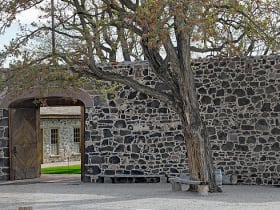
Cove Fort was built in 1867 under the direction of Brigham Young as a way station between settlements in the Sevier Valley and Beaver to the south.

Territorial Statehouse
26 miles away
Fillmore was Utah's first territorial capital, designated by Congress in 1851 as the midpoint between Salt Lake City and the southern settlements.

Capitol Reef National Park
63 miles away
A hundred-mile wrinkle in the earth called the Waterpocket Fold, plus historic orchards you can still pick from.

Bryce Canyon National Park
66 miles away
The largest concentration of hoodoos on Earth, a natural amphitheater of orange and pink stone spires.