
Chain of Craters Road
Chain of Craters Road, Hawaii Volcanoes National Park, HI
Volcano, HI
Drive nearly 20 miles from the volcano's summit down to the rugged sea.
Chain of Craters Road winds nearly 20 miles from the summit area of Kilauea down to the sea, dropping some 3,700 feet through an ever-changing volcanic landscape. Along the way, it passes craters and cinder cones, vast hardened rivers of black lava from past eruptions, pockets of forest, and sweeping views of the coastline far below.
The road ends abruptly near the coast at a place where a lava flow once poured across and buried the pavement, a vivid reminder that this is a living volcanic landscape still being reshaped. A dead-end drive with no services, it rewards those who take it slowly with striking, varied scenery, from summit rainforest to the rugged black shore of the Pacific.
What Travelers Love
- A dramatic drive from the summit to the sea
- Craters, cinder cones, and vast lava flows
- Sweeping coastal views along the way
- The road's end, where lava buried the pavement
Worth Knowing
- It is inside Hawaii Volcanoes National Park
- It is a dead-end road; there are no services along it
- Fill up on gas, water, and food before driving it
- Allow a few hours for the round trip with stops
Learn about Chain of Craters Road
The drive down
Descending from the summit, Chain of Craters Road passes a series of pit craters, remnants of past volcanic activity, and cinder cones, before entering the vast plains of hardened lava that spread across the landscape. These lava flows, some smooth and ropy, others jagged, record eruptions from recent decades and lend the drive an otherworldly feel.
Pullouts and short trails along the way let visitors stop to look into craters, walk out onto lava, and take in the expanding coastal views as the road drops toward the ocean. Interpretive signs help explain the geology and the eruptions that shaped what you are seeing.
The end of the road and planning
Near the coast, the road reaches a dramatic conclusion where a lava flow crossed and buried it, leaving the pavement to simply end at a wall of hardened black rock, a striking demonstration of the volcano's power. Nearby, ancient Hawaiian petroglyphs and coastal features can be explored.
Because Chain of Craters Road is a dead-end route with no gas, food, or water along its length, it is important to fuel up and bring supplies before driving it, and to allow a few hours for the round trip with stops. There is little shade and the sun and lava can make it hot, so water and sun protection are essential. Check current conditions, as volcanic activity can occasionally affect access.
Closest Boutels
The closest Boutel™ stays, so you can turn this stop into an overnight. Each is a place we chose through independent editorial review, never a paid placement.
Details
Volcano, HI
Frequently asked questions
What is Chain of Craters Road?
Chain of Craters Road is a scenic drive in Hawaii Volcanoes National Park that winds nearly 20 miles from the summit area of Kilauea down to the coast, dropping about 3,700 feet in elevation. Along the way, it passes pit craters, cinder cones, and vast plains of hardened black lava from past eruptions, along with pockets of forest and sweeping views of the coastline. The road ends near the sea at a place where a lava flow once buried the pavement, a vivid reminder of the living volcanic landscape. With no services along its length, it is a dead-end route that rewards unhurried driving with striking, varied scenery, from summit rainforest to the rugged black shore, making it a highlight of any visit.
How long does it take to drive Chain of Craters Road?
Driving Chain of Craters Road takes roughly 45 minutes to an hour each way without stopping, but you should plan for much more time to truly experience it, typically a few hours round trip or more. The road is nearly 20 miles long one way and is a dead end, so you must drive back up the way you came. Along the route are numerous pullouts, overlooks, craters, lava flows, and short trails worth stopping for, and at the end are the buried road and nearby petroglyphs and coastal features to explore. Allowing several hours lets you enjoy these stops rather than rushing. Because there are no services along the road, fuel up and bring water, food, and sun protection beforehand, and start with enough daylight to complete the round trip comfortably.
Why does Chain of Craters Road end?
Chain of Craters Road ends near the coast because a lava flow buried the road. In the past, the road actually continued farther and connected to other areas, but eruptions from Kilauea sent lava flows across the pavement, covering sections of it under hardened black rock. Rather than repeatedly rebuild a road that lava kept overrunning, the park left the buried section, and today the road simply ends at a wall of hardened lava, where you can see the pavement disappear beneath the black rock. It is a dramatic and humbling demonstration of the volcano's power to reshape the landscape, and it is one of the memorable sights at the road's end. This is also why the road is now a dead-end route rather than a through road.
What should you bring to drive Chain of Craters Road?
Because Chain of Craters Road is a long, dead-end route with no gas stations, stores, food, or water anywhere along its nearly 20-mile length, you should come prepared before driving it. Fill your gas tank beforehand, and bring plenty of drinking water, snacks or food, and sun protection such as a hat, sunscreen, and sunglasses, since much of the drive crosses open lava fields with little shade and can be hot and bright. Sturdy shoes are helpful if you plan to walk on the lava or short trails. It is also wise to start with enough daylight to complete the round trip, to check current park conditions in case volcanic activity affects access, and to carry a map. With these basics, you can comfortably enjoy the dramatic scenery, craters, lava flows, coastal views, and the buried road at the end.
Nearby
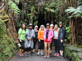
Thurston Lava Tube
11 miles away
Thurston Lava Tube, known in Hawaiian as Nahuku, is a walkable lava tube near the Kilauea summit, a natural tunnel formed when the outer crust of a lava river hardened while molten lava drained away i...
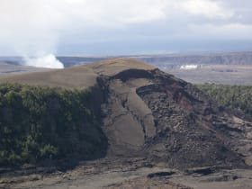
Kilauea Iki Trail
12 miles away
The Kilauea Iki Trail descends through rainforest to the floor of a crater that held a churning lava lake during a 1959 eruption, letting hikers walk straight across the now-solid but still-steaming l...

Kilauea Caldera
14 miles away
Kilauea is one of the most active volcanoes on Earth, and its summit caldera, with the Halemaumau crater at its heart, is the centerpiece of Hawaii Volcanoes National Park.