
Allegheny River Trail
Allegheny River Trail
Foxburg, PA
A smooth, flat river trail on an old railroad grade, running past two long stone tunnels and an ancient carved boulder, right where the Allegheny is protected as a Wild and Scenic River.
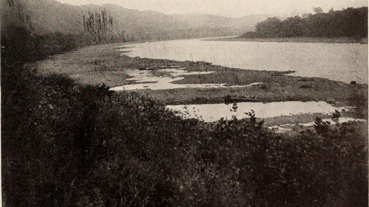
The Allegheny River Trail is one of the finest rail-trails in Pennsylvania, a smooth, level ribbon of asphalt laid on an old railroad grade that runs for about thirty miles beside the Allegheny River in the northwest corner of the state. It threads together the river towns of Franklin, Emlenton, and Foxburg, and for most of its length the wide, clean river is right at your elbow on one side while wooded bluffs rise on the other. Because it follows a former rail line, it is almost perfectly flat, which is what makes it such a joy on a bike or on foot for people of all ages.
What sets it apart from an ordinary bike path is everything the old railroad left behind. Two long stone-lined tunnels, cool and completely dark inside, still carry the trail straight through the hills. An ancient carved boulder sits at the river's edge. And the river itself, along this reach, is protected as a national Wild and Scenic River, so the water runs clear and the birdlife is rich. Rails to Trails named it one of the state's ten best trails, and once you have ridden through a tunnel with the far end just a pinpoint of light ahead, it is easy to see why.
What Travelers Love
- A long, flat, paved path that hugs the Allegheny River almost the whole way, easy for bikes, families, and walkers alike
- Riding or walking straight through two long, cool, pitch-dark railroad tunnels, a highlight you feel as much as see
- Bald eagles, herons, and other wildlife drawn to a river clean enough to earn Wild and Scenic protection
- Stopping at Indian God Rock, a boulder covered in Native American carvings right at the water's edge
Worth Knowing
- The two tunnels are genuinely dark inside, so bring a light or a bike headlamp even in daytime, and go slowly past other people
- The main paved section runs from Franklin to Emlenton, and the stretch down to Foxburg is older and rougher, better on a mountain bike or on foot
- It is a river trail, so it can be cool and shady, and low spots may hold water or mud after heavy rain
- There are several trailheads with parking along the way, so you can pick a short out-and-back rather than the whole length
Learn about Allegheny River Trail
From a busy oil-country railroad to a quiet trail
The path you ride today was once a working railroad. The Allegheny Valley Railroad reached up this river valley in the 1860s to serve the oil fields around Oil City and Franklin, the very cradle of the world's petroleum industry, and the line later became part of the giant Pennsylvania Railroad. To straighten out the river's sharp bends and speed up the trains, the railroad bored long tunnels straight through the hills, a huge undertaking for the time.
As the oil traffic faded and the railroads pulled back, the grade fell silent. In the 1990s local trail advocates, with help from the National Park Service, studied the corridor and set about turning it into a trail, and over the following years they paved a beautiful eight-foot-wide surface from Franklin down toward Emlenton and Foxburg. The old tunnels were reopened and paved through in the early 2000s, and a busy freight line became one of the most scenic riverside trails in the state.
The tunnels and Indian God Rock
The two tunnels are the trail's signature. The Kennerdell Tunnel runs about 3,350 feet and the Rockland Tunnel about 2,868 feet, both straight, both paved, and both so long that the middle is genuinely, deeply dark. Rows of reflectors mark the edges and center of the path, but a light of your own turns the passage from a little unnerving into pure fun, the temperature dropping and your voice echoing off the stone as the daylight shrinks to a coin behind you.
The other great landmark is Indian God Rock, a large boulder at the water's edge covered in petroglyphs that Native people carved into it long ago, some believed to date back many centuries. It is a listed historic site, and reaching it on a quiet stretch of trail, with the river sliding past, gives the ride a real sense of deep human history layered over the newer story of railroads and oil.
Along the way you also pass the Belmar Bridge, a long pedestrian bridge that carries a spur of the trail out over the Allegheny for wide valley views, and the remnants of the oil era tucked into the woods, so the trail keeps handing you reasons to stop and look.
A Wild and Scenic river at your side
The Allegheny along here is not just pretty, it is officially protected. Congress added this stretch of the river to the national Wild and Scenic Rivers system, a designation reserved for free-flowing rivers with outstanding natural, scenic, or historic value. That protection helps keep the water clean and the corridor wild, and it shows in the birdlife.
Bald eagles, ospreys, and great blue herons all patrol this reach of river, hunting the clear water, and patient trail users often spot them from the path. In the shoulder seasons the wooded bluffs turn gold and red above the river, and on a still morning the whole scene, water, forest, and the ruled-straight line of the old grade, feels a world away from the highways.
Riding to Foxburg
The smooth, fully paved heart of the trail runs from Franklin down to Emlenton, and this is where most riders spend their day, picking one of the trailheads with parking and riding an easy out-and-back through the tunnels. Because the grade is flat, you can go as far as you like and turn around whenever you please.
From Emlenton the corridor continues a few more miles downriver to the handsome old railroad town of Foxburg, where the trail meets the water in a spot worth the trip. This last stretch is older and unimproved, best tackled on a mountain bike or on foot, but it delivers you right into a riverside village. Whether you ride the whole length or just dip in for a tunnel and a stretch of river, it is the kind of easy, richly rewarding trail that makes northwest Pennsylvania a pleasure to explore slowly.
Closest Boutels
The closest Boutel™ stays, so you can turn this stop into an overnight. Each is a place we chose through independent editorial review, never a paid placement.
Details
Foxburg, PA
Frequently asked questions
What is the Allegheny River Trail?
The Allegheny River Trail is a smooth, paved rail-trail in northwestern Pennsylvania that runs for many scenic miles along the Allegheny River between Franklin and Emlenton. Flat and easy, it is a favorite for biking, walking, and running through beautiful forest and river scenery, passing historic oil-heritage sites and two old railroad tunnels along the way. Its gentle grade, riverside setting, and connection to other trails make it one of the region's most rewarding and accessible rail-trails.
What can you do on the Allegheny River Trail?
You can bike, walk, or run the flat paved path along the river, ride through the two historic railroad tunnels, a memorable highlight, and watch for wildlife such as bald eagles and herons along the water. The trail connects to the Sandy Creek Trail for even more miles of riding. Because it is smooth and level, it is ideal for a relaxed, scenic outing suitable for cyclists and walkers of many ages and abilities.
What should I bring for the Allegheny River Trail?
A bike light or flashlight is important, since the trail passes through railroad tunnels that can be quite dark inside, and it is smart to have lights to see and be seen. Bring plenty of water and snacks, since there can be long stretches between towns and services, along with sun protection, though much of the trail is pleasantly shaded. Comfortable shoes or cycling gear and a basic repair kit for bikes round out a well-prepared outing.
When is the best time to visit the Allegheny River Trail?
Spring through fall is best, with summer offering shaded, pleasant riding along the river and fall delivering beautiful foliage over the water, one of the trail's most scenic times. The flat, paved surface makes for easy going in any warm-weather season. Whenever you go, an earlier start on hot summer days keeps things cool, and a clear day makes the river and forest scenery especially lovely.
What is near the Allegheny River Trail?
The trail runs near the towns of Franklin and Oil City in northwestern Pennsylvania, in the heart of the region's oil-heritage country, close to the Drake Well Museum, marking the world's first commercial oil well, and Oil Creek State Park. The scenic Route 6 corridor and more of the region's history and outdoor recreation are within reach. That makes the Allegheny River Trail an easy and scenic addition to a trip through northwestern Pennsylvania.
Nearby

Drake Well Museum
32 miles away
Most people know oil is big; few realize the whole industry started at one spot on a creek near Titusville.
Randyland
50 miles away
Locals send visitors here and grin about it. Randyland at 1501 Arch St is a free courtyard on the North Side that folk artist Randy Gilson has been painting and decorating for decades, turning a rough...
Phipps Conservatory and Botanical Gardens
50 miles away
A dependable rainy-day or cold-day stop that keeps young kids engaged.