
Waterbury Reservoir at Little River State Park
3444 Little River Road
Waterbury, VT
A quiet, mountain-ringed reservoir for paddling and swimming, with a vanished hill-farm village hidden in the woods above it.
Waterbury Reservoir is a long, forested body of water in the Green Mountains, ringed by hills and dotted with quiet coves, and Little River State Park along its shore is the way most people reach it. The reservoir is a favorite for paddling, with sheltered arms to explore by canoe, kayak, or paddleboard, plus a swimming area and campsites set among the trees.
But the water has a history beneath its recreation. The reservoir exists because of a dam built in the 1930s to control the flooding of the Little River, and the hills above it hold something older still: the ruins of a nineteenth-century hill-farm community, its houses long gone but its cellar holes, stone walls, and cemeteries still there in the woods for hikers to find.
What Travelers Love
- Paddling a large, protected reservoir with mountain views and quiet coves
- A sandy swimming area and shoreline campsites tucked into the forest
- Hiking to the cellar holes and cemeteries of an abandoned hillside farm community
- The layered history of a New Deal dam built after a devastating flood
Worth Knowing
- The reservoir was built for flood control, so water levels can vary through the season
- The history hike passes cellar holes and old cemeteries, which deserve a respectful visit
- Little River State Park is seasonal, with camping and full access in the warmer months
- Bring your own boat or paddleboard, as the reservoir rewards a slow exploration by water
Learn about Waterbury Reservoir at Little River State Park
A dam born from disaster
In 1927, Vermont suffered its most catastrophic flood, when torrential rains sent rivers roaring out of the mountains, killing dozens and devastating towns across the state. The disaster spurred a push for flood control, and the Little River valley was chosen for a major dam.
During the 1930s, workers built the Waterbury Dam to hold back the Little River, creating the reservoir that fills the valley today. Much of the labor came from the Civilian Conservation Corps, the New Deal program that put young men to work on public lands across the country.
The reservoir, then, is a piece of engineering history as much as a recreation area, a monument to how the state responded to tragedy by reshaping a river.
The lost hill farms
Long before the dam, the hillsides above the valley were farmed by families who cleared the steep, stony land in the 1800s. It was a hard living, and as better farmland opened elsewhere and the soil wore out, the community gradually emptied, its people moving on and its buildings falling into the forest.
Today the History Hike in Little River State Park leads through what remains: cellar holes where houses once stood, tumbled stone walls, old roadbeds, and small family cemeteries, all reclaimed by trees. Interpretive markers help visitors read the vanished community in the landscape.
Walking among these traces is a moving experience, a reminder of the many Vermont hill farms that were abandoned as the state's population shifted, and it deserves the same quiet respect one would give any cemetery or homesite.
On the water and in the woods
The reservoir is the draw for many, its long shape and branching coves ideal for a leisurely paddle, with mountain views opening up as you go. Quiet inlets reward those willing to explore, and the protected water suits paddlers of a range of abilities.
Little River State Park provides a swimming area, campsites in the forest, and trailheads for both the history hikes and longer routes into the surrounding hills. It is a full outdoor base rather than a single overlook.
Because the park sits up a dead-end valley, it has a tucked-away calm, less trafficked than Vermont's marquee sights despite being close to Stowe and the interstate.
Season by season
Summer is the prime season, when the swimming area, campground, and paddling are all in play and the reservoir is at its most inviting. It is a classic Vermont summer spot.
Fall lays foliage over the hills ringing the water, and a paddle beneath the color, or a history hike through the leaf-strewn ruins, is one of the season's quieter pleasures. The crowds thin as the air cools.
In the colder months the park winds down and access narrows, the reservoir still and gray beneath the surrounding mountains, resting until the return of the paddling season.
Closest Boutels
The closest Boutel™ stays, so you can turn this stop into an overnight. Each is a place we chose through independent editorial review, never a paid placement.
Details
Waterbury, VT
Frequently asked questions
What is the Waterbury Reservoir at Little River State Park?
The Waterbury Reservoir at Little River State Park, near Waterbury in central Vermont, is a beautiful mountain reservoir and state park offering swimming, boating, camping, and hiking amid the forested Green Mountains. Set in a scenic valley, the reservoir provides clear water for swimming, paddling, and boating, ringed by wooded hills, while the state park offers campsites, trails, and access to a fascinating historic area of old farmsteads abandoned long ago. A lovely spot for lakeside recreation and exploring nature and history, it delights campers, paddlers, and hikers. With its reservoir and trails, the Waterbury Reservoir at Little River State Park offers a delightful destination in Vermont.
What can you do at the Waterbury Reservoir at Little River State Park?
You can swim, paddle, and boat on the scenic reservoir, camp at the state park, hike the trails including routes past historic abandoned farmsteads and cellar holes, fish, picnic, and enjoy the forested mountain scenery. The reservoir recreation, the camping, the trails, and the intriguing historic ruins of the old hillside farms are the draws, making it a rewarding blend of nature, water, and history. Paddling the quiet reservoir is especially lovely. With its reservoir and trails, the Waterbury Reservoir at Little River State Park offers a rewarding experience in Vermont.
When is the best time to visit the Waterbury Reservoir at Little River State Park?
The warm months of late spring through early fall are ideal for swimming, paddling, boating, and camping, with summer the peak season and late spring and early fall offering pleasant weather and fewer crowds, while fall brings beautiful foliage around the reservoir, a lovely time for the trails. The water is warmest in mid to late summer. For water recreation and camping choose the warm season, or visit in fall for foliage and hiking, at the Waterbury Reservoir at Little River State Park in Vermont.
What should I know before visiting the Waterbury Reservoir at Little River State Park?
Little River State Park is a seasonal campground, so booking campsites ahead is wise in the busy summer season, and checking current hours and offerings before you go helps. On the reservoir, wearing life jackets when boating, watching for conditions, and supervising children while swimming are important. Some trails to the historic farmsteads are rugged, so sturdy shoes and water help, and treating the historic ruins with respect is appreciated. Planning ahead for camping and water safety ensures an enjoyable visit to the Waterbury Reservoir at Little River State Park in Vermont.
What is near the Waterbury Reservoir at Little River State Park?
The Waterbury Reservoir at Little River State Park is near Waterbury in central Vermont, within reach of the Ben and Jerry's Factory in Waterbury, Stowe with Mount Mansfield and the Stowe Recreation Path, the Morse Farm Maple Sugarworks near Montpelier, and central Vermont. That makes the Waterbury Reservoir at Little River State Park a delightful stop to combine with the Ben and Jerry's Factory, the Stowe attractions, and the other sights of central Vermont on a visit to the state.
Outside the Park
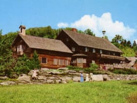
Trapp Family Lodge
4.6 miles away
The Sound of Music has a real-life Vermont sequel, and you can walk right into it.

Ben and Jerry's Factory
5.1 miles away
Two guys from a converted Burlington gas station built a Vermont icon, and this Waterbury factory is where it all scaled up.
Stowe Recreation Path
6.0 miles away
A free 5.3-mile paved greenway that follows the West Branch of the Little River from Stowe Village toward Mount Mansfield, crossing the water a dozen times on arched wooden bridges.

Moss Glen Falls
9.0 miles away
For one of the tallest waterfalls in Vermont with almost no effort, stop at Moss Glen Falls just north of Stowe village.

Mount Mansfield
10 miles away
Mount Mansfield is the roof of Vermont at 4,395 feet, and its long ridgeline famously resembles a face in profile, with high points called the Chin, the Nose, and the Forehead.

Smugglers' Notch
11 miles away
A dramatic mountain pass on VT-108 above Stowe where the road narrows to a single lane between giant fallen boulders under thousand-foot cliffs, laced with caves and smuggling lore.
Morse Farm Maple Sugarworks
14 miles away
Morse Farm turns Vermont's signature food into a fun, hands-on farm visit.
Hope Cemetery
19 miles away
This is a cemetery that doubles as one of the best sculpture galleries in New England, and almost no one outside Vermont knows it.