

Smugglers' Notch
VT Route 108, Mount Mansfield State Forest
Stowe, VT
A twisting mountain pass where the road narrows to a single lane between thousand-ton boulders under cliffs a thousand feet high, laced with caves and smuggling stories.
Smugglers' Notch is one of Vermont's most dramatic drives, a high mountain pass where the road does something few roads ever do: it narrows to a single lane and winds directly among enormous fallen boulders, with cliff walls rising close to a thousand feet on either side. It threads between Mount Mansfield, the highest peak in the state, and the Sterling Range, and at the height of land the mountains seem to lean in over the pavement.
The name is not decoration. This tight, cave-laced gap was a real smuggling route across generations, and the same remote geology that made it ideal for moving goods in secret makes it a spectacular place to visit today. Come in summer to drive it and hike from it, and know that in winter the road shuts and the notch belongs to skiers and snowshoers instead.
What Travelers Love
- A road that squeezes to a single lane between enormous fallen boulders under thousand-foot cliffs
- Layered smuggling lore, from the 1807 embargo to Prohibition to the Underground Railroad
- Named rock formations high on the walls, like Elephant's Head, Singing Bird, and the Hunter and His Dog
- Trailheads right at the pass, including the climb to Sterling Pond and access to Mount Mansfield
Worth Knowing
- VT-108 through the notch closes for winter, typically from around mid-fall to mid-spring, with exact dates shifting year to year with the weather
- When the road is closed to cars it becomes a snowshoe, backcountry-ski, and cross-country route
- Trucks, buses, and RVs are prohibited through the notch because the hairpin turns are too tight and jackknifes are common
- The road narrows to a single lane between boulders with blind, sharp turns, so drive slowly, and note that parking at the pass is limited and fills fast
Learn about Smugglers' Notch
Three centuries of smuggling
The notch earned its name in 1807, when President Jefferson's Embargo Act barred trade with Britain and Canada. Vermonters, with long-standing trade ties to Montreal, simply kept trading illegally, herding cattle north through the pass and hauling silk, lace, and whiskey back to sell across New England. The rugged, hidden gap was perfect for slipping goods across the line.
The smuggling did not end there. The first road was pushed through the notch in 1922, just as Prohibition took hold, and Canadian whiskey began moving south through the same rocks. Earlier still, freedom seekers escaping slavery are said to have used the notch as a route north toward Canada, hiding and sleeping in its caves by day and traveling by night. Few mountain passes carry so many layers of quiet history in one narrow place.
Boulders, cliffs, and named rocks
The notch is choked with enormous boulders that have fallen from the cliffs over the ages, some of them thousands of tons. King Rock, a roughly six-thousand-ton mass, dropped from the mountain in 1910 and sits beside the road on the Stowe side. It is these giants the road must weave around, which is why it narrows and twists the way it does.
High on the walls, the cliffs form shapes that generations of travelers have named. Elephant's Head, which lost its stone trunk in the 1960s, still watches over the pass, and there are others called Singing Bird, the Hunter and His Dog, and Smuggler's Face, a great visage in relief on the rock. Looking up to find them is part of the fun of stopping in the notch, and the cliffs themselves are a well-known destination for rock and ice climbers.
Hiking from the pass
The notch is a launching point for some of the best hiking around Stowe. The Sterling Pond Trail leaves right from the parking area at the top and climbs steeply about a mile to Vermont's highest trout pond, where it joins the Long Trail, the state's storied ridgeline footpath. From the notch you can also reach Mount Mansfield itself by way of the Long Trail and other routes rising from VT-108.
Just down the road toward Stowe, within Smugglers' Notch State Park, a short trail drops to Bingham Falls, a scenic multi-tier gorge and waterfall on the West Branch of the Waterbury River. Between the summit hikes, the pond, the falls, and the climbing crags, the pass is far more than a scenic pull-through. It is a hub for a full day in the Green Mountains.
Visiting Smugglers' Notch
The pass sits on VT Route 108 about six and a half miles northwest of Stowe Village, and the drive up is half the experience. The road is tight and twisting with blind hairpin turns, so take it slowly, and note that trucks, buses, and RVs are not allowed through, because the turns are too sharp and jackknifes are frequent. Parking at the height of land is limited and fills quickly on peak days.
Timing matters here more than at most stops. VT-108 through the notch closes for the winter, generally from around mid-fall until mid-spring, with the exact dates shifting each year with the snow. When it is gated shut, the notch does not go quiet so much as change hands, becoming a beloved snowshoe, backcountry-ski, and cross-country route through a hushed, cliff-walled corridor. In the open season, give yourself time to park, walk among the boulders, look up for the named rocks, and take a trail into the mountains.
Closest Boutels
The closest Boutel™ stays, so you can turn this stop into an overnight. Each is a place we chose through independent editorial review, never a paid placement.
Details
Stowe, VT
Frequently asked questions
What is Smugglers Notch?
Smugglers Notch, near Stowe in northern Vermont, is a dramatic and narrow mountain pass winding steeply between towering cliffs high in the Green Mountains, a spectacular scenic drive and natural landmark. The narrow road threads through a rugged notch flanked by sheer rock walls and enormous boulders, with sweeping mountain scenery, hiking trails, ice-climbing spots, and a colorful history that gave the pass its name, tied to smuggling in earlier eras. A breathtaking and adventurous passage through the mountains, Smugglers Notch delights scenic drivers, hikers, and nature lovers in the warm months. With its dramatic mountain pass, Smugglers Notch offers a spectacular destination in Vermont.
What can you do at Smugglers Notch?
You can drive the dramatic scenic road through the narrow notch between towering cliffs, stop to admire the sheer rock walls and enormous boulders, hike the trails that climb from the notch to overlooks and destinations, watch rock and ice climbers, and take in the rugged mountain scenery and colorful history. The spectacular narrow pass, the towering cliffs, the hiking, and the scenery are the draws, making it a memorable stop. The winding drive itself is an adventure. With its dramatic pass and trails, Smugglers Notch offers a rewarding experience in Vermont.
Is the drive through Smugglers Notch safe?
The drive through Smugglers Notch can be done safely with caution, but the road is extremely narrow, steep, and sharply winding, threading between cliffs and boulders, so driving slowly, watching for oncoming traffic, pedestrians, and cyclists, and taking the tight curves carefully are essential. Large vehicles, buses, trucks, and trailers are prohibited because they cannot navigate the tight turns. The notch road is seasonal and closed in winter due to snow and ice, and rockfall can occur, so checking current conditions before you go is wise. Driving carefully and heeding restrictions ensure a safe passage through Smugglers Notch in Vermont.
When is the best time to visit Smugglers Notch?
The notch road is open seasonally in the warm months, generally late spring through fall, and closed in winter due to snow and ice, so the warm season is the time to drive it, with summer lush and fall spectacular when the mountains blaze with foliage, one of the most beautiful times. Fall foliage is a highlight, though the road is busy then. For the scenic drive and hiking aim for late spring through fall, with fall foliage especially stunning, at Smugglers Notch in Vermont, noting the road closes in winter.
What is near Smugglers Notch?
Smugglers Notch is near Stowe in northern Vermont, within reach of Mount Mansfield, the Stowe Recreation Path, the Trapp Family Lodge, Moss Glen Falls, and the Stowe area. That makes Smugglers Notch a spectacular stop to combine with Mount Mansfield, the Stowe Recreation Path, and the other attractions of the Stowe area on a visit to Vermont.
Nearby

Mount Mansfield
1.1 miles away
Mount Mansfield is the roof of Vermont at 4,395 feet, and its long ridgeline famously resembles a face in profile, with high points called the Chin, the Nose, and the Forehead.
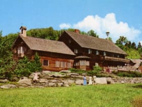
Trapp Family Lodge
6.6 miles away
The Sound of Music has a real-life Vermont sequel, and you can walk right into it.
Stowe Recreation Path
8.2 miles away
A free 5.3-mile paved greenway that follows the West Branch of the Little River from Stowe Village toward Mount Mansfield, crossing the water a dozen times on arched wooden bridges.

Moss Glen Falls
9.8 miles away
For one of the tallest waterfalls in Vermont with almost no effort, stop at Moss Glen Falls just north of Stowe village.
Waterbury Reservoir at Little River State Park
11 miles away
Little River State Park pairs an easy mountain swim with a touch of ghost-town adventure.

Ben and Jerry's Factory
16 miles away
Two guys from a converted Burlington gas station built a Vermont icon, and this Waterbury factory is where it all scaled up.