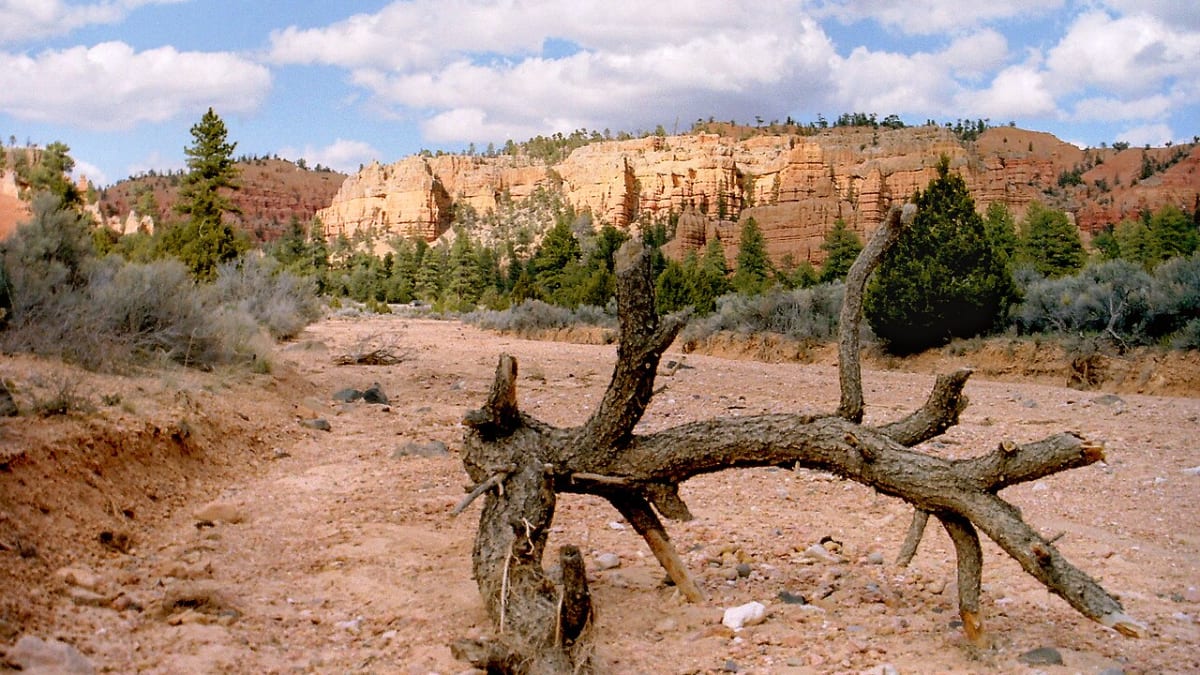
Red Canyon
Johnson Canyon Rd, Hatch, UT
Hatch, UT
Fiery red hoodoos crowd right up to Scenic Byway 12, where the road ducks through two arches carved from solid rock.
Red Canyon is the fiery red gateway to Bryce Canyon country, a stretch of Scenic Byway 12 where crimson hoodoos and spires crowd so close to the road that the highway has to duck through two tunnels blasted from the rock. Set in the Dixie National Forest just west of the national park, its formations are, if anything, even redder than Bryce's, glowing almost incandescent in the low sun.
Because it is national forest rather than a national park, Red Canyon is free to wander, and it is far quieter than its famous neighbor. A paved path and a web of hiking and mountain-biking trails weave among the hoodoos, letting you walk right up into the red rock. For travelers driving to Bryce, it is an easy stop; for those in the know, it is a destination in its own right.
What Travelers Love
- Vivid red hoodoos even brighter than those in nearby Bryce
- Two red-rock tunnels the highway passes through, carved in the 1920s
- Trails and a paved bike path winding right among the formations
- A free, uncrowded taste of hoodoo country outside the national park
Worth Knowing
- This is Dixie National Forest, not part of Bryce Canyon, so it is free to explore
- The paved multi-use path runs alongside the highway, good for bikes and easy walking
- The high elevation means cool nights and lingering snow into spring on shaded trails
- It makes an easy stop on the drive between Bryce Canyon and Highway 89
Learn about Red Canyon
Redder than Bryce
Red Canyon and Bryce Canyon are carved from the same rock formation, a soft pink-and-red limestone laid down in ancient lakes and then sculpted by frost and water into hoodoos, the tall, top-heavy pillars that make this country famous. Here the iron in the stone runs especially rich, so the color is intense, deep reds and burnt oranges that seem to catch fire in morning and evening light.
The hoodoos form through a patient, relentless process. Water seeps into cracks, freezes and expands on cold nights, and pries the rock apart bit by bit, while summer rains wash the loosened material away. Harder caps of rock shelter the columns beneath them, so the stone erodes into fins, windows, and finally the slender standing spires you see, each one a stage in the same slow unmaking of the plateau.
The tunnels and the highway
The most striking feature at Red Canyon is the pair of arched tunnels the highway passes through, carved by hand and drill in the mid-1920s so the road could push through the wall of red rock. Framed by hoodoos on either side, they are among the most photographed spots on all of Scenic Byway 12, and driving through them feels like passing through a red-stone gate into hoodoo country.
The road itself is part of the appeal. Scenic Byway 12 is one of the great drives in the American West, and this red stretch is one of its highlights, with formations pressing right to the roadside. A paved multi-use path parallels the highway through the canyon, so cyclists and walkers can travel among the hoodoos safely, away from the traffic.
Trails through the hoodoos
A network of short trails climbs from the highway up into the formations, with names like Pink Ledges, Hoodoo, and Arches, each leading among the spires and past small natural windows in the rock. Most are short enough for a casual visit, and they let you get in close among the hoodoos in a way that feels more intimate than the rim overlooks at the national park.
The area is also a favorite with mountain bikers, who ride the longer forest trails that spin off into the ponderosa pine above the canyon. Whether on foot or on wheels, the pleasure here is the same: red rock and green pine together, uncrowded, and free to explore, a quieter counterpart to the busier trails just up the road at Bryce.
Seasons at altitude
Red Canyon sits high, around 7,000 feet, so the seasons run cool. Late spring through early fall is the prime window, with warm days, cool nights, and green ponderosa contrasting against the red rock. Snow can linger on shaded north-facing trails well into spring, and summer afternoons can bring quick thunderstorms, so it pays to start early and watch the sky.
Fall brings crisp air and thinner crowds, and winter transforms the place entirely, when snow settles on the red hoodoos for a striking contrast of white and crimson. In any season the light is the thing: come at the edges of the day, when the low sun sets the whole canyon glowing, and you will understand why this stretch of road stops so many travelers in their tracks.
Closest Boutels
The closest Boutel™ stays, so you can turn this stop into an overnight. Each is a place we chose through independent editorial review, never a paid placement.
Details
Hatch, UT
Frequently asked questions
What is Red Canyon?
Red Canyon is a vivid red-rock canyon of fiery hoodoos, spires, and arches in Dixie National Forest, along Scenic Byway 12 just west of Bryce Canyon. Often described as a mini-Bryce, it offers similar brilliant orange-and-red rock scenery, but it lies in a national forest with no entrance fee and far fewer crowds. The highway even passes through two picturesque red-rock tunnel arches, making the drive alone a memorable introduction to the area's dramatic geology.
What can you do at Red Canyon?
You can drive the scenic byway through its striking tunnel arches, hike a network of trails among the glowing hoodoos, such as the Pink Ledges, Arches, and Losee Canyon trails, and ride the paved bike path that parallels the highway through the red rock. A visitor center helps you plan. With options from short, easy walks to longer hikes and rides, it suits a quick scenic stop or a half-day of exploring.
When is the best time to visit Red Canyon?
Spring through fall offers the most comfortable conditions for hiking and biking, and the red rock is especially beautiful in the warm, low light of morning and evening. Summer days can be hot, so carry water and sun protection and consider hiking earlier or later. As a higher-elevation area near Bryce, it can be cool in the shoulder seasons and snowy in winter, so check conditions if visiting outside the warm months.
Is Red Canyon free, and is it worth stopping?
Yes, because it sits in a national forest rather than a fee-charging national park, Red Canyon is free to visit, which is part of its appeal. It is absolutely worth a stop, offering Bryce-like scenery, enjoyable trails, and those iconic highway tunnels without the entrance fees or crowds of the national park. For travelers heading to Bryce along Scenic Byway 12, it makes a rewarding, low-key addition to the trip.
What is near Red Canyon?
Red Canyon sits right along Scenic Byway 12, one of the most beautiful drives in the country, a short distance from Bryce Canyon National Park to the east, making the two easy to combine. The broader region includes Grand Staircase-Escalante and other southern Utah wonders farther along the byway. That makes Red Canyon a natural, scenic stop on a road trip through Utah's spectacular red-rock country.
Nearby

UT-12 Scenic Byway
5.2 miles away
Utah Highway 12 runs 124 miles from US-89 near Panguitch to Torrey near Capitol Reef, crossing five distinct geological formations and three national park corridors.

Willis Creek Slot Canyon
7.8 miles away
Willis Creek is a narrow slot canyon cut through Jurassic-era sandstone near Cannonville, south of Bryce Canyon. The canyon is free, requires no permit, and is accessible to most hikers.

Bryce Canyon National Park
11 miles away
The largest concentration of hoodoos on Earth, a natural amphitheater of orange and pink stone spires.

Mossy Cave
13 miles away
Mossy Cave is a lesser-known Bryce Canyon trail that most park visitors skip in favor of the main canyon.

Kodachrome Basin State Park
23 miles away
Kodachrome Basin has 67 solid rock spires (called "sand pipes") rising from a basin floor of red and white sandstone.

Zion National Park
47 miles away
Towering sandstone cliffs and the Virgin River carving the Narrows, one of the great slot-canyon hikes.