

Pictured Rocks National Lakeshore
1500 Cedar St, Munising, MI
Munising, MI
Miles of Lake Superior cliffs stained in bands of red, orange, and green, arched into caves and hung with waterfalls, best seen from the water looking up.
Pictured Rocks National Lakeshore protects one of the most beautiful stretches of shoreline on the Great Lakes, miles of sandstone cliffs rising straight out of Lake Superior. The rock face is stained in ribbons of red, orange, green, and brown where groundwater carrying minerals seeps down over it, giving the pictured rocks their name.
Established in 1966 as the first national lakeshore in the country, the park runs along the Superior shore of the Upper Peninsula between Munising and Grand Marais. The cliffs are carved into arches, caves, and towering formations, and waterfalls tumble off them into the lake. The whole scene is best appreciated from the water, looking up at the painted walls from a boat or a kayak.
What Travelers Love
- The mineral-stained cliffs glowing in bands of color above the blue lake
- Sea caves, arches, and formations best seen from a boat or kayak below
- Waterfalls that spill straight off the cliffs into Lake Superior
- The famous Chapel Rock, Miners Castle, and other landmark formations
Worth Knowing
- The cliffs are best seen from the water, by tour boat or by guided kayak
- Lake Superior is cold and its weather changes fast, so paddlers must plan carefully
- Land overlooks like Miners Castle give views without a boat
- The park is large and spread out; give it more than a single quick stop
Learn about Pictured Rocks National Lakeshore
The painted cliffs
The cliffs are made of layered sandstone, laid down long ago and now standing exposed along the Superior shore. What makes them extraordinary is the color: groundwater seeping through the rock carries dissolved minerals such as iron, copper, and manganese, which stain the cliff face in vivid streaks and bands as the water trickles down and dries.
Wind and waves have sculpted the soft sandstone into a gallery of shapes, from the turreted Miners Castle to the arch and grotto formations along the shore. Waterfalls pour off the tops of the cliffs, and in some places the lake has hollowed out caves at the waterline. Every stretch offers something different to the eye.
Seeing it from the water
The cliffs reveal their full grandeur only from below, out on the lake. Tour boats run from Munising in the warm months, cruising along the base of the cliffs so passengers can take in the colors, caves, and waterfalls from the water, the classic way to experience Pictured Rocks.
For the more adventurous, guided sea-kayak trips paddle right up to the cliff walls, arches, and Chapel Rock, an unforgettable perspective. Lake Superior is cold and unpredictable, though, and its weather can turn dangerous quickly, so paddling here calls for experience or a guide and careful attention to conditions.
Land, trails, and waterfalls
There is plenty to explore on land as well. Overlooks like Miners Castle offer sweeping views of the cliffs from above without a boat, and the Chapel Basin area leads hikers to waterfalls, beaches, and the iconic Chapel Rock with its lone tree rooted atop a sandstone pillar. Miles of the North Country Trail run along the shore.
Beyond the cliffs, the park holds sandy beaches, the Grand Sable Dunes rising above the eastern lakeshore, inland lakes, forests, and numerous waterfalls. It rewards a multi-day visit with a range of landscapes packed into one long shoreline park.
The land and its people
This is the homeland of the Ojibwe, the Anishinaabe people who have lived along Gitche Gumee, Lake Superior, for countless generations. The shore, its formations, and the lake itself hold deep meaning in Ojibwe tradition, and the tribe's long relationship with these waters continues today.
The park is beautiful in every season. Summer brings the boat tours, paddlers, and hikers, and the warmest lake days. Fall lights the hardwood forests in brilliant color above the cliffs. Winter transforms the shore into a realm of frozen waterfalls and ice climbing, remote, quiet, and starkly beautiful under the Superior sky.
Closest Boutels
The closest Boutel™ stays, so you can turn this stop into an overnight. Each is a place we chose through independent editorial review, never a paid placement.
Details
Munising, MI
Frequently asked questions
What is Pictured Rocks National Lakeshore?
Pictured Rocks National Lakeshore stretches for miles along the Lake Superior coast in Michigan's Upper Peninsula, between Munising and Grand Marais. It is famous for its dramatic, multicolored sandstone cliffs, stained in bands of red, orange, green, and tan by mineral-rich groundwater, that rise straight from the deep blue water. Along with the cliffs, the park offers waterfalls, sea caves, arches, beaches, dunes, and forest trails, making it one of the most beautiful and beloved natural areas in the Midwest.
What is the best way to see the Pictured Rocks cliffs?
The colorful cliffs are best appreciated from the water, since they rise directly from Lake Superior, so a popular boat cruise out of Munising is the classic way to see the full painted expanse. Guided kayak tours offer a closer, more intimate view for those up for it. On land, viewpoints like Miners Castle and trails to Chapel Rock and the many waterfalls provide stunning scenery. Combining a boat tour with some hiking gives the fullest experience of the park.
What safety precautions should I take at Pictured Rocks?
Lake Superior is frigid and its weather can change fast, so kayaking here is best done with a professional guided tour rather than on your own, since conditions can turn dangerous quickly. On land, stay back from the cliff edges, which are made of sandstone that can crumble, and heed all barriers and warning signs, as falls from the cliffs have been fatal. Keep children close near the edges and waterfalls, wear sturdy shoes, and carry water on the trails.
When is the best time to visit Pictured Rocks?
Summer through early fall is prime, when the boat cruises and kayak tours operate, the weather is mildest, and the waterfalls and beaches are at their best, with fall adding spectacular foliage to the cliffs and forests. This far north the season is short, so many services run only in the warmer months. Even in summer, Lake Superior stays cold and evenings can be cool, so pack layers, and check the boat-tour schedule when planning your visit.
What is near Pictured Rocks National Lakeshore?
The lakeshore is anchored by the towns of Munising to the west and Grand Marais to the east in Michigan's Upper Peninsula, near the vast Hiawatha National Forest and countless waterfalls, including the famous Tahquamenon Falls a drive to the east. The wild Lake Superior coast and inland lakes surround the area. That makes Pictured Rocks a highlight of any road trip through the rugged, water-rich landscapes of the U.P.
Nearby

Kitch-iti-kipi
31 miles away
Most people driving the U.S. 2 corridor across the U.P. never turn off for this, and that is their loss.
Da Yoopers Tourist Trap
52 miles away
This is peak Yooper humor, and the best parts are free. Da Yoopers Tourist Trap on U.S. 41 near Ishpeming celebrates U.P. culture with a straight face and a wink.
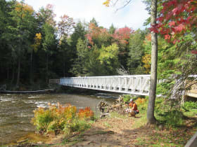
Tahquamenon Falls State Park
67 miles away
The huge amber-colored Upper Falls, one of the largest waterfalls east of the Mississippi, plus the braided Lower Falls, set in a 50,000-acre Upper Peninsula wilderness.