
Montana de Oro State Park
Pecho Valley Rd
Los Osos, CA
A raw, uncrowded stretch of the Central Coast where sandstone bluffs drop to tide pools, a hidden cove waits at a creek mouth, and a golden peak looks out over the whole shoreline.
Montana de Oro means mountain of gold, a name the early Californians gave these hills for the blaze of poppies, mustard, and monkeyflower that washes over them each spring. It is one of the largest state parks on the California coast and, for its size, one of the quietest, an eight-thousand-acre sweep of sea bluffs, sandy coves, coastal canyons, and low mountains reaching to the fourteen-hundred-foot crown of Valencia Peak. Where much of the Central Coast has filled in with towns and highway, this stretch stayed wild.
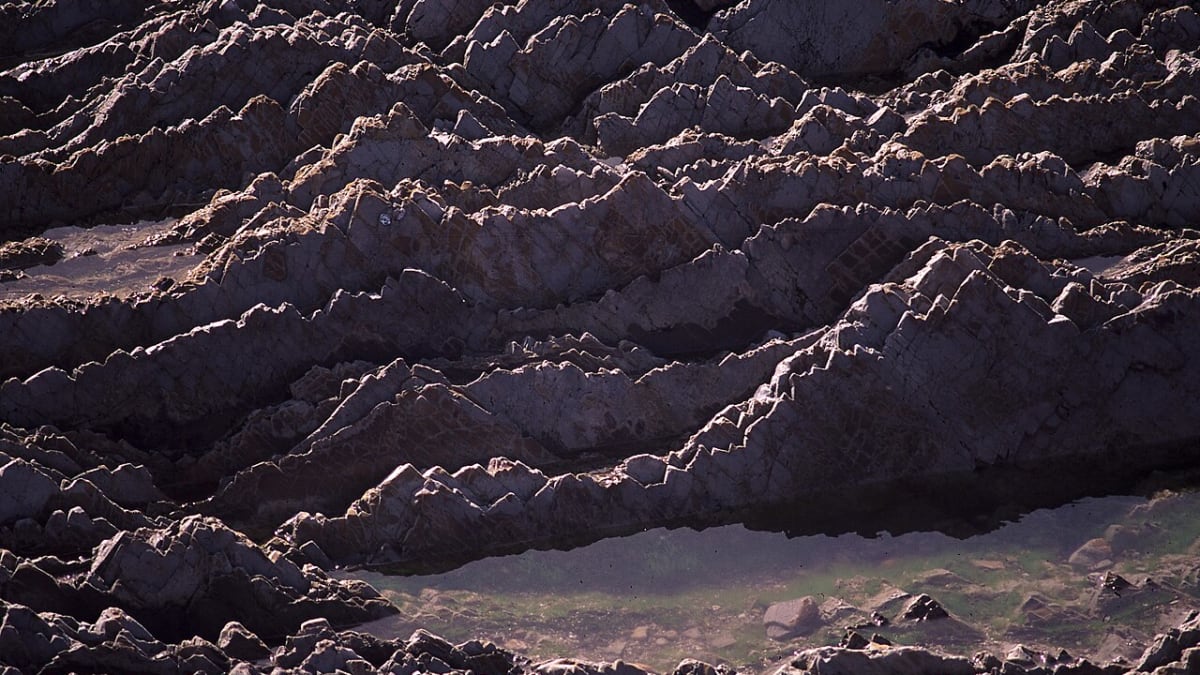
Most people come first for the Bluff Trail, a nearly level path that runs right along the lip of the sandstone cliffs, so close to the edge that you look straight down into surging tide pools, sea caves, and the occasional blowhole spouting spray. But there is far more here than one walk: a hidden cove where a creek slips into the sea, a peak worth the climb for its view, and a ranch house that has stood since the days when this whole coast was a working dairy.
What Travelers Love
- The Bluff Trail, an easy walk along the very edge of the sea past tide pools, sea caves, and blowholes
- Spooner's Cove, a sheltered sand-and-shale beach where a creek meets the ocean
- The climb up Valencia Peak for a sweeping view of the coast from Morro Rock to Point Buchon
- Spring wildflowers that light the hills gold, and gray whales passing offshore in winter and spring
Worth Knowing
- It is a big, wild park with limited services, so bring water, sun protection, and layers for the coastal wind and fog
- The tide pools are richest at low tide, so check a tide chart before you go, and tread carefully on wet rock
- Trails run from flat and easy along the bluff to a real uphill push on Valencia Peak, so pick to match your group
- Everything living in the tide pools is protected, so look but leave the creatures, shells, and rocks where they are
Learn about Montana de Oro State Park
From Chumash coast to Spooner ranch
Long before it was a park, this coast belonged to the Chumash, who lived in villages scattered along the shore and gathered shellfish from the same tide pools visitors peer into today. In the Mexican era the land became part of a coastal rancho, and by the end of the 1800s it had passed into the hands of ranching and dairy families who ran cattle over the bluffs and farmed the valley bottoms.
In 1892 Alden Spooner leased this remote piece of coast and built it into a dairy and stock ranch that his family worked for three generations. Their weathered ranch house still stands near the shore and serves as the park's visitor center, furnished as it might have been in the early 1900s. The little beach below it, Spooner's Cove, carries the family name, though locals sometimes call it Smuggler's Cove for the rumrunners said to have used its shelter during Prohibition.
California bought the land in 1965 and opened it as a state park, and the choice to leave it largely undeveloped is exactly why it feels the way it does: a real working landscape given back to the wind and the sea rather than paved and packaged.
The Bluff Trail, the cove, and the tide pools
The Bluff Trail is the park's signature walk, and it earns the reputation. From the trailhead near the campground it follows the edge of the marine terrace along low, flat-topped sandstone cliffs, with the open Pacific on one side and coastal scrub on the other. The path is easy underfoot, but the drama is constant: coves and sea stacks below, arches and caves cut into the rock, and pockets of tide pool life wherever the reef flattens out at the waterline.
Spooner's Cove, near the start of the trail, is the park's most popular beach, a crescent of coarse sand and shale where Islay Creek reaches the ocean between rocky points. It is a fine spot to sit, poke among the rocks at low tide, or simply watch the surf work the headlands. Just remember that the whole shore is a protected reserve, so the sea stars, anemones, and crabs stay where they live.
Beyond the marquee spots, the park's canyons hold quieter trails inland along creeks and through eucalyptus, so it is easy to trade the exposed coast for shade and birdsong whenever the wind picks up.
Valencia Peak and the wide view
For the biggest reward per step, hikers point themselves up Valencia Peak, the fourteen-hundred-foot high point that rises just inland from the bluffs. The trail climbs steadily through scrub to a bare, rocky summit, and on a clear day the view is one of the best on this part of the coast: the whole arc of shoreline laid out below, Morro Rock and the smokestacks of the bay to the north, Point Buchon to the south, and the open ocean running to the horizon.
Timing matters here more than distance. The coast is famous for morning and evening fog that can swallow the view entirely, so the peak rewards a clear, wind-scrubbed afternoon or an early start ahead of the marine layer. In spring the same slopes that give the park its golden name blaze with wildflowers, turning the climb into a walk through color.
Wildlife and the seasons
The park's mix of open water, rocky reef, bluff, and canyon makes it a strong place for wildlife. Gray whales pass offshore on their long migration in winter and spring, sometimes close enough to spot the spouts from the bluff. Harbor seals and sea otters work the kelp beds, cormorants and pelicans wheel along the cliffs, and the tide pools teem with the small, tough creatures of the intertidal zone.
Each season has its own character. Spring brings the wildflowers and the whales, summer the clearest tide-pool days at low tide, fall the calm golden light photographers love, and winter the biggest surf and the greenest hills. Whenever you come, plan for coastal weather that can shift from warm sun to cold fog within the hour, and give yourself time to slow down. Montana de Oro is the kind of place that repays a whole unhurried day rather than a quick stop, a wild coast that the state, unusually, decided to leave wild.
Closest Boutels
The closest Boutel™ stays, so you can turn this stop into an overnight. Each is a place we chose through independent editorial review, never a paid placement.
Details
Los Osos, CA
Frequently asked questions
What is Montana de Oro State Park?
Montana de Oro State Park, on the coast near Los Osos and Morro Bay on California's Central Coast, is a large and beautiful park whose name means mountain of gold, inspired by the golden wildflowers that blanket its hills in spring. It features rugged coastline with dramatic bluffs and coves, sandy Spooner's Cove, tide pools, sand dunes, and inland peaks like Valencia Peak, all laced with scenic trails. Wilder and less crowded than many coastal parks, Montana de Oro offers spectacular hiking, tide pooling, and stunning ocean scenery in a relatively unspoiled natural setting.
What can you do at Montana de Oro State Park?
You can hike a network of trails along the dramatic coastal bluffs, up peaks like Valencia Peak for sweeping views, and through canyons and dunes, explore Spooner's Cove and the excellent tide pools at low tide, watch for wildlife and, offshore, migrating whales, mountain bike, and camp at the primitive campground. Spring wildflowers are a highlight. With its bluff-top trails, tide pools, beaches, and peaks, the park offers varied and rewarding outdoor recreation amid some of the most beautiful and unspoiled coastal scenery on the Central Coast.
What safety tips apply at Montana de Oro State Park?
The coastline has powerful surf, cold water, and dangerous sneaker waves and rip currents, so keep well back from the water, never turn your back on the ocean, and be cautious on slippery rocks when tide pooling, minding the tides so you are not cut off. Stay back from unstable cliff edges on the bluff trails, wear good shoes, and carry water on longer hikes. Watch for poison oak and, in warm weather, rattlesnakes on inland trails. Caution near the surf, cliffs, and tides keeps a visit safe.
When is the best time to visit Montana de Oro State Park?
Spring is especially beautiful, when golden wildflowers carpet the hills and green scenery abounds, while winter and spring offer whale watching offshore, and low tide any season is ideal for tide pooling. Clear days provide the best coastal views, though fog can roll in and often clears by midday. The park is enjoyable year-round with its mild climate. For wildflowers, aim for spring, and for tide pools, time your visit around low tide, but the park's dramatic coast rewards a visit any clear day.
What is near Montana de Oro State Park?
The park is near Los Osos and Morro Bay with its iconic Morro Rock on the San Luis Obispo County coast, close to the town of San Luis Obispo, and within reach of Cayucos, Cambria, and Hearst Castle to the north. That makes Montana de Oro State Park a spectacular and less-crowded natural stop to combine with Morro Bay, San Luis Obispo, and the charming beach towns and scenery of the Central Coast on a California road trip.
Outside the Park
Morro Rock
6.6 miles away
Morro Rock is a 576-foot volcanic plug rising straight out of the Pacific at the mouth of Morro Bay, about 40 minutes west of Paso Robles by way of Highway 46 and Highway 1.

Cayucos Pier
12 miles away
The Cayucos Pier was built in 1872 by Captain James Cass, who founded the town as a shipping and cattle-loading port for the surrounding ranch country.

Estero Bluffs State Park
13 miles away
Estero Bluffs State Park covers the coastal terrace between Cayucos and Morro Bay along a stretch of Highway 1 that has remained largely undeveloped.