
Maah Daah Hey Trail
Sully Creek State Park trailhead
Medora, ND
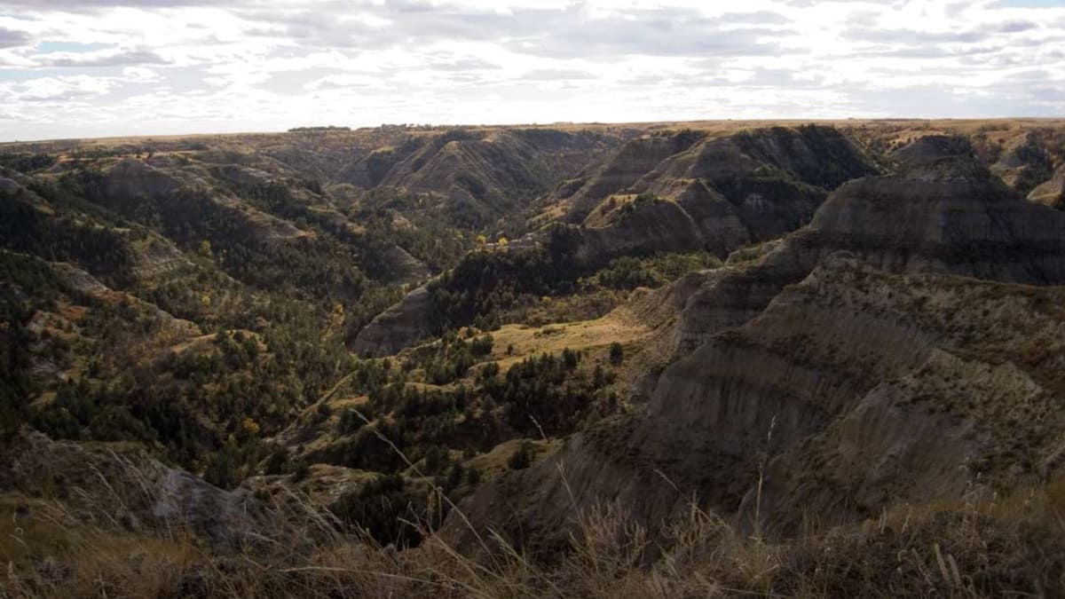
The longest continuous singletrack trail in America, winding 144 miles through the buttes, canyons, and prairie of the North Dakota badlands.
The Maah Daah Hey Trail is the longest continuous singletrack trail in America, a slim ribbon of dirt that runs about 144 miles through the badlands of western North Dakota. It links the southern and northern units of Theodore Roosevelt National Park across the wild, eroded country in between, and it has become a bucket-list ride for mountain bikers and a quietly spectacular long hike for anyone drawn to big, lonely landscapes.
Its name comes from the Mandan language and is usually translated as an area that has been or will be around for a long time, something grandfather-old and deserving of respect. That is a fitting name for a path through badlands that took millions of years of wind and water to carve, and the trail was designed to let people move through that country under their own power, at the pace it deserves.
What Travelers Love
- One long, uninterrupted singletrack, honored as an international mountain-biking classic, that you can sample for an hour or ride for days
- Riding or hiking through real badlands scenery, buttes and canyons and river bottoms, far from crowds
- Wildlife along the way, from bison and elk to wild horses, pronghorn, and prairie birds
- The turtle trail markers and well-cared-for path, a labor of love by the local trail association
Worth Knowing
- This is a backcountry trail with long stretches and no services, so carry plenty of water, know your route, and turn back with time to spare unless you are set up for the whole distance
- Summer heat and afternoon storms are real; spring and fall are the kindest seasons, and the clay turns to slick gumbo when wet, so avoid it right after rain
- It is non-motorized and open to hikers, mountain bikers, and horseback riders; a trailhead parking fee or pass may apply at the state-park access
- Short out-and-back samples from Sully Creek or other trailheads give a taste of the badlands without committing to the full point-to-point journey
Learn about Maah Daah Hey Trail
A trail born to connect the badlands
The idea of a long trail linking the scattered pieces of the North Dakota badlands goes back to the 1960s, but it took decades of planning and volunteer labor to make it real. The route was laid out to connect the North and South units of Theodore Roosevelt National Park, along with the park's remote Elkhorn Ranch unit, stitching together public land across the Little Missouri National Grasslands into one continuous non-motorized path.
The result, completed in the 1990s, is unusual in American trail building: not a loop or a short scenic walk but a true point-to-point wilderness trail more than a hundred miles long, marked by carved wooden posts topped with a turtle, a symbol of steadiness and long life that suits both the trail and its name. It is maintained today largely by a devoted local trail association and its volunteers.
Riding and hiking the badlands
The Maah Daah Hey earned early fame among mountain bikers, who recognized it as one of the great long rides in the country and gave it their highest honor as an epic ride. Riders take on the whole distance over several days, camping at trailhead campgrounds along the way, or bite off shorter segments as day rides from the trailheads near Medora and elsewhere along the route.
But it is just as rewarding on foot. The trail climbs onto clay buttes for long views, drops into shaded draws and river bottoms, and crosses open prairie where the grass runs to the horizon. Along the way you may share the country with bison, elk, pronghorn, wild horses, and a chorus of prairie birds, the same living badlands that captivated a young Theodore Roosevelt when he ranched here in the 1880s and that helped turn him into the conservationist president.
Wild country, and how to meet it
The badlands are beautiful and unforgiving in equal measure. Summer brings fierce heat and sudden thunderstorms, and the fine clay soil turns to a boot-swallowing gumbo when it rains, so the friendliest seasons are spring and fall. There is little to no water on much of the route, so long trips demand real planning, caching or carrying water, and honest respect for distance and weather.
The good news is that you do not have to ride the whole thing to feel it. From Sully Creek State Park and other trailheads near Medora you can head out on the trail for a few miles and turn around, sampling the buttes and the silence before returning to town for the night. However far you go, the Maah Daah Hey delivers the same thing: a chance to move slowly and honestly through one of the emptiest, most quietly beautiful landscapes in the country.
Visiting the Maah Daah Hey Trail
The easiest place to touch the trail is near Medora, the small frontier-styled town that serves as the gateway to Theodore Roosevelt National Park. Just south of town, Sully Creek State Park offers a trailhead, parking, and campground, and puts you straight onto the singletrack for a day ride or a hike. Other trailheads and campgrounds are spaced along the route to the north for those going farther.
Fuel up, fill your water, and check conditions in Medora before you set out, since the badlands hold no services once you leave the trailhead. Whether you plan a gentle out-and-back or a multi-day traverse, the trail rewards preparation and patience, and it leaves most visitors understanding why the Mandan word for something long-lasting felt like the right name for a path through this ancient, weathered country.
Closest Boutels
The closest Boutel™ stays, so you can turn this stop into an overnight. Each is a place we chose through independent editorial review, never a paid placement.
Details
Medora, ND
Frequently asked questions
What is the Maah Daah Hey Trail?
The Maah Daah Hey Trail is a long and spectacular single-track trail winding through the rugged North Dakota Badlands, one of the premier long-distance trails in the region for hiking and mountain biking. Stretching for many miles across the badlands between the units of Theodore Roosevelt National Park, the trail traverses stunning scenery of colorful buttes, canyons, prairie, and river valleys, offering an immersive wilderness experience for hikers, mountain bikers, and horseback riders. Its name comes from a Mandan phrase meaning something like an area that will be around for a long time. Its beauty and challenge make it a beloved destination for the adventurous. A rugged and scenic wilderness trail, it delights the adventurous. With its badlands route, the Maah Daah Hey Trail offers a spectacular destination in North Dakota.
What can you do on the Maah Daah Hey Trail?
You can hike, mountain bike, or ride horseback along the long single-track trail through the badlands, taking in the stunning scenery of buttes, canyons, and prairie, camping at trail camps for longer trips, and experiencing the wilderness, with options for short day outings or long multi-day journeys. The scenic single-track, the badlands scenery, the mountain biking and hiking, and the wilderness experience are the draws, making it a superb destination for adventure. The immersive badlands scenery is the highlight. With its trail, the Maah Daah Hey offers a rewarding experience in North Dakota.
What should I know before using the Maah Daah Hey Trail?
The Maah Daah Hey crosses remote, rugged badlands with little shade, few services, and sometimes limited water, so carrying plenty of water, food, sun protection, and supplies, planning your route and access points, and being prepared for heat, weather, and self-sufficiency are essential, especially on longer sections. This is wildlife country including bison, so keeping a safe distance and being aware matter. Checking current trail and weather conditions before you go is wise. Preparing well and carrying enough water ensure a safe trip on the Maah Daah Hey Trail in North Dakota.
When is the best time to use the Maah Daah Hey Trail?
The mild months of late spring through early fall are the best for hiking and biking the trail, avoiding the extreme heat of midsummer and the cold of winter, with spring and fall offering the most comfortable temperatures and beautiful scenery, though water can be scarce in dry periods. Because conditions and water availability vary, checking current information before you go is important. For the most comfortable and scenic conditions, aim for late spring or early fall on the Maah Daah Hey Trail in North Dakota.
What is near the Maah Daah Hey Trail?
The Maah Daah Hey Trail winds through the North Dakota Badlands between the units of Theodore Roosevelt National Park, within reach of Medora, the park's South Unit and Painted Canyon rim view, Little Missouri State Park, and the Badlands region. That makes the Maah Daah Hey Trail a spectacular way to experience the North Dakota Badlands alongside Theodore Roosevelt National Park on a visit to the state.
Nearby

Theodore Roosevelt National Park
2.8 miles away
Badlands and free-roaming bison in the Dakota country that shaped the conservation-minded president.

Theodore Roosevelt Presidential Library
2.9 miles away
A world-class presidential library, designed by the Norwegian firm Snohetta, that rises out of a Badlands butte beneath a walkable green roof above the Little Missouri River.
Painted Canyon Rim View
6.7 miles away
Painted Canyon Rim View: I-94 exit 32, 7 miles east of Medora. Free, the overlook is accessible year-round even when the rim visitor center is closed.
Theodore Roosevelt National Park South Unit
7.1 miles away
Theodore Roosevelt National Park South Unit: entrance at Medora off I-94. Entrance fee applies.
Burning Coal Vein and the Columnar Junipers
20 miles away
Burning Coal Vein: in the Little Missouri National Grassland, reached by gravel roads southwest of Medora through the tiny community of Amidon. A Forest Service campground sits at the site.