

Jordan Craters Wilderness
Cow Lakes Road, off US-95
Jordan Valley, OR
One of the youngest lava flows in Oregon, a field of ropy black basalt spread across the empty Owyhee desert around a single dark crater.
Jordan Craters is one of the youngest volcanic landscapes in Oregon, a field of black basalt that spread across the Owyhee desert only a few thousand years ago, so recently that in places it looks as though it cooled last week. At its center is Coffeepot Crater, the steep-sided vent that poured out the whole flow, and around it lies square mile after square mile of ropy, glittering, jet-black rock.
Almost nobody comes here. The lava field sits far out in the emptiest corner of the state, reached by miles of gravel and dirt, which is exactly what makes it feel like a discovery. Stand on the flow at dusk, with no sound and no lights and the desert running to the horizon, and it is easy to believe you have the place, and the geology, entirely to yourself.
What Travelers Love
- Walking out onto a black, ropy lava flow that looks freshly cooled
- Peering into the deep bowl of Coffeepot Crater, the vent that fed the whole field
- The total remoteness and dark, star-filled skies
- The strange spatter cones, lava tubes, and pressure ridges scattered across the flow
Worth Knowing
- This is genuinely remote high desert on rough gravel and dirt roads; carry water, food, a full tank, and a good spare tire, and check road conditions first
- The roads turn to impassable mud after rain and snow, so late spring through fall is the reliable window
- There are no services, no water, and no reliable phone signal, so come fully self-sufficient and tell someone your plan
- The lava is sharp and uneven, so wear sturdy boots and watch your footing, and give rattlesnakes room in warm weather
Learn about Jordan Craters Wilderness
A very young lava flow
Geologists estimate the Jordan Craters lava field is only a few thousand years old, one of the most recent volcanic events in Oregon, its age judged in part by how little lichen has managed to grow on the rock. The flow covers a broad area of dark olivine basalt, the kind of runny, low-silica lava that spreads out in smooth sheets rather than building tall cones.
That is why so much of it is pahoehoe, the ropy, wrinkled surface that forms when a thin skin cools over still-moving lava beneath. Walk the edges and you can read the flow like a frozen liquid: pressure ridges, collapsed lava tubes, and channels where the molten rock once ran. The whole field is managed by the Bureau of Land Management and studied as a small, well-preserved window into how basalt eruptions work.
Coffeepot Crater
The source of it all is Coffeepot Crater, a deep, steep-walled bowl that was the main vent for the eruption. It is the one feature you can drive close to, and standing on its rim you look down into the throat of the volcano that built the surrounding desert of stone.
Around the crater are smaller spatter cones, mounds of half-molten lava blobs that were thrown into the air and welded together as they fell. Where the flow ran into low ground it dammed the local drainage and pooled up two small ponds, the Cow Lakes, at the far end of the field, an odd splash of water at the edge of all that black rock.
Life in the Owyhee
This is Owyhee canyon country, a high, dry sagebrush sea broken by deep river gorges, one of the largest blocks of unroaded land left in the Lower 48. The wildlife is desert wildlife: pronghorn drifting across the flats, jackrabbits, coyotes, and raptors riding the wind, with bighorn sheep and mule deer in the nearby canyons.
The plant life is tough and sparse, sagebrush and bunchgrass with a scatter of wildflowers after the spring rains, slowly reclaiming the oldest edges of the lava. The emptiness is the point: few places in Oregon feel this far from anywhere.
Getting there and when to go
Jordan Craters lies roughly twenty miles northwest of the little town of Jordan Valley, reached by turning off the highway onto gravel and following it for many slow miles across the desert. A high-clearance vehicle is the safe choice, and conditions matter enormously: the dirt turns to gumbo mud when wet, and vehicles get badly stuck.
Late spring through fall is the practical season, avoiding both winter snow and the muddy shoulders of the year. Summer days are hot and exposed, so early and late in the day are best for walking the flow, and the dark, dry skies out here make it one of Oregon's great stargazing spots once the sun goes down. Come self-sufficient, and treat the remoteness with respect.
Closest Boutels
The closest Boutel™ stays, so you can turn this stop into an overnight. Each is a place we chose through independent editorial review, never a paid placement.
Details
Jordan Valley, OR
Frequently asked questions
What are Jordan Craters?
Jordan Craters is one of Oregon's youngest lava flows, a vast field of black basalt in the remote high desert of the state's far southeast that erupted only a few thousand years ago. Its source, Coffeepot Crater, is a well-preserved volcanic cone, and the flow around it is a striking moonscape of ropey pahoehoe lava, pressure ridges, spatter cones, and lava tubes. It is a fascinating stop for anyone drawn to raw volcanic geology.
What can you see and do at Jordan Craters?
The main attraction is Coffeepot Crater, the vehicle-accessible source cone, with a short loop of about a mile that circles the rim and descends into the crater's heart. Nearby you can see a line of spatter cones and walk across the strange, glassy folds of the lava flow. It is a place for exploring on foot, marveling at the volcanic textures, and soaking up the immense desert silence.
How do you get to Jordan Craters, and what are the roads like?
It lies well off Highway 95 north of Jordan Valley, reached by many miles of gravel and dirt BLM roads. A high-clearance vehicle is strongly recommended, and, crucially, the access road turns to slick, impassable mud when wet, so do not attempt it if rain is falling or threatening. There are no services out here, so arrive with a full tank, plenty of water, and supplies, and tell someone your plans.
Is it safe to hike on the lava at Jordan Craters?
It requires real care. The lava surface is rugged and uneven, with razor-sharp edges, hidden cracks, open pits, and thin crust over tubes and caves that can break underfoot, dangerous even for experienced hikers. Wear stable, sturdy boots, watch every step, keep well back from crater edges and holes, and keep children close. In summer the black rock can heat past scorching, so bring sun protection and lots of water.
When is the best time to visit Jordan Craters?
Spring and fall are ideal, offering cooler temperatures for walking on the heat-absorbing lava and better odds of dry, passable roads. Avoid the peak of summer, when the black rock bakes, and steer clear of any wet weather that makes the access road impassable. As part of the remote Oregon Outback region, it also boasts superb dark skies, so a clear night rewards those who come fully prepared to stay.
Nearby

Snake River Birds of Prey National Conservation Area
61 miles away
The Snake River Birds of Prey NCA protects 81 miles of Snake River canyon south of Boise, home to the densest nesting population of raptors in North America.

Steens Mountain
62 miles away
A mile-high fault-block mountain rising alone from the southeast Oregon high desert, its gentle west slope climbing to a rim that drops nearly a mile to the Alvord Desert.
Alvord Desert
65 miles away
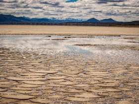
The Alvord playa is one of the flattest surfaces in Oregon and one of the more surreal. Looking east from the playa, the land runs flat toward Idaho with no interruption.