
Goblin Valley State Park
18630 Goblin Valley Rd, Green River, UT
Green River, UT
A hidden desert basin packed with thousands of squat, mushroom-shaped rocks you are actually allowed to walk right in among.
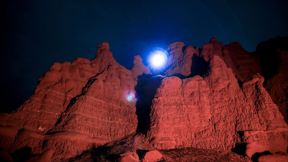
Goblin Valley is a shallow desert basin filled with thousands of squat, mushroom-shaped rock formations that Utahns have long called goblins. Standing at the overlook, you look down on a field of them stretching to the cliffs beyond, each one a knob of harder rock perched on a softer stem, and the whole valley glows orange and red as the sun drops. It is one of the rare protected places where you are welcome to leave the trail and simply wander in among the stone.
The park sits at the foot of the San Rafael Swell, a great buckle of rock that few travelers ever detour to see. That remoteness is part of the appeal. The valley stays quiet, the skies stay dark, and the goblins keep their strange, silent company, looking for all the world like a crowd frozen mid-step.
What Travelers Love
- Scrambling freely among the goblins, which is one of the few places you are encouraged to roam off-trail
- A landscape that feels like another planet, especially at first or last light
- The easy overlook where the whole valley of hoodoos opens up below you
- Some of the darkest night skies anywhere, with the Milky Way overhead
Worth Knowing
- Bring more water than you think you need; there is little shade and the heat can be severe
- The rock is soft, so climbing on the taller goblins can break them and is discouraged
- It is easy to lose your bearings among the identical formations, so note landmarks as you wander
- Summer middays are punishing; early morning, evening, and the shoulder seasons are far more pleasant
Learn about Goblin Valley State Park
How the goblins came to be
The goblins are carved from a rust-colored rock called Entrada Sandstone, laid down more than 150 million years ago along the muddy edge of an ancient sea. That mud and sand hardened in uneven layers, some tightly cemented and some crumbly, and it is this difference that made the shapes. Where a hard cap of rock protected the softer stone beneath it, the softer material eroded more slowly, leaving the stubby pedestals you see today.
Wind and the rare desert rainstorm did the rest, working down through cracks and rounding every edge over millions of years. The taller goblins are still eroding, and now and then one topples. Because the sandstone is soft, it wears quickly by geologic standards, so the valley you walk through is a snapshot of a landscape that is always quietly changing shape.
The people of the Swell
The desert around Goblin Valley lies within the ancestral homelands of the Ute and Southern Paiute peoples, who traveled and hunted across the San Rafael Swell and the canyon country for generations and whose descendants live in the region today. Earlier still, the Fremont people farmed and camped along the washes and left rock art and stone tools scattered through the wider region.
The valley itself was little known to outsiders until the mid-twentieth century, when a rancher searching for a stock route is said to have crested a rise and looked down on the field of goblins by chance. Word spread slowly, a few curious visitors came to see the odd rocks, and in 1964 Utah set the basin aside as a state park to protect it.
Wandering the valley and the Swell beyond
The heart of a visit is simply the wander. From the overlook you can drop down into the basin and roam among the goblins at your own pace, ducking between them, climbing the low ridges, and finding shapes that seem to shift as the light moves. Because there is no set path, children love it, and it rewards slowing down and letting yourself get a little lost in the crowd of stone.
Short marked trails lead out to viewpoints and toward a couple of narrow slot canyons on the valley's edges, where the walls close in and the light goes cool and dim. Beyond the park, the San Rafael Swell offers longer canyons, dirt-road drives, and quiet camps for those with time, a whole hidden district of Utah that most road trips pass by.
Wildlife, seasons, and the dark sky
For a place so barren-looking, the desert holds real life. Kangaroo rats and other small rodents work the night, jackrabbits and lizards move by day, and coyotes, kit foxes, and the occasional bobcat range the flats. Ravens and raptors ride the thermals above the cliffs, and after a rare rain the valley can bloom with brief desert wildflowers.
Spring and fall are the finest seasons, with mild days and cool nights, while summer brings intense heat and the danger of sudden flash floods in the slots. Winter is cold and very quiet, and a dusting of snow on the red goblins is a rare and striking sight. On any clear night the park's certified dark skies open up, and the Milky Way arches over the valley in a way city dwellers rarely get to see.
Closest Boutels
The closest Boutel™ stays, so you can turn this stop into an overnight. Each is a place we chose through independent editorial review, never a paid placement.
Details
Green River, UT
Frequently asked questions
What is Goblin Valley State Park?
Goblin Valley is one of Utah's most delightfully strange landscapes, a broad desert basin filled with thousands of mushroom-shaped rock formations called goblins, or hoodoos, sculpted by erosion from the soft sandstone. Unlike most parks, you are free to wander off-trail and weave, climb, and explore among the goblins to your heart's content, making it a photographer's dream and a kid's fantasy playground. It offers an easy, whimsical way to experience Utah's wild desert beauty, often without big crowds.
What can you do at Goblin Valley?
The main attraction is exploring the valleys of goblins, especially the classic main valley reached by a short, easy descent from the overlook, where you can roam freely among the dense formations. There are also marked hiking trails, a disc golf course, and camping. The freedom to clamber around the whimsical rock shapes makes it especially fun for families and kids. Your entrance fee is good for two days, so you can return to explore more.
Why is Goblin Valley great for stargazing?
Goblin Valley is a certified International Dark Sky Park with some of the darkest skies on earth and virtually no light pollution, so on a clear night the Milky Way blazes overhead in stunning detail. The surreal goblins silhouetted against a star-filled sky make it a favorite for astrophotography and constellation viewing. The park offers ranger-led night programs, including moonlit hikes and telescope tours, making an overnight visit especially rewarding for sky lovers.
When is the best time to visit Goblin Valley?
Spring and fall bring the most comfortable temperatures, with pleasant days ideal for wandering and photographing the goblins, and spring adding wildflowers at lower elevations. Summer is extremely hot, often well over ninety degrees with zero shade in the valleys, so if you visit then, go early in the morning or in the evening and carry plenty of water. Advance camping reservations are recommended, since sites are limited and popular.
What should I know before visiting Goblin Valley?
There is a per-vehicle entrance fee that covers two days, and the park lies in a remote part of central Utah, so fuel up and bring supplies. Come prepared for desert conditions with lots of water, sun protection, and sturdy shoes, since there is little to no shade among the goblins. It is family and even dog friendly, but keep a close eye on children as they climb, and enjoy the rare freedom to explore off-trail responsibly.
Outside the Park

San Rafael Swell
22 miles away
The San Rafael Swell is a 75-mile-wide uplifted dome that has been eroded into a complex of slot canyons, mesas, buttes, and badlands. It gets a fraction of the visitors of the nearby national parks.

Capitol Gorge
32 miles away
Capitol Gorge is a narrow, twisting canyon at the end of the Scenic Drive, where sheer sandstone walls close in overhead and an easy trail follows the sandy wash floor.

Cassidy Arch
34 miles away
Cassidy Arch is a dramatic sandstone arch that hikers can actually walk on top of, reached by a moderately strenuous trail climbing from Grand Wash.

Capitol Reef National Park
36 miles away
A hundred-mile wrinkle in the earth called the Waterpocket Fold, plus historic orchards you can still pick from.

UT-12 Scenic Byway
42 miles away
Utah Highway 12 runs 124 miles from US-89 near Panguitch to Torrey near Capitol Reef, crossing five distinct geological formations and three national park corridors.

Canyonlands National Park
48 miles away
The Colorado and Green Rivers split a vast desert into mesas, buttes, and canyons across four wild districts.